world.wikisort.org - Spain
Berzosa de Lozoya (Spanish pronunciation: [beɾˈθosa ðe loˈθoʝa]) is a municipality situated in the north of the autonomous community of Madrid in central Spain.[2] It had 234 inhabitants in 2011, covers an area of 14.3 km² and a population density of 16.36people per km².

This article may be expanded with text translated from the corresponding article in Spanish. (June 2012) Click [show] for important translation instructions.
|
Berzosa del Lozoya | |
|---|---|
Municipality | |
 Flag  Coat of arms | |
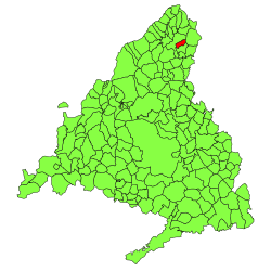 | |
 Berzosa del Lozoya Location in Spain | |
| Coordinates: 40°58′31″N 3°31′28″W | |
| Country | |
| Autonomous community | |
| Province | |
| Area | |
| • Total | 14.3 km2 (5.5 sq mi) |
| Elevation | 1,094 m (3,589 ft) |
| Population (2018)[1] | |
| • Total | 198 |
| • Density | 14/km2 (36/sq mi) |
| Time zone | UTC+1 (CET) |
| • Summer (DST) | UTC+2 (CEST) |
| Postal code | 28194 |
Education
There is one nursery (public) in Berzosa del Lozoya.
References
- Municipal Register of Spain 2018. National Statistics Institute.
- Los 'nuevos vecinos' de Berzosa, el único consuelo, El País, 16 March 2004
External links
| Wikimedia Commons has media related to Berzosa del Lozoya. |
Municipalities of the Community of Madrid | ||
|---|---|---|
| 3,000,000+ |
| |
| 200,000+ |
| |
| 150,000+ |
| |
| 100,000+ |
| |
| 50,000+ |
| |
| 25,000+ |
| |
| under 25,000 |
| |
| Authority control |
|
|---|
This Spain-related article is a stub. You can help Wikipedia by expanding it. |
На других языках
- [en] Berzosa del Lozoya
[es] Berzosa del Lozoya
Berzosa de Lozoya es un municipio español de la provincia y Comunidad de Madrid, situado al norte de dicha comunidad. Cuenta con 234 habitantes. Tiene una extensión de 14,3 km² y una densidad de población de 16.36 hab/Km².[ru] Берсоса-дель-Лосоя
Берсоса-дель-Лосоя (исп. Berzosa del Lozoya) — муниципалитет в Испании, входит в провинцию Мадрид в составе автономного сообщества Мадрид.Текст в блоке "Читать" взят с сайта "Википедия" и доступен по лицензии Creative Commons Attribution-ShareAlike; в отдельных случаях могут действовать дополнительные условия.
Другой контент может иметь иную лицензию. Перед использованием материалов сайта WikiSort.org внимательно изучите правила лицензирования конкретных элементов наполнения сайта.
Другой контент может иметь иную лицензию. Перед использованием материалов сайта WikiSort.org внимательно изучите правила лицензирования конкретных элементов наполнения сайта.
2019-2026
WikiSort.org - проект по пересортировке и дополнению контента Википедии
WikiSort.org - проект по пересортировке и дополнению контента Википедии