world.wikisort.org - Japan
Ōmachi (大町市, Ōmachi-shi) is a city located in Nagano Prefecture, Japan. As of 1 March 2019[update], the city had an estimated population of 27,559 in 11861 households,[1] and a population density of 49 persons per km2. The total area of the city is 565.15 square kilometres (218.21 sq mi).
Ōmachi
大町市 | |
|---|---|
City | |
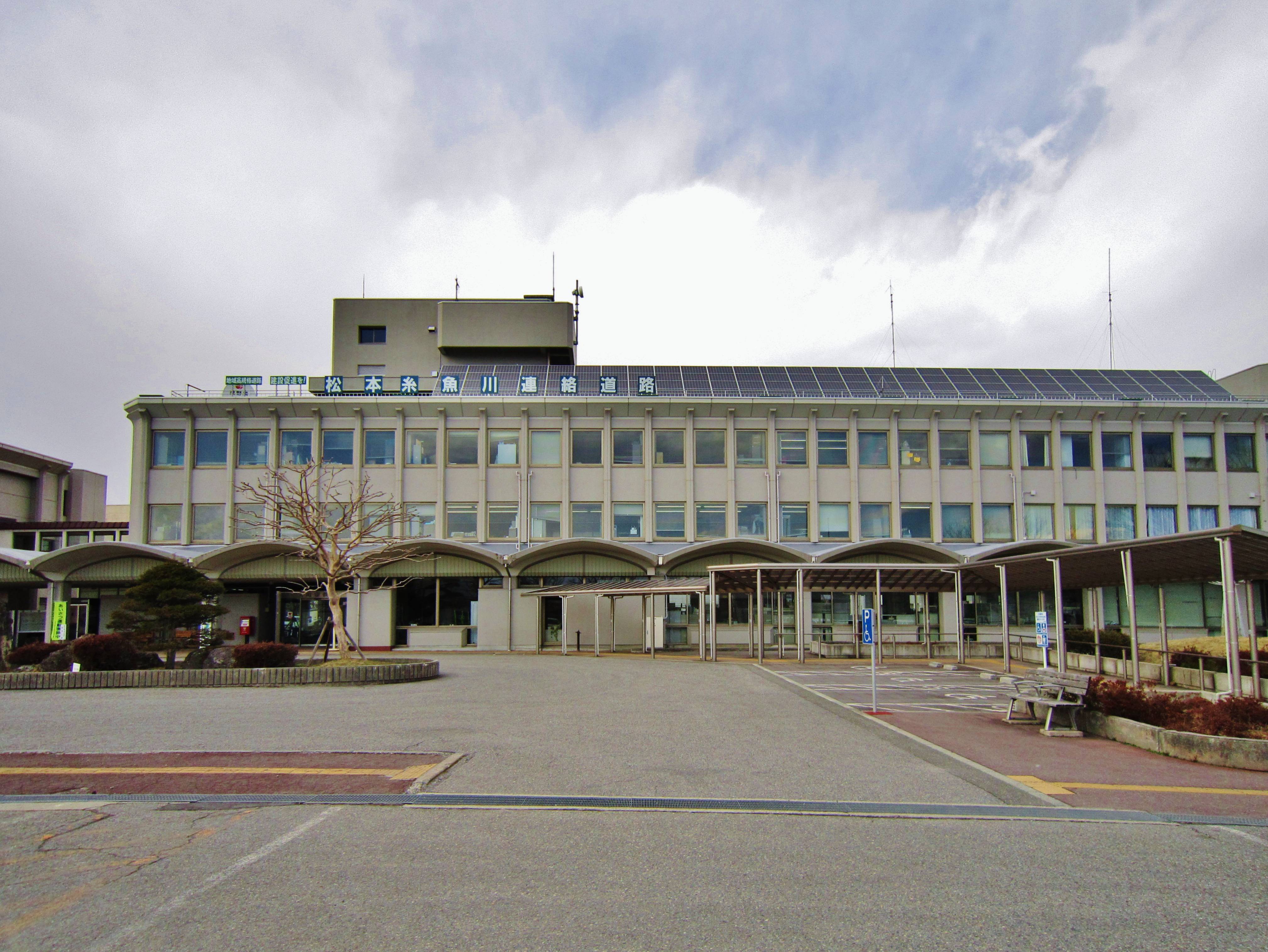 Ōmachi City Hall | |
 Flag  Seal | |
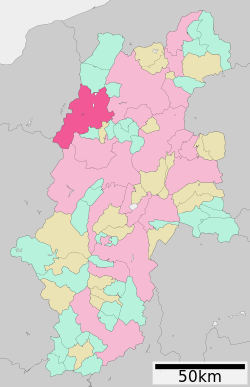 Location of Ōmachi in Nagano Prefecture | |
 Ōmachi | |
| Coordinates: 36°30′10.8″N 137°51′4″E | |
| Country | Japan |
| Region | Chūbu (Kōshin'etsu) |
| Prefecture | Nagano |
| Area | |
| • Total | 565.15 km2 (218.21 sq mi) |
| Population (March 2019) | |
| • Total | 27,559 |
| • Density | 49/km2 (130/sq mi) |
| Time zone | UTC+9 (Japan Standard Time) |
| Symbols | |
| • Tree | Prunus sargentii |
| • Flower | Erythronium japonicum |
| • Bird | Rock ptarmigan |
| • Animal | Japanese Serow |
| Phone number | 0261-22-0420 |
| Address | 3887, Ōmachi, Ōmachi-shi, Nagano-ken 398-0002 |
| Website | Official website |

Geography
Ōmachi is located west of Nagano, the capital of Nagano Prefecture, in the Daihoku District (大北地域, Daihoku-chiiki) of the prefecture. The 3000 meter Northern Japanese Alps (or Hida Mountains) are to the west ranges to the west of the city and mountains of around 1000 meters form the eastern border. The Takase River runs through the city, which is located in the northern Matsumoto basin.
The Itoigawa-Shizuoka Tectonic Line active fault system is also running through the city.
- Mountains: Mount Yarigatake, Mount Noguchigorō (野口五郎岳, Noguchigorō-dake), Mount Eboshi (烏帽子岳, Eboshi-dake), Mount Sugoroku (双六岳, Sugoroku-dake), Mount Otenshō (大天井岳, Otenshō-dake), Mount Tsubakuro (燕岳, Tsubakuro-dake), Mount Gaki (餓鬼岳, Gaki-dake), Mount Harinoki (針ノ木岳, Harinoki-dake), Mount Renge (蓮華岳, Renge-dake), Mount Jii (爺ヶ岳, Jii-ga-take), Mount Kashimayari (鹿島槍ヶ岳, Kashimayari-ga-take), Mount Goryū (五竜岳, Goryū-dake)
- Rivers: Takase River
- Lakes and marshes: Nishina three lakes (仁科三湖, Nishina-san-ko) (Lake Kizaki (木崎湖, Kizaki-ko), Lake Nakatsuna (中綱湖, Nakatsuna-ko), Lake Aoki (青木湖, Aoki-ko))
Surrounding municipalities
- Nagano Prefecture
- Toyama Prefecture
- Toyama
- Tateyama
- Kurobe
- Gifu Prefecture
Climate
Due to its elevation, the city has a Köppen climate classification Dfa climate. Winters are cold and very snowy, while summers are very warm and wet. The average annual temperature in Ōmachi is 9.7 °C (49.5 °F). The average annual rainfall is 1,405.9 mm (55.35 in) with July as the wettest month. The temperatures are highest on average in August, at around 22.4 °C (72.3 °F), and lowest in January, at around −2.8 °C (27.0 °F).[2]
| Climate data for Ōmachi (1991−2020 normals, extremes 1978−present) | |||||||||||||
|---|---|---|---|---|---|---|---|---|---|---|---|---|---|
| Month | Jan | Feb | Mar | Apr | May | Jun | Jul | Aug | Sep | Oct | Nov | Dec | Year |
| Record high °C (°F) | 13.7 (56.7) |
18.0 (64.4) |
22.6 (72.7) |
28.2 (82.8) |
31.8 (89.2) |
32.5 (90.5) |
34.9 (94.8) |
35.5 (95.9) |
32.8 (91.0) |
28.2 (82.8) |
22.1 (71.8) |
18.3 (64.9) |
35.5 (95.9) |
| Average high °C (°F) | 1.6 (34.9) |
2.8 (37.0) |
7.4 (45.3) |
15.0 (59.0) |
20.8 (69.4) |
23.8 (74.8) |
27.2 (81.0) |
28.5 (83.3) |
23.7 (74.7) |
17.7 (63.9) |
11.6 (52.9) |
4.8 (40.6) |
15.4 (59.7) |
| Daily mean °C (°F) | −2.8 (27.0) |
−2.3 (27.9) |
1.6 (34.9) |
8.0 (46.4) |
14.0 (57.2) |
17.9 (64.2) |
21.6 (70.9) |
22.4 (72.3) |
18.1 (64.6) |
11.8 (53.2) |
5.8 (42.4) |
0.2 (32.4) |
9.7 (49.4) |
| Average low °C (°F) | −7.5 (18.5) |
−7.4 (18.7) |
−3.4 (25.9) |
2.0 (35.6) |
8.1 (46.6) |
13.2 (55.8) |
17.4 (63.3) |
18.0 (64.4) |
13.9 (57.0) |
7.2 (45.0) |
0.9 (33.6) |
−3.9 (25.0) |
4.9 (40.8) |
| Record low °C (°F) | −17.0 (1.4) |
−18.0 (−0.4) |
−14.5 (5.9) |
−11.1 (12.0) |
−1.2 (29.8) |
3.6 (38.5) |
10.3 (50.5) |
9.0 (48.2) |
2.0 (35.6) |
−4.2 (24.4) |
−7.6 (18.3) |
−14.8 (5.4) |
−18.0 (−0.4) |
| Average precipitation mm (inches) | 84.7 (3.33) |
78.1 (3.07) |
100.1 (3.94) |
98.1 (3.86) |
111.5 (4.39) |
159.4 (6.28) |
195.3 (7.69) |
136.1 (5.36) |
165.0 (6.50) |
129.1 (5.08) |
69.8 (2.75) |
78.8 (3.10) |
1,405.9 (55.35) |
| Average snowfall cm (inches) | 164 (65) |
133 (52) |
76 (30) |
5 (2.0) |
0 (0) |
0 (0) |
0 (0) |
0 (0) |
0 (0) |
0 (0) |
6 (2.4) |
73 (29) |
454 (179) |
| Average precipitation days (≥ 1.0 mm) | 12.2 | 10.9 | 12.0 | 10.3 | 10.8 | 11.5 | 14.0 | 11.0 | 10.8 | 9.2 | 9.2 | 12.4 | 134.3 |
| Average snowy days (≥ 3 cm) | 18.4 | 15.9 | 9.4 | 0.8 | 0 | 0 | 0 | 0 | 0 | 0 | 0.7 | 7.7 | 52.9 |
| Mean monthly sunshine hours | 107.2 | 125.3 | 163.4 | 185.1 | 198.4 | 146.6 | 137.4 | 169.4 | 118.9 | 137.6 | 132.2 | 108.6 | 1,730 |
| Source: Japan Meteorological Agency[3][2] | |||||||||||||
History
The area of present-day Ōmachi was part of ancient Shinano Province. The area was part of the holdings of Matsumoto Domain during the Edo period. The modern town of Ōmachi was established with the creation of the municipalities system on April 1, 1889. It merged with the neighboring villages of Taira, Tokiwa and Yashiro on July 1, 1954 to form the city of Ōmachi. On January 1, 2006, the villages of Miasa and Yasaka (both from Kitaazumi District) were merged into Ōmachi.
Demographics
Per Japanese census data,[4] the population of Ōmachi has been declining over the past 40 years.
| Year | Pop. | ±% |
|---|---|---|
| 1960 | 41,185 | — |
| 1970 | 35,817 | −13.0% |
| 1980 | 36,083 | +0.7% |
| 1990 | 34,300 | −4.9% |
| 2000 | 33,550 | −2.2% |
| 2010 | 28,805 | −14.1% |
| 2020 | 26,029 | −9.6% |
Government
Ōmachi has a mayor-council form of government with a directly elected mayor and a unicameral city legislature of 16 members. The city contributes one member to the Nagano Prefectural Assembly. In terms of national politics, Ōmachi is grouped with Matsumoto, Azumino, Higashichikuma District, Nagano, Kitaazumi District, Nagano, Kamiminochi District, Nagano and part of the city of Nagano to form Nagano 2nd District in the lower house of the National Diet.
Economy
Ōmachi is a regional commercial center and a producer of aluminum, cotton thread and rice. Seasonal tourism to the mountains is also an important source of local income.[5]
Education
Ōmachi has five public elementary schools, three public middle schools and one combined elementary/middle school operated by the city government. There are two public high schools operated by the Nagano Prefectural Board of Education.
Transportation
Railway
 East Japan Railway Company - Ōito Line
- Azumi-Kutsukake - Shinano-Tokiwa - Minami-Ōmachi - Shinano-Ōmachi - Kita-Ōmachi - Shinano-Kizaki - Inao - Uminokuchi - Yanaba - Yanaba-Ski-jō-mae
- Kansai Electric Power Company
- Kanden Tunnel Trolleybus
Highway
 National Route 19
 National Route 147
 National Route 148
 National Route 406
International relations
 - Innsbruck, Austria, since November 20, 1972
 - Mendocino, California, United States since May 1980
Local attractions
- Nishina Shinmei Shrine, a National Treasure
- Ōmachi Aloine Museum
- Ōmachi Dam
- Shin-Takasegawa Pumped Storage Station
References
- ¥http://www.city.omachi.nagano.jp Ōmachi City official statistics](in Japanese)
- 気象庁 / 平年値(年・月ごとの値). JMA. Retrieved April 19, 2022.
- 観測史上1~10位の値(年間を通じての値). JMA. Retrieved April 19, 2022.
- Ōmachi population statistics
- Campbell, Allen; Nobel, David S (1993). Japan: An Illustrated Encyclopedia. Kodansha. p. 1147. ISBN 406205938X.
External links
- Official Website (in Japanese)
- Ōmachi City Tourism Website (in Japanese)
Nagano (capital) | |
| Core cities | |
| Cities | |
| Districts |
|
List of mergers in Nagano Prefecture | |
Authority control | |
|---|---|
| General | |
| National libraries | |
| Other |
|
На других языках
[de] Ōmachi
Ōmachi (jap. 大町市, -shi) ist eine Stadt im Zentrum der Präfektur Nagano auf der japanischen Hauptinsel Honshū.- [en] Ōmachi, Nagano
[es] Ōmachi (Nagano)
Ōmachi (大町市, Ōmachi-shi?) es una ciudad localizada en la prefectura de Nagano, Japón. En marzo de 2019 tenía una población de 27.559 habitantes en 11.861 hogares [3] y una densidad de población de 49 personas por km². Su área total es de 565,15 km².[ru] Омати (город)
О́мати[1] (яп. 大町市 О:мати-си) — город, расположенный на севере префектуры Нагано, Япония. Этот город был использован в качестве места действия для аниме Onegai Teacher и Onegai Twins, где знаковым местом также являлось озеро Кидзаки. Площадь города составляет 564,99 км²[2], население — 28 440 человек (1 августа 2014)[3], плотность населения — 50,34 чел./км².Другой контент может иметь иную лицензию. Перед использованием материалов сайта WikiSort.org внимательно изучите правила лицензирования конкретных элементов наполнения сайта.
WikiSort.org - проект по пересортировке и дополнению контента Википедии