world.wikisort.org - Japan
Tatsuno (辰野町, Tatsuno-machi) is a town located in Nagano Prefecture, Japan. As of 1 June 2019[update], the town had an estimated population of 18,951 in 7917 households,[1] and a population density of 112 persons per km2. The total area of the town is 169.20 square kilometres (65.33 sq mi).
Tatsuno
辰野町 | |
|---|---|
Town | |
 Tatsuno Town Hall | |
 Flag  Seal | |
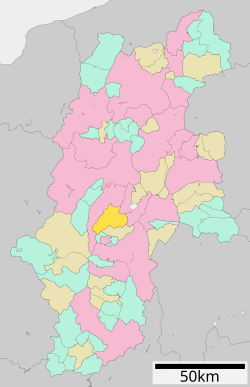 Location of Tatsuno in Nagano Prefecture | |
 Tatsuno | |
| Coordinates: 35°58′56.7″N 137°59′15.2″E | |
| Country | Japan |
| Region | Chūbu (Kōshin'etsu) |
| Prefecture | Nagano |
| District | Kamiina |
| Area | |
| • Total | 169.20 km2 (65.33 sq mi) |
| Population (June 1, 2019) | |
| • Total | 18,951 |
| • Density | 110/km2 (290/sq mi) |
| Time zone | UTC+9 (Japan Standard Time) |
| Phone number | 0266-41-1111 |
| Address | 1-banchi, Chuo Nakaminowa, Tatsuno-machi, Kitaina-gun, Nagano-ken 399-0493 |
| Climate | Cfa/Dfa |
| Website | Official website |
| Symbols | |
| Flower | Adonis amurensis |
Geography
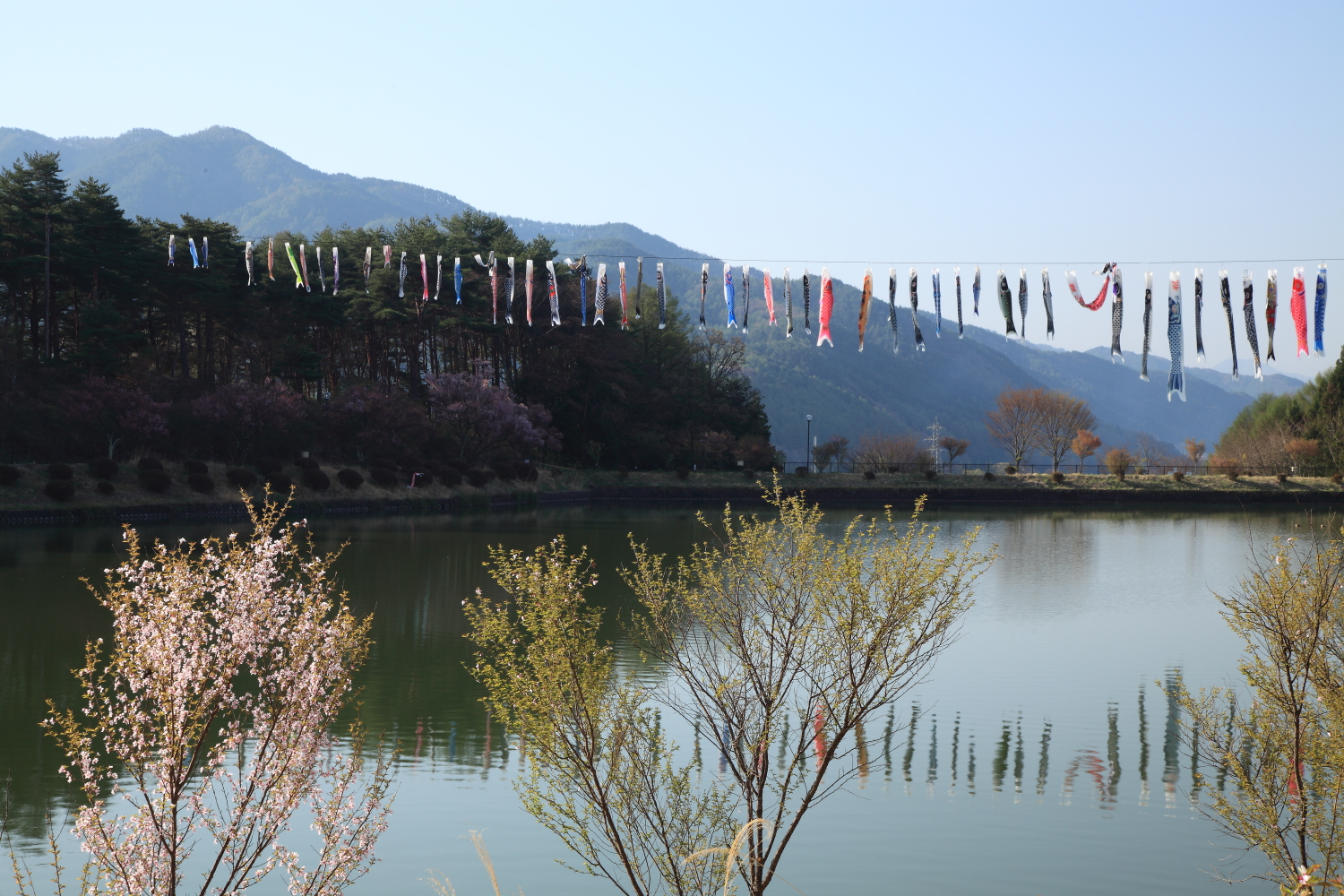
Tatsuno is located in the Ina Valley of south-central Nagano Prefecture, bordered by the Kiso Mountains. The Tenryū River flows through the town, which is surrounded by mountains and is rich in a natural environment. It is takes about 3 hours from Tokyo, 2 hours from Nagoya, 5 hours from Kyoto by train and equally by car. Part of the town is within the borders of the Enrei Ōjō Prefectural Natural Park. The Yokokawa Dam is located in Tatsuno.
Surrounding municipalities
Climate
The village has a climate characterized by characterized by warm and humid summers, and cold winters (Köppen climate classification Dfa). The average annual temperature in Tatsuno is 11.1 °C (52.0 °F). The average annual rainfall is 1,435.8 mm (56.53 in) with July as the wettest month. The temperatures are highest on average in August, at around 23.6 °C (74.5 °F), and lowest in January, at around −1.2 °C (29.8 °F).[2]
| Climate data for Tatsuno (1991−2020 normals, extremes 1978−present) | |||||||||||||
|---|---|---|---|---|---|---|---|---|---|---|---|---|---|
| Month | Jan | Feb | Mar | Apr | May | Jun | Jul | Aug | Sep | Oct | Nov | Dec | Year |
| Record high °C (°F) | 15.1 (59.2) |
18.4 (65.1) |
23.6 (74.5) |
28.8 (83.8) |
32.6 (90.7) |
33.4 (92.1) |
36.2 (97.2) |
36.4 (97.5) |
33.5 (92.3) |
28.8 (83.8) |
21.9 (71.4) |
18.8 (65.8) |
36.4 (97.5) |
| Average high °C (°F) | 3.9 (39.0) |
5.3 (41.5) |
10.0 (50.0) |
16.6 (61.9) |
22.0 (71.6) |
24.9 (76.8) |
28.4 (83.1) |
29.9 (85.8) |
25.0 (77.0) |
18.7 (65.7) |
12.8 (55.0) |
6.9 (44.4) |
17.0 (62.7) |
| Daily mean °C (°F) | −1.2 (29.8) |
−0.3 (31.5) |
3.6 (38.5) |
9.7 (49.5) |
15.2 (59.4) |
19.0 (66.2) |
22.8 (73.0) |
23.6 (74.5) |
19.3 (66.7) |
12.9 (55.2) |
6.7 (44.1) |
1.5 (34.7) |
11.1 (51.9) |
| Average low °C (°F) | −6.1 (21.0) |
−5.6 (21.9) |
−1.9 (28.6) |
3.3 (37.9) |
9.1 (48.4) |
14.2 (57.6) |
18.7 (65.7) |
19.3 (66.7) |
15.2 (59.4) |
8.5 (47.3) |
1.8 (35.2) |
−3.1 (26.4) |
6.1 (43.0) |
| Record low °C (°F) | −16.7 (1.9) |
−17.2 (1.0) |
−16.2 (2.8) |
−8.0 (17.6) |
−0.5 (31.1) |
4.6 (40.3) |
11.5 (52.7) |
11.2 (52.2) |
3.7 (38.7) |
−2.1 (28.2) |
−7.7 (18.1) |
−14.8 (5.4) |
−17.2 (1.0) |
| Average precipitation mm (inches) | 45.6 (1.80) |
58.1 (2.29) |
102.5 (4.04) |
106.5 (4.19) |
129.7 (5.11) |
174.2 (6.86) |
214.4 (8.44) |
149.7 (5.89) |
179.1 (7.05) |
146.7 (5.78) |
78.4 (3.09) |
50.9 (2.00) |
1,435.8 (56.53) |
| Average precipitation days (≥ 1.0 mm) | 6.4 | 6.2 | 9.7 | 9.5 | 10.4 | 12.6 | 13.6 | 10.2 | 11.0 | 9.3 | 7.6 | 7.1 | 113.6 |
| Mean monthly sunshine hours | 164.2 | 168.1 | 187.6 | 195.4 | 202.6 | 160.9 | 162.1 | 194.2 | 145.7 | 151.0 | 156.4 | 156.7 | 2,044 |
| Source: Japan Meteorological Agency[3][2] | |||||||||||||
History
The area of present-day Tatsuno was part of ancient Shinano Province. The village of Inatomi established on April 1, 1889, by the establishment of the municipalities system, and was elevated to town status on January 1, 1947, changing its name to Tatsuno at that time. The neighboring village of Asahi was annexed on April 1, 1955, followed by Kawashima on September 30, 1956, and Ono on March 31, 1961.
Demographics
Per Japanese census data,[4] the population of Tatsuno has declined slightly in recent decades.
| Year | Pop. | ±% |
|---|---|---|
| 1940 | 20,842 | — |
| 1950 | 24,146 | +15.9% |
| 1960 | 22,419 | −7.2% |
| 1970 | 22,351 | −0.3% |
| 1980 | 23,894 | +6.9% |
| 1990 | 23,901 | +0.0% |
| 2000 | 22,407 | −6.3% |
| 2010 | 20,909 | −6.7% |
| 2020 | 18,555 | −11.3% |
Education
Tatsuno has five public elementary schools and five public middle school operated by the town government, and one high school operated the Nagano Prefectural Board of Education. The Shinshu Honan Junior College is also located in Tatsuno.
Transportation
Railway
 East Japan Railway Company - Chūō Main Line (old line)
 Central Japan Railway Company - Iida Line
- Haba - Ina-Shimmachi - Miyaki - Tatsuno
Highway
 Chūō Expressway
 National Route 153
International relations
 - Waitomo, New Zealand.
Local attractions
- Matsuo-kyo (松尾峡): one of the most famous places in Japan for fireflies (called Genji fireflies (ゲンジボタル) in Japan) every summer. However, the intentional introduction of non-native fireflies and its negative influence on the native fireflies of Tatsuno were highlighted in an academic journal.[5] and several major newspapers.[6][7][8]
- Enrei Ōjō Prefectural Natural Park
References
- Tatsuno town official statistics(in Japanese)
- 気象庁 / 平年値(年・月ごとの値). JMA. Retrieved April 20, 2022.
- 観測史上1~10位の値(年間を通じての値). JMA. Retrieved April 20, 2022.
- Tatsuno population statistics
- Y. Iguchi (2009) The ecological impact of an introduced population on a native population in the firefly Luciola cruciata (Coleoptera: Lampyridae).Biodiversity and Conservation, 18: 82119-2126. https://doi.org/10.1007%2Fs10531-009-9576-8.
- Asahi Shimbun (Jun 17, 2008; Nagano Chunan edition, p27).
- Mainichi Shimbun (Jun 22, 2008; Nagano Nanshin edition, p25).
- Yomiuri Shimbun (July 28, 2008; evening edition, p13).
External links
 Media related to Tatsuno, Nagano at Wikimedia Commons
- Official Website (in Japanese)
Authority control | |
|---|---|
| General | |
| National libraries | |
| Other |
|
Nagano (capital) | |
| Core cities | |
| Cities | |
| Districts |
|
List of mergers in Nagano Prefecture | |
This Nagano Prefecture location article is a stub. You can help Wikipedia by expanding it. |
На других языках
[de] Tatsuno (Nagano)
Tatsuno (jap. 辰野町, -machi) ist eine Stadt im Landkreis Kamiina in der Präfektur Nagano auf der japanischen Hauptinsel Honshū.- [en] Tatsuno, Nagano
[es] Tatsuno (Nagano)
Tatsuno (辰野町, Tatsuno-machi?) es un pueblo en la prefectura de Nagano, Japón, localizado en la parte central de la isla de Honshū, en la región de Chūbu. El 1 de marzo de 2021 tenía una población estimada de 18 503 habitantes y una densidad de población de 109 personas por km².[4][ru] Тацуно (посёлок)
Тацуно (яп. 辰野町 Тацуно-мати) — посёлок в Японии, находящийся в уезде Камиина префектуры Нагано. Площадь посёлка составляет 169,02 км²[1], население — 19 719 человек (1 августа 2014)[2], плотность населения — 116,67 чел./км².Другой контент может иметь иную лицензию. Перед использованием материалов сайта WikiSort.org внимательно изучите правила лицензирования конкретных элементов наполнения сайта.
WikiSort.org - проект по пересортировке и дополнению контента Википедии