world.wikisort.org - Japan
Nagawa (長和町, Nagawa-machi) is a town located in Nagano Prefecture, Japan. As of 1 April 2019[update], the town had an estimated population of 6,088 in 2650 households,[1] and a population density of 32.6 persons per km². The total area of the town is 183.86 square kilometres (70.99 sq mi).
Nagawa
長和町 | |
|---|---|
Town | |
 Nagawa Town Hall | |
 Flag  Seal | |
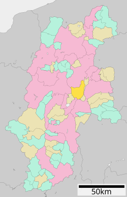 Location of Nagawa in Nagano Prefecture | |
 Nagawa | |
| Coordinates: 36°15′21.5″N 138°16′4.1″E | |
| Country | Japan |
| Region | Chūbu (Kōshin'etsu) |
| Prefecture | Nagano |
| District | Chiisagata |
| Area | |
| • Total | 183.86 km2 (70.99 sq mi) |
| Population (April 2019) | |
| • Total | 6,088 |
| • Density | 33/km2 (86/sq mi) |
| Time zone | UTC+9 (Japan Standard Time) |
| Symbols | |
| • Tree | Prunus serrulata |
| • Flower | Azalea |
| • Bird | Green pheasant |
| • Rock | Obsidian |
| Phone number | 0268-68-0111 |
| Address | 525-1 Nagakubo, Nagawa-machi, Chiisagata-gun, Nagano-ken 386-0602 |
| Website | Official website |

Geography
Nagawa is located in the center of Nagano Prefecture.
Surrounding municipalities
Climate
The town has a climate characterized by characterized by warm and humid summers, and cold, very snowy winters (Köppen climate classification Dfb). The average annual temperature in Nagawa is 8.9 °C. The average annual rainfall is 1388 mm with September as the wettest month. The temperatures are highest on average in August, at around 21.9 °C, and lowest in January, at around -3.6 °C.[2]
Demographics
Per Japanese census data,[3] the population of Nagawa has declined my more than half over the past 70 years.
| Year | Pop. | ±% |
|---|---|---|
| 1940 | 9,658 | — |
| 1950 | 12,054 | +24.8% |
| 1960 | 10,854 | −10.0% |
| 1970 | 8,791 | −19.0% |
| 1980 | 8,185 | −6.9% |
| 1990 | 7,984 | −2.5% |
| 2000 | 7,807 | −2.2% |
| 2010 | 6,782 | −13.1% |
| 2020 | 5,600 | −17.4% |
History
The area of present-day Nagawa was part of ancient Shinano Province. The area was part of the holdings of Ueda Domain during the Edo period, and had two stations on the Nakasendō highway connecting Edo with Kyoto: Nagakubo-shuku and Wada-shuku. The modern town of Nagakubo-shinmachi was established on April 1, 1889 by the establishment of the municipalities system and was renamed Nagato on September 1, 1956. The town of Nagawa was formed by the merger of Nagato with the village of Wada (also from Chiisagata District on October 1, 2005 when the town.
Education
Nagawa has two public elementary schools and one public middle school operated by the town government, and one middle school operated jointly between Nagawa and neighboring Ueda city. The town does not have a high school.
Transportation
Railway
The town does not have any passenger railway service.
Highway
 National Route 142
 National Route 152
 National Route 254
Local attractions
- Hoshikuso Pass obsidian mine site, a National Historic Site
References
External links
 Media related to Nagawa, Nagano at Wikimedia Commons
- Official Website (in Japanese)
Nagano (capital) | |
| Core cities | |
| Cities | |
| Districts |
|
List of mergers in Nagano Prefecture | |
This Nagano Prefecture location article is a stub. You can help Wikipedia by expanding it. |
На других языках
[de] Nagawa (Nagano)
Nagawa (jap.: 長和町, -machi) ist eine Stadt im Chiisagata-gun in der Präfektur Nagano auf der japanischen Hauptinsel Honshū. Die Stadt ist am 1. Oktober 2005 im Zuge einer Zusammenlegung der Stadt Nagato und des Dorfes (mura) Wada entstanden.- [en] Nagawa, Nagano
[es] Nagawa
Nagawa (長和町, Nagawa-machi?) es un pueblo en la prefectura de Nagano, Japón, localizado en la parte central de la isla de Honshū, en la región de Chūbu. El 1 de marzo de 2021 tenía una población estimada de 5580 habitantes y una densidad de población de 30 personas por km².[4][ru] Нагава
Нагава (яп. 長和町 Нагава-мати) — посёлок в Японии, находящийся в уезде Тииагата префектуры Нагано. Площадь посёлка составляет 183,95 км²[1], население — 6320 человек (1 августа 2014)[2], плотность населения — 34,36 чел./км².Другой контент может иметь иную лицензию. Перед использованием материалов сайта WikiSort.org внимательно изучите правила лицензирования конкретных элементов наполнения сайта.
WikiSort.org - проект по пересортировке и дополнению контента Википедии