world.wikisort.org - Japan
Tenryū (天龍村, Tenryū-mura) is a village located in Nagano Prefecture, Japan. As of 1 April 2019[update], the village had an estimated population of 1,275 in 712 households,[1] and a population density of 12.1 persons per km². The total area of the village is 109.44 square kilometres (42.26 sq mi).
Tenryū
天龍村 | |
|---|---|
Village | |
 Tenryū Village Hall | |
 Flag  Seal | |
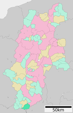 Location of Tenryū in Nagano Prefecture | |
 Tenryū | |
| Coordinates: 35°16′34.9″N 137°51′15.2″E | |
| Country | Japan |
| Region | Chūbu (Kōshin'etsu) |
| Prefecture | Nagano |
| District | Shimoina |
| Area | |
| • Total | 109.44 km2 (42.26 sq mi) |
| Population (April 2019) | |
| • Total | 1,275 |
| • Density | 12/km2 (30/sq mi) |
| Time zone | UTC+9 (Japan Standard Time) |
| Symbols | |
| • Tree | Trachycarpus |
| • Flower | Lilium auratum |
| • Bird | Dollarbird |
| Phone number | 0260-26-2111 |
| Address | 878 Hiraoka Tenryū-mura, Shimoina-gun, Nagano-ken 399-1201 |
| Website | Official website |

Geography
Tenryū is located in mountainous far south of Nagano Prefecture on its border with Aichi Prefecture and Shizuoka Prefecture. The Tenryū River runs through the village, which is over 90% covered in mountains and forest. Hiraoka Dam is located within Tenryū.
Surrounding municipalities
- Nagano Prefecture
- Aichi Prefecture
- Toyone
- Shizuoka Prefecture
- Hamamatsu
Climate
The town has a climate characterized by hot and humid summers, and cold winters (Köppen climate classification Cfa). The average annual temperature in Tenryū is 13.3 °C. The average annual rainfall is 1964 mm with September as the wettest month. The temperatures are highest on average in August, at around 25.1 °C, and lowest in January, at around 1.9 °C.[2]
Demographics
Per Japanese census data,[3] the population of Tenryū has dropped rapidly over the past 70 years.
| Year | Pop. | ±% |
|---|---|---|
| 1940 | 5,763 | — |
| 1950 | 8,337 | +44.7% |
| 1960 | 5,792 | −30.5% |
| 1970 | 4,222 | −27.1% |
| 1980 | 3,389 | −19.7% |
| 1990 | 2,822 | −16.7% |
| 2000 | 2,239 | −20.7% |
| 2010 | 1,657 | −26.0% |
| 2020 | 1,178 | −28.9% |
History
The area of present-day Tenryū was part of ancient Shinano Province. The village was established on September 30, 1956 by the merger of the villages of Hiraoka and Kamihara.
Education
Tenryū has one public elementary school and one public middle school operated by the village government, and one private elementary school and one private middle school. The village does not have a high school.
Transportation
Railway
 JR Tōkai – Iida Line
- Nakaisamurai - Ina-Kozawa - Ugusu - Hiraoka - Shiteguri
Highway
 National Route 418
References
External links
 Media related to Tenryū, Nagano at Wikimedia Commons
- Official Website (in Japanese)
Nagano (capital) | |
| Core cities | |
| Cities | |
| Districts |
|
List of mergers in Nagano Prefecture | |
This Nagano Prefecture location article is a stub. You can help Wikipedia by expanding it. |
На других языках
- [en] Tenryū, Nagano
[es] Tenryū (Nagano)
Tenryū (天龍村, Tenryū-mura?) es una villa en la prefectura de Nagano, Japón, localizada en la parte central de la isla de Honshū, en la región de Chūbu. El 1 de marzo de 2021 tenía una población estimada de 1120 habitantes y una densidad de población de 10 personas por km².[4][ru] Тенрю (Нагано)
Тенрю (яп. 天龍村 Тэнрю:-мура) — село в Японии, находящееся в уезде Симоина префектуры Нагано. Площадь села составляет 109,56 км²[1], население — 1446 человек (1 августа 2014)[2], плотность населения — 13,20 чел./км².Другой контент может иметь иную лицензию. Перед использованием материалов сайта WikiSort.org внимательно изучите правила лицензирования конкретных элементов наполнения сайта.
WikiSort.org - проект по пересортировке и дополнению контента Википедии