world.wikisort.org - Japan
Omi (麻績村, Omi-mura) is a village located in Nagano Prefecture, Japan. As of 1 April 2019[update], the village had an estimated population of 2,738 in 1130 households,[1] and a population density of 80 persons per km². The total area of the village is 34.48 square kilometres (13.31 sq mi).
Omi
麻績村 | |
|---|---|
Village | |
 Omi Village Hall | |
 Flag  Seal | |
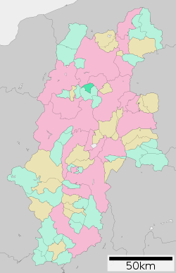 Location of Omi in Nagano Prefecture | |
 Omi | |
| Coordinates: 36°27′21.9″N 138°2′42.7″E | |
| Country | Japan |
| Region | Chūbu (Kōshin'etsu) |
| Prefecture | Nagano |
| District | Higashichikuma |
| Area | |
| • Total | 34.38 km2 (13.27 sq mi) |
| Population (April 2019) | |
| • Total | 2,738 |
| • Density | 80/km2 (210/sq mi) |
| Time zone | UTC+9 (Japan Standard Time) |
| Symbols | |
| • Tree | Magnolia kobus |
| • Flower | Erythronium japonicum |
| • Bird | Common cuckoo |
| Phone number | 0263-69-3111 |
| Address | 3837 Asa, Omi-mura, Higashichikuma-gun, Nagano-ken 399-7701 |
| Website | Official website |

Geography
Omi is located in the centre of Nagano Prefecture. The Kitayama Dam and the Hijiri Highlands are located in the village.
Surrounding municipalities
- Nagano Prefecture
- Nagano
- Chikuma
- Ikusaka
- Chikuhoku
Climate
The village has a climate characterized by characterized by hot and humid summers, and cold winters (Köppen climate classification Cfa). The average annual temperature in Omi is 10.3 °C. The average annual rainfall is 1159 mm with September as the wettest month. The temperatures are highest on average in August, at around 23.7 °C, and lowest in January, at around -2.3 °C.[2]
Demographics
Per Japanese census data,[3] the population of Omi has been declining over the past 70 years.
| Year | Pop. | ±% |
|---|---|---|
| 1940 | 4,819 | — |
| 1950 | 5,855 | +21.5% |
| 1960 | 5,080 | −13.2% |
| 1970 | 4,512 | −11.2% |
| 1980 | 4,016 | −11.0% |
| 1990 | 3,622 | −9.8% |
| 2000 | 3,347 | −7.6% |
| 2010 | 2,971 | −11.2% |
| 2020 | 2,593 | −12.7% |
History
The area of present-day Ikusaka was part of ancient Shinano Province and the name of "Omi" appears in the Kamakura period Azuma kagami. The area was part of the holdings of Matsumoto Domain during the Edo period. The village of Ikusaka was established on April 1, 1889 by the establishment of the modern municipalities system. An attempt to merge with neighboring Chikuhoku was rejected by voters in 2004.
Economy
The economy of the village is based on agriculture.
Education
Omi has one public elementary school and one public middle school shared with the neighboring village of Chikuhoku. The village does not have a high school.
Transportation
Railway
 East Japan Railway Company - Shinonoi Line
Highway
 National Route 403
Local attractions
References
- Omi village official statistics (in Japanese)
- Omi climate data
- Omi population statistics
- 麻績村立聖(ひじり)博物館 Retrieved February 10, 2016 (in Japanese)
External links
 Media related to Omi, Nagano at Wikimedia Commons
- Official Website (in Japanese)
Nagano (capital) | |
| Core cities | |
| Cities | |
| Districts |
|
List of mergers in Nagano Prefecture | |
This Nagano Prefecture location article is a stub. You can help Wikipedia by expanding it. |
На других языках
[de] Omi (Nagano)
Omi (jap.: 麻績村, -mura) ist ein Dorf in Higashichikuma-gun in der Präfektur Nagano auf der japanischen Hauptinsel Honshū.- [en] Omi, Nagano
[ru] Оми (село)
Оми (яп. 麻績村 Оми-мура) — село в Японии, находящееся в уезде Хигаситикума префектуры Нагано. Площадь села составляет 34,38 км²[1], население — 2814 человек (1 августа 2014)[2], плотность населения — 81,85 чел./км².Другой контент может иметь иную лицензию. Перед использованием материалов сайта WikiSort.org внимательно изучите правила лицензирования конкретных элементов наполнения сайта.
WikiSort.org - проект по пересортировке и дополнению контента Википедии