world.wikisort.org - New_Zealand
Waitomo is a rural community in the King Country region of New Zealand's North Island. There are several solutional cave systems in the area around the village, which are popular tourist attractions. Restaurants and accommodation are centred in the village to serve visiting tourists.
Waitomo | |
|---|---|
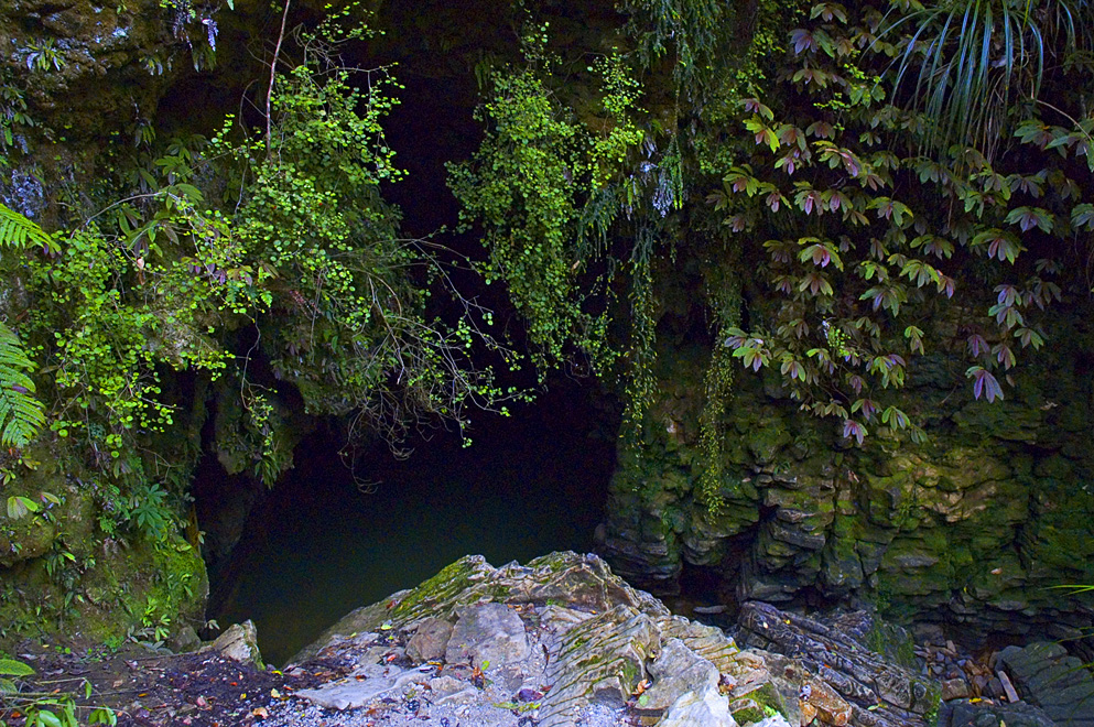 The entrance to a cave in the Waitomo area | |
 | |
| Coordinates: | |
| Country | New Zealand |
| Region | Waikato Region |
| Territorial authority | Waitomo District |
| Population (2018) | |
| • Total | 1,185 |
| Time zone | UTC+12 (NZST) |
| • Summer (DST) | UTC+13 (NZDT) |
| Area code(s) | 07 |
The word Waitomo comes from the Māori language: wai meaning water and tomo meaning a doline or sinkhole; it can thus be translated to be "water passing through a hole".[1] The caves are formed in Oligocene limestone.[2]
The historic Waitomo Caves Hotel is located in Waitomo Caves village.[3]
History
The village Waitomo Caves is named for the hundreds of caves present in the spectacular karst landscape.
The limestone landscape of the Waitomo District area has been the centre of increasingly popular commercial caving tourism since before 1900. Initially mostly consisting of impromptu trips guided by local Māori, a large cave system near Waitomo Caves were nationalised by the Crown[4] and managed as a (relatively genteel) tourism attraction from 1904 onwards.[5] A 1915 guide said, "It is reached by railway to Hangatiki, thence 6 miles by coach along a good road".[6]
A visit to Waitomo Caves made number 14 amongst a list of 101 "Kiwi must-do's" in a New Zealand Automobile Association poll of over 20,000 motorists published 2007,[7] and in 2004, around 400,000 visitors entered caves in the area.[5]
The Waitomo Caves Museum provides information about the karst landscape, caves and caving and the history of the area.
Tourist caves

Companies specialise in leading tourists through the caves of the area, from easily accessible areas with hundreds of tourists per hour in the peak season, to extreme sports, like crawls into cave systems, which are only seen by a few tourists each day.[citation needed]
The caves are noted for their stalactite and stalagmite displays, and (in the caves with streams running through) for the presence of glowworms (the fungus gnat Arachnocampa luminosa).
Walks
The Waitomo Walkway runs through the valley of the Waitomo Stream (a tributary of the Waipā River) for 3.3 km (2.1 mi) from the village to the Ruakuri Scenic Reserve.[8] At the reserve the Ruakuri Walk leads through short caves to the Ruakuri Natural Bridge.[9]
Te Araroa, a national long distance walkway, passes through Waitomo. The section from Mt Pirongia joins the Waitomo Walkway to enter the village.[10] The 17.5 km (10.9 mi) section to Te Kuiti goes over Mangapu River suspension bridge and through Pehitawa kahikatea forest.[11]
Demographics
| Year | Pop. | ±% p.a. |
|---|---|---|
| 2006 | 1,059 | — |
| 2013 | 1,101 | +0.56% |
| 2018 | 1,185 | +1.48% |
| Source: [12] | ||
The statistical area of Hangatiki, which covers 326 square kilometres, had a population of 1,185 at the 2018 New Zealand census, an increase of 84 people (7.6%) since the 2013 census, and an increase of 126 people (11.9%) since the 2006 census. There were 432 households. There were 618 males and 564 females, giving a sex ratio of 1.1 males per female. The median age was 41.4 years (compared with 37.4 years nationally), with 240 people (20.3%) aged under 15 years, 213 (18.0%) aged 15 to 29, 543 (45.8%) aged 30 to 64, and 189 (15.9%) aged 65 or older.
Ethnicities were 72.9% European/Pākehā, 36.5% Māori, 1.3% Pacific peoples, 1.5% Asian, and 1.8% other ethnicities (totals add to more than 100% since people could identify with multiple ethnicities).
The proportion of people born overseas was 11.4%, compared with 27.1% nationally.
Although some people objected to giving their religion, 57.0% had no religion, 31.4% were Christian, 0.5% were Hindu and 4.8% had other religions.
Of those at least 15 years old, 138 (14.6%) people had a bachelor or higher degree, and 219 (23.2%) people had no formal qualifications. The median income was $34,000, compared with $31,800 nationally. The employment status of those at least 15 was that 558 (59.0%) people were employed full-time, 165 (17.5%) were part-time, and 21 (2.2%) were unemployed.[12]
Marae
The community has a number of marae, affiliated with Ngāti Maniapoto hapū:[13][14]
- Kaputuhi Marae is affiliated with the hapū of Ngāti Matakore, Pare te Kawa, Ngāti Peehi and Rōrā.
- Te Kauae Marae and Te Kauae o Niu Tereni meeting house are affiliated with the hapū of Huiao, Ngāti Kinohaku, Ngāti Peehi and Ngāti Te Kanawa.
- Te Korapatu Marae is affiliated with the hapū of Peehi and Te Kanawa.
- Pohatuiri Marae is affiliated with the hapū of Uekaha.
- Tokikapu Marae and Matua a Iwi meeting house are affiliated with the hapū of Ruapuha, Te Kanawa and Uekaha.[15]
Education
Waitomo Caves School is a co-educational state primary school,[16][17] with a roll of 20 as of March 2022.[18][19]
References
- "Waitomo Caves". Encyclopedia of New Zealand (1966).
- "The Geological History of New Zealand". Retrieved 16 May 2014.
- "Search the List | Waitomo Hotel | Heritage New Zealand". www.heritage.org.nz. Retrieved 4 August 2021.
- Evans, Kate (May–June 2017). "Rock Stars". New Zealand Geographic.
The Scenery Preservation Act of 1903 gave the government far-reaching powers to forcibly purchase land, and in 1904 the Waitomo Glowworm Cave was the first place to be nationalised. The landowners were awarded £625 in compensation
- Caving tourism (from Te Ara: The Encyclopedia of New Zealand)
- Bradbury, E E (1915). The Raglan and Kawhia Districts. Waikato University library: Bradbury. p. 85.
- Dye, Stuart (10 February 2007). "Peaks, sounds, parks and islands tops in Kiwi eyes". The New Zealand Herald. Retrieved 1 December 2011.
- "Waitomo Walkway". www.doc.govt.nz. Department of Conservation. Retrieved 4 February 2017.
- "Ruakuri Walk". www.doc.govt.nz. Department of Conservation. Retrieved 4 February 2017.
- "Pirongia to Waitomo:Te Araroa – New Zealand's Trail – Waikato / King Country". www.teararoa.org.nz. Retrieved 4 February 2017.
- "Pehitawa Track:Te Araroa – New Zealand's Trail – Waikato / King Country". www.teararoa.org.nz. Retrieved 4 February 2017.
- "Statistical area 1 dataset for 2018 Census". Statistics New Zealand. March 2020. Hangatiki (187100). 2018 Census place summary: Hangatiki
- "Te Kāhui Māngai directory". tkm.govt.nz. Te Puni Kōkiri.
- "Māori Maps". maorimaps.com. Te Potiki National Trust.
- "Tainui Maniapoto - Hapū and Marae". Te Puni Kōkiri. Retrieved 9 December 2019.
- "Waitomo Caves School Official School Website". waitomocaves.school.nz.
- "Waitomo Caves School Ministry of Education School Profile". educationcounts.govt.nz. Ministry of Education.
- "New Zealand Schools Directory". New Zealand Ministry of Education. Retrieved 23 April 2022.
- "Waitomo Caves School Education Review Office Report". ero.govt.nz. Education Review Office.
External links
- Waitomo Caves area in Episode 4 "Caves" of BBC's Planet Earth.
- Waitomo Caves Museum & Discovery Centre
Другой контент может иметь иную лицензию. Перед использованием материалов сайта WikiSort.org внимательно изучите правила лицензирования конкретных элементов наполнения сайта.
WikiSort.org - проект по пересортировке и дополнению контента Википедии