world.wikisort.org - France
Oxelaëre (from Flemish; Okselare in modern Dutch spelling) is a commune in the Nord department in northern France.
Oxelaëre
Okselare | |
|---|---|
Commune | |
 Houses in the centre of the village | |
 Coat of arms | |
Location of Oxelaëre  | |
 Oxelaëre  Oxelaëre | |
| Coordinates: 50°47′22″N 2°28′24″E | |
| Country | France |
| Region | Hauts-de-France |
| Department | Nord |
| Arrondissement | Dunkerque |
| Canton | Bailleul |
| Intercommunality | Flandre Intérieure |
| Government | |
| • Mayor (2020–2026) | Stéphane Dieusaert[1] |
| Area 1 | 4.72 km2 (1.82 sq mi) |
| Population | 517 |
| • Density | 110/km2 (280/sq mi) |
| Demonym(s) | Oxelaërois (es) |
| Time zone | UTC+01:00 (CET) |
| • Summer (DST) | UTC+02:00 (CEST) |
| INSEE/Postal code | 59454 /59670 |
| Elevation | 29–103 m (95–338 ft) (avg. 36 m or 118 ft) |
| 1 French Land Register data, which excludes lakes, ponds, glaciers > 1 km2 (0.386 sq mi or 247 acres) and river estuaries. | |
Heraldry
 |
The arms of Oxelaëre are blazoned : Chequy Or and gules. (Oxelaëre, Quesnoy-sur-Deûle and Sars-et-Rosières use the same arms.)
|
See also
References
- "Répertoire national des élus: les maires". data.gouv.fr, Plateforme ouverte des données publiques françaises (in French). 2 December 2020.
- "Populations légales 2019". The National Institute of Statistics and Economic Studies. 29 December 2021.
 St Martin's church
 St Martin's church
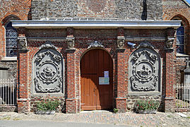 Porch of St Martin's church
 Cemetery


| Wikimedia Commons has media related to Oxelaëre. |
This Nord geographical article is a stub. You can help Wikipedia by expanding it. |
Текст в блоке "Читать" взят с сайта "Википедия" и доступен по лицензии Creative Commons Attribution-ShareAlike; в отдельных случаях могут действовать дополнительные условия.
Другой контент может иметь иную лицензию. Перед использованием материалов сайта WikiSort.org внимательно изучите правила лицензирования конкретных элементов наполнения сайта.
Другой контент может иметь иную лицензию. Перед использованием материалов сайта WikiSort.org внимательно изучите правила лицензирования конкретных элементов наполнения сайта.
2019-2026
WikiSort.org - проект по пересортировке и дополнению контента Википедии
WikiSort.org - проект по пересортировке и дополнению контента Википедии