world.wikisort.org - France
Châteaulin (French: [ʃɑtolɛ̃] (![]() listen); Breton: Kastellin) is a commune in the Finistère department and administrative region of Brittany in north-western France. It is a sub-prefecture of the department.
listen); Breton: Kastellin) is a commune in the Finistère department and administrative region of Brittany in north-western France. It is a sub-prefecture of the department.
Châteaulin
| |
|---|---|
Subprefecture and commune | |
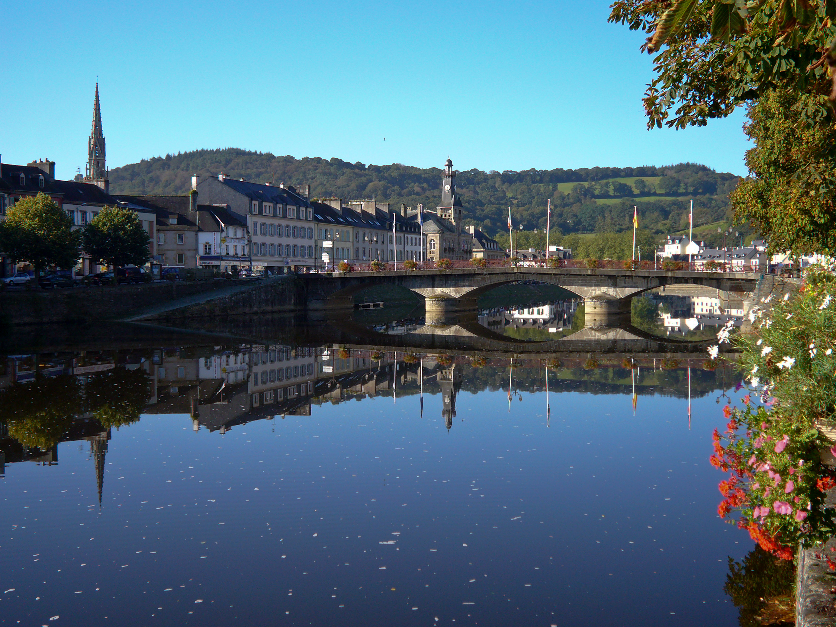 Châteaulin and the Aulne | |
 Coat of arms | |
Location of Châteaulin  | |
 Châteaulin  Châteaulin | |
| Coordinates: 48°11′51″N 4°05′19″W | |
| Country | France |
| Region | Brittany |
| Department | Finistère |
| Arrondissement | Châteaulin |
| Canton | Crozon |
| Intercommunality | Pleyben-Châteaulin-Porzay |
| Government | |
| • Mayor (2020–2026) | Gaëlle Nicolas[1] |
| Area 1 | 20.81 km2 (8.03 sq mi) |
| Population | 5,164 |
| • Density | 250/km2 (640/sq mi) |
| Time zone | UTC+01:00 (CET) |
| • Summer (DST) | UTC+02:00 (CEST) |
| INSEE/Postal code | 29026 /29150 |
| Elevation | 2–206 m (6.6–675.9 ft) |
| 1 French Land Register data, which excludes lakes, ponds, glaciers > 1 km2 (0.386 sq mi or 247 acres) and river estuaries. | |
Geography
Châteaulin is located in a valley towards the center of the Finistère. Situated on the Aulne River, also Canal de Nantes à Brest there, Châteaulin is centrally located between Quimper to the south and Brest to the North. To the West, the Menez-Hom hills separate it from the Crozon peninsula and the Bay of Douarnenez which leads into the Atlantic Ocean.
Population
In French the inhabitants of Châteaulin are known as Châteaulinois.
|
| ||||||||||||||||||||||||||||||||||||||||||||||||||||||||||||||||||||||||||||||||||||||||||||||||||||||||||||||||||
| Source: EHESS[3] and INSEE (1968-2017)[4] | |||||||||||||||||||||||||||||||||||||||||||||||||||||||||||||||||||||||||||||||||||||||||||||||||||||||||||||||||||
Breton language
In 2008, 1.96% of primary-school children attended bilingual schools.[5]
Economy
Châteaulin's economy rests on the twin bedrocks of food processing (salmon and poultry) and, to an ever-greater extent, tourism. The Gendarmerie school on the outskirts of the town provides for a large number of families and the many recruits passing through the school provide the economic backbone of the town's night-life. A cake shop is also well known within the area of Châteaulin,"Histoire de Macaron" is famous thanks to its tasty and wide range of macarons as well as the Java, created in 1907 by Mister Le Meur, which is a legend in the city.
Personalities
- Yves Marie André, better known as le Père André (1675–1764), Jesuit priest and philosopher.
- 27 November 1761 : Birth of Julien Marie Cosmao-Kerjulien (died in Brest 17 February 1825), Rear-Admiral and Baron d'Empire.
- Jean Moulin, emblem of the French Resistance during the Second World War, was the sub-prefect from 1930 to 1933.
- Henri Ernest Ponthier de Chamaillard, usually known as Ernest de Chamaillard, (9 December 1862, Gourlizon – 1931, Eaubonne) was a French artist, one of a group of painters who gathered in the Breton village of Pont-Aven. He was a friend and student of Paul Gauguin. In 1893, unable to make a living from his painting, he moved to Châteaulin behind Église Saint-Idunet where he worked as a lawyer until 1905.
International relations
Châteaulin is twinned with:
See also
- Cantons of the Finistère department
- Communes of the Finistère department
- Arrondissements of the Finistère department
- Parc naturel régional d'Armorique

References
- "Répertoire national des élus: les maires". data.gouv.fr, Plateforme ouverte des données publiques françaises (in French). 2 December 2020.
- "Populations légales 2019". The National Institute of Statistics and Economic Studies. 29 December 2021.
- Des villages de Cassini aux communes d'aujourd'hui: Commune data sheet Châteaulin, EHESS. (in French)
- Population en historique depuis 1968, INSEE
- (in French) Ofis ar Brezhoneg: Enseignement bilingue
External links
- Official website of the town of Châteaulin / Kastellin (in French)
- Base Mérimée: Search for heritage in the commune, Ministère français de la Culture. (in French)
Authority control | |
|---|---|
| General |
|
| National libraries | |
This Finistère geographical article is a stub. You can help Wikipedia by expanding it. |
На других языках
[de] Châteaulin
Châteaulin (bretonisch Kastellin) ist eine französische Gemeinde mit 5164 Einwohnern (Stand 1. Januar 2019) und Unterpräfektur im Département Finistère in der Bretagne. Châteaulin gehört zum Kanton Crozon (bis 2015 Hauptort des Kantons Châteaulin).- [en] Châteaulin
[ru] Шатолен
Шатолен (фр. Châteaulin, брет. Kastellin) — город на северо-западе Франции, находится в регионе Бретань, департамент Финистер, центр округа Шатолен, кантон Крозон. Расположен на востоке полуострове Бретань, в 46 км к юго-востоку от Бреста и в 27 км к северу от Кемпера, в 3 км от национальной автомагистрали N165. На территории города соединяются река Он и канал Нант — Брест. В левобережной части города находится железнодорожная станция Шатолен-Амбраншман линии Савене-Ландерно.Другой контент может иметь иную лицензию. Перед использованием материалов сайта WikiSort.org внимательно изучите правила лицензирования конкретных элементов наполнения сайта.
WikiSort.org - проект по пересортировке и дополнению контента Википедии