world.wikisort.org - France
Anoye (French pronunciation: [anɔj]; Occitan: Anoja) is a commune in the Pyrénées-Atlantiques department in the Nouvelle-Aquitaine region of southwestern France. It is part of the urban area (aire d'attraction des villes) of Pau.[3]
Anoye | |
|---|---|
Commune | |
 Town hall | |
Location of Anoye  | |
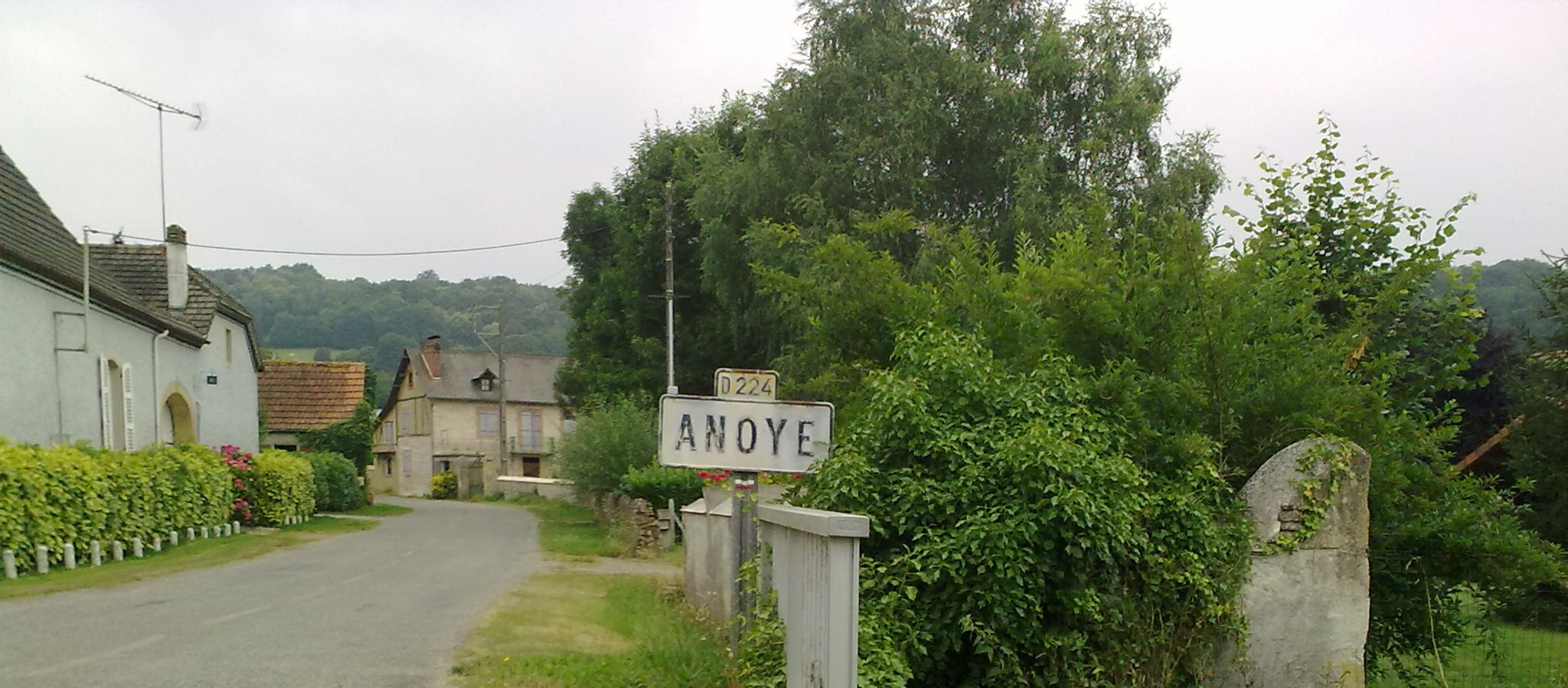
 Anoye  Anoye | |
| Coordinates: 43°23′44″N 0°08′11″W | |
| Country | France |
| Region | Nouvelle-Aquitaine |
| Department | Pyrénées-Atlantiques |
| Arrondissement | Pau |
| Canton | Terres des Luys et Coteaux du Vic-Bilh |
| Intercommunality | Nord Est Béarn |
| Government | |
| • Mayor (2020–2026) | Alain Lavoye[1] |
| Area 1 | 9.65 km2 (3.73 sq mi) |
| Population | 136 |
| • Density | 14/km2 (37/sq mi) |
| Time zone | UTC+01:00 (CET) |
| • Summer (DST) | UTC+02:00 (CEST) |
| INSEE/Postal code | 64028 /64350 |
| Elevation | 199–344 m (653–1,129 ft) (avg. 275 m or 902 ft) |
| 1 French Land Register data, which excludes lakes, ponds, glaciers > 1 km2 (0.386 sq mi or 247 acres) and river estuaries. | |
The inhabitants of the commune are known as Anoyais or Anoyaises.[4]
Geography


Anoye is located some 25 km north-east of Pau and 15 km west of Vic-en-Bigorre. It can be accessed by the D604 road coming north from the D7 just west of Baleix and continuing through the village and the commune north to Maspie-Lalonquere-Juillacq. The D224 road also goes east from the village to Momy and the D207 road forms part of the western border of the commune. The commune is heavily forested in the east and central west however there is a large area of farmland in a central north-south strip and also in the west.
The Léez river, a tributary of the Adour, flows from south to north in the east of the commune with a tributary forming the north-western border of the commune and another tributary forming part of the southern border. A further tributary flows east just south of the village into the Lees.
Historical Places and Hamlets
- Astis[5][6]
- Bourdallé[7]
- Cantou[8]
- Capdepont
- Chambord
- la Commande[9] or Lacommande
- Dibat
- Fustié[10]
- Gassiabère
- Gué
- l'Honoré[11]
- Hourticq[12]
- Lasbarthes
- Latare
- Lermanou[13]
- Mandou[14]
- Mouly d'Anoye[15]
- Mouly deu Poun[16]
- Nouaou[17]
- Perrieu
- Pessarthou[18]
- Talabot
- Teulé
- Trianon
- Les Trois Fontaines
- Les Tuquets
Neighbouring communes and villages
Places adjacent to Anoye | |
|---|---|
Toponymy
The commune name in Bearnais is Anoja (according to the classical norm of Occitan).
Brigitte Jobbé-Duval[19] states that the origin of the name is Latin (noda or noia) and refers to a "marshland".
The following table details the origins of the commune name and other names in the commune.
| Name | Spelling | Date | Source | Page | Origin | Description |
|---|---|---|---|---|---|---|
| Anoye | Noja | 1060 | Grosclaude | Marca | Village | |
| Anoia | 11th century | Raymond | 6 | Saint-Pé | ||
| Anoia | 1131 | Grosclaude | ||||
| Noye | 1212 | Grosclaude | Marca | |||
| Noia | 13th century | Raymond | 6 | Fors de Béarn | ||
| le casteg d'Anoge | 1372 | Raymond | 6 | Malta | ||
| Noye | 1385 | Raymond | 6 | Census | ||
| Sanctus Orentius de Anoya | 1485 | Raymond | 6 | Malta | ||
| Noye | 1750 | Cassini | ||||
| Annoye | 1801 | Ldh/EHESS/Cassini | Bulletin des lois | |||
| La Brouste | La Brouste | 1778 | Raymond | 36 | Denombrement | Wood |
| Caubin de Sendets | Los Ospitals de Sendegs e de Caubin de l'ordie de Sent Johan de Jherusalem | 1341 | Raymond | 47 | Malta | Commandery of the Order of St John of Jerusalem. |
| L'Espitau de Sendetz d'Anoya | 1492 | Raymond | 47 | Pau | ||
| L'Espitau de Scendetz | 1538 | Raymond | 47 | Reformation | ||
| l'Espitau quy lo comanday de Cauby thien | 1548 | Raymond | 47 | Reformation | ||
| Caubii de Sendets | 1585 | Raymond | 47 | Anoye | ||
| Boirie Saint-Jacques | 1585 | Raymond | 47 | Anoye | ||
| la Commande de Sendets | 1585 | Raymond | 47 | Anoye | ||
| La Cave | La Cave | 1863 | Raymond | 47 | Place | |
| Chemin de la Commande | lo molin deu Pont sur le Lés | 1538 | Raymond | 51-52 | Reformation | A way between Momy and Anoye, part of the Romiu way on the Way of St James. In 1538 it designated a Mill of the Commandery of the Order of St John of Jerusalem of Caubin and Morlaàs. |
Sources:
- Grosclaude: Toponymic Dictionary of communes, Béarn, 2006 (in French)[20]
- Raymond: Topographic Dictionary of the Department of Basses-Pyrenees, 1863, on the page numbers indicated in the table. (in French)[21]
- Cassini: Cassini Map from 1750[22]
- Ldh/EHESS/Cassini: Des villages de Cassini aux communes d'aujourd'hui: Commune data sheet Anoye, EHESS. (in French)
Origins:
- Marca: Pierre de Marca, History of Béarn.[23]
- Saint-Pé: Cartulary of the Abbey of Saint-Pé[24]
- Fors de Béarn[25]
- Malta: Titles of the Order of St John of Jerusalem[26]
- Census: Census of Béarn[25]
- Denombrement: Denombremont of Anoye[27]
- Pau:[28]
- Anoye: Titles of Anoye[29]
History
Brigitte Jobbé-Duval[19] indicates that the village, a stop on the Way of Saint James of Compostela, was identified in the 11th century. There was also a hospital at Anoye run by the Knights of St. John of Jerusalem under the responsibility of the Commander of Caubin.
In 1385, according to the census demanded by Gaston Phoebus, the village of Anoye had 45 fires and depended on the Bailiwick of Lembeye. There was a market, three to four bakeries, and seven shops.[30]
In 1648[21] the Barony of Lons became a marquisate which included Abitain, Anoye, Baleix, Castillon, Juillacq, Le Leu (a hamlet in Oraàs), Lion, Lons, Maspie, Oraàs, Peyrède (fief of Oraàs), Sauvagnon, and Viellepinte. Paul Raymond[21] noted that Anoye was a former archpriesthood of the diocese of Lescar, a member of the Commandery of Saint John of Jerusalem, of Caubin, and of Morlaàs.
Anoye was the chief town of a district called the Clau of Anoye[21] comprising Anoye, Maspie, Juillacq, and Lion.
Administration
This list is incomplete; you can help by adding missing items. (April 2021) |
List of Successive Mayors[31]
| From | To | Name |
|---|---|---|
| 1995 | 2014 | Jean Puyo |
| 2014 | 2026 | Alain Lavoye |
Inter-communality
Anoye is a member of four inter-communal structures:
- The Communauté de communes du Nord-Est Béarn;
- The SIVU of Highways of the Canton de Lembeye;
- The AEP association of the Lembeye Region;
- The Energy association of Pyrénées-Atlantiques.
Demography
In 2017 the commune had 144 inhabitants.
|
| ||||||||||||||||||||||||||||||||||||||||||||||||||||||||||||||||||||||||||||||||||||||||||||||||||||||||||||||||||
| Source: EHESS[32] and INSEE[33] | |||||||||||||||||||||||||||||||||||||||||||||||||||||||||||||||||||||||||||||||||||||||||||||||||||||||||||||||||||
Culture and Heritage
Civil heritage
The commune has many buildings and structures that are registered as historical monuments:
- A Fountain (1652)
 [34]
[34] - A Hospital (ruins)[35][36] of the Hospitallers of Saint John of Jerusalem and the Knights of St. John of Jerusalem of Sendets, founded in 1315. The hospital had two Maltese Boundary Markers (18th century)
 called maltaises which are registered as historical objects. One has been in the Museum of Morlaàs since 1965 and the second has disappeared.[37]
 - A Mill at Mouly deu Poun (18th century)[16]
- A Mill at Mouly d'Anoye (1838)[15]
- A Bridge (1784)[38] over the Léez.
- A Fortified Complex (11th century)[39] (Motte-and-bailey castle, outer courtyard, moat, entry portal, church, castle) was a lordship present in the 11th century.
- A former Lay Abbey at Astis (1784)[5]
- The Castaing House (1831)[40]
- The Sanglar House (1788)[41]
- The Teinto House (1861)[42]
- The Puyo-Ladevèse Farmhouse at Mandou (1803)[14]
- The Poudjet Farmhouse (1844)[43]
- A Farmhouse at Pessarthou (1639)[18]
- A Farmhouse at Nouaou (1793)[17]
- A former Town Hall and School (1783)[44]
- The Loste Farmhouse (19th century)[45]
- A Farmhouse at l'Honoré (1793)[11]
- A Farmhouse at Lermanou (19th century)[13]
- A Farmhouse at Bourdallé (19th century)[7]
- A Farmhouse at la Commande (19th century)[9]
- A Farmhouse at Hourticq (19th century)[12]
- The Guithou House (16th century)[46]
- A Farmhouse at Fustié (19th century)[10]
- A Farmhouse at Cantou (1807)[8]
- Houses and Farms (17th-19th century)[47]
- The Chateau de Salettes (17th century)[48]
- The Maison Commune (Communal House) (1771)[49]
Religious heritage
The commune has several religious buildings and sites that are registered as historical monuments:
- A Presbytery (1701)[50]
- The Parish Church of Saint-Orens (remains)[6] which was at a place called Astis until the 18th century.
- The Parish Church of Notre Dame (12th century)[51] was a former chapel from the 12th, 13th, and 14th centuries and was rebuilt in 1757, 1764, and 1878. The church contains many items which are registered as historical objects:
Anoye is a stage on the via Tolosane (or Toulouse route) on the Way of St James.
See also
References
- "Répertoire national des élus: les maires". data.gouv.fr, Plateforme ouverte des données publiques françaises (in French). 2 December 2020.
- "Populations légales 2019". The National Institute of Statistics and Economic Studies. 29 December 2021.
- Commune d'Anoye (64028), INSEE
- Inhabitants of Pyrénées-Atlantiques (in French)
- Ministry of Culture, Mérimée IA00026870 Lay Abbey (in French)
- Ministry of Culture, Mérimée IA00026421 Parish Church of Saint-Orens (in French)
- Ministry of Culture, Mérimée IA00026428 Farmhouse at Bourdallé (in French)
- Ministry of Culture, Mérimée IA00026423 Farmhouse at Cantou (in French)
- Ministry of Culture, Mérimée IA00026427 Farmhouse at la Commande (in French)
- Ministry of Culture, Mérimée IA00026424 Farmhouse at Fustié (in French)
- Ministry of Culture, Mérimée IA00026430 Farmhouse at l'Honoré (in French)
- Ministry of Culture, Mérimée IA00026426 Farmhouse at Hourticq (in French)
- Ministry of Culture, Mérimée IA00026429 Farmhouse at Lermanou (in French)
- Ministry of Culture, Mérimée IA00026437 Puyo-Ladevèse Farmhouse (in French)
- Ministry of Culture, Mérimée IA00027287 Mill at Mouly d'Anoye (in French)
- Ministry of Culture, Mérimée IA00027508 Mill at Mouly deu Poun (in French)
- Ministry of Culture, Mérimée IA00026433 Farmhouse at Nouaou (in French)
- Ministry of Culture, Mérimée IA00026434 Farmhouse at Pessarthou (in French)
- Brigitte Jobbé-Duval, Dictionary of Place names - Pyrénées-Atlantiques, 2009, Archives and Culture, ISBN 978-2-35077-151-9 (in French)
- Michel Grosclaude, Toponymic Dictionary of communes, Béarn, Edicions reclams & Édition Cairn - 2006, 416 pages, ISBN 2-35068-005-3 (in French)
- Topographic Dictionary of the Department of Basses-Pyrenees, Paul Raymond, Imprimerie nationale, 1863, Digitised from Lyon Public Library 15 June 2011 (in French)
- Cassini Map 1750 – Anoye
- Pierre de Marca, History of Béarn
- Pierre de Marca, History of Béarn (in French)
- Manuscript from the 14th century - Departmental Archives of Pyrénées-Atlantiques (in French)
- Titles of the Order of St John of Jérusalem, Caubin in the Departmental Archives of Haute-Garonne (in French)
- Manuscripts from the 17th and 18th centuries in the Departmental Archives of Pyrénées-Atlantiques (in French)
- Notaries of Pau in the Departmental Archives of Pyrénées-Atlantiques (in French)
- Titles in the Town Hall of Anoye (in French)
- Paul Raymond, General Census of Houses in the Viscounty of Béarn in 1385 by order of Gaston Fébus, reprint Manucius, Pau, (ISBN 2-84578-018-4) (in French)
- List of Mayors of France
- Des villages de Cassini aux communes d'aujourd'hui: Commune data sheet Anoye, EHESS. (in French)
- Population en historique depuis 1968, INSEE
- Ministry of Culture, Mérimée IA00027521 Fountain (in French)
- Ministry of Culture, Mérimée IA00027520 Hospital (in French)
- Ministry of Culture, Mérimée IA00027290 Hospitallers Hospital (in French)
- Ministry of Culture, Palissy PM64002095 Maltese Boundary Markers (in French)
- Ministry of Culture, Mérimée IA00027291 Bridge (in French)
- Ministry of Culture, Mérimée IA00027289 Fortified Complex (in French)
- Ministry of Culture, Mérimée IA00026440 Castaing House (in French)
- Ministry of Culture, Mérimée IA00026439 Sanglar House (in French)
- Ministry of Culture, Mérimée IA00026438 Teinto House (in French)
- Ministry of Culture, Mérimée IA00026435 Poudjet Farmhouse (in French)
- Ministry of Culture, Mérimée IA00026432 Former Town Hall and School (in French)
- Ministry of Culture, Mérimée IA00026431 Loste Farmhouse (in French)
- Ministry of Culture, Mérimée IA00026425 Guitho House (in French)
- Ministry of Culture, Mérimée IA00026422 Houses and Farms (in French)
- Ministry of Culture, Mérimée IA00026419 Chateau de Salettes (in French)
- Ministry of Culture, Mérimée IA00026418 Maison Commune (in French)
- Ministry of Culture, Mérimée IA00026436 Presbytery (in French)
- Ministry of Culture, Mérimée IA00026420 Parish Church of Notre-Dame (in French)
- Ministry of Culture, Palissy PM64000031 Retable, Altar, TabernaclePM64002070 The whole main AltarPM64002071 Main AltarPM64002072 2 Altar seating etc.PM64002073 RetablePM64002076 Relief: God the FatherPM64002078 6 Altar CandlesticksPM64002079 Lighting ArmPM64002080 AltarPM64002081 ConfessionalPM64002082 Baptismal fontPM64002083 PulpitPM64002084 LecternPM64002085 2 ChandeliersPM64002090 Altar CandlestickPM64002091 Stations of the CrossPM64002092 Processional LanternPM64002093 MonstrancePM64002094 Baptismal water storage(in French)
- Ministry of Culture, Palissy PM64002069 7 Stained glass windows (in French)
- Ministry of Culture, Palissy PM64002077 AssumptionPM64002089 Appearance of Christ to St Francis of AssisiPM64002088 Virgin & Child and Virgin at the foot of the Cross(in French)
- Ministry of Culture, Palissy PM64002074 4 Statues: Biblical figuresPM64002075 4 StatuesPM64002087 Immaculate Conception(in French)
- Ministry of Culture, Palissy PM64002067 Cemetery Cross (in French)
- Ministry of Culture, Palissy PM64002068 Tombstone (in French)
External links
На других языках
[de] Anoye
Anoye ist eine französische Gemeinde mit 136 Einwohnern (Stand 1. Januar 2019) im Département Pyrénées-Atlantiques in der Region Nouvelle-Aquitaine (vor 2016: Aquitanien). Die Gemeinde gehört zum Arrondissement Pau und zum Kanton Terres des Luys et Coteaux du Vic-Bilh (bis 2015: Kanton Lembeye).- [en] Anoye
[ru] Ануа (Атлантические Пиренеи)
Ануа́ (фр. Anoye) — коммуна во Франции, находится в регионе Аквитания. Департамент — Атлантические Пиренеи. Входит в состав кантона Тер-де-Люи и Кото-дю-Вик-Бий. Округ коммуны — По.Другой контент может иметь иную лицензию. Перед использованием материалов сайта WikiSort.org внимательно изучите правила лицензирования конкретных элементов наполнения сайта.
WikiSort.org - проект по пересортировке и дополнению контента Википедии