world.wikisort.org - China
Madoi County (Tibetan: རྨ་སྟོད་རྫོང; Chinese: 玛多县; also Matö County or Maduo County) is a county of Golog Tibetan Autonomous Prefecture, in southeast-central Qinghai province, bordering Sichuan to the south. Its area is about 25,000 km2 (9,700 sq mi), and with an average elevation of 4,300 m (14,000 ft) it is the highest Chinese county by average elevation[citation needed]. In Madoi County is the upper stream of the Yellow River which flows to Ngoring and Gyaring lake.
Madoi County
རྨ་སྟོད་རྫོང · 玛多县 | |
|---|---|
County | |
 Madoi / Maduo County (light red) within Golog Prefecture (yellow) and Qinghai | |
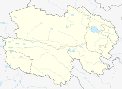 Madoi County Location in Qinghai | |
| Coordinates: 34°42′N 98°13′E | |
| Country | People's Republic of China |
| Province | Qinghai |
| Autonomous prefecture | Golog |
| Time zone | UTC+8 (China Standard) |
| Madoi County | |||||||
|---|---|---|---|---|---|---|---|
| Chinese name | |||||||
| Simplified Chinese | 玛多县 | ||||||
| Traditional Chinese | 瑪多縣 | ||||||
| |||||||
| Tibetan name | |||||||
| Tibetan | རྨ་སྟོད་རྫོང | ||||||
| |||||||
Geography
With an elevation of around 4,300 m (14,000 ft), Madoi County has an alpine climate (Köppen EH), with long, bitterly cold and very dry winters, and brief, rainy, cool summers. Average low temperatures are below freezing from early September to mid June; however, due to the wide diurnal temperature variation, average highs are only below freezing from early November thru mid March. Despite frequent rain during summer, when a majority of days sees rain, no month has less than 50% of possible sunshine; with monthly percent possible sunshine ranging from 53% in June to 79% in November, the county seat receives 2,838 hours of bright sunshine annually. The monthly 24-hour average temperature ranges from −15.7 °C (3.7 °F) in January to 8.0 °C (46.4 °F) in July, while the annual mean is −3.33 °C (26.0 °F), making the county seat one of the coldest locales nationwide in terms of annual mean temperature. Nearly three-fourths of the annual precipitation of 332 mm (13.1 in) is delivered from June to September.
| Climate data for Madoi County (1981−2010 normals) | |||||||||||||
|---|---|---|---|---|---|---|---|---|---|---|---|---|---|
| Month | Jan | Feb | Mar | Apr | May | Jun | Jul | Aug | Sep | Oct | Nov | Dec | Year |
| Average high °C (°F) | −7.0 (19.4) |
−4.4 (24.1) |
−0.2 (31.6) |
4.5 (40.1) |
8.4 (47.1) |
11.4 (52.5) |
14.0 (57.2) |
13.8 (56.8) |
10.3 (50.5) |
4.1 (39.4) |
−2.0 (28.4) |
−5.8 (21.6) |
3.9 (39.1) |
| Daily mean °C (°F) | −15.7 (3.7) |
−12.6 (9.3) |
−8.0 (17.6) |
−2.8 (27.0) |
1.8 (35.2) |
5.4 (41.7) |
8.0 (46.4) |
7.4 (45.3) |
3.8 (38.8) |
−2.6 (27.3) |
−10.1 (13.8) |
−14.6 (5.7) |
−3.3 (26.0) |
| Average low °C (°F) | −22.7 (−8.9) |
−19.5 (−3.1) |
−14.2 (6.4) |
−8.8 (16.2) |
−3.6 (25.5) |
0.5 (32.9) |
3.0 (37.4) |
2.2 (36.0) |
−0.9 (30.4) |
−7.2 (19.0) |
−16.2 (2.8) |
−21.5 (−6.7) |
−9.1 (15.7) |
| Average precipitation mm (inches) | 3.9 (0.15) |
4.7 (0.19) |
9.5 (0.37) |
12.1 (0.48) |
32.7 (1.29) |
60.3 (2.37) |
72.4 (2.85) |
62.6 (2.46) |
49.6 (1.95) |
19.0 (0.75) |
3.3 (0.13) |
2.3 (0.09) |
332.4 (13.08) |
| Average precipitation days (≥ 0.1 mm) | 6.7 | 8.2 | 9.8 | 10.3 | 15.5 | 17.6 | 18.5 | 14.8 | 14.9 | 11.0 | 4.6 | 4.3 | 136.2 |
| Average relative humidity (%) | 53 | 49 | 49 | 48 | 56 | 65 | 67 | 63 | 65 | 60 | 52 | 50 | 56 |
| Mean monthly sunshine hours | 226.2 | 209.6 | 240.6 | 257.1 | 256.3 | 228.6 | 236.8 | 244.0 | 217.1 | 241.2 | 244.6 | 236.2 | 2,838.3 |
| Percent possible sunshine | 73 | 68 | 65 | 66 | 60 | 53 | 54 | 59 | 59 | 69 | 79 | 78 | 64 |
| Source: China Meteorological Administration (precipitation days and sunshine 1971–2000)[1][2] | |||||||||||||
Administrative divisions
Madoi is divided into two towns and two townships:
- Huashixia Town (花石峡镇)
- Mazhali Town (玛查理镇)
- Heihe Township (黑河乡)
- Huanghe Township (黄河乡)
- Zhalinghu Township (扎陵湖乡)
See also
References
- 中国气象数据网 - WeatherBk Data (in Chinese (China)). China Meteorological Administration. Retrieved 2020-04-15.
- 中国地面国际交换站气候标准值月值数据集(1971-2000年). China Meteorological Administration. Archived from the original on 2013-09-21. Retrieved 2010-05-25.
This Qinghai location article is a stub. You can help Wikipedia by expanding it. |
На других языках
[de] Madoi
Der Kreis Madoi (auch Matö; chinesisch .mw-parser-output .Hani{font-size:110%}玛多县, Pinyin Mǎduō Xiàn; tibetisch .mw-parser-output .Tibt.uchen{font-family:"Qomolangma-Dunhuang","Qomolangma-Uchen Sarchen","Qomolangma-Uchen Sarchung","Qomolangma-Uchen Suring","Qomolangma-Uchen Sutung","Qomolangma-Title","Qomolangma-Subtitle","Qomolangma-Woodblock","DDC Uchen","DDC Rinzin","Kailash","BabelStone Tibetan","Jomolhari","TCRC Youtso Unicode","Tibetan Machine Uni","Wangdi29","Noto Sans Tibetan","Microsoft Himalaya"}.mw-parser-output .Tibt.ume{font-family:"Qomolangma-Betsu","Qomolangma-Chuyig","Qomolangma-Drutsa","Qomolangma-Edict","Qomolangma-Tsumachu","Qomolangma-Tsuring","Qomolangma-Tsutong","TibetanSambhotaYigchung","TibetanTsugRing","TibetanYigchung"}.mw-parser-output .Tibt{font-size:140%}རྨ་སྟོད་རྫོང, Umschrift nach Wylie rma stod rdzong) ist ein Kreis des Autonomen Bezirks Golog der Tibeter im Südosten der chinesischen Provinz Qinghai. Die Fläche beträgt 24.478 Quadratkilometer und die Einwohnerzahl 14.500 (Stand: Zensus 2020).[1] 1999 betrug die Einwohnerzahl 10.717.[2] Sein Hauptort ist die in der Großgemeinde Huanghe (Huánghé Xiàng 黄河乡) gelegene städtische Siedlung Machali (玛查里).[3]- [en] Madoi County
[ru] Мадё
Уезд Мадё (кит. упр. 玛多县, пиньинь Mǎduō xiàn, палл. Мадо сянь, тиб. རྨ་སྟོད་རྫོང, Вайли: rma stod rdzong, тиб. пиньинь: Madoi zong) — уезд Голог-Тибетского автономного округа провинции Цинхай (КНР).Другой контент может иметь иную лицензию. Перед использованием материалов сайта WikiSort.org внимательно изучите правила лицензирования конкретных элементов наполнения сайта.
WikiSort.org - проект по пересортировке и дополнению контента Википедии