world.wikisort.org - China
Huangzhong District (Chinese: 湟中区; pinyin: Huángzhōng Qū) is a district of Xining, Qinghai Province, China. It is located about 80 km (50 mi) east of Qinghai Lake and about 10 km (6.2 mi) southwest of downtown Xining. In 2020 the district had a population of 463,900, of which 153,000 belonging to minorities.[1] The Kumbum Monastery (Ta'er Temple) is located in the district.
Huangzhong
湟中区 | |
|---|---|
District | |
 Kumbum Monastery | |
 Location of Huangzhong | |
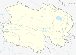 Huangzhong Location in Qinghai | |
| Coordinates: | |
| Country | People's Republic of China |
| Province | Qinghai |
| Prefecture-level city | Xining |
| Area | |
| • District | 2,444 km2 (944 sq mi) |
| Highest elevation | 4,488 m (14,724 ft) |
| Lowest elevation | 2,225 m (7,300 ft) |
| Population (2020) | 463,900 |
| • Rural | 369,000 |
| Time zone | UTC+8 (China Standard) |
| Website | www |
History
Huangzhong has been inhabited since at least 4,000 years ago, as shown by archeological excavations in Lijiashan town. Later, the area belonged to the Qiang people. Since the capture of Xining by Emperor Wu of Han, Huangzhong has been part of the Chinese dynasties. The Han dynasty rulers established a county called Linqiang (临羌县) in the area, governed by Jincheng (Lanzhou). In 1943, the county seat was moved to Lushar town, and the county was named Huangzhong County, after the Huangshui river basin.[2] In 2020 Huangzhong County was changed to Huangzhong District of Xining.[1]
Administrative divisions
Huangzhong governs over 10 towns, 5 townships and one subdistrict.[1][3]
- Lushar town (鲁沙尔镇), county seat
- Kangchuan subdistrict (康川街道)
- Duoba town (多巴镇)
- Shangxinzhuang town (上新庄镇)
- Tianjiazhai town (田家寨镇)
- Honghe town (共和镇)
- Lanlongkou town (拦隆口镇)
- Ganhetan town (甘河滩镇)
- Xibao town (西堡镇)
- Lijiashan town (李家山镇)
- Shangwuzhuang town (上五庄镇)
- Qunjia township (群加乡)
- Haizigou township (海子沟乡)
- Handong Hui Ethnic township (汉东回族乡)
- Tumenguan township (土门关乡)
- Dacai Hui Ethnic township (大才回族乡)
See also
- List of administrative divisions of Qinghai
References
This Qinghai location article is a stub. You can help Wikipedia by expanding it. |
На других языках
- [en] Huangzhong District
[ru] Хуанчжун
Хуанчжу́н (кит. упр. 湟中, пиньинь Huángzhōng, буквально: «среднее течение реки Хуаншуй») — район городского подчинения городского округа Синин провинции Цинхай (КНР).Другой контент может иметь иную лицензию. Перед использованием материалов сайта WikiSort.org внимательно изучите правила лицензирования конкретных элементов наполнения сайта.
WikiSort.org - проект по пересортировке и дополнению контента Википедии