world.wikisort.org - China
Golmud, also known by various other romanizations, is a county-level city in the Haixi Mongol and Tibetan Autonomous Prefecture of Qinghai Province, China. It is now the second-largest city in Qinghai and the third largest in the Tibetan Plateau (after Xining and Lhasa). The population in 2020 is 221,863.[1][2]
This article needs additional citations for verification. (January 2013) |
Golmud
格尔木市 · ᠭᠣᠯᠮᠣᠣᠠ ᠬᠣᠲᠠ · ན་གོར་མོ་གྲོང་ཁྱེར། Golmo | |
|---|---|
County-level & Sub-prefectural city | |
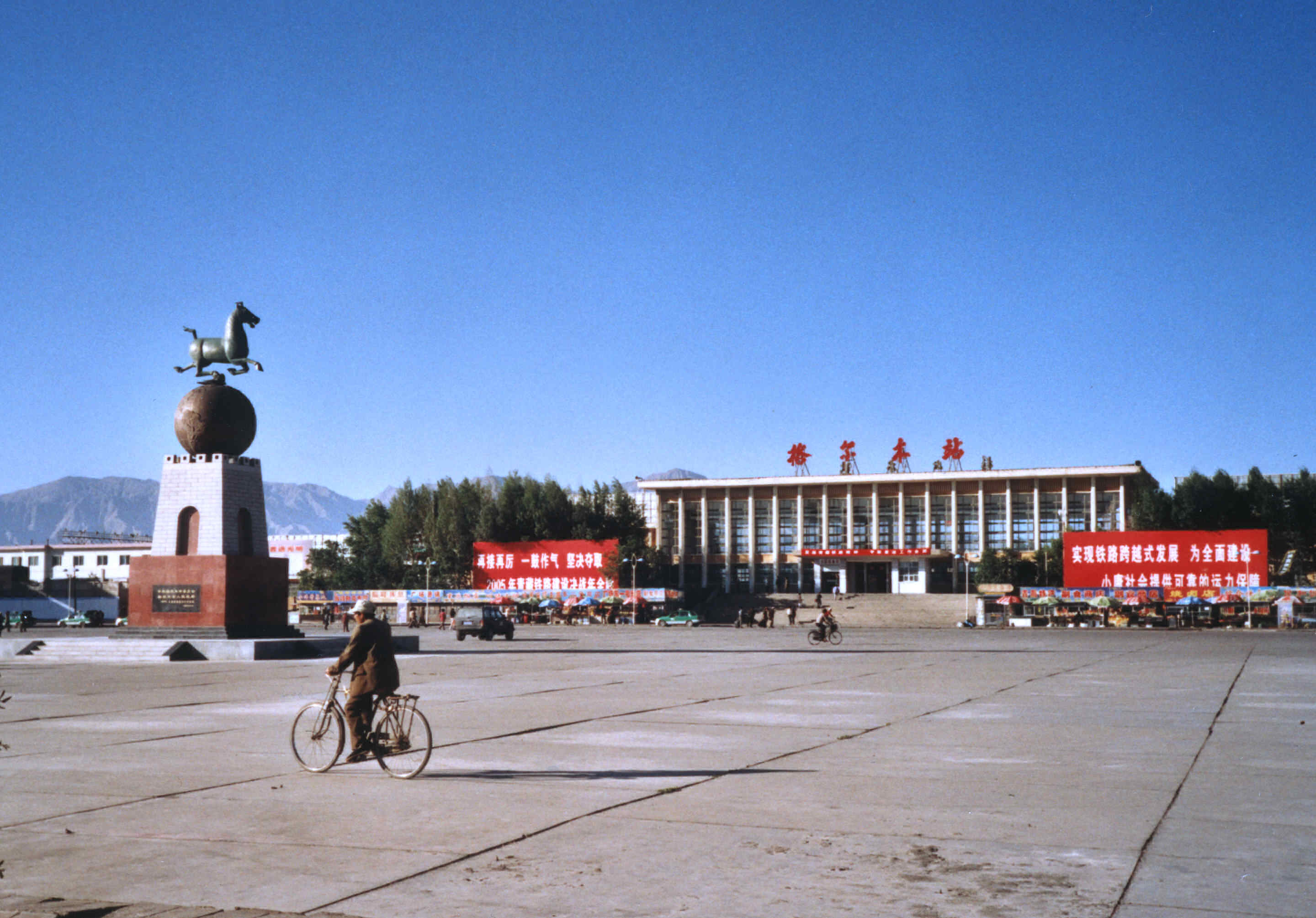 Golmud railway station | |
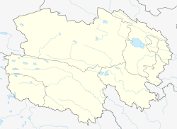
 Location of Golmud City (red) in Haixi Prefecture (yellow) and Qinghai | |
 Golmud Location of the city centre in Qinghai | |
| Coordinates (Golmud government): 36°24′26″N 94°55′42″E | |
| Country | People's Republic of China |
| Province | Qinghai |
| Prefecture-level city | Haixi |
| Area | |
| • County-level & Sub-prefectural city | 119,165 km2 (46,010 sq mi) |
| • Urban | 72 km2 (28 sq mi) |
| Elevation | 2,809 m (9,216 ft) |
| Population (2020) | |
| • County-level & Sub-prefectural city | 221,863 |
| • Density | 1.9/km2 (4.8/sq mi) |
| • Urban | 197,153 |
| • Urban density | 2,700/km2 (7,100/sq mi) |
| Time zone | UTC+8 (China Standard) |
| Website | gem |
| Golmud | |||||||||
|---|---|---|---|---|---|---|---|---|---|
| Chinese name | |||||||||
| Simplified Chinese | 格尔木 | ||||||||
| Traditional Chinese | 格爾木 | ||||||||
| Postal | Golmot | ||||||||
| Literal meaning | Rivers (in Mongolian) | ||||||||
| |||||||||
| Tibetan name | |||||||||
| Tibetan | ན་གོར་མོ། | ||||||||
| |||||||||
| Mongolian name | |||||||||
| Mongolian script | ᠭᠣᠯᠮᠤᠳ | ||||||||
Name
Golmud is a romanization of a Mongolian word meaning "rivers". Ge'ermu is the pinyin romanization of the Mandarin pronunciation of the same name's transcription into Chinese characters; it is sometimes misspelled Geermu. Ko-erh-mu was the same name romanized using the Wade–Giles system; Golmot was the romanization used by the Chinese Postal Map.[3] The Wylie romanization of the Tibetan form of the name is Nagormo.
Geography
Golmud is part of Haixi Prefecture in western Qinghai Province. Despite being nominally a "city", the built-up urban area of Golmud comprises only 72 km2 (28 sq mi) of the county's 124,500 square kilometres (48,100 sq mi). Most of the county lies in the southern Qaidam Basin and in the foothills of the Kunlun Mountains. A large southern exclave is administered as the "town" of Tanggula, separated from the rest of the county by the western panhandle of the Yushu Tibetan Autonomous Prefecture. The northern part borders Xinjiang to its northwest; the southern exclave borders the Tibetan Autonomous Region to its southwest.
Golmud proper is at an elevation of 2,809 m (9,216 ft). It grew up alongside the Golmud River, which gave it its name.
North of Golmud is the Qarhan Playa, a 5,856 km2 (2,261 sq mi) salt flat with about ten perennial salt lakes. The largest is Dabusun Lake, which receives the waters of the Golmud. The more important smaller lakes are Suli, South Suli, Dabiele, Xiaobiele, Tuanjie, Xiezuo, Dongling, and North and South Hulsan, which receive the waters of smaller inflowing streams. Qarhan is part of the larger Sanhu Depression, which includes East and West Taijinar Lakes. Other major lakes in the southern exclave of Golmud include Ulan Ul Lake (Chinese: 乌兰乌拉湖; pinyin: Wūlán Wūlā Hú)[4] and Migriggyangzham Co (Chinese: 赤布张错; pinyin: Chìbùzhāng Cuò, Standard Tibetan: མི་རིག་རྒྱང་གྲམ་མཚོ).[5]
Climate
Golmud has a cold arid climate (Köppen BWk), with long, cold winters, and warm summers. The monthly 24-hour average temperature drops to −8.4 °C (16.9 °F) in January and rises to 18.5 °C (65 °F) in July, while the annual mean is 5.76 °C (42.4 °F). Precipitation is very low, totaling only 45 millimetres (1.77 in) per annum, falling on 28 days, most of which are during the summer. Relative humidity averages only 32%, with all months below 40%, some of the lowest levels nationally. With monthly percent possible sunshine ranging from 62% in July to 81% in November, the city receives 3,096 hours of bright sunshine annually.
| Climate data for Golmud (1981–2010 normals) | |||||||||||||
|---|---|---|---|---|---|---|---|---|---|---|---|---|---|
| Month | Jan | Feb | Mar | Apr | May | Jun | Jul | Aug | Sep | Oct | Nov | Dec | Year |
| Record high °C (°F) | 13.9 (57.0) |
18.0 (64.4) |
24.3 (75.7) |
31.3 (88.3) |
31.0 (87.8) |
32.7 (90.9) |
34.0 (93.2) |
35.5 (95.9) |
31.0 (87.8) |
25.1 (77.2) |
16.7 (62.1) |
10.0 (50.0) |
35.5 (95.9) |
| Average high °C (°F) | −0.8 (30.6) |
3.6 (38.5) |
9.0 (48.2) |
14.8 (58.6) |
19.5 (67.1) |
22.9 (73.2) |
25.3 (77.5) |
24.5 (76.1) |
19.8 (67.6) |
13.2 (55.8) |
6.0 (42.8) |
0.2 (32.4) |
13.2 (55.7) |
| Daily mean °C (°F) | −8.4 (16.9) |
−4.2 (24.4) |
1.2 (34.2) |
7.1 (44.8) |
12.3 (54.1) |
16.2 (61.2) |
18.5 (65.3) |
17.5 (63.5) |
12.8 (55.0) |
5.4 (41.7) |
−2.0 (28.4) |
−7.3 (18.9) |
5.8 (42.4) |
| Average low °C (°F) | −14.2 (6.4) |
−10.6 (12.9) |
−5.3 (22.5) |
0.3 (32.5) |
5.6 (42.1) |
9.9 (49.8) |
12.2 (54.0) |
11.4 (52.5) |
6.9 (44.4) |
−0.6 (30.9) |
−8.0 (17.6) |
−13.0 (8.6) |
−0.4 (31.2) |
| Record low °C (°F) | −33.6 (−28.5) |
−26.6 (−15.9) |
−26.1 (−15.0) |
−13.4 (7.9) |
−7.8 (18.0) |
−5.2 (22.6) |
1.9 (35.4) |
−1.4 (29.5) |
−8.2 (17.2) |
−20.2 (−4.4) |
−25.4 (−13.7) |
−28.5 (−19.3) |
−33.6 (−28.5) |
| Average precipitation mm (inches) | 0.7 (0.03) |
0.3 (0.01) |
1.3 (0.05) |
1.5 (0.06) |
5.1 (0.20) |
8.9 (0.35) |
12.3 (0.48) |
8.2 (0.32) |
4.9 (0.19) |
0.8 (0.03) |
0.5 (0.02) |
0.7 (0.03) |
45.2 (1.77) |
| Average precipitation days (≥ 0.1 mm) | 1.4 | 0.8 | 1.1 | 1.0 | 2.6 | 5.1 | 6.4 | 4.2 | 2.4 | 0.7 | 0.9 | 1.1 | 27.7 |
| Average relative humidity (%) | 38 | 29 | 27 | 24 | 28 | 33 | 37 | 34 | 34 | 31 | 32 | 38 | 32 |
| Mean monthly sunshine hours | 219.9 | 210.9 | 247.7 | 274.3 | 295.3 | 273.4 | 276.4 | 284.6 | 261.2 | 277.7 | 247.7 | 227.3 | 3,096.4 |
| Percent possible sunshine | 72 | 69 | 67 | 70 | 68 | 63 | 62 | 68 | 70 | 80 | 81 | 76 | 70 |
| Source: China Meteorological Administration (precipitation days and sunshine 1971–2000)[6][7] | |||||||||||||
History
Golmud is a rather young city. It was first established in 1954 when the Transportation regiments of Qinghai-Tibet Corps set up a food distribution base, manned by 10 people, at the current location, and in May of that year, construction on the Qinghai-Tibet Highway commenced.[8][9] Scientific exploration of the mineral resources of Qarhan were undertaken in the 1950s, leading to the discovery of the area's potash and gas fields. Systematic surveying was undertaken in the 1960s and 1970s, with the railway permitting industrial exploitation from the 1980s. The first oil pipeline[10] and potassium fertilizer factory were opened in 1989. The 28 km2 (11 sq mi) Golmud Kunlun Economic Development Zone was opened in 1992. In 2004, a second pipeline arrived.[10] In the 2010s, an influx of further investment followed realization of the importance of the Sanhu's supplies of lithium and rare earths for modern personal electronics and electric cars.[citation needed] In 2016, over 85% of goods movement with Tibet passed through Golmud.[8]
Administrative divisions
- Kunlun Road Subdistrict (昆仑路街道)
- Jinfeng Road Subdistrict (金峰路街道)
- Hexi Subdistrict (河西街道)
- Huanghe Road Subdistrict (黄河路街道)
- Xizang Road Subdistrict (西藏路街道)
Towns:
Townships:
Demographics
In 2017, the population of the total area of Golmud was approximately 240,494.[citation needed] A 2018 publication by the National Ethnic Affairs Commission reported that ethnic Han Chinese comprise 69.82% of the city's population, and minority ethnic groups comprise 30.18%.[14] The city's is home to 33 ethnic minorities, of which, the largest are the Mongols, Tibetans, and Hui people.[14]
Economy
The Qarhan Playa has China's largest reserves of salt, potassium, and magnesium,[15] as well as other valuable minerals. Taken together, the mineral resources in the playa were estimated to be worth over 15 trillion renminbi (RMB) as of 2002.[15] The area's salt has also trapped valuable hydrocarbons. The Sebei-1 and Sebei-2 fields near Suli Lake are also China's 4th-largest onshore reserves of natural gas[10] and the entire area may have reserves as high as 1 trillion m³ (35 trillion cu. ft.).[15] The larger Sanhu Depression includes East and West Taijinar, which hold China's largest reserves of lithium.
The surrounding countryside also produces gold, copper, jade, lead, and zinc.[15]
A pipeline delivers crude oil from Huatugou Oilfield to a refinery at Golmud.[10] The refinery has a capacity of 1 million metric tons a year; is able to produce 100,000 metric tons a year of methanol and 20,000 MT/yr of polypropylene; and has a 100,000 MT/yr gas fractionator.[10]
According to the National Ethnic Affairs Commission, the per capita disposable income in Golmud was 6,852 yuan in the first quarter of 2017, a 9.3% increase from the one year prior.[14] Golmud has been one of the areas included in China's Targeted Poverty Alleviation program, which the Commission states has entailed the reconstruction of houses in the city with subpar living conditions, and subsidizing low-income students in the city.[14] The Commission also states that the government has been developing the production of traditional woodworking, embroidery, and other local crafts through designated "demonstration areas" (Chinese: 示范区; pinyin: shìfàn qū).[14]
Statistics for 2001 show that the city's nominal GDP totaled 2.213 billion RMB, a rise of 31.9% from the previous year[15][why?] and the highest growth rate since 1990.[16]
Transportation
Railway
Golmud lies along the Qinghai–Tibet railway, a 1,956 km (1,215 mi) railway that starts from Xining and ends at Lhasa in the Tibet Autonomous Region. The Golmud-Lhasa section, with a length of 1,142 km (710 mi), was the last and most challenging part of the railway to be completed. After five years of construction, the first train for Lhasa left Golmud on 1 July 2006.
In October 2012 construction started on the Golmud–Dunhuang Railway. It will actually branch off the Qinghai–Tibet Railway at the Yinmaxia station north of Golmud, and will cross the Qaidam Basin and the Altyn-Tagh/Qilian system on the way to Dunhuang in the neighboring Gansu province.[17]
The Golmud-Korla Railway running north west from Golmud into Korla, Xinjiang began construction in November 2014 and was completed in 2020.[18][19]
Highways
- The Golmud-Lhasa highway, extending 1,050 km (650 mi), is part of the 1,930-km Qinghai-Tibet highway (China National Highway 109) connecting Xining and Lhasa.
- China National Highway 215, runs north from Golmud to Dunhuang, Gansu
Airport
This section needs expansion. You can help by adding to it. (February 2013) |
Twin cities
In popular culture
The Golmud Railway is featured as an online multiplayer map in the video game Battlefield 4.
References
Citations
- "Reservoir nearing collapse poses threat to Qinghai Tibet railway". Phayul. Dharamsala. 9 July 2010. Archived from the original on 9 June 2011. Retrieved 9 July 2010.
- "Gé'ĕrmù Shì (County-level City, China) - Population Statistics, Charts, Map and Location". citypopulation.de. Retrieved 21 November 2021.
- Stanford (1917), p. 21.
- Ulan Ul Hu (Approved - N) at GEOnet Names Server, United States National Geospatial-Intelligence Agency
- Migriggyangzham Co (Approved - N) at GEOnet Names Server, United States National Geospatial-Intelligence Agency
- 中国气象数据网 - WeatherBk Data (in Chinese (China)). China Meteorological Administration. Retrieved 15 April 2020.
- 中国地面国际交换站气候标准值月值数据集(1971-2000年). China Meteorological Administration. Archived from the original on 21 September 2013. Retrieved 25 May 2010.
- 张建设 (1 May 2016). 柴达木文史丛书.第5辑.格尔木长镜头 (in Chinese). Beijing Book Co. Inc. ISBN 978-7-999066-08-8.
- 王宗仁 (1 October 2001). 苍茫青藏 (in Chinese). Beijing Book Co. Inc. ISBN 978-7-5065-4113-8.
- CNPC, p. 19.
- 格尔木市历史沿革 [Goldmud City Historical Development] (in Simplified Chinese). XZQH. 10 December 2013. Retrieved 27 November 2018.
2000年第五次人口普查,格尔木市总人口135897人,其中:昆仑路街道38214人,金峰路街道26567人,河西街道27417人,郭勒木德乡15771人,大格勒乡2106人,乌图美仁乡1808人,唐古拉山乡1880人,格尔木铁路12249人,格尔木农场9883人。{...}2005年,格尔木市调整乡镇行政区划:撤销郭勒木德乡,设立郭勒木德镇,镇政府驻地和镇区行政区划范围不变,实行镇管村体制。2、撤销唐古拉山乡,设立唐古拉山镇,镇政府驻地和镇区行政区划范围不变,实行镇管村体制。
- 2020年统计用区划代码(格尔木市) [2020 Statistical Division Codes (Golmud)] (in Simplified Chinese). National Bureau of Statistics of China. 2020. Archived from the original on 21 October 2021. Retrieved 21 October 2021.
- 世界盐湖城—青海格尔木市门户网站 概览 [World Salt Lake City - Qinghai Golmud City Web Portal Overview] (in Simplified Chinese). Golmud People's Government. Retrieved 27 November 2018.
昆仑经济开发区 东城区工行委 西城区工行委 察尔汗工行委 乌图美仁乡 大格勒乡 郭勒木德镇 唐古拉山镇 昆仑路街道办事处 黄河路街道办事处 河西办事处 金锋路办事处 西藏路办事处
- 青海海西蒙古族藏族自治州格尔木市 [Qinghai Haixi Mongol and Tibetan Autonomous Prefecture Golmud]. www.neac.gov.cn (in Chinese). National Ethnic Affairs Commission. 28 February 2018. Archived from the original on 21 October 2021. Retrieved 21 October 2021.
- "City in Gobi Desert Aims High", Shanghai Daily, Shanghai, 10 July 2002.
- "Golmud City Set to Become China's Salt Lake City". Alexander's Gas and Oil Connections. Xinhua News Agency. 28 June 2002. Archived from the original on 10 March 2007. Retrieved 30 January 2006.
- 格尔木至敦煌铁路开工. Huochepiao.com. 20 October 2012. Archived from the original on 9 December 2012. Retrieved 26 October 2012.
- 人民铁道网 - 中国铁路新闻门户新疆库尔勒至格尔木铁路拟11月开建 - 运输 -. Tianshannet. 23 May 2014. Retrieved 12 May 2020 – via peoplerail.com.
- "首趟列车出发!12月9日格库铁路新疆段正式通车运营_【高铁网】". news.gaotie.cn. Retrieved 9 December 2020.
- 格尔木市戮力打造丝路开放新高地. Haixi Prefecture Science and Technology Bureau. 11 April 2017. Retrieved 26 July 2018.
Bibliography
- "20: Qaidam Basin" (PDF), Brochures, Beijing: China National Petroleum Corporation.
- Stanford, Edward (1917), Complete Atlas of China, 2nd ed., London: China Inland Mission.
External links
Authority control | |
|---|---|
| General |
|
| National libraries | |
На других языках
- [en] Golmud
[ru] Голмуд
Голмуд (кит. упр. 格尔木, пиньинь Gé'ěrmù, тиб. ན་གོར་མོ, Вайли Na-gor-mo, монг. ᠭᠣᠯᠮᠣᠣᠠ; Голмуд) — городской уезд Хайси-Монгольско-Тибетского автономного округа провинции Цинхай (КНР). Название взято от реки Голмуд-Гол.Другой контент может иметь иную лицензию. Перед использованием материалов сайта WikiSort.org внимательно изучите правила лицензирования конкретных элементов наполнения сайта.
WikiSort.org - проект по пересортировке и дополнению контента Википедии