world.wikisort.org - China
Gangca County (Tibetan: རྐང་ཚ་རྫོང; Chinese: 刚察县) is a county of northeastern Qinghai province, China, on the northern shore of Qinghai Lake. It is under the administration of Haibei Tibetan Autonomous Prefecture.
This article includes a list of references, related reading or external links, but its sources remain unclear because it lacks inline citations. (December 2021) |
Gangca County
刚察县 • རྐང་ཚ་རྫོང | |
|---|---|
County | |
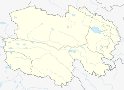
 Gangca / Gangcha County (light red) within Haibei Prefecture (yellow) and Qinghai | |
 Gangca Location in Qinghai | |
| Coordinates: 37°19′N 100°09′E | |
| Country | People's Republic of China |
| Province | Qinghai |
| Autonomous prefecture | Haibei |
| Township-level divisions |
|
| County seat | Shaliuhe (沙柳河镇) |
| Area | |
| • Total | 9,575.91 km2 (3,697.28 sq mi) |
| Elevation | 3,309 m (10,856 ft) |
| Population (2007) | |
| • Total | 41,883 |
| • Density | 4.4/km2 (11/sq mi) |
| Time zone | UTC+8 (China Standard) |
| Postal code | 812300 |
| Area code(s) | 0970 |
| Gangca County | |||||||||||
|---|---|---|---|---|---|---|---|---|---|---|---|
| Chinese name | |||||||||||
| Simplified Chinese | 刚察县 | ||||||||||
| Traditional Chinese | 剛察縣 | ||||||||||
| |||||||||||
| Tibetan name | |||||||||||
| Tibetan | རྐང་ཚ་རྫོང | ||||||||||
| |||||||||||
Geography and climate
With an elevation of around 3,300 metres (10,800 ft), Gangca County has an alpine subarctic climate (Köppen Dwc), with long, very cold, dry, and sunny winters, and short, rainy, mild summers. Average low temperatures are below freezing from late September to mid May; however, due to the wide diurnal temperature variation, the average high is above freezing from March to November inclusive. Despite frequent rain during summer, when a majority of days sees rain, no month has less than 55% of possible sunshine; with monthly percent possible sunshine ranging from 56% in June to 83% in November, the county seat receives 3,012 hours of bright sunshine annually. The monthly 24-hour average temperature ranges from −13.5 °C (7.7 °F) in January to 10.9 °C (51.6 °F) in July, while the annual mean is −0.32 °C (31.4 °F). Over 80% of the annual precipitation of 379 mm (14.9 in) is delivered from June to September.
| Climate data for Gangca County (1971−2000) | |||||||||||||
|---|---|---|---|---|---|---|---|---|---|---|---|---|---|
| Month | Jan | Feb | Mar | Apr | May | Jun | Jul | Aug | Sep | Oct | Nov | Dec | Year |
| Average high °C (°F) | −5.3 (22.5) |
−2.1 (28.2) |
2.9 (37.2) |
8.1 (46.6) |
12.0 (53.6) |
14.4 (57.9) |
16.7 (62.1) |
16.6 (61.9) |
12.6 (54.7) |
7.8 (46.0) |
1.9 (35.4) |
−2.6 (27.3) |
6.9 (44.5) |
| Average low °C (°F) | −19.8 (−3.6) |
−16.9 (1.6) |
−11.3 (11.7) |
−5.3 (22.5) |
−0.4 (31.3) |
3.2 (37.8) |
5.7 (42.3) |
5.1 (41.2) |
1.3 (34.3) |
−4.8 (23.4) |
−12.3 (9.9) |
−17.2 (1.0) |
−6.1 (21.1) |
| Average precipitation mm (inches) | .9 (0.04) |
2.0 (0.08) |
5.9 (0.23) |
11.2 (0.44) |
35.0 (1.38) |
74.4 (2.93) |
86.1 (3.39) |
91.0 (3.58) |
54.3 (2.14) |
15.5 (0.61) |
2.5 (0.10) |
.7 (0.03) |
379.5 (14.95) |
| Average precipitation days (≥ 0.1 mm) | 2.0 | 3.0 | 5.0 | 6.2 | 11.4 | 17.6 | 18.7 | 17.1 | 14.6 | 6.4 | 1.7 | 1.3 | 105.0 |
| Average relative humidity (%) | 46 | 43 | 45 | 47 | 56 | 64 | 68 | 68 | 69 | 57 | 45 | 44 | 54 |
| Mean monthly sunshine hours | 243.8 | 231.1 | 257.0 | 266.3 | 269.0 | 243.7 | 255.1 | 260.4 | 231.4 | 259.8 | 251.8 | 242.7 | 3,012.1 |
| Percent possible sunshine | 80 | 76 | 70 | 68 | 62 | 56 | 57 | 62 | 62 | 75 | 83 | 82 | 68 |
| Source: China Meteorological Administration | |||||||||||||
Transport
- China National Highway 315
See also
- List of administrative divisions of Qinghai
References
External links
Authority control | |
|---|---|
| General |
|
| National libraries | |
This Qinghai location article is a stub. You can help Wikipedia by expanding it. |
На других языках
[de] Gangca
Gangca (auch Kangtsha; tibetisch རྐང་ཚ་རྫོང, Umschrift nach Wylie rkang tsha rdzong; chinesisch .mw-parser-output .Hani{font-size:110%}刚察县, Pinyin Gāngchá Xiàn) ist ein Kreis des Autonomen Bezirks Haibei der Tibeter im Nordosten der chinesischen Provinz Qinghai. Er hat eine Fläche von 9.706 km² und zählt 40.720 Einwohner (Stand: Zensus 2020).[1] Sein Hauptort ist die Großgemeinde Shaliuhe (沙柳河镇).- [en] Gangca County
[ru] Гангца
Гангца́ (кит. упр. 刚察, пиньинь Gāngchá, палл. Ганча) — уезд Хайбэй-Тибетского автономного округа провинции Цинхай (КНР).Другой контент может иметь иную лицензию. Перед использованием материалов сайта WikiSort.org внимательно изучите правила лицензирования конкретных элементов наполнения сайта.
WikiSort.org - проект по пересортировке и дополнению контента Википедии