world.wikisort.org - USA
Spartanburg County is a county located on the northwestern border of the U.S. state of South Carolina. As of the 2020 Census, the population was 327,997,[2] making it the fifth-most populous county in South Carolina. Its county seat is Spartanburg.[3]
Spartanburg County | |
|---|---|
U.S. county | |
 Spartanburg County Courthouse | |
 Seal | |
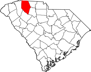 Location within the U.S. state of South Carolina | |
 South Carolina's location within the U.S. | |
| Coordinates: 34°56′N 81°59′W | |
| Country | |
| State | |
| Founded | 1791 |
| Named for | The Spartan Rifles[1] |
| Seat | Spartanburg |
| Largest city | Spartanburg |
| Area | |
| • Total | 819 sq mi (2,120 km2) |
| • Land | 808 sq mi (2,090 km2) |
| • Water | 11 sq mi (30 km2) 1.4% |
| Population | |
| • Estimate (2021) | 335,864 |
| • Density | 415.7/sq mi (160.5/km2) |
| Time zone | UTC−5 (Eastern) |
| • Summer (DST) | UTC−4 (EDT) |
| Congressional districts | 4th, 5th |
| Website | www |
Spartanburg County is coterminous with the Spartanburg, SC Metropolitan Statistical Area, which is also included in the Greenville–Spartanburg–Anderson, SC Combined Statistical Area.[4]
USS Spartanburg County is named after the county.
History
The county was founded in 1785 and was named after the Spartan Rifles.[5] The largest city and the county seat is Spartanburg which resides in Upstate South Carolina.
Geography

According to the U.S. Census Bureau, the county has a total area of 819 square miles (2,120 km2), of which 808 square miles (2,090 km2) is land and 11 square miles (28 km2) (1.4%) is water.[6]
State and local protected areas/sites
- Arcadia Mill No. 1
- Arcadia Mill No. 2
- Battle of Musgrove Mill State Historic Site (part)
- Blackstock Plantation (part)
- Converse Heights Historic District
- Croft State Park
- Daniel Morgan Monument
- Emily Dickinson
- Glendale Ridge Archaeological Site
- Hampton Heights Historic District
- Hatcher Garden and Woodland Preserve
- Historic Price House
- Lake Cooley Park
- Nesbitt Shoals Nature Park
- Peter’s Creek Heritage Preserve
- Seay House
- Tyger River Park
Major water bodies
- Enoree River
- Lake Craig
- Lake William C. Bowan
- Pacolet River
- South Tyger River
- Tyger Lake
- Tyger River
Adjacent counties
- Rutherford County, North Carolina – north
- Cherokee County – east
- Union County – southeast
- Laurens County – south
- Greenville County – west
- Polk County, North Carolina – northwest
Major highways
 I-26
I-26 I-85
I-85 I-85 BL
 I-585
I-585 US 29
US 29 US 176
 US 176 Conn. (Spartanburg 1)
- US 176 Conn. (Spartanburg 2)
 US 221
 US 221 Alt.
 SC 9
SC 9 SC 11
SC 11 SC 43
SC 43 SC 49
SC 49 SC 56
SC 56 SC 56 Conn.
 SC 80
SC 80 SC 92
SC 92- SC 92 Conn.
 SC 101
 SC 101 Truck
 SC 110
 SC 129
 SC 146
 SC 150
- SC 150 Truck
 SC 215
 SC 290
- SC 290 Truck
 SC 292
- SC 292 Conn.
 SC 296
 SC 357
 SC 358
Major infrastructure
- Greenville–Spartanburg International Airport
- Inland Port Greer, major rail depot in the county.
- Spartanburg Downtown Airport
- Spartanburg Station
Demographics
| Historical population | |||
|---|---|---|---|
| Census | Pop. | %± | |
| 1790 | 8,800 | — | |
| 1800 | 12,122 | 37.8% | |
| 1810 | 14,259 | 17.6% | |
| 1820 | 16,989 | 19.1% | |
| 1830 | 21,150 | 24.5% | |
| 1840 | 23,669 | 11.9% | |
| 1850 | 26,400 | 11.5% | |
| 1860 | 26,919 | 2.0% | |
| 1870 | 25,784 | −4.2% | |
| 1880 | 40,409 | 56.7% | |
| 1890 | 55,385 | 37.1% | |
| 1900 | 65,560 | 18.4% | |
| 1910 | 83,465 | 27.3% | |
| 1920 | 94,265 | 12.9% | |
| 1930 | 116,323 | 23.4% | |
| 1940 | 127,733 | 9.8% | |
| 1950 | 150,349 | 17.7% | |
| 1960 | 156,830 | 4.3% | |
| 1970 | 173,724 | 10.8% | |
| 1980 | 201,861 | 16.2% | |
| 1990 | 226,800 | 12.4% | |
| 2000 | 253,791 | 11.9% | |
| 2010 | 284,307 | 12.0% | |
| 2020 | 327,997 | 15.4% | |
| 2021 (est.) | 335,864 | [7] | 2.4% |
| U.S. Decennial Census[8] 1790–1960[9] 1900–1990[10] 1990–2000[11] 2010–2017[12] 2020[7] | |||
2020 census
| Race | Num. | Perc. |
|---|---|---|
| White (non-Hispanic) | 214,440 | 65.38% |
| Black or African American (non-Hispanic) | 63,565 | 19.38% |
| Native American | 699 | 0.21% |
| Asian | 8,176 | 2.49% |
| Pacific Islander | 190 | 0.06% |
| Other/Mixed | 13,195 | 4.02% |
| Hispanic or Latino | 27,732 | 8.45% |
As of the 2020 United States census, there were 327,997 people, 121,256 households, and 83,432 families residing in the county.
2010 census
As of the 2010 United States Census, there were 284,307 people, 109,246 households, and 75,404 families residing in the county.[14] The population density was 351.9 inhabitants per square mile (135.9/km2). There were 122,628 housing units at an average density of 151.8 per square mile (58.6/km2).[15] The racial makeup of the county was 72.3% white, 20.6% black or African American, 2.0% Asian, 0.3% American Indian, 3.1% from other races, and 1.7% from two or more races. Those of Hispanic or Latino origin made up 5.9% of the population.[14] In terms of ancestry, 13.6% were American, 10.5% were Irish, 9.6% were English, and 8.8% were German.[16]
Of the 109,246 households, 34.3% had children under the age of 18 living with them, 48.9% were married couples living together, 15.1% had a female householder with no husband present, 31.0% were non-families, and 26.2% of all households were made up of individuals. The average household size was 2.53 and the average family size was 3.05. The median age was 38.0 years.[14]
The median income for a household in the county was $42,680 and the median income for a family was $53,149. Males had a median income of $41,445 versus $31,602 for females. The per capita income for the county was $21,924. About 11.0% of families and 14.8% of the population were below the poverty line, including 20.5% of those under age 18 and 10.9% of those age 65 or over.[17]
Government and politics
| Year | Republican | Democratic | Third parties |
|---|---|---|---|
| 2020 | 62.9% 93,560 | 35.6% 52,926 | 1.5% 2,169 |
| 2016 | 63.0% 76,277 | 33.0% 39,997 | 4.0% 4,816 |
| 2012 | 60.9% 66,969 | 37.7% 41,461 | 1.3% 1,476 |
| 2008 | 60.0% 65,042 | 38.4% 41,632 | 1.5% 1,654 |
| 2004 | 64.1% 62,004 | 34.8% 33,633 | 1.2% 1,121 |
| 2000 | 62.4% 52,114 | 35.4% 29,559 | 2.3% 1,880 |
| 1996 | 53.5% 35,972 | 39.9% 26,814 | 6.6% 4,410 |
| 1992 | 51.9% 37,707 | 35.1% 25,488 | 13.0% 9,440 |
| 1988 | 63.2% 40,801 | 35.6% 22,964 | 1.2% 803 |
| 1984 | 66.4% 41,553 | 32.2% 20,130 | 1.4% 892 |
| 1980 | 51.1% 30,092 | 46.3% 27,245 | 2.6% 1,532 |
| 1976 | 42.0% 20,456 | 57.3% 27,925 | 0.7% 336 |
| 1972 | 75.3% 31,308 | 23.1% 9,586 | 1.6% 662 |
| 1968 | 38.7% 18,183 | 24.4% 11,467 | 36.9% 17,346 |
| 1964 | 47.9% 18,411 | 52.1% 20,034 | |
| 1960 | 35.2% 10,940 | 64.8% 20,134 | |
| 1956 | 26.7% 6,822 | 65.0% 16,637 | 8.3% 2,124 |
| 1952 | 31.4% 10,028 | 68.6% 21,883 | |
| 1948 | 5.2% 627 | 56.0% 6,741 | 38.8% 4,673 |
| 1944 | 4.6% 402 | 92.6% 8,092 | 2.8% 244 |
| 1940 | 2.7% 248 | 97.4% 9,119 | |
| 1936 | 1.6% 173 | 98.4% 10,739 | |
| 1932 | 2.4% 227 | 97.6% 9,216 | 0.0% 1 |
| 1928 | 16.5% 760 | 83.5% 3,859 | 0.0% 1 |
| 1924 | 0.0% 0 | 0.0% 0 | 0.0% 0 |
| 1920 | 3.8% 182 | 96.2% 4,584 | |
| 1916 | 2.4% 112 | 96.3% 4,503 | 1.3% 60 |
| 1912 | 1.0% 37 | 94.1% 3,616 | 5.0% 191 |
| 1908 | 5.1% 225 | 94.7% 4,162 | 0.1% 5 |
| 1904 | 3.1% 84 | 96.9% 2,621 | |
| 1900 | 3.9% 101 | 96.1% 2,467 | |
| 1896 | 5.5% 247 | 94.4% 4,234 | 0.0% 0 |
| 1892 | 13.1% 551 | 83.7% 3,515 | 3.0% 129 |
Spartanburg County has long been a Republican stronghold, having not voted for a Democratic presidential nominee since 1976. No Democrat has won 40% of the county’s vote since 1980.
Education
Primary and secondary schools
Spartanburg County is served by the Spartanburg County School System, which is divided into seven districts. Some of the districts share a vocational school, and also share the McCarthy Teszler School, a special education school.
- School District One[19] includes Campobello-Gramling, Chapman High School, Holly Springs-Motlow Elementary, Inman Elementary, Inman Intermediate, Landrum High, Landrum Middle, Mabry Middle, New Prospect Elementary, and O.P. Earle Elementary. District One students can also attend Swofford Career Center
- School District Two[20] includes Boiling Springs Elementary, Cooley Springs-Fingerville Elementary, Chesnee Elementary, Hendrix Elementary, Carlisle-Foster's Grove Elementary, Mayo Elementary, Oakland Elementary, Boiling Springs Intermediate, Boling Springs Junior High, Rainbow Lake Middle School, Chesnee Middle School, Boiling Springs High 9th grade, Boiling Springs High School, and Chesnee High School. District Two students can also attend Swofford Career Center.
- School District Three[21] includes Cannons Elementary, Clifdale Elementary, Cowpens Elementary School, Pacolet Elementary School, Cowpens Middle School, Middle School of Pacolet, and Broome High School. District Three students can attend the Daniel Morgan Technology Center.
- School District Four[22] has four schools: Woodruff Primary, Woodruff Elementary, Woodruff Middle and Woodruff High School. High school students also can attend R.D. Anderson Applied Technology Center to learn vocational skills.
- School District Five[23] consists of Abner Creek Academy (formerly Abner Creek Elementary), Duncan Elementary, Lyman Elementary, Reidville Elementary, River Ridge Elementary, Wellford Academy of Science and Technology (formerly Wellford Elementary), Beech Springs Intermediate, Berry Shoals Intermediate, D. R. Hill Middle, Florence Chapel Middle, James F. Byrnes Freshman Academy, and James F. Byrnes High School. Vocational school students can attend R. D. Anderson Applied Technology Center.
- School District Six[24] comprises Anderson Mill Elementary, Arcadia Elementary, Jesse S. Bobo Elementary, Fairforest Elementary, Lone Oak Elementary, Pauline-Glenn Springs Elementary, Roebuck Elementary, West View Elementary, Woodland Heights Elementary, Fairforest Middle, R. P. Dawkins Middle, L. E. Gable Middle, Dorman Freshman Campus, and Paul M. Dorman High School. District Six students can attend R. D. Anderson Applied Technology Center.
- School District Seven[25] consists of Jesse Boyd Elementary, Chapman Elementary, Cleveland Elementary, Houston Elementary, Park Hills Elementary, Pine Street Elementary, Mary H. Wright Elementary, Edwin P. Todd School, George Washington Carver Middle, Joseph G. McCracken Middle, Whitlock Junior High, Spartanburg High School Freshman Academy, and Spartanburg High School. The Daniel Morgan Technology Center, ZL Madden Learning Center, The Myles W. Whitlock Flexible Learning Center, and The Early Learning Center at Park Hills also serve District Seven.
South Carolina School for the Deaf and the Blind is in an unincorporated area in the county, near Spartanburg.
Spartanburg Day School, a private school, is in an unincorporated area.
Colleges and universities
- Spartanburg Community College
- University of South Carolina Upstate in Valley Falls
- Spartanburg Methodist College in Saxon
- Converse University (Spartanburg)
- Wofford College (Spartanburg)
- Edward Via College of Osteopathic Medicine (Spartanburg)
- Sherman College of Chiropractic (Spartanburg)
Healthcare
Spartanburg County's healthcare is mainly provided by Spartanburg Regional Healthcare System. Spartanburg Regional is a public, not-for-profit, integrated health care delivery system with several facilities in Spartanburg, including:
- Spartanburg Medical Center (SMC), a research and teaching hospital with two locations: Spartanburg Medical Center campus on East Wood Street and Spartanburg Medical Center — Mary Black Campus on Skylyn Drive. Together, these campuses share a history that stretches back to the 1920s. Spartanburg Medical Center includes a total of 747 beds, and services that include emergency, surgical, maternity, cancer, a Heart Center and inpatient rehabilitation.
- Pelham Medical Center, in Greer, S.C., provides emergency services, general surgery, a medical office building and numerous practices.[26]
- Spartanburg Hospital for Restorative Care (SHRC), a 97-bed long-term, acute-care hospital with a 25-bed skilled nursing facility.
- Gibbs Cancer Center & Research Institute, providing an inpatient oncology unit and outpatient care, along with access to clinical trials and the latest cancer technology. With locations across Upstate S.C., including Spartanburg and Greer in Spartanburg County.[27]
- Bearden-Josey Center for Breast Health, a state-of-the-art imaging center for digital mammography, ultrasound, stereotactic breast biopsy and bone densitometry.[28]
- Medical Group of the Carolinas, a physician group with offices located throughout Spartanburg and Upstate S.C.[29]
- Regional HealthPlus (RHP), a network of hospitals and physicians of every specialty
- Woodruff Manor, an 88-bed skilled nursing and rehabilitation facility in Woodruff, S.C.
- The Sports Medicine Institute, located at Upward Star Center, where doctors, athletic trainers physical therapists serve professional and recreational athletes [30]
Cancer care expansion
In early 2018, Spartanburg Regional began construction on an expansion of its Gibbs Cancer Center & Research Institute at Pelham location. The 190,000-square-foot expansion is intended to provide cancer care for more patients along the border of Spartanburg and Greenville counties. It is anticipated that the construction will be completed in spring 2020.[31]
Communities
Cities
- Chesnee (partly in Cherokee County)
- Greer (mostly in Greenville County)
- Inman
- Landrum
- Spartanburg (county seat and largest city)
- Wellford
- Woodruff
Towns
Census-designated places
Other unincorporated communities
- Campton
- Cashville
- Cherokee Springs
- Crescent
- Holly Springs
- Little Africa
- Little Chicago
- Moore
- New Prospect
- Pelham (also known as Sugar Tit)
- Stone Station
- Switzer
- Una
- White Stone
Notable people
- Ira Roe Foster
- Joe Bennett & the Sparkletones
- Marshall Tucker Band
See also
- List of counties in South Carolina
- National Register of Historic Places listings in Spartanburg County, South Carolina
- South Carolina State Parks
- Spartanburg County Foundation
- Tryon County, North Carolina
References
- "Spartanburg | county, South Carolina, United States". www.britannica.com/. Retrieved June 13, 2022.
- "2020 Population and Housing State Data". United States Census Bureau. Retrieved October 28, 2021.
- "Find a County". National Association of Counties. Retrieved June 7, 2011.
- "OMB Bulletin No. 18-04: Revised Delineations of Metropolitan Statistical Areas, Micropolitan Statistical Areas, and Combined Statistical Areas, and Guidance on Uses of the Delineations of These Areas" (PDF). United States Office of Management and Budget. September 14, 2018. Archived (PDF) from the original on October 9, 2022. Retrieved June 21, 2019.
- "Spartanburg | county, South Carolina, United States | Britannica". www.britannica.com. Retrieved September 6, 2022.
- "2010 Census Gazetteer Files". United States Census Bureau. August 22, 2012. Retrieved March 19, 2015.
- "U.S. Census Bureau QuickFacts: Spartanburg County, South Carolina". www.census.gov. Retrieved June 11, 2022.
- "U.S. Decennial Census". United States Census Bureau. Retrieved March 19, 2015.
- "Historical Census Browser". University of Virginia Library. Retrieved March 19, 2015.
- Forstall, Richard L., ed. (March 27, 1995). "Population of Counties by Decennial Census: 1900 to 1990". United States Census Bureau. Retrieved March 19, 2015.
- "Census 2000 PHC-T-4. Ranking Tables for Counties: 1990 and 2000" (PDF). United States Census Bureau. April 2, 2001. Archived (PDF) from the original on October 9, 2022. Retrieved March 19, 2015.
- "Counties Population Totals Tables: 2010-2017". United States Census Bureau. Retrieved March 26, 2018.
- "Explore Census Data". data.census.gov. Retrieved December 10, 2021.
- "DP-1 Profile of General Population and Housing Characteristics: 2010 Demographic Profile Data". United States Census Bureau. Archived from the original on February 13, 2020. Retrieved March 11, 2016.
- "Population, Housing Units, Area, and Density: 2010 – County". United States Census Bureau. Archived from the original on February 13, 2020. Retrieved March 11, 2016.
- "DP02 SELECTED SOCIAL CHARACTERISTICS IN THE UNITED STATES – 2006–2010 American Community Survey 5-Year Estimates". United States Census Bureau. Archived from the original on February 13, 2020. Retrieved March 11, 2016.
- "DP03 SELECTED ECONOMIC CHARACTERISTICS – 2006–2010 American Community Survey 5-Year Estimates". United States Census Bureau. Archived from the original on February 13, 2020. Retrieved March 11, 2016.
- Leip, David. "Dave Leip's Atlas of U.S. Presidential Elections". uselectionatlas.org. Retrieved March 13, 2018.
- "School District One". Spartanburg1.k12.sc.us. Retrieved September 1, 2011.
- "School District Two". Spartanburg2.k12.sc.us. Retrieved September 1, 2011.
- "School District Three". Spa3.k12.sc.us. Archived from the original on September 18, 2011. Retrieved September 1, 2011.
- "School District Four". Spartanburg4.org. September 10, 2008. Retrieved September 1, 2011.
- "School District Five". Spart5.k12.sc.us. Archived from the original on April 10, 2008. Retrieved November 21, 2013.
- "School District Six". Spartanburg6.k12.sc.us. May 30, 2011. Retrieved September 1, 2011.
- "School District Seven". Spart7.org. Retrieved September 1, 2011.
- "Pelham Medical Center - Spartanburg Regional Healthcare System". www.spartanburgregional.com. Retrieved January 15, 2019.
- "Cancer Treatment at Gibbs Cancer Center - Spartanburg Regional Healthcare System". www.spartanburgregional.com. Retrieved January 15, 2019.
- "Bearden-Josey Center for Breast Health - Spartanburg Regional Healthcare System". www.spartanburgregional.com. Retrieved January 15, 2019.
- "About Us - Spartanburg Regional Healthcare System". www.medicalgroupofthecarolinas.com. Retrieved January 15, 2019.
- "About Spartanburg Regional - Spartanburg Regional Healthcare System". www.spartanburgregional.com. Retrieved January 15, 2019.
- Pickens, Jessica (December 18, 2018). "Expansion of cancer care on the horizon". DiscoverHealth.org. Retrieved January 15, 2019.
External links
- https://web.archive.org/web/20100715053617/http://www.statelibrary.sc.gov/spartanburg-county
 Geographic data related to Spartanburg County, South Carolina at OpenStreetMap
- Spartanburg Regional Healthcare System
- Gibbs Cancer Center & Research Institute
Places adjacent to Spartanburg County, South Carolina | ||||||||||||||||
|---|---|---|---|---|---|---|---|---|---|---|---|---|---|---|---|---|
| ||||||||||||||||
Municipalities and communities of Spartanburg County, South Carolina, United States | ||
|---|---|---|
County seat: Spartanburg | ||
| Cities |  | |
| Towns | ||
| CDPs | ||
| Other communities |
| |
| Ghost town | ||
| Footnotes | ‡This populated place also has portions in an adjacent county or counties | |
| ||
Authority control | |
|---|---|
| General | |
| Other |
|
На других языках
[de] Spartanburg County
Spartanburg County[1] ist ein County im Bundesstaat South Carolina der Vereinigten Staaten. Der Verwaltungssitz (County Seat) ist Spartanburg.- [en] Spartanburg County, South Carolina
[es] Condado de Spartanburg
El condado de Spartanburg (en inglés: Spartanburg County, South Carolina), fundado en 1785, es uno de los 46 condados del estado estadounidense de Carolina del Sur. En el año 2000 tenía una población de 29 881 habitantes con una densidad poblacional de 121 personas por km².[1] La sede del condado es Spartanburg.[2][ru] Спартанберг (округ)
Округ Спартанберг (англ. Spartanburg County) располагается в штате Южная Каролина, США. Официально образован в 1785 году. По состоянию на 2013 год, численность населения составляла 290 969 человек.Другой контент может иметь иную лицензию. Перед использованием материалов сайта WikiSort.org внимательно изучите правила лицензирования конкретных элементов наполнения сайта.
WikiSort.org - проект по пересортировке и дополнению контента Википедии