world.wikisort.org - USA
Williamston is a town in Anderson County, South Carolina, United States. The population was 3,934 at the 2010 census.[5][6]
Williamston, South Carolina | |
|---|---|
Town | |
 Top, left to right: Downtown Williamston, the grave of West Allen William (founder of Williamston) in Williamston Springs Mineral Park, water tower at the Williamston Mill, Williamston Municipal Center | |
 Flag  Seal | |
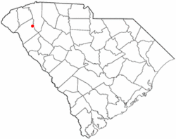 Location of Williamston, South Carolina | |
| Coordinates: 34°37′4″N 82°28′45″W | |
| Country | United States |
| State | South Carolina |
| County | Anderson |
| Area | |
| • Total | 3.73 sq mi (9.65 km2) |
| • Land | 3.69 sq mi (9.55 km2) |
| • Water | 0.04 sq mi (0.09 km2) |
| Elevation | 807 ft (246 m) |
| Population (2020)[3] | |
| • Total | 4,043 |
| • Density | 1,095.96/sq mi (423.20/km2) |
| Time zone | UTC−5 (Eastern (EST)) |
| • Summer (DST) | UTC−4 (EDT) |
| ZIP code | 29697 |
| Area code | 864 |
| FIPS code | 45-77875[4] |
| GNIS feature ID | 1251452[2] |
| Website | www |
Geography
Williamston is located in northeastern Anderson County at 34°37′4″N 82°28′45″W (34.617699, -82.479256).[7] The twin towns of Pelzer and West Pelzer are 2 miles (3 km) to the north. Anderson, the county seat, is 15 miles (24 km) to the southwest.
According to the United States Census Bureau, the town has a total area of 3.7 square miles (9.5 km2), of which 3.6 square miles (9.4 km2) is land and 0.04 square miles (0.1 km2), or 1.01%, is water.[8]
Demographics
| Historical population | |||
|---|---|---|---|
| Census | Pop. | %± | |
| 1890 | 935 | — | |
| 1900 | 991 | 6.0% | |
| 1910 | 1,957 | 97.5% | |
| 1920 | 2,322 | 18.7% | |
| 1930 | 2,235 | −3.7% | |
| 1940 | 2,509 | 12.3% | |
| 1950 | 2,782 | 10.9% | |
| 1960 | 3,721 | 33.8% | |
| 1970 | 3,991 | 7.3% | |
| 1980 | 4,310 | 8.0% | |
| 1990 | 3,876 | −10.1% | |
| 2000 | 3,791 | −2.2% | |
| 2010 | 3,934 | 3.8% | |
| 2020 | 4,043 | 2.8% | |
| U.S. Decennial Census[9][3] | |||
2020 census
| Race | Num. | Perc. |
|---|---|---|
| White (non-Hispanic) | 3,117 | 77.1% |
| Black or African American (non-Hispanic) | 517 | 12.79% |
| Native American | 23 | 0.57% |
| Asian | 6 | 0.15% |
| Pacific Islander | 1 | 0.02% |
| Other/Mixed | 145 | 3.59% |
| Hispanic or Latino | 234 | 5.79% |
As of the 2020 United States census, there were 4,043 people, 1,963 households, and 1,092 families residing in the town.
2000 census
As of the census[4] of 2000, there were 3,791 people, 1,590 households, and 1,090 families residing in the town. The population density was 1,056.2 people per square mile (407.7/km2). There were 1,762 housing units at an average density of 490.9 per square mile (189.5/km2). The racial makeup of the town was 80.80% White, 17.67% African American, 0.08% Native American, 0.11% Asian, 0.66% from other races, and 0.69% from two or more races. Hispanic or Latino of any race were 1.74% of the population.
There were 1,590 households, out of which 27.6% had children under the age of 18 living with them, 49.9% were married couples living together, 14.0% had a female householder with no husband present, and 31.4% were non-families. 28.8% of all households were made up of individuals, and 14.7% had someone living alone who was 65 years of age or older. The average household size was 2.38 and the average family size was 2.91.
In the town, the population was spread out, with 22.8% under the age of 18, 7.4% from 18 to 24, 28.3% from 25 to 44, 22.7% from 45 to 64, and 18.9% who were 65 years of age or older. The median age was 40 years. For every 100 females, there were 91.7 males. For every 100 females age 18 and over, there were 86.7 males.
The median income for a household in the town was $31,458, and the median income for a family was $37,679. Males had a median income of $30,585 versus $21,771 for females. The per capita income for the town was $14,085. About 9.4% of families and 12.3% of the population were below the poverty line, including 10.3% of those under age 18 and 13.3% of those age 65 or over.
Education
Public schools in the Pelzer/Williamston/West Pelzer area are administered by Anderson District One. The public elementary schools in Anderson district one are Cedar Grove Elementary, Powdersville Elementary, Concrete Primary, Spearman Elementary, Hunt Meadows Elementary, West Pelzer Elementary, Palmetto Elementary, and Wren Elementary. The Middle schools are Palmetto Middle, Wren Middle, and Powdersville Middle. High schools are; Palmetto High School, Palmetto High Freshman Academy, Powdersville High School, Wren High School, and Wren High School Freshman Academy.[11]
Willimaston has a public library, a branch of the Anderson County Library System.[12]
Emergency Services
- EMS - Emergency Medical Services - Paramedic level service is provided by Anderson County EMS, utilizing quick response vehicles (QRVs) which are equipped and staffed at the paramedic level. Basic life support (BLS) transport is provided by Medshore Ambulance Service through a contract with Anderson County.
- Fire - Fire/Rescue service is provided by the Williamston Fire Department. This is a primarily volunteer fire department, with a paid full-time fire chief. Mutual aid back-up is also provided to and from, the West Pelzer Fire Department, South Greenville Fire Department, Piedmont Fire Department, Wren Fire Department, Belton Fire Department, Cheddar Fire Department, and Whitefield Fire Department.
- Law Enforcement - The Williamston Police department provides services to the town. They are backed-up, when necessary, by the Anderson County Sheriff's Office, Belton Police Department, and the West Pelzer Police Department. The department also provides mutual aid back-up to those agencies as requested.
References
- "ArcGIS REST Services Directory". United States Census Bureau. Retrieved October 15, 2022.
- U.S. Geological Survey Geographic Names Information System: Williamston, South Carolina
- "Census Population API". United States Census Bureau. Retrieved Oct 15, 2022.
- "U.S. Census website". United States Census Bureau. Retrieved 2008-01-31.
- "Population and Housing Unit Estimates". United States Census Bureau. 2016.
- "Population and Housing Unit Estimates". United States Census Bureau. Retrieved 2017-11-18.
- "US Gazetteer files: 2010, 2000, and 1990". United States Census Bureau. 2011-02-12. Retrieved 2011-04-23.
- "Geographic Identifiers: 2010 Demographic Profile Data (G001): Williamston town, South Carolina". U.S. Census Bureau, American Factfinder. Archived from the original on February 12, 2020. Retrieved August 8, 2013.
- "Census of Population and Housing". Census.gov. Retrieved June 4, 2015.
- "Explore Census Data". data.census.gov. Retrieved 2021-12-14.
- "Schools / Primary & Elementary Schools". Anderson1.k12.sc.us. Retrieved 2 January 2018.
- "South Carolina libraries and archives". SCIWAY. Retrieved 7 June 2019.
External links
- Town of Williamston official website
- The Journal, Williamston's newspaper
- PelzerWilliamston.com, local information
- Anderson School District One
Municipalities and communities of Anderson County, South Carolina, United States | ||
|---|---|---|
County seat: Anderson | ||
| Cities | 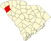 | |
| Towns | ||
| CDPs | ||
| Other communities | ||
| Footnotes | ‡This populated place also has portions in an adjacent county or counties | |
| ||
Authority control | |
|---|---|
| General | |
| National libraries | |
Другой контент может иметь иную лицензию. Перед использованием материалов сайта WikiSort.org внимательно изучите правила лицензирования конкретных элементов наполнения сайта.
WikiSort.org - проект по пересортировке и дополнению контента Википедии