world.wikisort.org - USA
La France is an unincorporated community and census-designated place (CDP) in Anderson County, South Carolina, United States. It was first listed as a CDP in the 2020 census with a population of 476.[4]
La France, South Carolina | |
|---|---|
Census-designated place | |
 La France, South Carolina  La France, South Carolina | |
| Coordinates: 34°36′43″N 82°45′55″W | |
| Country | United States |
| State | South Carolina |
| County | Anderson |
| Area | |
| • Total | 1.31 sq mi (3.40 km2) |
| • Land | 1.30 sq mi (3.36 km2) |
| • Water | 0.02 sq mi (0.04 km2) |
| Elevation | 761 ft (232 m) |
| Population (2020)[3] | |
| • Total | 476 |
| • Density | 367.28/sq mi (141.78/km2) |
| Time zone | UTC-5 (Eastern (EST)) |
| • Summer (DST) | UTC-4 (EDT) |
| ZIP code | 29656 |
| Area code | 864 |
| GNIS feature ID | 1246273[2] |
La France is located on U.S. Route 76 and South Carolina Highway 28, 10 miles (16 km) northwest of Anderson. La France has a post office with ZIP code 29656, which opened on April 12, 1871.[5][6]
Demographics
| Historical population | |||
|---|---|---|---|
| Census | Pop. | %± | |
| 2020 | 476 | — | |
| U.S. Decennial Census[7] 2020[8][3] | |||
2020 census
| Race / Ethnicity | Pop 2020[8] | % 2020 |
|---|---|---|
| White alone (NH) | 391 | 82.14% |
| Black or African American alone (NH) | 30 | 6.30% |
| Native American or Alaska Native alone (NH) | 0 | 0.00% |
| Asian alone (NH) | 1 | 0.21% |
| Pacific Islander alone (NH) | 0 | 0.00% |
| Some Other Race alone (NH) | 2 | 0.42% |
| Mixed Race/Multi-Racial (NH) | 30 | 6.30% |
| Hispanic or Latino (any race) | 22 | 4.62% |
| Total | 476 | 100.00% |
Note: the US Census treats Hispanic/Latino as an ethnic category. This table excludes Latinos from the racial categories and assigns them to a separate category. Hispanics/Latinos can be of any race.
References
- "ArcGIS REST Services Directory". United States Census Bureau. Retrieved October 15, 2022.
- U.S. Geological Survey Geographic Names Information System: La France, South Carolina
- "Census Population API". United States Census Bureau. Retrieved Oct 15, 2022.
- "La France CDP, South Carolina". United States Census Bureau. Retrieved April 7, 2022.
- United States Postal Service (2012). "USPS - Look Up a ZIP Code". Retrieved 2012-02-15.
- "Postmaster Finder - Post Offices by ZIP Code". United States Postal Service. Retrieved August 6, 2013.
- "Decennial Census of Population and Housing by Decades". US Census Bureau.
- "P2 HISPANIC OR LATINO, AND NOT HISPANIC OR LATINO BY RACE – 2020: DEC Redistricting Data (PL 94-171) – La France CDP, South Carolina". United States Census Bureau.
Municipalities and communities of Anderson County, South Carolina, United States | ||
|---|---|---|
County seat: Anderson | ||
| Cities | 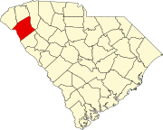 | |
| Towns | ||
| CDPs | ||
| Other communities | ||
| Footnotes | ‡This populated place also has portions in an adjacent county or counties | |
| ||
This South Carolina state location article is a stub. You can help Wikipedia by expanding it. |
Текст в блоке "Читать" взят с сайта "Википедия" и доступен по лицензии Creative Commons Attribution-ShareAlike; в отдельных случаях могут действовать дополнительные условия.
Другой контент может иметь иную лицензию. Перед использованием материалов сайта WikiSort.org внимательно изучите правила лицензирования конкретных элементов наполнения сайта.
Другой контент может иметь иную лицензию. Перед использованием материалов сайта WikiSort.org внимательно изучите правила лицензирования конкретных элементов наполнения сайта.
2019-2025
WikiSort.org - проект по пересортировке и дополнению контента Википедии
WikiSort.org - проект по пересортировке и дополнению контента Википедии