world.wikisort.org - USA
O'Fallon is a city in St. Clair County, Illinois, United States. The 2020 census listed the population at 32,289. The city is the second largest city in the Metro-East region and Southern Illinois. It sits 5 miles (8.0 km) from Scott Air Force Base and 18 miles (29 km) from Downtown St Louis.
O'Fallon, Illinois | |
|---|---|
City | |
| City of O’Fallon | |
 | |
 Flag  Seal | |
| Nickname: "O-Town" | |
 Location of O'Fallon in St. Clair County, Illinois. | |
 Location of Illinois in the United States | |
| Coordinates: 38.59611°N 89.91551°W | |
| Country | |
| State | |
| County | |
| Township | O'Fallon |
| Government | |
| • Type | Home rule[1] |
| • Mayor | Herb Roach |
| Area | |
| • Total | 15.71 sq mi (40.67 km2) |
| • Land | 15.59 sq mi (40.39 km2) |
| • Water | 0.11 sq mi (0.29 km2) |
| Population (2020) | |
| • Total | 32,289 |
| • Density | 2,070.60/sq mi (799.48/km2) |
| Time zone | UTC−6 (CST) |
| • Summer (DST) | UTC−5 (CDT) |
| ZIP code(s) | 62269 |
| Area code | 618 |
| FIPS code | 17-55249 |
| Wikimedia Commons | O'Fallon, Illinois |
| Website | ofallon |
Like its namesake in St. Charles County, Missouri, O'Fallon is part of the St. Louis Metropolitan Statistical Area. This makes O'Fallon (along with the two Troys in Illinois and Missouri) one of the few pairs of like-named municipalities to be part of the same MSA.
History
Founded in 1854, O'Fallon's namesake comes from Colonel John O'Fallon who was a wealthy gentleman from St. Louis. In downtown O'Fallon, a Baltimore and Ohio Railroad railroad depot was built, which helped put O'Fallon on the map. City lots were platted and sold at a public auction on May 18, 1854. A post office was established the following year and the city began attracting German settlers looking for fertile farming land. On January 27, 1874, O'Fallon was incorporated as a village. On March 14, 1905, the citizens voted for a change to the city form of government. Since its founding, O'Fallon has gained population every decennial census year except 1930, when the census showed a net loss of six residents.

The city center is approximately two miles east of the intersection of Interstate 64 and U.S. Route 50. Suburban growth in O'Fallon expanded considerably during the 1980s and following the expansion of Interstate 64 in the 1990s. Subdivisions include Thornbury Hill, Nolin Creek Estates, Fairwood Hills, Deer Creek, Forest Hills, and Fairwood East. O'Fallon Township High School's main campus at 600 South Smiley Street has undergone numerous additions over the past decades to ease overcrowding, including the creation of the separate 9th Grade Milburn Campus.
O'Fallon's city seal was designed in 1974 by Michael Donovan, an OTHS freshman, during a contest held by the O'Fallon Junior Woman's Club to create a city flag. In May 1975, the design was finalized by Louis Bradshaw and was then adopted by the city as its official flag. According to the 2004 publication by the O'Fallon Historical Society, O'Fallon Sesquicentennial History:[3]
"The design is yellow gold on a blue background—the colors of the high school. The pick and shovel represent the coal mines that were so important to O'Fallon's economy for over 100 years. The locomotive represents the railroad to which O'Fallon owes its existence. The planes represent Scott Air Force Base where many in O'Fallon find employment—both military and civil service."
Events
- Tornado outbreak of April 2, 2006
Annual events
- May - Memorial Day To Honor Those Who Gave their lives in service of the nation (O'Fallon Veterans Monument)[4]
- November – Veterans Day Celebration at O'Fallon Veterans Monument; Veterans Day Parade - largest in the area
- November, the Saturday after Thanksgiving - Lighted Holiday Parade
Parks and public services

O'Fallon Parks and Recreation
- Family Sports Park
- Hesse Park
- Katy Cavin's Community Center
- O'Fallon Community Park
- O'Fallon Memorial Pool
- Rock Springs Nature Park
- Nature center
- Jogging/cycling paths
- Nature trails
- Natural prairie
- Dog Park
- MCT Goshen Trailhead
- St. Clair Recreation Complex
- St. Ellen Mine Park
- Thoman Park
- Veteran's Monument
Library
- O'Fallon Public Library
Registered historic places
- Scott Field Historic District
Schools

- O'Fallon Community Consolidated School District #90
- Delores Moye Elementary School
- Estelle Kampmeyer Elementary School
- J. E. Hinchcliffe Sr. Elementary School
- Laverna Evans Elementary School
- Marie Schaefer Elementary School
- Amelia V. Carriel Junior High School
- Edward A. Fulton Junior High School
- O'Fallon Central School District #104
- O'Fallon Township High School District No. 203
- O'Fallon Township High School
Private schools
- Discovery School
- St. Clare Catholic School
- First Baptist Academy
Geography
O'Fallon is located at 38°35′N 89°54′W (38.591549, −89.912000).[5] O'Fallon is:
- 5 mi (8.0 km) from Scott Air Force Base
- 10 mi (16 km) from McKendree University
- and 17 mi (27 km) from St. Louis, Missouri
According to the 2010 census, the city has a total area of 14.48 square miles (37.5 km2), of which 14.35 square miles (37.2 km2) (or 99.10%) is land and 0.12 square miles (0.31 km2) (or 0.83%) is water.[6]
Demographics
| Historical population | |||
|---|---|---|---|
| Census | Pop. | %± | |
| 1870 | 1,117 | — | |
| 1880 | 921 | −17.5% | |
| 1890 | 865 | −6.1% | |
| 1900 | 1,267 | 46.5% | |
| 1910 | 2,018 | 59.3% | |
| 1920 | 2,379 | 17.9% | |
| 1930 | 2,373 | −0.3% | |
| 1940 | 2,407 | 1.4% | |
| 1950 | 3,022 | 25.6% | |
| 1960 | 4,018 | 33.0% | |
| 1970 | 7,268 | 80.9% | |
| 1980 | 12,173 | 67.5% | |
| 1990 | 16,073 | 32.0% | |
| 2000 | 21,910 | 36.3% | |
| 2010 | 28,281 | 29.1% | |
| 2020 | 32,289 | 14.2% | |
| U.S. Decennial Census[7] 2018 Estimate[8] | |||
As of the census[9] of 2010, there were 28,281 people, 8,310 households, and 6,016 families living in the city. The population density was 1,970/sq mi (760/km2). There were 8,310 housing units at an average density of 580/sq mi (220/km2). The racial makeup of the city was 82.67% White, 11.99% African American, 0.23% Native American, 2.47% Asian, 0.07% Pacific Islander, 0.79% from other races, and 1.77% from two or more races. Hispanic or Latino of any race were 2.23% of the population.
Of the 8,310 households 39.6% had children under the age of 18 living with them, 59.0% were married couples living together, 10.5% had a female householder with no husband present, and 27.6% were non-families. 23.2% of households were one person and 7.2% were one person aged 65 or older. The average household size was 2.62 and the average family size was 3.13.
The age distribution was 28.3% under the age of 18, 8.0% from 18 to 24, 32.2% from 25 to 44, 22.7% from 45 to 64, and 8.9% 65 or older. The median age was 35 years. For every 100 females, there were 93.2 males. For every 100 females age 18 and over, there were 90.1 males.
The median household income was $55,927 and the median family income was $66,262. Males had a median income of $46,303 versus $30,158 for females. The per capita income for the city was $24,821. About 4.1% of families and 5.0% of the population were below the poverty line, including 5.0% of those under age 18 and 7.9% of those age 65 or over.
Notable people
- Bob Cryder, professional football player
- Bernie Fuchs, illustrator
- Lance Geiger,[10] The History Guy on YouTube
- William Holden, Academy Award-winning actor
- Joseph W. Schmitt, spacesuit technician for the National Aeronautics and Space Administration
Gallery
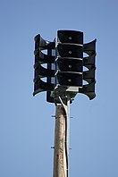 City Civil defense siren
 O’Fallon War Memorial
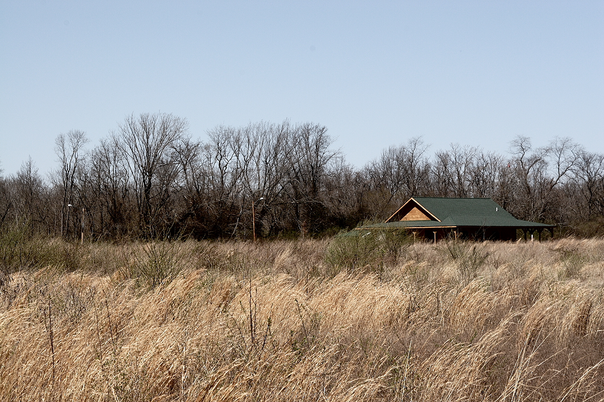
 Hesse Park


References
- "Form of Government City of O'Fallon". City of O'Fallon, IL. Retrieved December 13, 2019.
- "2020 U.S. Gazetteer Files". United States Census Bureau. Retrieved March 15, 2022.
- O'Fallon Historical Society (2004). O'Fallon Sesquicentennial History.
- "Calendar | City of OFallon, IL".
- "US Gazetteer files: 2010, 2000, and 1990". United States Census Bureau. February 12, 2011. Retrieved April 23, 2011.
- "2010 Census U.S. Gazetteer Files for Places – Illinois". United States Census. Retrieved October 13, 2012.
- United States Census Bureau. "Census of Population and Housing". Retrieved May 13, 2015.
- "Population Estimates". United States Census Bureau. Retrieved June 8, 2018.
- "U.S. Census website". United States Census Bureau. Retrieved January 31, 2008.
- "EXCHANGE: Man has become known as social media's History Guy". Daily Herald - Paddock Publications. Retrieved December 18, 2019.
External links
| Counties |  | |
|---|---|---|
| Major cities (25,000+) |
| |
| Cities (5,000-25,000) | ||
| Communities (1,000-5,000) |
| |
| Interstates |
| |
| Airports | ||
| Colleges |
| |
| Sports teams |
| |
Municipalities and communities of St. Clair County, Illinois, United States | ||
|---|---|---|
County seat: Belleville | ||
| Cities |  | |
| Villages | ||
| Townships | ||
| CDPs |
| |
| Other unincorporated communities | ||
| Footnotes | ‡This populated place also has portions in an adjacent county or counties | |
| ||
| Topics |
|  |
|---|---|---|
| Central city | ||
| Largest cities (over 50,000 in 2020) | ||
| Medium-sized cities (over 20,000 in 2020) | ||
| Largest towns and villages (over 10,000 in 2020) |
| |
| Missouri counties | ||
| Illinois counties | ||
| Subregions |
| |
| Counties |  | |
|---|---|---|
| Mid-sized cities (25,000+) |
| |
| Small Cities (10,000-25,000) | ||
| Small Cities (5,000-10,000) | ||
| Interstates |
| |
| Airports/Military bases |
| |
| Universities |
| |
| Colleges |
| |
| Sports teams based in the Southern Illinois |
| |
Authority control | |
|---|---|
| General | |
| National libraries | |
На других языках
[de] O’Fallon (Illinois)
O’Fallon ist eine Stadt mit 29.031 Einwohnern (2017)[1] im St. Clair County im Westen des US-amerikanischen Bundesstaates Illinois. Sie liegt im Metro-East genannten östlichen Teil der Metropolregion Greater St. Louis um die rund 32 km westlich gelegene Stadt St. Louis im benachbarten Missouri.- [en] O'Fallon, Illinois
Другой контент может иметь иную лицензию. Перед использованием материалов сайта WikiSort.org внимательно изучите правила лицензирования конкретных элементов наполнения сайта.
WikiSort.org - проект по пересортировке и дополнению контента Википедии