world.wikisort.org - USA
McKenzie County is a county in the U.S. state of North Dakota. As of the 2020 census, the population was 14,704.[1] Its county seat is Watford City.[2]
McKenzie County | |
|---|---|
U.S. county | |
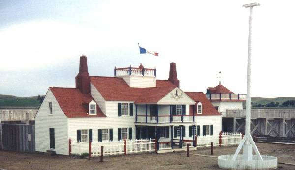 Fort Union Trading Post National Historic Site | |
 Location within the U.S. state of North Dakota | |
 North Dakota's location within the U.S. | |
| Coordinates: 47°44′N 103°23′W | |
| Country | |
| State | |
| Founded | March 9, 1883 (created) April 20, 1905 (organized) |
| Named for | Alexander McKenzie |
| Seat | Watford City |
| Largest city | Watford City |
| Area | |
| • Total | 2,861 sq mi (7,410 km2) |
| • Land | 2,760 sq mi (7,100 km2) |
| • Water | 100 sq mi (300 km2) 3.5% |
| Population (2020) | |
| • Total | 14,704 |
| • Estimate (2021) | 13,819 |
| • Density | 5.1/sq mi (2.0/km2) |
| Time zones | |
| (northern portion) | UTC−6 (Central) |
| • Summer (DST) | UTC−5 (CDT) |
| (southern portion) | UTC−7 (Mountain) |
| • Summer (DST) | UTC−6 (MDT) |
| Congressional district | At-large |
| Website | county |
The county lies immediately adjacent to the Williston Micropolitan Statistical Area, although the Census Bureau does not include McKenzie County in that grouping.
History
The Dakota Territory legislature created the county on March 9, 1883, with areas partitioned from Howard County (now extinct). The county was named for Alexander McKenzie, a territorial political figure who was later disgraced for corruption.[3] The county was not organized at that time, and was not attached to another county for administrative or judicial purposes. The county's boundary was altered in 1885, and on March 2, 1891, the state legislature authorized the dissolution of the county, assigning its territories to Billings and Stark counties. However, this directive was not implemented, and McKenzie continued as a defined county until November 3, 1896, when another act was passed to dissolve the county and assign its territories to Billings County. This act was challenged in the courts, and on May 24, 1901, the state Supreme Court held that the county was to continue in existence.
On March 10, 1903, the county was attached to Stark County for administrative purposes. On March 16, 1905, McKenzie gained the territories of Allred and Wallace counties as those counties were administratively dissolved. On April 20, 1905, the McKenzie County government was organized, and its previous attachment to Stark was terminated.
The first county seat was Alexander. In 1907 the seat was moved to Schafer, and in 1941 it was moved to the present location, Watford City.[4][5]
Between the 2010 and 2020 censuses, McKenzie County was the fastest growing county in the United States, growing by 131.2% from 6,360 to 14,704 inhabitants, largely due to the Bakken Formation oil boom.[6][7]
Geography
McKenzie County lies on the west line of North Dakota. Its west boundary line abuts the east boundary line of the state of Montana. The Missouri River flows easterly along the western portion of the county's north boundary line, and the enlargement of the Missouri as it discharges into Lake Sakakawea forms the eastern portion of the county's north and northeastern boundary line. The Yellowstone River flows into the northwestern corner of the county from Montana, and discharges into the Missouri at the county's northern boundary line. The Little Missouri River flows northeasterly through the county's lower portion, on its way to discharge into Lake Sakakawea, east of the county's east boundary line. The county terrain consists of semi-arid rolling hills, carved by river valleys and drainages. The area is partially devoted to agriculture.[8] The terrain slopes to the east and north, with its highest point on its south boundary line, at 2,684' (818m) ASL.[9] The county has a total area of 2,861 square miles (7,410 km2), of which 2,760 square miles (7,100 km2) is land and 100 square miles (260 km2) (3.5%) is water.[10] It is the largest county in North Dakota by area.
The McKenzie County landscape features a wide diversity of physical features, ranging from sugarbeet fields bordering the Missouri River at the northwest corner of the county to rugged badlands near the Little Missouri River in the south, where Theodore Roosevelt National Park and the Little Missouri National Grassland are located. Between the two rivers is a large area of prairie, ranging from gentle rolling terrain to rocky, rugged pastures. The southeast corner of the county, bordering on the Little Missouri badlands of neighboring Dunn County, is abundant in wildlife, quaking aspen groves, and bur oak groves, interspersed in places with western red cedar on the north-facing slopes of the badlands.
The southwestern corner counties of North Dakota (Adams, Billings, Bowman, Golden Valley, Grant, Hettinger, Slope, Stark) observe Mountain Time. The counties of McKenzie, Dunn, and Sioux are split between Mountain and Central Time.
Major highways
 U.S. Highway 85
 North Dakota Highway 22
 North Dakota Highway 23
 North Dakota Highway 58
 North Dakota Highway 68
 North Dakota Highway 73
 North Dakota Highway 200
 North Dakota Highway 1806
Adjacent counties
- Williams County - north (observes Central Time)
- Mountrail County - northeast (observes Central Time)
- Dunn County - southeast (observes Mountain Time in western section)
- Billings County - south (observes Mountain Time)
- Golden Valley County - southwest (observes Mountain Time)
- Wibaux County, Montana - west (observes Mountain Time)
- Richland County, Montana - northwest (observes Mountain Time)
Protected areas[8]
- Antelope Creek State Game Management Area
- Antelope Creek State Wildlife Refuge
- Bear Den Creek Public Use Area
- Little Missouri National Grassland (part)
- Maah Daah Hey Trail
- Theodore Roosevelt National Park (North Unit - contained within LM National Grassland)
- Tobacco Garden Creek State Game Management Area
- Tobacco Garden Creek Recreation Area
Lakes[8]
- Demicks Lake
- Lake Sakakawea
- Nohly Lake
Demographics
| Historical population | |||
|---|---|---|---|
| Census | Pop. | %± | |
| 1910 | 5,720 | — | |
| 1920 | 9,544 | 66.9% | |
| 1930 | 9,709 | 1.7% | |
| 1940 | 8,426 | −13.2% | |
| 1950 | 6,849 | −18.7% | |
| 1960 | 7,296 | 6.5% | |
| 1970 | 6,127 | −16.0% | |
| 1980 | 7,132 | 16.4% | |
| 1990 | 6,383 | −10.5% | |
| 2000 | 5,737 | −10.1% | |
| 2010 | 6,360 | 10.9% | |
| 2020 | 14,704 | 131.2% | |
| 2021 (est.) | 13,819 | −6.0% | |
| U.S. Decennial Census[11] 1790-1960[12] 1900-1990[13] 1990-2000[14] 2010-2020[1] | |||
2000 census
As of the 2000 census, there were 5,737 people, 2,151 households, and 1,548 families in the county. The population density was 2.08/sqmi (0.80/km2). There were 2,719 housing units at an average density of 0.99/sqmi (0.38/km2). The racial makeup of the county was 77.36% White, 0.07% Black or African American, 21.18% Native American, 0.05% Asian, 0.02% Pacific Islander, 0.14% from other races, and 1.19% from two or more races. 1.01% of the population were Hispanic or Latino of any race. 33.4% were of Norwegian and 20.9% German ancestry.
There were 2,151 households, out of which 34.50% had children under the age of 18 living with them, 57.90% were married couples living together, 9.30% had a female householder with no husband present, and 28.00% were non-families. 25.80% of all households were made up of individuals, and 13.10% had someone living alone who was 65 years of age or older. The average household size was 2.64 and the average family size was 3.17.
The county population contained 30.60% under the age of 18, 5.50% from 18 to 24, 23.30% from 25 to 44, 24.90% from 45 to 64, and 15.70% who were 65 years of age or older. The median age was 40 years. For every 100 females there were 100.70 males. For every 100 females age 18 and over, there were 98.90 males.
The median income for a household in the county was $29,342, and the median income for a family was $34,091. Males had a median income of $26,351 versus $20,147 for females. The per capita income for the county was $14,732. About 13.70% of families and 17.20% of the population were below the poverty line, including 22.10% of those under age 18 and 12.70% of those age 65 or over.
2010 census
As of the 2010 census, there were 6,360 people, 2,410 households, and 1,682 families in the county.[15] The population density was 2.30/sqmi (0.89/km2). There were 3,090 housing units at an average density of 1.12/sqmi (0.43/km2).[16] The racial makeup of the county was 75.3% white, 22.2% American Indian, 0.3% Asian, 0.1% black or African American, 0.4% from other races, and 1.6% from two or more races. Those of Hispanic or Latino origin made up 2.2% of the population.[15] In terms of ancestry, 39.5% were Norwegian, 30.6% were German, 6.1% were Irish, and 0.7% were American.[17]
Of the 2,410 households, 33.7% had children under the age of 18 living with them, 52.7% were married couples living together, 10.2% had a female householder with no husband present, 30.2% were non-families, and 25.3% of all households were made up of individuals. The average household size was 2.58 and the average family size was 3.06. The median age was 38.0 years.[15]
The median income for a household in the county was $48,480 and the median income for a family was $58,906. Males had a median income of $42,803 versus $33,056 for females. The per capita income for the county was $27,605. About 6.7% of families and 10.0% of the population were below the poverty line, including 12.8% of those under age 18 and 10.0% of those age 65 or over.[18]
Communities
Cities
- Alexander
- Arnegard
- Watford City (county seat)
Census-designated places
- East Fairview
- Four Bears Village
- Mandaree
Unincorporated communities[8]
- Banks
- Cartwright
- Charbonneau
- Charlson
- Dore
- Grassy Butte
- Hawkeye
- Johnsons Corner (or Johnson Corner)
- Keene
- Kroff
- Rawson
- Schafer
Townships
- Alex
- Antelope Creek
- Arnegard
- Blue Butte
- Charbon
- Elm Tree
- Ellsworth
- Grail
- Hawkeye
- Keene
- Randolph
- Riverview
- Sioux
- Tri
- Twin Valley
- Yellowstone
Defunct Townships
Elk, Poe, and Wilbur townships merged January 1, 2002 to form Tri Township.[19]
Politics
McKenzie County voters have traditionally voted Republican. In only one national election since 1948 has the county selected the Democratic Party candidate (as of 2020).
| Year | Republican | Democratic | Third party | |||
|---|---|---|---|---|---|---|
| No. | % | No. | % | No. | % | |
| 2020 | 4,482 | 82.71% | 814 | 15.02% | 123 | 2.27% |
| 2016 | 3,670 | 78.55% | 698 | 14.94% | 304 | 6.51% |
| 2012 | 2,458 | 71.23% | 927 | 26.86% | 66 | 1.91% |
| 2008 | 1,740 | 64.09% | 933 | 34.36% | 42 | 1.55% |
| 2004 | 1,897 | 68.68% | 847 | 30.67% | 18 | 0.65% |
| 2000 | 1,634 | 69.12% | 653 | 27.62% | 77 | 3.26% |
| 1996 | 1,338 | 49.50% | 928 | 34.33% | 437 | 16.17% |
| 1992 | 1,324 | 42.85% | 787 | 25.47% | 979 | 31.68% |
| 1988 | 1,949 | 59.91% | 1,273 | 39.13% | 31 | 0.95% |
| 1984 | 2,610 | 71.96% | 974 | 26.85% | 43 | 1.19% |
| 1980 | 2,265 | 67.25% | 867 | 25.74% | 236 | 7.01% |
| 1976 | 1,595 | 53.56% | 1,335 | 44.83% | 48 | 1.61% |
| 1972 | 1,913 | 65.87% | 937 | 32.27% | 54 | 1.86% |
| 1968 | 1,625 | 59.63% | 935 | 34.31% | 165 | 6.06% |
| 1964 | 1,352 | 46.02% | 1,584 | 53.91% | 2 | 0.07% |
| 1960 | 1,715 | 53.08% | 1,514 | 46.86% | 2 | 0.06% |
| 1956 | 1,609 | 53.15% | 1,405 | 46.42% | 13 | 0.43% |
| 1952 | 2,260 | 71.70% | 846 | 26.84% | 46 | 1.46% |
| 1948 | 1,168 | 45.08% | 1,227 | 47.36% | 196 | 7.56% |
| 1944 | 1,241 | 43.35% | 1,592 | 55.61% | 30 | 1.05% |
| 1940 | 1,563 | 38.63% | 2,440 | 60.31% | 43 | 1.06% |
| 1936 | 570 | 14.66% | 2,885 | 74.20% | 433 | 11.14% |
| 1932 | 710 | 20.02% | 2,655 | 74.85% | 182 | 5.13% |
| 1928 | 2,100 | 61.14% | 1,289 | 37.53% | 46 | 1.34% |
| 1924 | 1,113 | 38.14% | 137 | 4.69% | 1,668 | 57.16% |
| 1920 | 2,587 | 79.50% | 511 | 15.70% | 156 | 4.79% |
| 1916 | 1,394 | 45.16% | 1,456 | 47.17% | 237 | 7.68% |
| 1912 | 285 | 27.54% | 293 | 28.31% | 457 | 44.15% |
| 1908 | 574 | 68.41% | 212 | 25.27% | 53 | 6.32% |
Education
School districts include:[22]
K-12:
- Alexander Public School District 2
- Mandaree Public School District 36
- McKenzie County Public School District 1
- New Town Public School District 1
- Williston Basin School District 7
Elementary:
- Earl Public School District 18
- Horse Creek Public School District 32
- Yellowstone Public School District 14
Former districts
- Grassy Butte District - Merged into the Killdeer district[23]
- Williston Public School District 1 - Merged into Williston Basin district in 2021[24]
See also
- National Register of Historic Places listings in McKenzie County, North Dakota
References
- "U.S. Census Bureau QuickFacts: McKenzie County, North Dakota". www.census.gov. United States Census Bureau. Retrieved March 25, 2022.
- "Find a County". National Association of Counties. Archived from the original on May 31, 2011. Retrieved June 7, 2011.
- Gannett, Henry (1905). The Origin of Certain Place Names in the United States. US Government Printing Office. p. 194.
- "Dakota Territory, South Dakota, and North Dakota: Individual County Chronologies". Dakota Territory Atlas of Historical County Boundaries. The Newberry Library. 2006. Archived from the original on April 2, 2018. Retrieved February 1, 2015.
- "County History". Official Portal for North Dakota State Government. Archived from the original on February 2, 2015. Retrieved May 4, 2011.
- "McKenzie County fastest growing county in the US". county.mckenziecounty.net. Retrieved December 1, 2021.
- Smith, Mitch (August 12, 2021). "Oil turns a rural county in North Dakota into a boomtown". The New York Times. ISSN 0362-4331. Retrieved December 1, 2021.
- McKenzie County ND Google Maps (accessed February 26, 2019)
- ""Find an Altitude/McKenzie County ND" Google Maps (accessed 26 February 2019)". Archived from the original on May 21, 2019. Retrieved February 26, 2019.
- "2010 Census Gazetteer Files". United States Census Bureau. August 22, 2012. Archived from the original on January 29, 2015. Retrieved February 1, 2015.
- "United States Decennial Census". United States Census Bureau. Retrieved February 1, 2015.
- "Historical Census Browser". University of Virginia Library. Retrieved February 1, 2015.
- Forstall, Richard L., ed. (April 20, 1995). "Population of Counties by Decennial Census: 1900 to 1990". United States Census Bureau. Retrieved February 1, 2015.
- "Census 2000 PHC-T-4. Ranking Tables for Counties: 1990 and 2000" (PDF). United States Census Bureau. April 2, 2001. Retrieved February 1, 2015.
- "Profile of General Population and Housing Characteristics: 2010 Demographic Profile Data". United States Census Bureau. Archived from the original on February 13, 2020. Retrieved March 14, 2016.
- "Population, Housing Units, Area, and Density: 2010 - County". United States Census Bureau. Archived from the original on February 13, 2020. Retrieved March 14, 2016.
- "Selected Social Characteristics in the US – 2006-2010 American Community Survey 5-Year Estimates". United States Census Bureau. Archived from the original on February 13, 2020. Retrieved March 14, 2016.
- "Selected Economic Characteristics – 2006-2010 American Community Survey 5-Year Estimates". United States Census Bureau. Archived from the original on February 13, 2020. Retrieved March 14, 2016.
- Historical census data
- Leip, David. "Atlas of US Presidential Elections". uselectionatlas.org. Retrieved April 12, 2018.
- The leading "other" candidate, Progressive Theodore Roosevelt, received 228 votes, while Socialist candidate Eugene Debs received 219 votes, Prohibition candidate Eugene Chafin received 10 votes.
- "2020 CENSUS - SCHOOL DISTRICT REFERENCE MAP: McKenzie County, ND" (PDF). U.S. Census Bureau. Retrieved July 23, 2022. - Text list - The 2010 map (see text list) does not list Williston District 1 while the 2020 map does. The Williston 1 district merged into the Williston Basin district in 2021
- Woodward, Curt (November 15, 2003). "Rural schools losing students". Bismarck Tribune. Retrieved August 14, 2021.
- "Home". Williams County School District 8. Archived from the original on July 25, 2021. Retrieved August 21, 2021.
External links
- McKenzie County Portal
- As the Sod Was Turned (Norma Berntson, 1959) from the Digital Horizons website
- McKenzie County maps, Sheet 1 (northeastern), Sheet 2 (northwestern), and Sheet 3 (southern), North Dakota DOT
Places adjacent to McKenzie County, North Dakota | ||||||||||||||||
|---|---|---|---|---|---|---|---|---|---|---|---|---|---|---|---|---|
| ||||||||||||||||
Municipalities and communities of McKenzie County, North Dakota, United States | ||
|---|---|---|
County seat: Watford City | ||
| Cities |  | |
| Townships |
| |
| Unorganized territories |
| |
| CDPs |
| |
| Other communities |
| |
| Indian reservation |
| |
| Footnotes | ‡This populated place also has portions in an adjacent county or counties | |
| ||
State of North Dakota | |
|---|---|
Bismarck (capital) | |
| Topics |
|
| Society |
|
| Regions |
|
| Larger cities pop. over 5,000 | |
| Smaller cities pop. 1,000–5,000 |
|
| Counties |
|
Authority control | |
|---|---|
| General | |
| National libraries | |
| Other | |
На других языках
[de] McKenzie County
Das McKenzie County[1] ist ein County im Bundesstaat North Dakota der Vereinigten Staaten. Der Verwaltungssitz (County Seat) ist Watford City.- [en] McKenzie County, North Dakota
[ru] Маккензи (округ)
Округ Маккензи (англ. McKenzie County) располагается в штате Северная Дакота, США. Официально образован в 1905 году. По состоянию на 2013 год, численность населения составляла 9314 человек.Другой контент может иметь иную лицензию. Перед использованием материалов сайта WikiSort.org внимательно изучите правила лицензирования конкретных элементов наполнения сайта.
WikiSort.org - проект по пересортировке и дополнению контента Википедии