world.wikisort.org - USA
Thompson is a city in Grand Forks County, North Dakota, United States. It is part of the "Grand Forks, ND-MN Metropolitan Statistical Area" or "Greater Grand Forks". It is located on the border of Allendale and Walle townships, with Walle on the east and Allendale on the west. The population was 1,101 at the 2020 census.[3] Thompson was founded in 1881.
Thompson, North Dakota | |
|---|---|
City | |
 S&T Quick Stop, the town's gas station and convenience store. | |
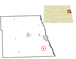 Location of Thompson, North Dakota | |
| Coordinates: 47°46′33″N 97°6′24″W | |
| Country | United States |
| State | North Dakota |
| County | Grand Forks |
| Metro | Greater Grand Forks |
| Founded | 1881 |
| Government | |
| • Mayor | Dean Larimer |
| Area | |
| • Total | 0.47 sq mi (1.23 km2) |
| • Land | 0.47 sq mi (1.21 km2) |
| • Water | 0.01 sq mi (0.02 km2) |
| Elevation | 873 ft (266 m) |
| Population (2020) | |
| • Total | 1,101 |
| • Density | 2,352.56/sq mi (909.26/km2) |
| Time zone | UTC-6 (CST) |
| • Summer (DST) | UTC-5 (CDT) |
| ZIP code | 58278 |
| Area code | 701 |
| FIPS code | 38-78660 |
| GNIS feature ID | 1032471[2] |
| Highways | ND 15 |
| Website | cityofthompsonnd.com |
History
The first residents of the town were businessmen who had come to support the needs of new settlers to the area. The town was first called Norton because the first buildings of the town were adjacent to land owned by George Norton. However, when the railroad came in 1881, the name caused an issue, since there was already a nearby town of Norton in Minnesota.[4]
Albert Thompson, co-owner of a general store with his brother Robert, was commissioned postmaster in January of 1881. The name of the town was then changed to Thompson in honor of Albert Thompson.[4]
Geography
Thompson is located at 47°46′33″N 97°06′24″W (47.775821, −97.106538).[5]
According to the United States Census Bureau, the city has a total area of 0.47 square miles (1.22 km2), of which 0.46 square miles (1.19 km2) is land and 0.01 square miles (0.03 km2) is water.[6]
Demographics
| Historical population | |||
|---|---|---|---|
| Census | Pop. | %± | |
| 1930 | 273 | — | |
| 1940 | 276 | 1.1% | |
| 1950 | 270 | −2.2% | |
| 1960 | 290 | 7.4% | |
| 1970 | 291 | 0.3% | |
| 1980 | 785 | 169.8% | |
| 1990 | 930 | 18.5% | |
| 2000 | 1,006 | 8.2% | |
| 2010 | 986 | −2.0% | |
| 2020 | 1,101 | 11.7% | |
| 2021 (est.) | 1,101 | [7] | 0.0% |
| U.S. Decennial Census[8] 2020 Census[3] | |||
2010 census
As of the census[9] of 2010, there were 986 people, 356 households, and 293 families living in the city. The population density was 2,143.5 inhabitants per square mile (827.6/km2). There were 362 housing units at an average density of 787.0 per square mile (303.9/km2). The racial makeup of the city was 98.1% White, 0.3% African American, 1.0% Native American, 0.1% Asian, 0.1% from other races, and 0.4% from two or more races. Hispanic or Latino of any race were 0.9% of the population.
There were 356 households, of which 42.1% had children under the age of 18 living with them, 73.0% were married couples living together, 7.0% had a female householder with no husband present, 2.2% had a male householder with no wife present, and 17.7% were non-families. 14.9% of all households were made up of individuals, and 4.8% had someone living alone who was 65 years of age or older. The average household size was 2.77 and the average family size was 3.04.
The median age in the city was 36.8 years. 28.4% of residents were under the age of 18; 6.9% were between the ages of 18 and 24; 27.2% were from 25 to 44; 30.5% were from 45 to 64; and 7.1% were 65 years of age or older. The gender makeup of the city was 51.0% male and 49.0% female.
2000 census
As of the census of 2000, there were 1,006 people, 329 households, and 273 families living in the city. The population density was 2,177.6 people per square mile (844.4/km2). There were 339 housing units at an average density of 733.8 per square mile (284.5/km2). The racial makeup of the city was 97.71% White, 0.40% African American, 0.10% Native American, 0.70% Asian, 0.20% from other races, and 0.89% from two or more races. Hispanic or Latino of any race were 0.80% of the population.
There were 329 households, out of which 53.2% had children under the age of 18 living with them, 74.5% were married couples living together, 4.3% had a female householder with no husband present, and 17.0% were non-families. 15.2% of all households were made up of individuals, and 6.4% had someone living alone who was 65 years of age or older. The average household size was 3.06 and the average family size was 3.43.
In the city, the population was spread out, with 34.9% under the age of 18, 6.3% from 18 to 24, 33.4% from 25 to 44, 19.8% from 45 to 64, and 5.7% who were 65 years of age or older. The median age was 33 years. For every 100 females, there were 105.7 males. For every 100 females age 18 and over, there were 97.9 males.
The median income for a household in the city was $54,514, and the median income for a family was $57,250. Males had a median income of $35,682 versus $21,298 for females. The per capita income for the city was $19,857. None of the families and 0.7% of the population were living below the poverty line, including no under eighteens and 7.7% of those over 64.
Education
The city is served by Thompson Public School. The school offers grades K–12.
High school championships
- State Class 'B' track & field: 1997 (4th place)
- State Class 'B' volleyball: 1997, 1998, 2004, 2005, 2018
- State Class 'B' baseball: 1983, 1985, 1999, 2005
- State Class 'B' jazz: 2010 (4th place)
- State Class 'B' hip-hop: 2011 (4th place)
- State Class 'B' football: 1993 semi-finalist, 1995 finalist, 1996 semi-finalist, 2010 semi-final loss, 2016 State Champions, 2018 State Champions.
- State Class ‘B’ boys basketball: 2019 Champions
References
- "ArcGIS REST Services Directory". United States Census Bureau. Retrieved September 20, 2022.
- "US Board on Geographic Names". United States Geological Survey. October 25, 2007. Retrieved January 31, 2008.
- "Explore Census Data". Explore Census Data. United States Census Bureau. Retrieved April 17, 2022.
- "Memories of Yesterday: Thompson Centennial, 1881-1981". www.digitalhorizonsonline.org. Retrieved March 15, 2021.
{{cite web}}: CS1 maint: url-status (link) - "US Gazetteer files: 2010, 2000, and 1990". United States Census Bureau. February 12, 2011. Retrieved April 23, 2011.
- "US Gazetteer files 2010". United States Census Bureau. Archived from the original on January 12, 2012. Retrieved June 14, 2012.
- "City and Town Population Totals: 2020-2021". United States Census Bureau. June 27, 2022. Retrieved June 27, 2022.
- United States Census Bureau. "Census of Population and Housing". Retrieved July 20, 2013.
- "U.S. Census website". United States Census Bureau. Retrieved June 14, 2012.
External links
 Media related to Thompson, North Dakota at Wikimedia Commons
- City of Thompson official website
- Thompson Public School website
- Memories of yesterday : Thompson centennial, 1881–1981, June 26–28, Thompson, North Dakota from the Digital Horizons website
Municipalities and communities of Grand Forks County, North Dakota, United States | ||
|---|---|---|
County seat: Grand Forks | ||
| Cities |  | |
| Townships |
| |
| CDP | ||
| Unincorporated communities | ||
| Ghost town | ||
| Footnotes | ‡This populated place also has portions in an adjacent county or counties | |
| ||
Bismarck (capital) | |
| Topics |
|
| Society |
|
| Regions |
|
| Larger cities pop. over 5,000 |
|
| Smaller cities pop. 1,000–5,000 |
|
| Counties |
|
| Counties |
|   |
|---|---|---|
| Main cities | ||
| Surrounding areas | ||
† - county seat | ||
Authority control | |
|---|---|
| General | |
| National libraries | |
На других языках
[de] Thompson (North Dakota)
Thompson ist eine Kleinstadt (mit dem Status „City“) im Grand Forks County im US-amerikanischen Bundesstaat North Dakota. Im Jahr 2010 hatte Thompson 986 Einwohner.[2]- [en] Thompson, North Dakota
Другой контент может иметь иную лицензию. Перед использованием материалов сайта WikiSort.org внимательно изучите правила лицензирования конкретных элементов наполнения сайта.
WikiSort.org - проект по пересортировке и дополнению контента Википедии