world.wikisort.org - USA
Towner County is a county in the U.S. state of North Dakota. As of the 2020 census, the population is 2,162.[1] Its county seat is Cando.[2] It is south of the Canada–US border with Manitoba.
Towner County | |
|---|---|
U.S. county | |
 Postcard. Towner County Courthouse in Cando, North Dakota, a historic Queen Anne-style building. | |
 Location within the U.S. state of North Dakota | |
 North Dakota's location within the U.S. | |
| Coordinates: 48°41′N 99°15′W | |
| Country | |
| State | |
| Founded | March 8, 1883 (created) January 24, 1884 (organized) |
| Named for | Oscar M. Towner |
| Seat | Cando |
| Largest city | Cando |
| Area | |
| • Total | 1,041 sq mi (2,700 km2) |
| • Land | 1,025 sq mi (2,650 km2) |
| • Water | 17 sq mi (40 km2) 1.6% |
| Population (2020) | |
| • Total | 2,162 |
| • Estimate (2021) | 2,140 |
| • Density | 2.1/sq mi (0.80/km2) |
| Time zone | UTC−6 (Central) |
| • Summer (DST) | UTC−5 (CDT) |
| Congressional district | At-large |
| Website | townercountynd |
History
The Dakota Territory legislature created the county on March 8, 1883, with areas partitioned from Cavalier and Rolette counties. It was named for Oscar M. Towner (1842–1897), a businessman and member of the 15th territorial legislature. The county organization was not completed at that time, and the county was attached to Pembina County for judicial and administrative purposes. That lasted until January 24, 1884, when the county organization was effected, and its attachment to Pembina was dissolved. However, on January 26, 1889, the county was attached to Ramsey County for judicial and administrative purposes. This arrangement only lasted a few months. The boundaries of Towner County as first formed have not been altered to the present (as of 2019).[3][4]
The city of Towner, North Dakota, is in McHenry County.
Geography
Towner County lies on the north line of North Dakota, and thus on the north line of the continental United States. Its north boundary line abuts the south boundary line of Canada. Its terrain consists of rolling hills, dotted with lakes and ponds. The area is devoted to agriculture.[5] The Laurentian Divide runs across Towner County - the northern terrain slopes to the north while the southern terrain slopes to the south, and the county as a whole slightly slopes to the east.[6] The county has a total area of 1,041 square miles (2,700 km2), of which 1,025 square miles (2,650 km2) is land and 17 square miles (44 km2) (1.6%) is water.[7]
Major highways
 U.S. Route 281
 North Dakota Highway 5
 North Dakota Highway 17
 North Dakota Highway 66
Adjacent counties and rural municipalities
- Municipality of Killarney-Turtle Mountain, Manitoba - northwest
- Cartwright-Roblin Municipality, Manitoba - north
- Municipality of Louise, Manitoba - northeast
- Cavalier County - east
- Ramsey County - southeast
- Benson County - south
- Pierce County - southwest
- Rolette County - west
National protected areas
- Brumba National Wildlife Refuge
- Lake Alice National Wildlife Refuge (part)
- Rock Lake National Wildlife Refuge
- Snyder Lake National Wildlife Refuge
Lakes[5]
- Armourdale Lake
- Brumba Pool
- Lake Alice (part)
- McLaughlin Lake
- Moore Lake
- Pound Lake
- Rock Lake
- Snyder Lake
Demographics
| Historical population | |||
|---|---|---|---|
| Census | Pop. | %± | |
| 1890 | 1,450 | — | |
| 1900 | 6,491 | 347.7% | |
| 1910 | 8,963 | 38.1% | |
| 1920 | 8,327 | −7.1% | |
| 1930 | 8,393 | 0.8% | |
| 1940 | 7,200 | −14.2% | |
| 1950 | 6,360 | −11.7% | |
| 1960 | 5,624 | −11.6% | |
| 1970 | 4,645 | −17.4% | |
| 1980 | 4,052 | −12.8% | |
| 1990 | 3,627 | −10.5% | |
| 2000 | 2,876 | −20.7% | |
| 2010 | 2,246 | −21.9% | |
| 2020 | 2,162 | −3.7% | |
| 2021 (est.) | 2,140 | −1.0% | |
| U.S. Decennial Census[8] 1790-1960[9] 1900-1990[10] 1990-2000[11] 2010-2020[1] | |||
2000 census
As of the 2000 census, there were 2,876 people, 1,218 households, and 785 families in the county. The population density was 2.8/sqmi (1.08/km2). There were 1,558 housing units at an average density of 1.52/sqmi (0.59/km2). The racial makeup of the county was 97.32% White, 0.07% Black or African American, 2.05% Native American, 0.07% Asian, 0.03% from other races, and 0.45% from two or more races. 0.17% of the population were Hispanic or Latino of any race. 35.1% were of German and 31.0% Norwegian ancestry. 98.4% spoke English as their first language.
There were 1,218 households, out of which 27.30% had children under the age of 18 living with them, 56.90% were married couples living together, 4.60% had a female householder with no husband present, and 35.50% were non-families. 33.60% of all households were made up of individuals, and 18.70% had someone living alone who was 65 years of age or older. The average household size was 2.31 and the average family size was 2.93.
The county population contained 24.60% under the age of 18, 3.60% from 18 to 24, 24.00% from 25 to 44, 24.50% from 45 to 64, and 23.30% who were 65 years of age or older. The median age was 44 years. For every 100 females there were 97.00 males. For every 100 females age 18 and over, there were 96.00 males.
The median income for a household in the county was $32,740, and the median income for a family was $39,286. Males had a median income of $24,917 versus $17,335 for females. The per capita income for the county was $17,605. About 6.30% of families and 8.90% of the population were below the poverty line, including 9.20% of those under age 18 and 8.80% of those age 65 or over.
2010 census
As of the 2010 census, there were 2,246 people, 1,048 households, and 639 families in the county.[12] The population density was 2.19/sqmi (0.85/km2). There were 1,449 housing units at an average density of 1.41/sqmi (0.55/km2).[13] The racial makeup of the county was 96.7% white, 2.2% American Indian, 0.1% black or African American, 0.3% from other races, and 0.7% from two or more races. Those of Hispanic or Latino origin made up 0.4% of the population.[12] In terms of ancestry, 46.5% were German, 41.5% were Norwegian, 10.4% were Irish, 7.4% were English, 5.5% were Swedish, and 3.2% were American.[14]
Of the 1,048 households, 22.2% had children under the age of 18 living with them, 51.5% were married couples living together, 6.0% had a female householder with no husband present, 39.0% were non-families, and 36.4% of all households were made up of individuals. The average household size was 2.10 and the average family size was 2.71. The median age was 50.3 years.[12]
The median income for a household in the county was $43,684 and the median income for a family was $54,609. Males had a median income of $36,350 versus $26,164 for females. The per capita income for the county was $24,203. About 8.5% of families and 10.3% of the population were below the poverty line, including 17.1% of those under age 18 and 9.7% of those age 65 or over.[15]
Communities
Cities
Unincorporated communities
- Agate
- Maza
- Olmstead
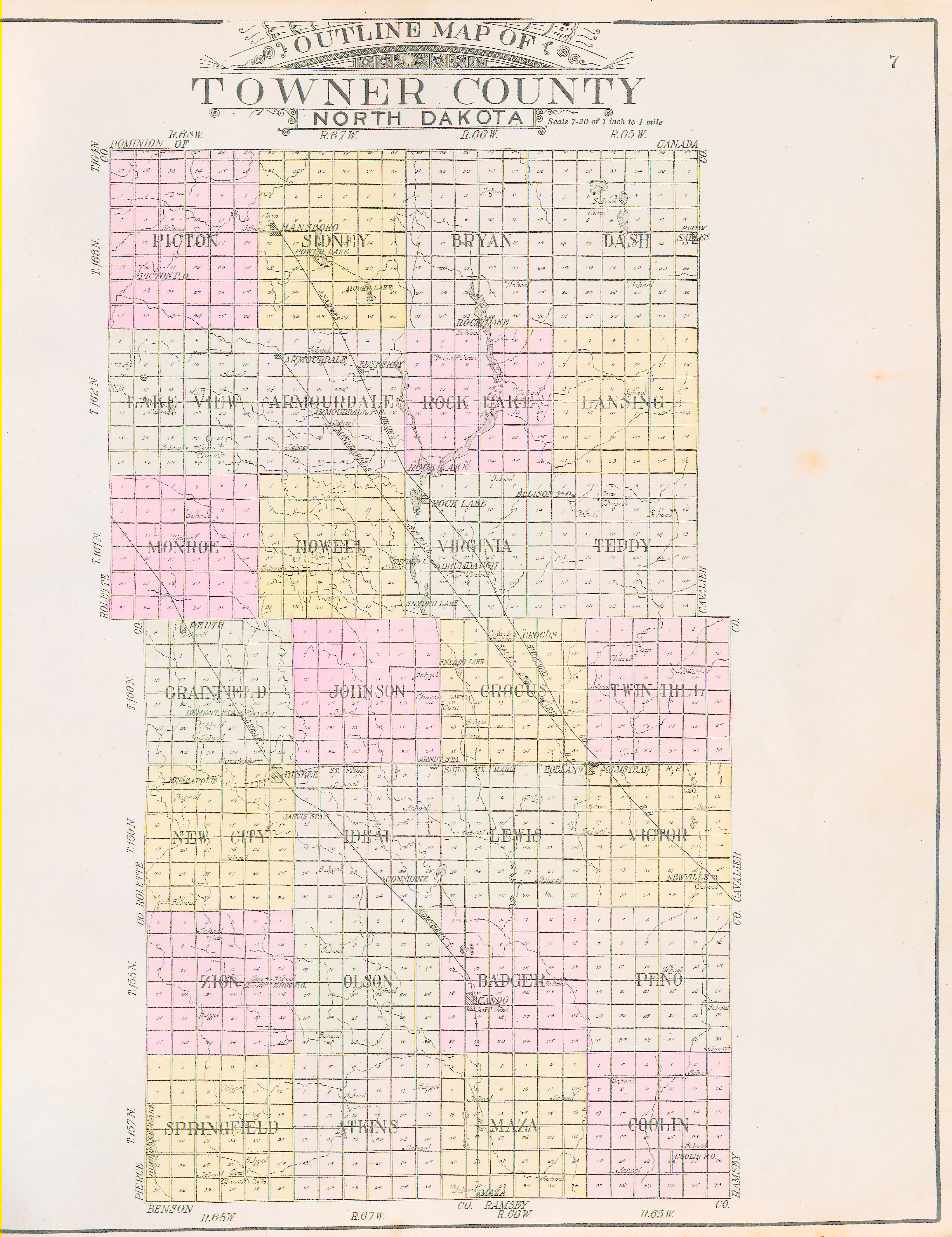
Townships
- Armourdale
- Atkins
- Bethel
- Cando
- Coolin
- Crocus
- Dash
- Gerrard
- Grainfield
- Howell
- Lansing
- Maza
- Monroe
- Mount View
- New City
- Olson
- Paulson
- Picton
- Rock Lake
- Sidney
- Smith
- Sorenson
- Springfield
- Teddy
- Twin Hill
- Victor
- Virginia
- Zion
Politics
| Year | Republican | Democratic | Third parties |
|---|---|---|---|
| 2020 | 70.7% 830 | 27.0% 317 | 2.3% 27 |
| 2016 | 63.4% 733 | 26.4% 305 | 10.3% 119 |
| 2012 | 52.7% 623 | 43.7% 516 | 3.6% 43 |
| 2008 | 44.8% 536 | 51.9% 621 | 3.3% 40 |
| 2004 | 54.2% 754 | 43.6% 606 | 2.2% 31 |
| 2000 | 58.4% 694 | 34.5% 410 | 7.2% 85 |
| 1996 | 39.1% 542 | 46.8% 649 | 14.1% 196 |
| 1992 | 34.2% 600 | 42.6% 748 | 23.3% 409 |
| 1988 | 48.9% 946 | 50.2% 970 | 0.9% 18 |
| 1984 | 60.2% 1,242 | 38.2% 789 | 1.7% 34 |
| 1980 | 64.9% 1,375 | 26.8% 568 | 8.3% 176 |
| 1976 | 44.5% 993 | 54.4% 1,216 | 1.1% 25 |
| 1972 | 58.0% 1,349 | 40.6% 944 | 1.4% 32 |
| 1968 | 49.8% 1,109 | 44.5% 990 | 5.7% 126 |
| 1964 | 32.6% 788 | 67.4% 1,628 | 0.0% 1 |
| 1960 | 52.2% 1,410 | 47.8% 1,292 | 0.0% 1 |
| 1956 | 54.3% 1,391 | 45.6% 1,169 | 0.2% 4 |
| 1952 | 69.2% 1,960 | 29.8% 843 | 1.0% 28 |
| 1948 | 49.8% 1,145 | 47.8% 1,100 | 2.4% 56 |
| 1944 | 48.0% 1,097 | 51.8% 1,185 | 0.2% 4 |
| 1940 | 50.3% 1,630 | 49.2% 1,596 | 0.5% 15 |
| 1936 | 22.4% 720 | 54.3% 1,744 | 23.3% 750 |
| 1932 | 25.5% 765 | 73.0% 2,190 | 1.5% 44 |
| 1928 | 54.2% 1,588 | 45.2% 1,324 | 0.6% 16 |
| 1924 | 47.7% 1,173 | 9.1% 223 | 43.3% 1,065 |
| 1920 | 79.3% 2,192 | 17.2% 476 | 3.4% 95 |
| 1916 | 43.7% 665 | 50.5% 769 | 5.8% 88 |
| 1912 | 26.4% 352 | 39.9% 532 | 33.7% 450 |
| 1908 | 54.2% 867 | 40.9% 655 | 4.9% 78 |
| 1904 | 67.2% 1,022 | 28.6% 435 | 4.1% 63 |
| 1900 | 62.0% 805 | 35.0% 454 | 3.1% 40 |
Education
School districts include:[18]
- Leeds Public School District 6
- Mount Pleasant Public School District 4
- Munich Public School District 19
- North Star School District
- Starkweather Public School District 44
Former school districts:
- Bisbee-Egeland School District - Formed in 1980 with the merger of the Bisbee and Egeland districts,[19] known as West Central School District 12 and East Central School District 12, respectively.[20] Merged into North Star Schools in 2008.[19]
- Cando School District - Merged into North Star Schools in 2008.[19]
- North Central Public School District 28[21]
See also
- National Register of Historic Places listings in Towner County, North Dakota
References
- "U.S. Census Bureau QuickFacts: Towner County, North Dakota". www.census.gov. United States Census Bureau. Retrieved March 27, 2022.
- "Find a County". National Association of Counties. Retrieved June 7, 2011.
- "Dakota Territory, South Dakota, and North Dakota: Individual County Chronologies". Dakota Territory Atlas of Historical County Boundaries. The Newberry Library. 2006. Archived from the original on April 2, 2018. Retrieved February 4, 2015.
- "County History". North Dakota.gov. The State of North Dakota. Archived from the original on February 2, 2015. Retrieved February 4, 2015.
- Towner County ND Google Maps (accessed February 21, 2019)
- ""Find an Altitude/Towner County ND" Google Maps (accessed February 21, 2019)". Archived from the original on May 21, 2019. Retrieved February 22, 2019.
- "2010 Census Gazetteer Files". United States Census Bureau. August 22, 2012. Archived from the original on January 29, 2015. Retrieved February 1, 2015.
- "United States Decennial Census". United States Census Bureau. Retrieved February 1, 2015.
- "Historical Census Browser". University of Virginia Library. Retrieved February 1, 2015.
- Forstall, Richard L., ed. (April 20, 1995). "Population of Counties by Decennial Census: 1900 to 1990". United States Census Bureau. Retrieved February 1, 2015.
- "Census 2000 PHC-T-4. Ranking Tables for Counties: 1990 and 2000" (PDF). United States Census Bureau. April 2, 2001. Retrieved February 1, 2015.
- "Profile of General Population and Housing Characteristics: 2010 Demographic Profile Data". United States Census Bureau. Archived from the original on February 13, 2020. Retrieved April 3, 2016.
- "Population, Housing Units, Area, and Density: 2010 - County". United States Census Bureau. Archived from the original on February 13, 2020. Retrieved April 3, 2016.
- "Selected Social Characteristics in the US – 2006-2010 American Community Survey 5-Year Estimates". United States Census Bureau. Archived from the original on February 13, 2020. Retrieved April 3, 2016.
- "Selected Economic Characteristics – 2006-2010 American Community Survey 5-Year Estimates". United States Census Bureau. Archived from the original on February 13, 2020. Retrieved April 3, 2016.
- 2007 Taxable Valuation Survey Archived February 13, 2012, at the Wayback Machine, North Dakota League of Cities
- Leip, David. "Atlas of US Presidential Elections". uselectionatlas.org. Retrieved April 13, 2018.
- "2020 CENSUS - SCHOOL DISTRICT REFERENCE MAP: Towner County, ND" (PDF). U.S. Census Bureau. Retrieved July 23, 2022. - Text list
- "Bisbee-Egeland school's final day ends in acceptance". Bismarck Tribune. May 23, 2008. Retrieved August 25, 2021.
- Schatz, Robert (March 16, 1989). "Bisbee celebrated 100 years in 1988". Bismarck Tribune. Bismarck, North Dakota. p. 44. - Clipping from Newspapers.com - The author was an English teacher at Bisbee-Egeland High School.
- "SCHOOL DISTRICT REFERENCE MAP (2010 CENSUS): Towner County, ND" (PDF). U.S. Census Bureau. Retrieved July 23, 2022. - Text list
External links
- Towner County official website
- Towner County map, North Dakota DOT
Places adjacent to Towner County, North Dakota | ||||||||||||||||
|---|---|---|---|---|---|---|---|---|---|---|---|---|---|---|---|---|
| ||||||||||||||||
Municipalities and communities of Towner County, North Dakota, United States | ||
|---|---|---|
County seat: Cando | ||
| Cities |  | |
| Townships |
| |
| Unincorporated communities |
| |
| Footnotes | ‡This populated place also has portions in an adjacent county or counties | |
| ||
Bismarck (capital) | |
| Topics |
|
| Society |
|
| Regions |
|
| Larger cities pop. over 5,000 |
|
| Smaller cities pop. 1,000–5,000 |
|
| Counties |
|
Authority control | |
|---|---|
| General | |
| National libraries | |
На других языках
[de] Towner County
Towner County[1] ist ein County im Bundesstaat North Dakota der Vereinigten Staaten. Der Verwaltungssitz (County Seat) ist Cando.- [en] Towner County, North Dakota
[ru] Таунер (округ)
Округ Таунер (англ. Towner County) располагается в штате Северная Дакота, США. Официально образован в 1883 году. По состоянию на 2013 год, численность населения составляла 2317 человек.Другой контент может иметь иную лицензию. Перед использованием материалов сайта WikiSort.org внимательно изучите правила лицензирования конкретных элементов наполнения сайта.
WikiSort.org - проект по пересортировке и дополнению контента Википедии