world.wikisort.org - USA
Bottineau is a city in Bottineau County, North Dakota, United States. It is the county seat of Bottineau County[3] and is located just over ten miles (16 km) south of the Canada–United States border. The city's population was 2,194 at the 2020 census.[4]
This article uses bare URLs, which are uninformative and vulnerable to link rot. (September 2022) |
Bottineau, North Dakota | |
|---|---|
City | |
 "Tommy Turtle", symbol of Bottineau | |
| Nickname: Four Seasons Playground | |
| Motto: Vi Skal Vinne | |
 Location of Bottineau, North Dakota | |
| Coordinates: 48°50′N 100°27′W | |
| Country | United States |
| State | North Dakota |
| County | Bottineau |
| Government | |
| • mayor | Perry Schoenborn |
| Area | |
| • Total | 1.32 sq mi (3.41 km2) |
| • Land | 1.32 sq mi (3.41 km2) |
| • Water | 0.00 sq mi (0.00 km2) |
| Elevation | 1,637 ft (499 m) |
| Population (2020) | |
| • Total | 2,194 |
| • Density | 1,667.17/sq mi (643.81/km2) |
| Time zone | UTC-6 (CST) |
| • Summer (DST) | UTC-5 (CDT) |
| ZIP code | 58318 |
| Area code | 701 |
| FIPS code | 38-08460 |
| GNIS feature ID | 1028083[2] |
| Highways | ND 5 |
| Website | bottineau.govoffice.com |
The city is home to Dakota College at Bottineau. Attractions in Bottineau include the Bottineau Winter Park and "Tommy Turtle," the world's largest turtle, which has become a landmark for the city. Built in 1978 and thirty feet (9 m) in height, the fiberglass turtle is located in the eastern half of the city and was built as a symbol for the nearby Turtle Mountains.[5] The International Peace Garden is nearby to the northeast.
Bottineau is also home to Programmer's Broadcasting, which owns and operates KBTO, along with KTZU and KWGO in Minot.
History
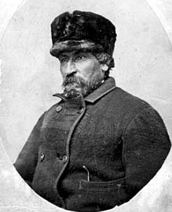
Bottineau was founded in 1883 as Oak Creek as a customs station and an overnight stagecoach stop. The town name was changed to Bottineau in 1884 in honor of Pierre Bottineau (c. 1814–1895), a Métis pioneer, hunter, and trapper, who became a successful land speculator.
The town was originally located about 1½ miles (2½ km) north of its current location. The entire town was moved south in 1887 to where the Great Northern Railway was installing new tracks.[6]
In 2012, a new chalet called Annie's House was built in Bottineau Winter Park, ten miles (16 km) north. The facility will be North Dakota's first ski facility for handicapped children and wounded veterans. It is being built to honor Ann Nicole Nelson, who was the only North Dakotan to die in the September 11 attacks on the World Trade Center in New York City.[7]
Geography and climate
According to the United States Census Bureau, the city has a total area of 1.09 square miles (2.82 km2), all land.[8] The elevation is 1,637 feet (499 m) above sea level.
Bottineau has a humid continental climate (Koppen: Dfb) with four seasons and huge differences in temperatures throughout the year. Summers tend to be warm, sometimes hot, and winters are severely cold. On February 13, 2021, the record low temperature of −51 °F (−46 °C) was registered.[9]
| Climate data for Bottineau, North Dakota (1991–2020 normals, extremes 1893–present) | |||||||||||||
|---|---|---|---|---|---|---|---|---|---|---|---|---|---|
| Month | Jan | Feb | Mar | Apr | May | Jun | Jul | Aug | Sep | Oct | Nov | Dec | Year |
| Record high °F (°C) | 54 (12) |
63 (17) |
79 (26) |
95 (35) |
110 (43) |
108 (42) |
111 (44) |
106 (41) |
102 (39) |
91 (33) |
73 (23) |
63 (17) |
111 (44) |
| Mean maximum °F (°C) | 38.3 (3.5) |
40.0 (4.4) |
53.5 (11.9) |
74.3 (23.5) |
84.6 (29.2) |
88.1 (31.2) |
90.9 (32.7) |
93.3 (34.1) |
88.7 (31.5) |
76.5 (24.7) |
54.6 (12.6) |
39.4 (4.1) |
94.9 (34.9) |
| Average high °F (°C) | 15.2 (−9.3) |
19.8 (−6.8) |
32.9 (0.5) |
51.3 (10.7) |
65.2 (18.4) |
74.0 (23.3) |
79.3 (26.3) |
79.1 (26.2) |
69.3 (20.7) |
52.6 (11.4) |
34.2 (1.2) |
20.1 (−6.6) |
49.4 (9.7) |
| Daily mean °F (°C) | 5.6 (−14.7) |
9.7 (−12.4) |
23.3 (−4.8) |
39.8 (4.3) |
53.1 (11.7) |
62.8 (17.1) |
67.7 (19.8) |
66.5 (19.2) |
56.7 (13.7) |
41.3 (5.2) |
24.9 (−3.9) |
11.4 (−11.4) |
38.6 (3.7) |
| Average low °F (°C) | −4 (−20) |
−0.4 (−18.0) |
13.7 (−10.2) |
28.2 (−2.1) |
41.0 (5.0) |
51.5 (10.8) |
56.1 (13.4) |
53.8 (12.1) |
44.1 (6.7) |
30.0 (−1.1) |
15.6 (−9.1) |
2.6 (−16.3) |
27.7 (−2.4) |
| Mean minimum °F (°C) | −28.7 (−33.7) |
−24.1 (−31.2) |
−12.0 (−24.4) |
11.5 (−11.4) |
25.4 (−3.7) |
39.3 (4.1) |
46.0 (7.8) |
42.7 (5.9) |
29.4 (−1.4) |
13.9 (−10.1) |
−5.1 (−20.6) |
−21.3 (−29.6) |
−31.3 (−35.2) |
| Record low °F (°C) | −47 (−44) |
−51 (−46) |
−37 (−38) |
−16 (−27) |
6 (−14) |
25 (−4) |
30 (−1) |
28 (−2) |
11 (−12) |
−6 (−21) |
−28 (−33) |
−44 (−42) |
−51 (−46) |
| Average precipitation inches (mm) | 0.53 (13) |
0.53 (13) |
0.76 (19) |
1.07 (27) |
2.58 (66) |
3.87 (98) |
2.75 (70) |
2.61 (66) |
1.52 (39) |
1.50 (38) |
0.78 (20) |
0.70 (18) |
19.20 (488) |
| Average snowfall inches (cm) | 9.1 (23) |
6.9 (18) |
7.3 (19) |
4.0 (10) |
1.1 (2.8) |
0.0 (0.0) |
0.0 (0.0) |
0.0 (0.0) |
0.1 (0.25) |
4.1 (10) |
8.2 (21) |
9.0 (23) |
49.8 (126) |
| Average precipitation days (≥ 0.01 in) | 6.7 | 5.3 | 5.5 | 7.0 | 9.8 | 12.6 | 9.3 | 8.1 | 7.1 | 7.4 | 6.7 | 6.7 | 92.2 |
| Average snowy days (≥ 0.1 in) | 6.4 | 4.7 | 4.2 | 1.7 | 0.7 | 0.0 | 0.0 | 0.0 | 0.0 | 1.7 | 5.0 | 6.2 | 30.6 |
| Source: NOAA[9][10] | |||||||||||||
Law and government
Bottineau uses the city council style of municipal government. Citizens are divided by location into four wards, who each elect two city council members, for a total of eight.
The current president of the city council is Doug Marsden and the current mayor of the city is Perry Schoenborn.[11] The city council meets on the first Monday of every month in the city's Armory.
Economy
The economy in Bottineau is based on agriculture and recreational activities.
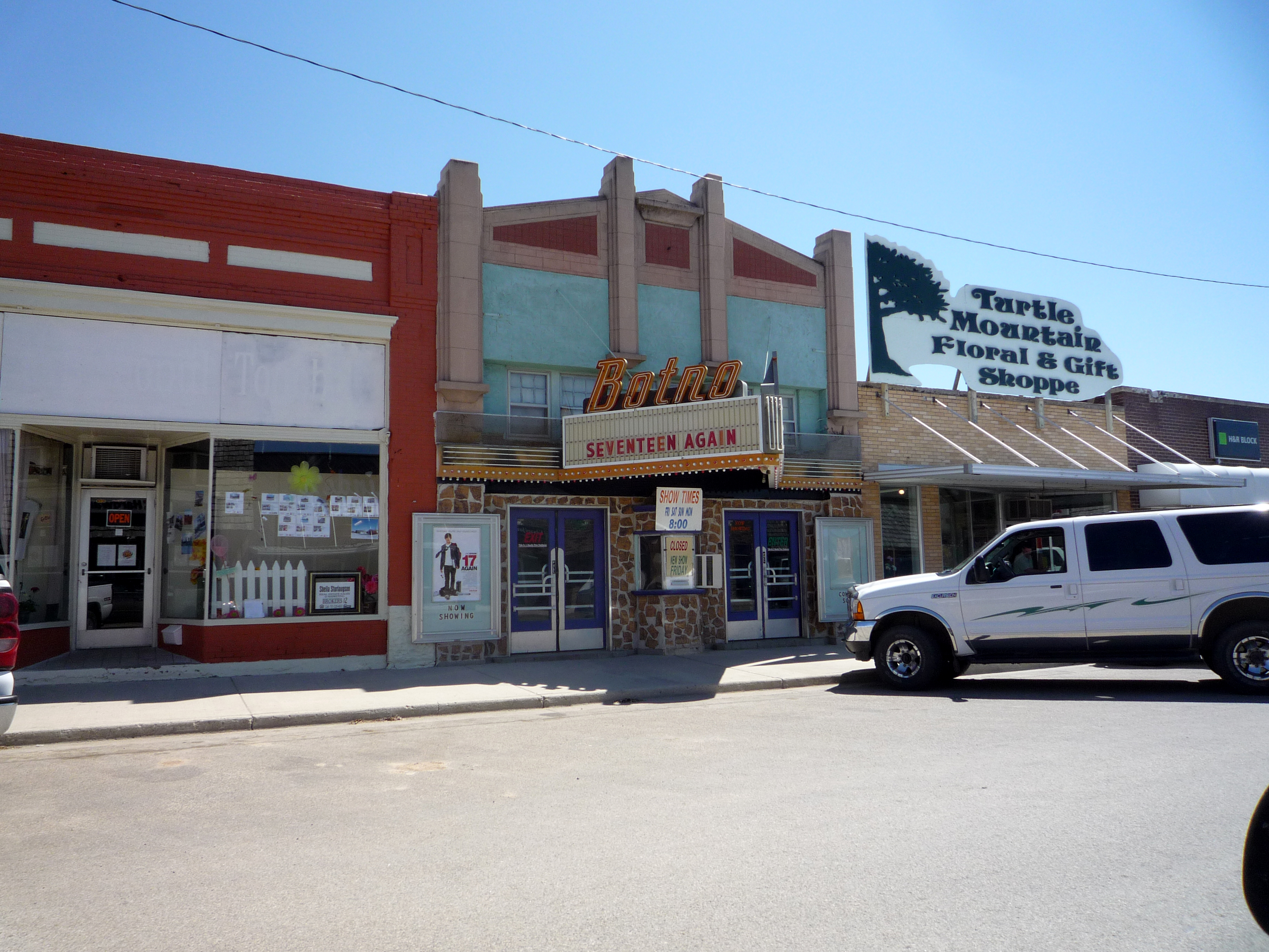
The city's commercial district consists mainly of small local shops, but a Wal-Mart Supercenter store is now operating within Bottineau; some consider this unusual for a town of such a small size.[12] Bottineau is also home to the Bottineau County Fair, which is the state's oldest county fair.[13]
Demographics
| Historical population | |||
|---|---|---|---|
| Census | Pop. | %± | |
| 1890 | 145 | — | |
| 1900 | 888 | 512.4% | |
| 1910 | 1,331 | 49.9% | |
| 1920 | 1,172 | −11.9% | |
| 1930 | 1,322 | 12.8% | |
| 1940 | 1,739 | 31.5% | |
| 1950 | 2,268 | 30.4% | |
| 1960 | 2,613 | 15.2% | |
| 1970 | 2,760 | 5.6% | |
| 1980 | 2,829 | 2.5% | |
| 1990 | 2,598 | −8.2% | |
| 2000 | 2,336 | −10.1% | |
| 2010 | 2,211 | −5.4% | |
| 2020 | 2,194 | −0.8% | |
| 2021 (est.) | 2,197 | [14] | 0.1% |
| U.S. Decennial Census[15] 2020 Census[4] | |||
2010 census
As of the census[16] of 2010, there were 2,211 people, 972 households, and 538 families living in the city. The population density was 2,028.4 inhabitants per square mile (783.2/km2). There were 1,085 housing units at an average density of 995.4 per square mile (384.3/km2). The racial makeup of the city was 92.4% White, 0.7% African American, 4.1% Native American, 0.5% Asian, 0.2% from other races, and 2.2% from two or more races. Hispanic or Latino of any race were 1.4% of the population.
There were 972 households, of which 23.3% had children under the age of 18 living with them, 43.5% were married couples living together, 8.8% had a female householder with no husband present, 3.0% had a male householder with no wife present, and 44.7% were non-families. 41.0% of all households were made up of individuals, and 21.7% had someone living alone who was 65 years of age or older. The average household size was 2.02 and the average family size was 2.71.
The median age in the city was 44.9 years. 18.1% of residents were under the age of 18; 13.5% were between the ages of 18 and 24; 18.4% were from 25 to 44; 25.1% were from 45 to 64; and 24.7% were 65 years of age or older. The gender makeup of the city was 48.8% male and 51.2% female.
2000 census
As of the census of 2000, there were 2,336 people, 979 households, and 550 families living in the city. The population density was 2,230.0 people per square mile (859.0/km2). There were 1,114 housing units at an average density of 1,063.4 per square mile (409.6/km2). The racial makeup of the city was 95.25% White, 0.34% African American, 2.87% Native American, 0.39% Asian, 0.09% from other races, and 1.07% from two or more races. Hispanic or Latino of any race were 0.98% of the population.
There were 979 households, out of which 24.4% had children under the age of 18 living with them, 47.6% were married couples living together, 6.4% had a female householder with no husband present, and 43.8% were non-families. 41.5% of all households were made up of individuals, and 24.2% had someone living alone who was 65 years of age or older. The average household size was 2.10 and the average family size was 2.86.
In the city, the population was spread out, with 19.0% under the age of 18, 14.2% from 18 to 24, 18.9% from 25 to 44, 20.8% from 45 to 64, and 27.2% who were 65 years of age or older. The median age was 43 years. For every 100 females, there were 87.6 males. For every 100 females age 18 and over, there were 85.0 males.
The median income for a household in the city was $29,022, and the median income for a family was $40,938. Males had a median income of $29,286 versus $20,089 for females. The per capita income for the city was $16,530. About 5.4% of families and 10.9% of the population were below the poverty line, including 16.0% of those under age 18 and 9.1% of those age 65 or over.
Education
K–12
Bottineau Public Schools, the local school district,[17] operates one elementary school, one middle school, and one high school.
Higher education
- Dakota College at Bottineau
Media
- Newspapers
The Bottineau Courant is a weekly publication.
- Radio
KBTO Sunny 101.9 is a local FM station offering local weather, sports, advertisement and country music.[18] A few other stations are available from nearby Manitoba such as 96.1 BOB FM which is an "80's 90's, and whatever" mix station from Brandon, MB, Canada.[19]
Notable people
- Duane Klueh, retired basketball player and coach; former head coach for Indiana State men's basketball team
- Ryan Kraft, left wing hockey player with the German Kassel Huskies
- Gregory R. Page, president and CEO of Cargill Inc.
- Ronald Paulson, English professor, expert on William Hogarth works
- Neal Peterson, musician
- Tom Rapp, leader of the band Pearls Before Swine
Notes
- "ArcGIS REST Services Directory". United States Census Bureau. Retrieved September 20, 2022.
- "US Board on Geographic Names". United States Geological Survey. October 25, 2007. Retrieved January 31, 2008.
- "Find a County". National Association of Counties. Archived from the original on May 31, 2011. Retrieved June 7, 2011.
- "Explore Census Data". United States Census Bureau. Retrieved June 27, 2022.
- Information about Tommy Turtle - roadsideamerica.com
- http://www.kxnet.com/getArticle.asp?s=rss&ArticleId=394118 "Bottineau Quasicentential." KXNET, June 20, 2009.
- Building Annie’s House published in the Minot Daily News on September 9, 2012
- "US Gazetteer files 2010". United States Census Bureau. Archived from the original on January 12, 2012. Retrieved June 14, 2012.
- "NowData - NOAA Online Weather Data". National Oceanic and Atmospheric Administration. Retrieved September 17, 2021.
- "Station: Bottineau, ND". U.S. Climate Normals 2020: U.S. Monthly Climate Normals (1991-2020). National Oceanic and Atmospheric Administration. Retrieved September 17, 2021.
- Local government information - city of Bottineau website
- Bottineau Wal-Mart story Archived September 27, 2007, at the Wayback Machine - KXMB
- Bottineau County Fair information
- "City and Town Population Totals: 2020-2021". United States Census Bureau. June 27, 2022. Retrieved June 27, 2022.
- United States Census Bureau. "Census of Population and Housing". Retrieved January 19, 2014.
- "U.S. Census website". United States Census Bureau. Retrieved June 14, 2012.
- "2020 CENSUS - SCHOOL DISTRICT REFERENCE MAP: Bottineau County, ND" (PDF). U.S. Census Bureau. Retrieved August 25, 2021.
- http://www.sunny1019fm.com/
- "Brandon's BOUNCE 96.1 | the Music You Just Can't Quit".
External links
Municipalities and communities of Bottineau County, North Dakota, United States | ||
|---|---|---|
County seat: Bottineau | ||
| Cities |  | |
| Townships |
| |
| Unincorporated communities | ||
| ||
State of North Dakota | |
|---|---|
Bismarck (capital) | |
| Topics |
|
| Society |
|
| Regions |
|
| Larger cities pop. over 5,000 |
|
| Smaller cities pop. 1,000–5,000 |
|
| Counties |
|
Authority control | |
|---|---|
| General | |
| National libraries | |
| Other |
|
На других языках
- [en] Bottineau, North Dakota
[ru] Боттино (Северная Дакота)
Боттино (англ. Bottineau) — город в штате Северная Дакота, США, административный центр округа Боттино. По состоянию на 2013 год, численность населения составляла 2341 человек[1].Другой контент может иметь иную лицензию. Перед использованием материалов сайта WikiSort.org внимательно изучите правила лицензирования конкретных элементов наполнения сайта.
WikiSort.org - проект по пересортировке и дополнению контента Википедии