world.wikisort.org - USA
Maywood is a village in Proviso Township, Cook County, Illinois, United States in the Chicago metropolitan area. It was founded on April 6, 1869,[2] and organized October 22, 1881.[3] The population was 23,512 at the 2020 United States Census.[4]
Maywood, Illinois | |
|---|---|
Village | |
 Masonic Temple | |
| Motto: "Village of Eternal Light" | |
 Location of Maywood in Cook County, Illinois. | |
 Location of Illinois in the United States | |
| Coordinates: 41°52′52″N 87°50′36″W | |
| Country | United States |
| State | Illinois |
| County | Cook |
| Township | Proviso |
| Area | |
| • Total | 2.72 sq mi (7.04 km2) |
| • Land | 2.72 sq mi (7.04 km2) |
| • Water | 0.00 sq mi (0.00 km2) |
| Population (2020) | |
| • Total | 23,512 |
| • Density | 8,653.66/sq mi (3,340.70/km2) |
| Time zone | UTC−6 (CST) |
| • Summer (DST) | UTC−5 (CDT) |
| ZIP Codes | 60153–60155 |
| Area codes | 708/464 |
| FIPS code | 17-47774 |
| Wikimedia Commons | Maywood, Illinois |
| Website | www |
History
This section does not cite any sources. (October 2015) |

There was limited European-American settlement in the Maywood area before a railroad was built after the American Civil War, which stimulated the rise of Chicago. At least one house in what became Maywood is known to have been used as a station on the Underground Railroad, to aid refugee African-American slaves in escaping to freedom in the North. Some settled in the free state of Illinois; others went on to Canada, which had abolished slavery, seeking further distance from slavecatchers. The site of the former house has been nationally commemorated. The plaque is located at today's Lake Street and the Des Plaines River bridge.[5]
This early West Side suburb of Chicago was developed along the oldest railway line that led away from the city. It attracted real estate developers because of its open grass prairie and scattered groves of ancient trees.
In 1868, Vermont businessmen established the Maywood Company. In 1870 it organized the platting of streets, and began construction on the north side of the Chicago Great Western railroad tracks. The company planted 20,000 eight-year-old, nursery-grown trees to enhance the future town. By 2010, the last of these 148-year-old trees had succumbed to the emerald ash borer.
The oldest documented ash tree in northeast Illinois is in Maywood and is dated at 250 years old. It is being protected from the borers with horticultural treatment. The danger is expected to pass locally by year 2020, as it already has in Canton, Michigan, where borers were first seen. The ash is nicknamed "The Great Dane", after Jens Jensen, founder of the Midwest's prairie ecology movement a century ago. The tree is located within old growth woods just behind Proviso East high school.[citation needed]
With settlement underway, the village was founded on October 22, 1881, by Colonel William T. Nichols. He named it after his late daughter, May, and the groves.[6]
Many century-old homes survive here in relatively unaltered condition. Maywood boasts 17 homes and properties listed on the National Register of Historic Places.[7][8]
At one time two airports operated in Maywood. Loyola University Medical Center was developed on the site of one former airport, at the southwest corner of First Avenue and Roosevelt Road. It was the airfield used by Charles Lindbergh during his days as an airmail pilot.[9]
Checkerboard Field was located at the southeastern corner of that intersection and was a private field. The land has been converted to a forest preserve meadow. There was some apparent consolidation of the fields in later years. Later, an automobile board racetrack was located here, along with a viewing grandstand. Barney Oldfield raced on the track.[10] The Hines Veterans Hospital constructed one of its buildings on the foundation of the former grandstand.
Maywood in World War II
Maywood was established as the base for the 33rd Tank Company, Illinois National Guard. The Armory was located on Madison Street, two blocks east of First Avenue. It was organized on 3 May 1929 with the purpose of training men for combat. On 25 November 1940, 122 men of the 33rd Tank Company were inducted into active service to become Company B of the famous 192nd Tank Battalion, which fought in the Philippine islands. Many of these American soldiers were taken prisoner by the Japanese and died in April 1942 on the Bataan Death March. Of the 122 men of Company B, only 41 survived the war to return to Maywood. Their sacrifice has been honored with an annual Bataan Day Parade.[11][12]
Given such losses, Ian Smith, who headed the history department at Proviso East High School, said that "World War II hit the town of Maywood really hard."[13]
Historic homes and buildings
 Maywood Fire Department
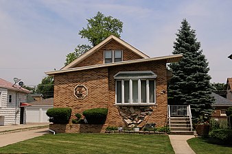 Mid-century Bungalow
 Jennie S. Thompkins House
 Harry H. Nichols House
 Robinson House


Fred Hampton, president of the Illinois chapter of the Black Panthers Party in the late 1960s, lived as a child in Maywood with his family for ten years. With the Black Panthers, he initiated community education and health programs for children, food for needy families, and other developmental projects. He was killed at the age of 21 in December 1969 in a police raid at his apartment in Chicago. In 2019, his family and supporters initiated a GoFundMe campaign to buy and restore his childhood house, to operate as a museum and community center. As of March 2021, they had exceeded their fundraising goal.[14]
Geography
According to the 2010 census, Maywood has a total area of 2.72 square miles (7.04 km2), all land.[15]
Neighboring villages are Broadview to the south, Forest Park and River Forest to the east, Melrose Park to the north, and Bellwood to the west.
Demographics
| Historical population | |||
|---|---|---|---|
| Census | Pop. | %± | |
| 1880 | 716 | — | |
| 1900 | 4,532 | — | |
| 1910 | 8,033 | 77.3% | |
| 1920 | 12,072 | 50.3% | |
| 1930 | 25,829 | 114.0% | |
| 1940 | 26,648 | 3.2% | |
| 1950 | 27,473 | 3.1% | |
| 1960 | 27,330 | −0.5% | |
| 1970 | 29,019 | 6.2% | |
| 1980 | 27,998 | −3.5% | |
| 1990 | 27,139 | −3.1% | |
| 2000 | 26,987 | −0.6% | |
| 2010 | 24,090 | −10.7% | |
| 2020 | 23,512 | −2.4% | |
| U.S. Decennial Census[16] 2010-2020[17] | |||
2020 census
| Race / Ethnicity | Pop 2010[18] | Pop 2020[17] | % 2010 | % 2020 |
|---|---|---|---|---|
| White alone (NH) | 891 | 722 | 3.70% | 3.07% |
| Black or African American alone (NH) | 17,781 | 14,193 | 73.81% | 60.36% |
| Native American or Alaska Native alone (NH) | 25 | 19 | 0.10% | 0.08% |
| Asian alone (NH) | 118 | 110 | 0.49% | 0.47% |
| Pacific Islander alone (NH) | 0 | 4 | 0.00% | 0.02% |
| Some Other Race alone (NH) | 20 | 61 | 0.08% | 0.26% |
| Mixed Race/Multi-Racial (NH) | 256 | 401 | 1.06% | 1.71% |
| Hispanic or Latino (any race) | 4,999 | 8,002 | 20.75% | 34.03% |
| Total | 24,090 | 23,512 | 100.00% | 100.00% |
Note: the US Census treats Hispanic/Latino as an ethnic category. This table excludes Latinos from the racial categories and assigns them to a separate category. Hispanics/Latinos can be of any race.
2010 Census
As of the census[19] of 2000, there were 26,987 people, 7,937 households, and 6,151 families residing in the village. The population density was 9,965.7 inhabitants per square mile (3,847.8/km2). There were 8,475 housing units at an average density of 3,129.6 per square mile (1,208.3/km2). The racial makeup of the village was 82.7% African American, 9.7% White, 0.1% Native American, 0.3% Asian, 5.6% from other races, and 1.63% from two or more races. Hispanic or Latino of any race were 10.5% of the population.
There were 7,937 households, out of which 36.2% had children under the age of 18 living with them, 40.7% were married couples living together, 30.2% had a female householder with no husband present, and 22.5% were non-families. 19.1% of all households were made up of individuals, and 6.8% had someone living alone who was 65 years of age or older. The average household size was 3.38 and the average family size was 3.84.
In the village, the population was spread out, with 31.7% under the age of 18, 10.4% from 18 to 24, 27.7% from 25 to 44, 20.6% from 45 to 64, and 9.6% who were 65 years of age or older. The median age was 31 years. For every 100 females, there were 87.9 males. For every 100 females age 18 and over, there were 82.3 males.
The median income for a household in the village was $41,942, and the median income for a family was $46,776. Males had a median income of $41,638 versus $37,316 for females. The per capita income for the village was $14,915. About 11.1% of families and 13.4% of the population were below the poverty line, including 1.3% of those under age 18 and 1.8% of those age 65 or over.
As of the census [20] 2010, Maywood population was 24,106. The racial makeup of the village was 74.4% African American, 12.6% White, 0.5% Asian, and 0.3% Native American.
Education
Maywood-Melrose Park-Broadview School District 89 operates elementary and middle schools. Proviso Township High Schools District 209 operates high schools, with Proviso East High School being located in Maywood.
Emerson Elementary School is an elementary school in Maywood. Enrollment as of 2006 was 476 students.[21] The school teaches grades kindergarten through fifth grade. Other elementary schools in Maywood include Garfield, Lincoln, Washington Dual Language Academy and Irving Middle School. Maywood residents may apply to Proviso Math & Science Academy in Forest Park.
Triton College is the area community college.
Infrastructure

Transportation
Public Transportation
The Village of Maywood is served by the Metra commuter railroad Union Pacific/West Line. Trains go east to Ogilvie Transportation Center in Chicago and as far west as Elburn, Illinois. Travel time from Maywood station to Ogilvie is 22 to 27 minutes. There are 13 inbound trains on weekdays, five on Saturdays and four on Sundays. Maywood station is in the heart of Maywood's business district. Maywood is also served by Melrose Park station, located on the border of Maywood and Melrose Park on the west side of town.
Pace Bus serves Maywood with lines and stops throughout the Village.
Illinois Prairie Path
The Illinois Prairie Path is a multi-use nature trail for non-motorized public use: it stretches for approximately 61 miles in Cook, DuPage and Kane counties in northeastern Illinois. It was the first U.S. rail-to-trail conversion in the nation in the 1960s, adapting a former right-of-way for the old Chicago Aurora & Elgin electric railroad.
In Maywood, the path runs between North and South Maywood Drive on the west side of town and along the Adams Street right-of way.[22]
Motor vehicle and air travel
Interstate 290, the Eisenhower Expressway, bisects (north and south) the town as it goes from Chicago west to join Interstate 294, the Tri-State Tollway, in Hillside. Maywood is located between O'Hare and Midway airports.
Notable people
- Naima Adedapo, singer
- Harry Julian Allen, director of NASA Ames Research Center
- Barbara Berger, catcher in All-American Girls Professional Baseball League; sister of Norma Berger
- Norma Berger, pitcher in the All-American Girls Professional Baseball League; sister of Barbara Berger
- Donnie Boyce, Atlanta Hawks basketball NBA player
- Jim Brewer, professional NBA basketball player
- Dee Brown, professional NBA basketball player
- Shannon Brown, professional NBA basketball player
- Sterling Brown, professional NBA basketball player
- Ray Buchanan, professional football player
- Walter Burley Griffin, architect, designer of Canberra, capital city of Australia.
- Jevon Carter, professional basketball player
- Eugene Cernan, astronaut, walked on the Moon during the Apollo 17 mission
- Michael Curry, presiding bishop of Episcopal Church
- Bill Donovan, pitcher for Boston Braves
- Todd Dulaney, gospel musician
- Michael Finley, professional NBA basketball player
- Dennis Franz, actor
- Craig Hall, ballet dancer
- Fred Hampton, Black Panther
- Shirley Jameson, nationally recognized speed skater and softball player, and outfielder in All-American Girls Professional Baseball League
- Sheila Crump Johnson, co-founder of BET.
- Jackie LaVine, Olympic bronze medalist in swimming
- Charles Lindbergh, aviator
- Eugene Moore, politician who served as Cook County recorder of deeds and as a member of the Illinois House of Representatives[23]
- Ray Nitschke, professional football player, Hall of Famer
- Walter "Walt" Parazaider, saxophonist for rock band, Chicago[24]
- John Prine, singer, musician, and award-winning songwriter
- Doc Rivers, professional basketball player, head coach of NBA's Philadelphia 76ers
- Wanda Sharp, Illinois state representative
- W.A. Yackey, decorated WWI pilot, 1920s aviator and final owner of Checkerboard Field.
- Perrion Winfrey NFL Football player
References
- "2020 U.S. Gazetteer Files". United States Census Bureau. Retrieved March 15, 2022.
- Franzosenbusch Heritage Project
- Village of Maywood Archived 2007-06-01 at the Wayback Machine
- "Maywood village, Illinois". United States Census Bureau. Retrieved January 30, 2022.
- "Underground Railroad Memorial - Maywood, IL - Illinois Historical Markers on". Waymarking.com. 2010-10-15. Retrieved 2022-05-03.
- "Village of Maywood, Illinois - Village of Maywood, IL".
- "Story Map Shortlist". Retrieved 2018-07-24.
- National Register of Historical Places
- Lindbergh, Charles A. (1953), The Spirit of St. Louis (1 ed.), Charles Scribners Son's, p. 4
- Borgeson, Griffith (1998), The Golden Age of the American Racing Car (2 ed.), SAE, p. 132, ISBN 978-0-7680-0023-8
- [Geserick, June; "MAYWOOD SHOWS SONS IT WON'T FORGET HEROISM: 30,000 See Ceremonies of Bataan Day"; 13 September 1942; Chicago Daily Tribune (1872–1963); ProQuest Historical Newspapers Chicago Tribune (1849–1986). (Document ID: 473319512); accessed 22 July 2009]
- "Maywood Marks Bataan", Pioneer Press (Maywood), 10 September 2009
- Benson, Heidi (2005-04-17). "Historian Iris Chang won many battles / The war she lost raged within". San Francisco Chronicle. Retrieved 2020-01-02.
- Brantley-Jones, Kiara (30 March 2021). "Black Panther leader Fred Hampton's family fights to keep his legacy alive". ABC News. Retrieved 26 April 2021.
- "G001 – Geographic Identifiers – 2010 Census Summary File 1". United States Census Bureau. Archived from the original on 2020-02-13. Retrieved 2015-10-26.
- "Census of Population and Housing from 1790". US Census Bureau. Retrieved January 24, 2022.
- "P2 HISPANIC OR LATINO, AND NOT HISPANIC OR LATINO BY RACE - 2020: DEC Redistricting Data (PL 94-171) - Maywood village, Illinois". United States Census Bureau.
- "P2 HISPANIC OR LATINO, AND NOT HISPANIC OR LATINO BY RACE - 2010: DEC Redistricting Data (PL 94-171) - Maywood village, Illinois". United States Census Bureau.
- "U.S. Census website". United States Census Bureau. Retrieved 2008-01-31.
- "U.S. Census Bureau QuickFacts: Maywood village, Illinois". Census.gov. Retrieved 2022-05-03.
- Irving Elementary School – Maywood, Illinois – IL – school overview
- "Trail Map - Illinois Prairie Path". Illinois Prairie Path. Retrieved 2018-07-24.
- Eltagouri, Marwa (16 June 2016). "Eugene Moore, former Cook County recorder of deeds, dies at 73". Chicago Tribune. Retrieved 5 November 2020.
- "Maywood Entryway Signs Unveiling, August 17". The Village Free Press. Retrieved 2016-01-20.
External links
Municipalities and communities of Cook County, Illinois, United States | ||
|---|---|---|
County seat: Chicago | ||
| Cities |
|  |
| Towns |
| |
| Villages |
| |
| Townships |
Former: Evanston • Hyde Park • Jefferson • Lake • Lake View • North Chicago • Rogers Park • South Chicago • West Chicago | |
| Unincorporated communities | ||
| Footnotes | ‡This populated place also has portions in an adjacent county or counties | |
| ||
Springfield (capital) | |
| Topics |
|
| Regions |
|
| Municipalities |
|
| Counties |
|
Authority control | |
|---|---|
| General | |
| National libraries | |
| Other |
|
На других языках
[de] Maywood (Illinois)
Maywood ist eine Gemeinde im Proviso Township in den Vereinigten Staaten. Beim Census 2000 lebten 26.987 Einwohner in der Maywood.- [en] Maywood, Illinois
[ru] Мэйвуд (Иллинойс)
Мэйвуд (англ. Maywood) — пригород Чикаго, штат Иллинойс, США.Другой контент может иметь иную лицензию. Перед использованием материалов сайта WikiSort.org внимательно изучите правила лицензирования конкретных элементов наполнения сайта.
WikiSort.org - проект по пересортировке и дополнению контента Википедии