world.wikisort.org - USA
Jourdanton (/ˈdʒɜːrdəntən/ JUR-dən-tən) is a city in and the county seat of Atascosa County, Texas, United States.[5] The population is 4,094 url=http://factfinder.census.gov/bkmk/table/1.0/en/DEC/10_DP/G001/1600000US4838116%7C archive-url=https://archive.today/20200212202629/http://factfinder.census.gov/bkmk/table/1.0/en/DEC/10_DP/G001/1600000US4838116%7C url-status=dead| archive-date=February 12, 2020| title=Geographic Identifiers: 2010 Demographic Profile Data (G001): Jourdanton city, Texas| publisher=U.S. Census Bureau, American Factfinder| access-date=August 23, 2013}}</ref> It is part of the San Antonio Metropolitan Statistical Area. The Mayor is Robert "Doc" Williams. The City Manager is Lamar Schulz. The Police Chief is Eric Kaiser. The Fire Chief is Jay Fojtik.
Jourdanton, Texas | |
|---|---|
City | |
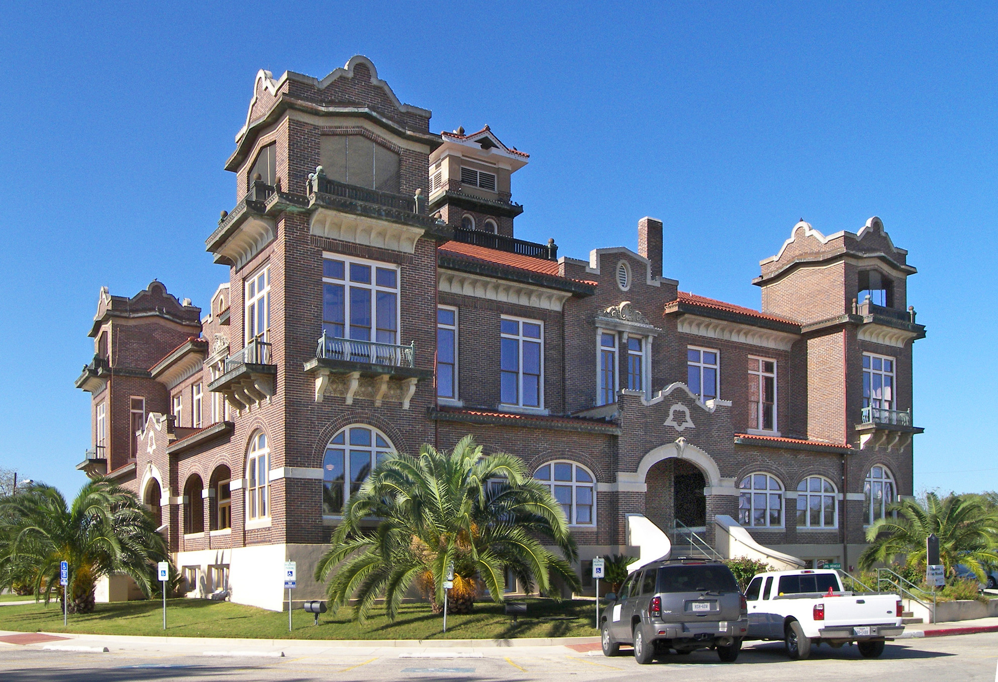 Atascosa County Courthouse | |
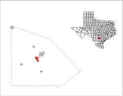
 Location of Jourdanton, Texas | |
 | |
| Coordinates: 28°55′18″N 98°32′47″W | |
| Country | United States |
| State | Texas |
| County | Atascosa |
| Area | |
| • Total | 3.58 sq mi (9.28 km2) |
| • Land | 3.58 sq mi (9.28 km2) |
| • Water | 0.00 sq mi (0.00 km2) |
| Elevation | 459 ft (140 m) |
| Population (2010) | |
| • Total | 3,871 |
| • Estimate (2019)[2] | 4,405 |
| • Density | 1,229.07/sq mi (474.52/km2) |
| Time zone | UTC-6 (Central (CST)) |
| • Summer (DST) | UTC-5 (CDT) |
| ZIP code | 78026 |
| Area code | 830 |
| FIPS code | 48-38116[3] |
| GNIS feature ID | 1360436[4] |
| Website | jourdantontexas |
History
Jourdanton was founded in 1909 and was named after founder Jourdan Campbell. The county seat was moved from Pleasanton to Jourdanton in 1910.
Geography
Jourdanton is located near the center of Atascosa County at 28°55′18″N 98°32′47″W (28.921530, –98.546440),[6] about 37 miles (60 km) south of downtown San Antonio. At the center of the city is the intersection of Texas State Highways 16 and 97. Highway 16 leads north to San Antonio and south 165 miles (266 km) to Zapata near the Mexican border. Highway 97 leads northeast 4 miles (6 km) to Pleasanton and 28 miles (45 km) to Floresville, and southwest 67 miles (108 km) to Cotulla.
According to the United States Census Bureau, Jourdanton has a total area of 3.5 square miles (9.1 km2), all land.[7]
Demographics
| Historical population | |||
|---|---|---|---|
| Census | Pop. | %± | |
| 1920 | 682 | — | |
| 1930 | 767 | 12.5% | |
| 1940 | 950 | 23.9% | |
| 1950 | 1,481 | 55.9% | |
| 1960 | 1,504 | 1.6% | |
| 1970 | 1,841 | 22.4% | |
| 1980 | 2,743 | 49.0% | |
| 1990 | 3,220 | 17.4% | |
| 2000 | 3,732 | 15.9% | |
| 2010 | 3,871 | 3.7% | |
| 2019 (est.) | 4,405 | [2] | 13.8% |
| U.S. Decennial Census[8] | |||
2020 census
| Race | Number | Percentage |
|---|---|---|
| White (NH) | 1,610 | 39.33% |
| Black or African American (NH) | 32 | 0.78% |
| Native American or Alaska Native (NH) | 11 | 0.27% |
| Asian (NH) | 16 | 0.39% |
| Pacific Islander (NH) | 2 | 0.05% |
| Some Other Race (NH) | 18 | 0.44% |
| Mixed/Multi-Racial (NH) | 88 | 2.15% |
| Hispanic or Latino | 2,317 | 56.6% |
| Total | 4,094 |
As of the 2020 United States census, there were 4,094 people, 1,431 households, and 1,039 families residing in the city.
2010 census
At the 2010 census there were 3,871 people, 1,187 households, and 923 families living in the city. The population density was 1,071.1 people per square mile (414.1/km2). There were 1,353 housing units at an average density of 388.3 per square mile (150.1/km2). The racial makeup of the city was 74.44% White, 1.13% African American, 0.96% Native American, 0.29% Asian, 0.03% Pacific Islander, 20.42% from other races, and 2.73% from two or more races. Hispanic or Latino of any race were 52.87%.[3]
Of the 1,187 households 44.4% had children under the age of 18 living with them, 58.5% were married couples living together, 15.2% had a female householder with no husband present, and 22.2% were non-families. 19.9% of households were one person and 9.5% were one person aged 65 or older. The average household size was 2.98 and the average family size was 3.42.
The age distribution was 32.2% under the age of 18, 9.0% from 18 to 24, 29.4% from 25 to 44, 18.6% from 45 to 64, and 10.8% 65 or older. The median age was 31 years. For every 100 females, there were 95.5 males. For every 100 females age 18 and over, there were 92.3 males.
The median household income was $34,975 and the median family income was $38,389. Males had a median income of $30,222 versus $16,313 for females. The per capita income for the city was $16,910. About 12.4% of families and 13.4% of the population were below the poverty line, including 13.1% of those under age 18 and 19.3% of those age 65 or over.
Education
Jourdanton is served by the Jourdanton Independent School District and home to the Jourdanton High School Indians and Squaws.
Climate
The climate in this area is characterized by hot, humid summers and generally mild to cool winters. According to the Köppen Climate Classification system, Jourdanton has a humid subtropical climate, abbreviated "Cfa" on climate maps.[12]
References
- "2019 U.S. Gazetteer Files". United States Census Bureau. Retrieved August 7, 2020.
- "Population and Housing Unit Estimates". United States Census Bureau. May 24, 2020. Retrieved May 27, 2020.
- "U.S. Census website". United States Census Bureau. Retrieved 2008-01-31.
- "US Board on Geographic Names". United States Geological Survey. 2007-10-25. Retrieved 2008-01-31.
- "Find a County". National Association of Counties. Archived from the original on 2011-05-31. Retrieved 2011-06-07.
- "US Gazetteer files: 2010, 2000, and 1990". United States Census Bureau. 2011-02-12. Retrieved 2011-04-23.
- "Geographic Identifiers: 2010 Demographic Profile Data (G001): Jourdanton city, Texas". U.S. Census Bureau, American Factfinder. Archived from the original on February 12, 2020. Retrieved August 23, 2013.
- "Census of Population and Housing". Census.gov. Retrieved June 4, 2015.
- "Explore Census Data". data.census.gov. Retrieved 2022-05-21.
- https://www.census.gov/ [not specific enough to verify]
- "About the Hispanic Population and its Origin". www.census.gov. Retrieved 18 May 2022.
- Climate Summary for Jourdanton, Texas
External links
Municipalities and communities of Atascosa County, Texas, United States | ||
|---|---|---|
County seat: Jourdanton | ||
| Cities |  | |
| Town | ||
| CDP | ||
| Other communities | ||
| Ghost towns | ||
| Footnotes | ‡This populated place also has portions in an adjacent county or counties | |
| ||
State of Texas | |
|---|---|
Austin (capital) | |
| Topics |
|
| Society |
|
| Regions |
|
| Metropolitan areas |
|
| Counties | See: List of counties in Texas |
На других языках
[de] Jourdanton
Jourdanton ist eine Stadt im US-Bundesstaat Texas in den Vereinigten Staaten und der Verwaltungssitz des Atascosa County. Die Einwohnerzahl wurde für 2019 auf ca. 4400 geschätzt.- [en] Jourdanton, Texas
[ru] Джердантон
Дже́рдантон (англ. Jourdanton) — город в США, расположенный в южной части штата Техас, административный центр округа Атаскоса. По данным переписи за 2010 год число жителей составляло 3871 человек, по оценке Бюро переписи США в 2016 году в городе проживало 4327 человек[2].Другой контент может иметь иную лицензию. Перед использованием материалов сайта WikiSort.org внимательно изучите правила лицензирования конкретных элементов наполнения сайта.
WikiSort.org - проект по пересортировке и дополнению контента Википедии