world.wikisort.org - USA
West Texas is a loosely defined region in the U.S. state of Texas, generally encompassing the arid and semiarid lands west of a line drawn between the cities of Wichita Falls, Abilene, and Del Rio.
West Texas | |
|---|---|
Region | |
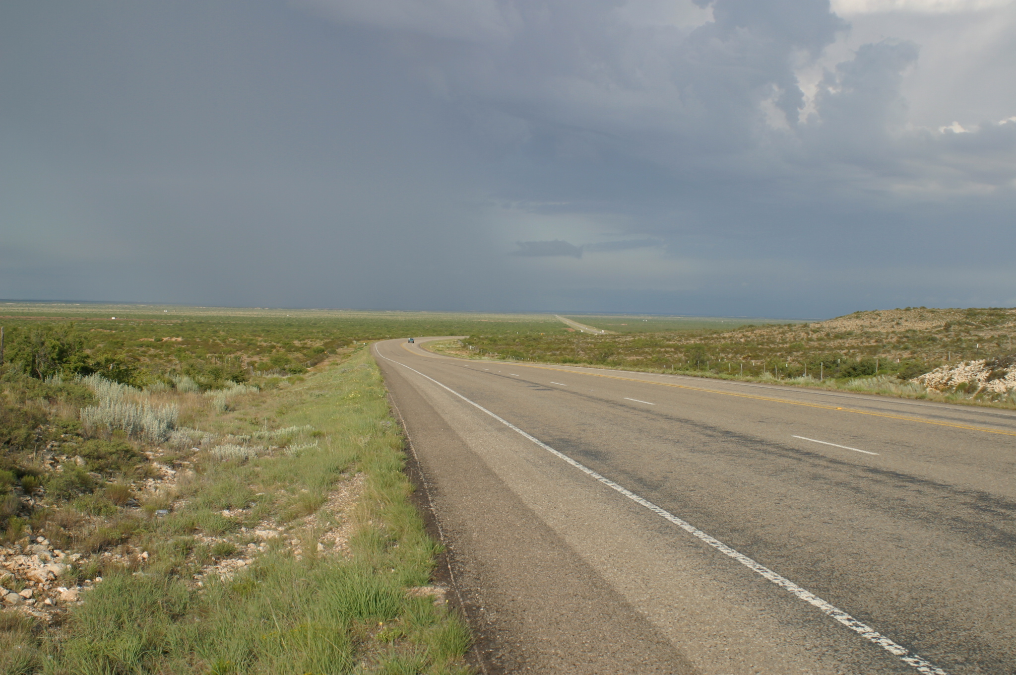 West of Notrees | |
 Map of Texas | |
| Country | United States |
| State | Texas |
| Population | |
| • Total | 2,471,311 |
No consensus exists on the boundary between East Texas and West Texas.[1] While most Texans understand these terms, no boundaries are officially recognized and any two individuals are likely to describe the boundaries of these regions differently. Walter Prescott Webb, American historian and geographer, suggested that the 98th meridian separates East and West Texas;[2] Texas writer A.C. Greene proposed that West Texas extends west of the Brazos River.[3] Use of a single line, though, seems to preclude the use of other separators, such as an area—Central Texas. Unlike East Texas, West Texas is not generally considered to be part of the American South, and the dry, desert climate is often more associated with the American Southwest.[citation needed]
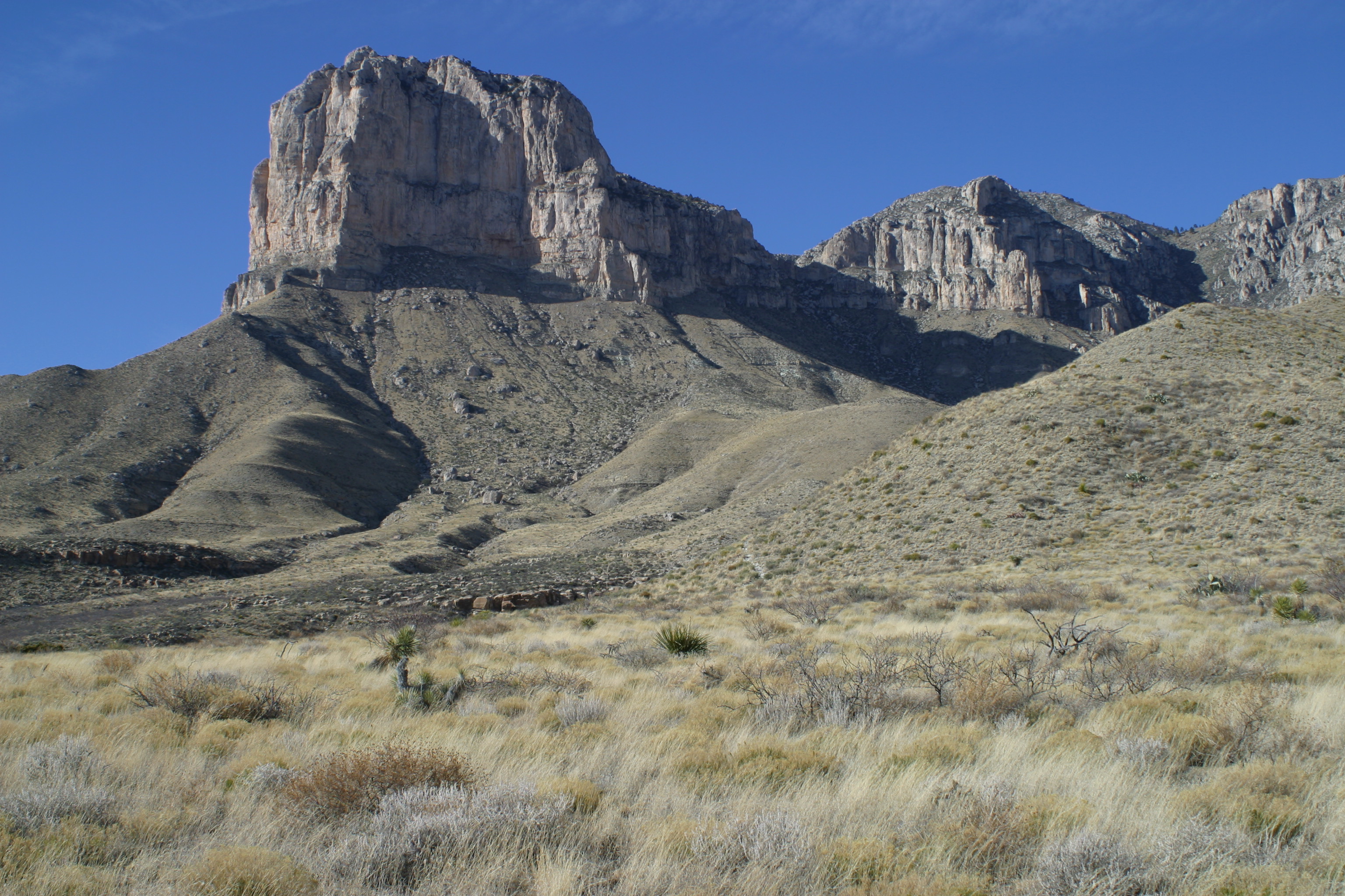
West Texas is often subdivided according to distinct physiographic features. The portion of West Texas that lies west of the Pecos River is often referred to as "Far West Texas" or the "Trans-Pecos", a term first introduced in 1887 by Texas geologist Robert T. Hill.[4] The Trans-Pecos lies within the Chihuahuan Desert, and is the most arid portion of the state. Another part of West Texas is the Llano Estacado, a vast region of high, level plains extending into Eastern New Mexico and the Texas Panhandle. To the east of the Llano Estacado lies the “redbed country” of the Rolling Plains and to the south of the Llano Estacado lies the Edwards Plateau. The Rolling Plains and the Edwards Plateau subregions act as transitional zones between eastern and western Texas.
Climate
West Texas receives much less rainfall than the rest of Texas and has an arid or semiarid climate, requiring most of its scant agriculture to be heavily dependent on irrigation.[5] This irrigation, and water taken out farther north for the needs of El Paso and Juarez, Mexico, has reduced the once mighty Rio Grande to a stream in some places, even dry at times. Much of West Texas has rugged terrain, including many small mountain ranges, while most parts of the state are near sea level. The northern parts of West Texas (notably the Texas Panhandle) and the higher elevations of the mountain ranges of the Trans-Pecos region are prone to occasionally heavy snowfall during winter, while snow is less common in other areas of West Texas.


 Santa Elena Canyon
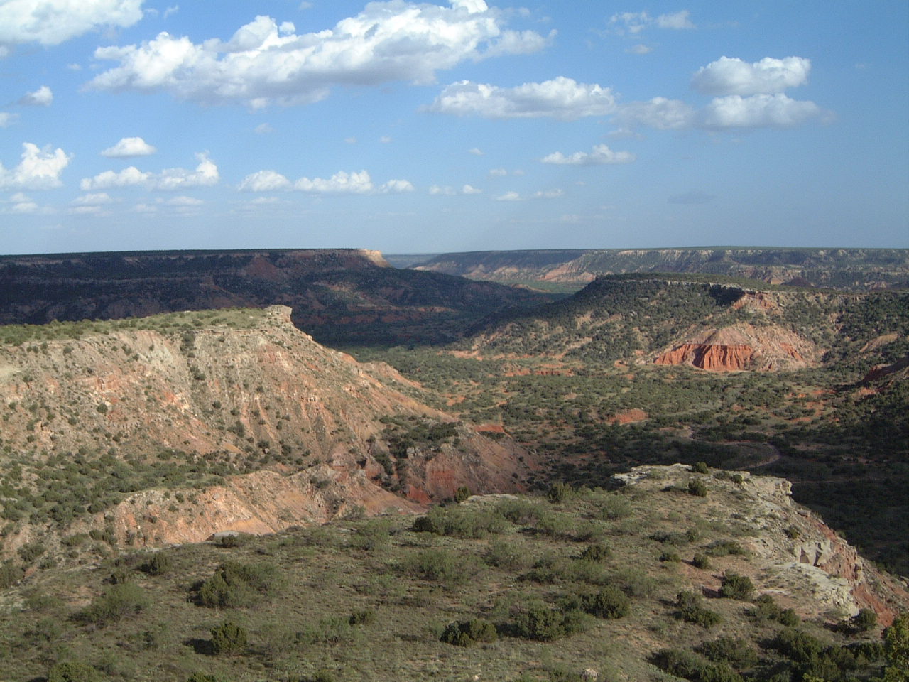
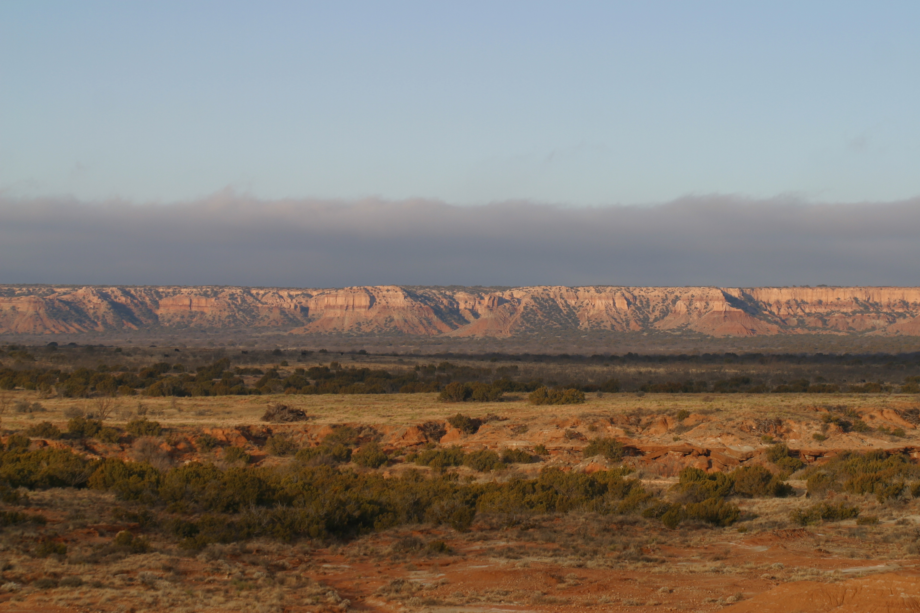
 Palo Duro Canyon
 Caprock Canyons
 Rita Blanca National Grassland
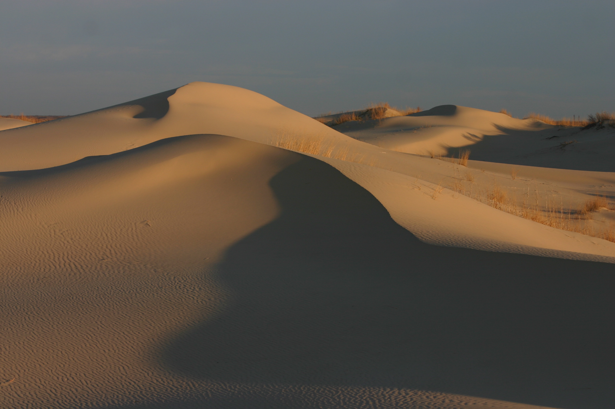
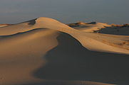 Monahans Sandhills State Park
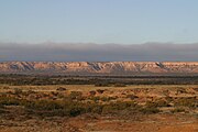


Counties
The counties included in the West Texas region vary depending on the organization. The Texas Counties.net website acknowledges the variations, and includes 70 counties in its definition, based on the five principal metropolitan areas it contains: El Paso, Lubbock, Abilene, Midland/Odessa, and San Angelo.[6]
The counties included are Andrews, Bailey, Borden, Brewster, Brown, Callahan, Castro, Cochran, Coke, Coleman, Comanche, Concho, Crane, Crockett, Crosby, Culberson, Dawson, Deaf Smith, Dickens, Eastland, Ector, El Paso, Fisher, Floyd, Gaines, Garza, Glasscock, Hale, Haskell, Hockley, Howard, Hudspeth, Irion, Jeff Davis, Jones, Kent, Kimble, King, Knox, Lamb, Loving, Lubbock, Lynn, Martin, Mason, McCulloch, Menard, Midland, Mitchell, Motley, Nolan, Parmer, Potter, Pecos, Presidio, Randall, Reagan, Reeves, Runnels, Schleicher, Scurry, Shackelford, Stephens, Sterling, Stonewall, Sutton, Taylor, Terrell, Terry, Throckmorton, Tom Green, Upton, Val Verde, Ward, Winkler, and Yoakum.
Major cities
| Region rank | City | Census 2013 population estimate[7] |
State ranked | County |
|---|---|---|---|---|
| 1 | El Paso | 674,433 | 6 | El Paso County |
| 2 | Lubbock | 258,862 | 11 | Lubbock County |
| 3 | Amarillo | 196,429 | 14 | Potter County |
| 4 | Midland | 123,933 | 26 | Midland County |
| 5 | Abilene | 120,099 | 27 | Taylor County |
| 6 | Odessa | 110,720 | 30 | Ector County |
| 7 | San Angelo | 106,715 | 37 | Tom Green County |
| 8 | Del Rio | 35,846 | 98 | Val Verde County |
| 9 | Socorro | 32,517 | 77 | El Paso County |
| 10 | Big Spring | 28,125 | 104 | Howard County |
| 11 | Plainview | 22,194 | 128 | Hale County |


Some of the smaller West Texas cities and towns include: Alpine, Andrews, Anthony, Brownfield, Canutillo, Canyon, Coyanosa, Crane, Dalhart, Fort Davis, Fabens, Fort Bliss, San Elizario, Fort Stockton, Hale Center, Hereford, Iraan, Kermit, Lamesa, Levelland, Littlefield, Marathon, Marfa, McCamey, Mertzon, Monahans, Muleshoe, Ozona, Pampa, Pecos, Horizon City, Post, Rankin, Seminole, Slaton, Snyder, Sweetwater, and Van Horn.
Economy
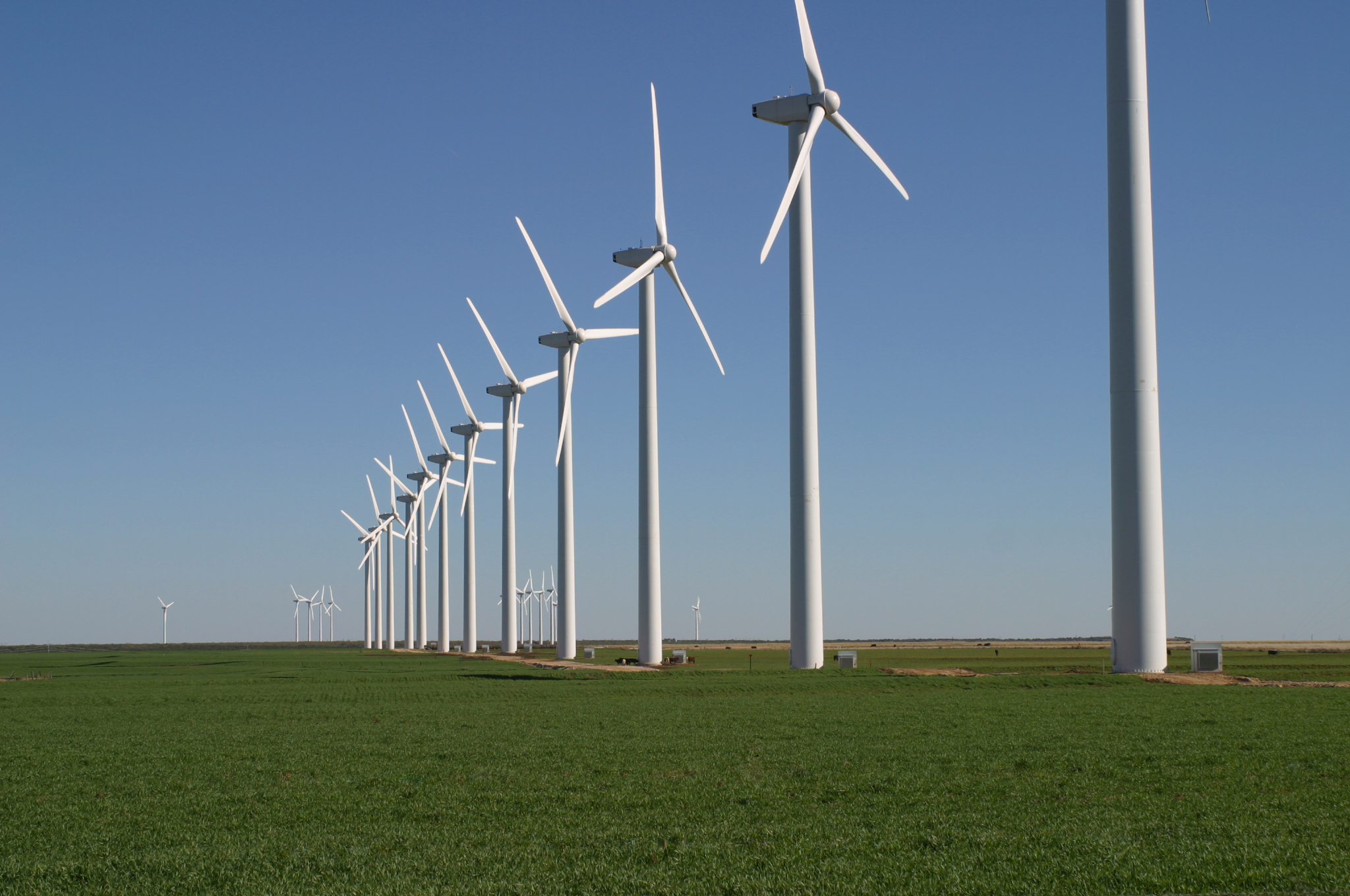
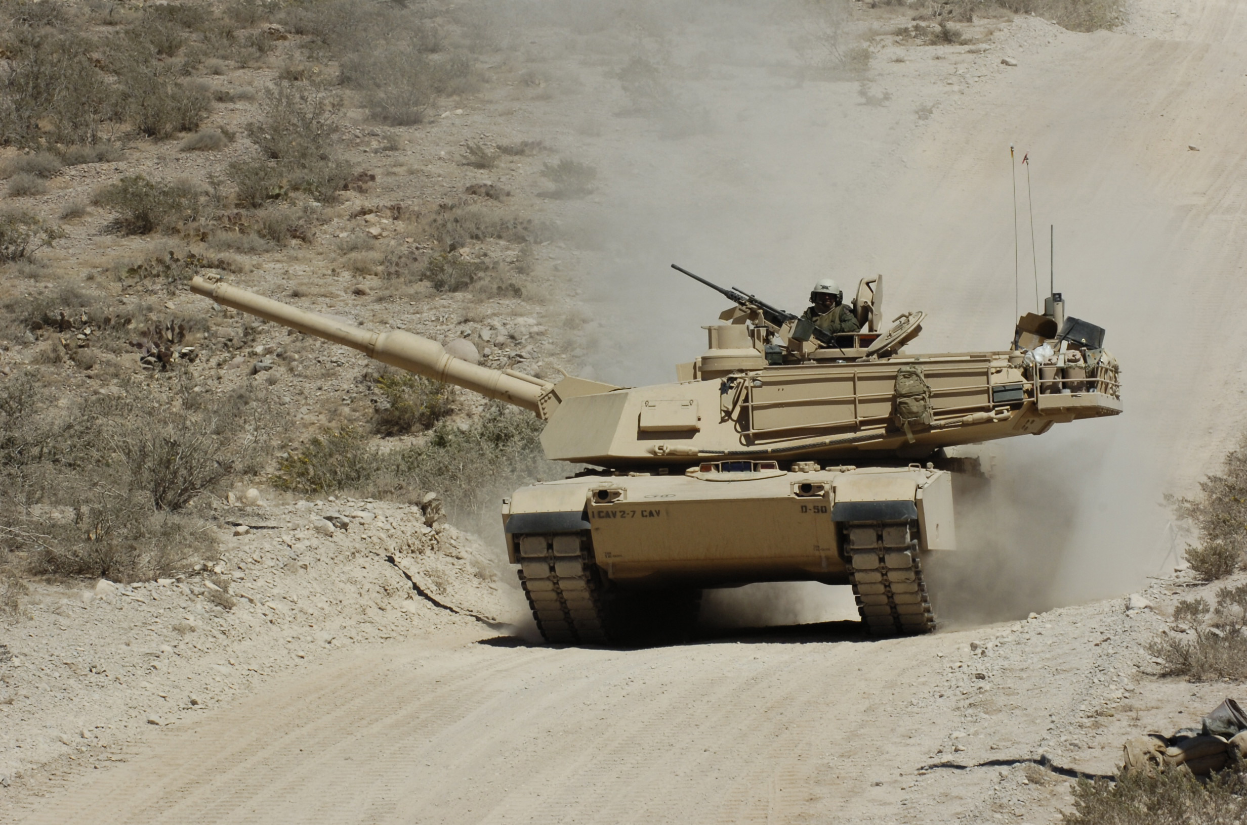
Major industries include livestock, petroleum and natural gas production, textiles such as cotton, grain, and because of very large military installations such as Fort Bliss, the defense industry. West Texas has become notable for its numerous wind turbines producing clean and alternative electricity.
As of 2018, the West Texan economy was in a prosperous economic period, which has been described as the "West Texas oil boom".[8][9]
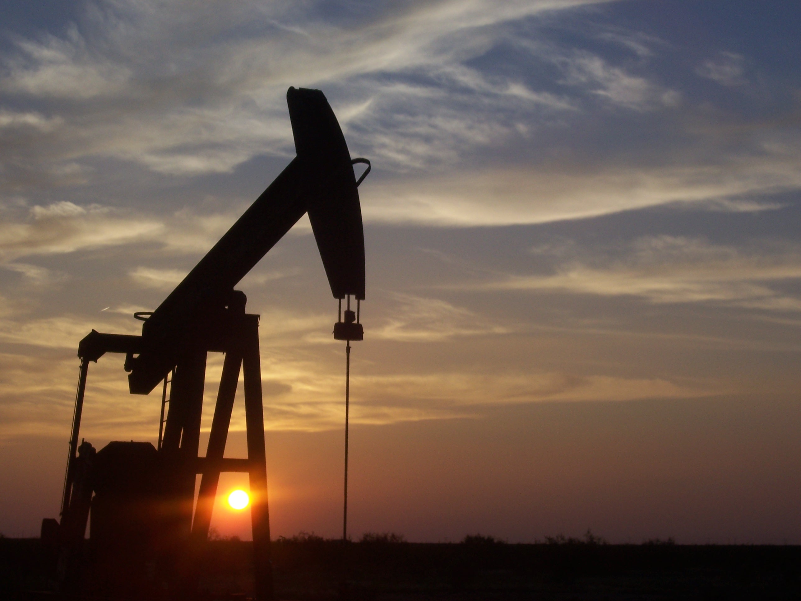
 Pumpjacks, like this one south of Midland, are a common sight in West Texas oil fields.
 Irrigated agriculture in West Texas
 The Brazos Wind Farm near Fluvanna is one of many wind farms in West Texas.
 Fort Bliss is the number one employer in the El Paso region

Sports
West Texas does not have major league sports teams. Instead, the region has college teams such as Texas Tech Red Raiders, UTEP Miners, and Abilene Christian University Wildcats, which play in NCAA Division I, and NCAA Division II teams of the West Texas A&M Buffaloes, the Texas–Permian Basin Falcons, and the Lubbock Christian Chaparrals and Lady Chaps. El Paso also hosts the El Paso Chihuahuas, a AAA baseball team, and El Paso Locomotive FC which plays in the USL Championship, the second tier of the American soccer pyramid. The Midland RockHounds and Amarillo Sod Poodles represent the region in double-A baseball. In 2019, the West Texas Rumbleweeds of the U.S. Arena Professional Soccer League began play. Junior hockey is also present in the region, with the Odessa Jackalopes of the Tier II North American Hockey League.
Politics
Except for the Trans-Pecos region, West Texas has become well known as a stronghold for conservative politics. Some of the most heavily Republican counties in the United States are located in the region. Former U.S. President George W. Bush spent most of his childhood in West Texas.
The Panhandle and several counties in the Midland-Odessa area were some of the first parts of Texas to abandon the state's "Solid South" Democratic roots; nine counties[lower-alpha 1] have not supported a Democrat for president since 1948. The Rolling Plains to the east remained Democratic for substantially longer: although Walter Mondale's 1984 campaign lost Texas by 27.50%, he won five counties in this region.[lower-alpha 2] However, since 2000 this region has swung very rapidly towards the Republican Party due to its population's intransigent opposition to the liberal social policies of the Democratic Party[10] and by 2016, has nearly the same Cook PVI as the Panhandle.
West of the Pecos in popular culture
West Texas.
"West of the Pecos" has become a metaphor for the universe of Westerns. "Fastest draw west of the Pecos" and similar superlatives are a cliche, and the title character of Chisum observed "There’s no law west of Dodge, and no God west of the Pecos”.
See also
- List of geographical regions in Texas
- Llano Estacado
- Beach Mountains
- Chalk Mountains
- Chamizal National Memorial
- Davis Mountains
- Franklin Mountains State Park
- Palo Duro Canyon
- Hueco Tanks State Historic Site
- Guadalupe Mountains
- McKittrick Canyon
- Big Bend National Park
- Ysleta del Sur Pueblo
- Mount Blanco
- Wind power in Texas
- Farm to Market Road 669
- West Texas Intermediate
- Wyler Aerial Tramway
References
- Cochran, M., Lumpkin, J. and Heflin, R. 1999. West Texas: a portrait of its people and their raw and wondrous land. Lubbock: Texas Tech University Press, 176 pp.
- Webb, W.P. 1935. The Texas Rangers: a century of frontier defense. New York: Houghton Mifflin Co., 583 pp.
- Greene, A.C. 1998. Sketches from the five states of Texas. College Station: Texas A&M University Press, 176 pp.
- Hill, R.T. 1887. The topography and geology of the Cross Timbers and surrounding regions in Northern Texas. The American Journal of Science, 3rd Series, 33:291–303.
- Bubenik, Travis (2018-04-15). "Texas Could Look Increasingly Like West Texas, Climate Study Says". Houston Public Media. Retrieved 2020-10-20.
- "The Regions of Texas". Texas Counties.net. Retrieved 13 October 2014.
- factfinder2.census.gov
- Clifford, Krauss (March 28, 2018). "$9.5 Billion Purchase by Concho Is Latest Sign of West Texas Oil Boom". New York Times. Retrieved May 15, 2018.
- Saphir, Ann (May 1, 2018). "Boom in West Texas oil patch lifts wages, prices". Reuters. Retrieved May 15, 2018.
- Cohn, Nate; 'Demographic Shift: Southern Whites' Loyalty to G.O.P. Nearing That of Blacks to Democrats', New York Times, April 24, 2014
We Wanna Know: Where Does West Texas Begin?
Notes
- West Texas counties voting Republican at every election since 1952 comprise Ector County, Gray County, Hansford County, Hutchinson County, Lipscomb County, Midland County, Ochiltree County, Randall County, and Roberts County.
- West Texas Plains "Bible Belt" counties voting for Mondale in 1984 were Cottle County (which was in fact one of 130 counties nationwide to vote for George McGovern in 1972), Dickens County, Fisher County, Stonewall County and Swisher County.
External links
State of Texas | |
|---|---|
Austin (capital) | |
| Topics |
|
| Society |
|
| Regions |
|
| Metropolitan areas |
|
| Counties | See: List of counties in Texas |
Другой контент может иметь иную лицензию. Перед использованием материалов сайта WikiSort.org внимательно изучите правила лицензирования конкретных элементов наполнения сайта.
WikiSort.org - проект по пересортировке и дополнению контента Википедии