world.wikisort.org - USA
Van Horn is a town in and the seat of Culberson County, Texas, United States.[5] According to the 2010 census, Van Horn had a population of 2,063,[6] down from 2,435 at the 2000 census. It is the westernmost incorporated community in the United States that uses the Central Time Zone.
Van Horn, Texas | |
|---|---|
Town | |
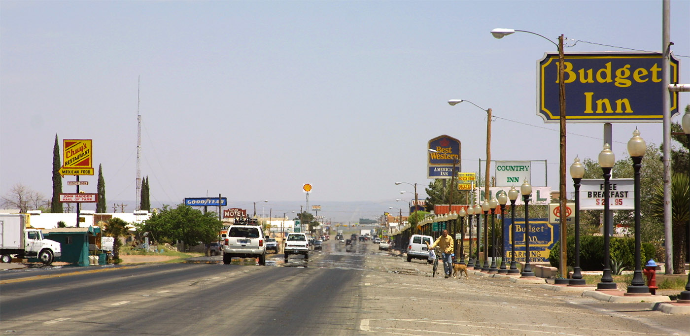 The main road through Van Horn (2006) | |
 | |
 Van Horn Location of Van Horn in Texas and the US  Van Horn Van Horn (the United States) | |
| Coordinates: 31°2′33″N 104°49′59″W | |
| Country | |
| State | |
| County | Culberson |
| Area | |
| • Total | 2.84 sq mi (7.35 km2) |
| • Land | 2.84 sq mi (7.35 km2) |
| • Water | 0.00 sq mi (0.00 km2) |
| Elevation | 4,042 ft (1,232 m) |
| Population (2010) | |
| • Total | 2,063 |
| • Estimate (2019)[2] | 1,870 |
| • Density | 658.91/sq mi (254.43/km2) |
| Time zone | UTC-6 (Central (CST)) |
| • Summer (DST) | UTC-5 (CDT) |
| ZIP code | 79855 |
| Area code | 432 |
| FIPS code | 48-75032[3] |
| GNIS feature ID | 1370571[4] |
| Website | www |
Geography
Van Horn is located in southwestern Culberson County at 31°2′33″N 104°49′59″W (31.042489, –104.832928).[7] Interstate 10 passes through the town, leading east 120 miles (190 km) to Fort Stockton and northwest 118 miles (190 km) to El Paso. Van Horn is the western terminus of U.S. Route 90; from Van Horn it leads southeast 73 miles (117 km) to Marfa. Texas State Highway 54 leads north from Van Horn 65 miles (105 km) to Pine Springs and the Guadalupe Mountains.
According to the United States Census Bureau, the town has a total area of 2.8 square miles (7.3 km2), all land.[6] Threemile Peak, elevation 4,868 feet (1,484 m), rises to the northwest overlooking the town.
 The old Eagle Field, before the 2014 construction of the new stadium, with Threemile Peak in the background
 Threemile Peak, with a white "V" for Van Horn on it


Climate
| Climate data for Van Horn, Texas | |||||||||||||
|---|---|---|---|---|---|---|---|---|---|---|---|---|---|
| Month | Jan | Feb | Mar | Apr | May | Jun | Jul | Aug | Sep | Oct | Nov | Dec | Year |
| Record high °F (°C) | 80 (27) |
87 (31) |
94 (34) |
100 (38) |
105 (41) |
112 (44) |
108 (42) |
108 (42) |
104 (40) |
98 (37) |
86 (30) |
82 (28) |
112 (44) |
| Average high °F (°C) | 58.8 (14.9) |
63.7 (17.6) |
70.8 (21.6) |
79.5 (26.4) |
87.5 (30.8) |
94.9 (34.9) |
93.6 (34.2) |
92.1 (33.4) |
86.7 (30.4) |
79.0 (26.1) |
67.4 (19.7) |
59.3 (15.2) |
77.8 (25.4) |
| Daily mean °F (°C) | 43 (6) |
48 (9) |
54 (12) |
62 (17) |
72 (22) |
79 (26) |
79 (26) |
78 (26) |
73 (23) |
63 (17) |
53 (12) |
44 (7) |
62 (17) |
| Average low °F (°C) | 29.1 (−1.6) |
32.5 (0.3) |
38.7 (3.7) |
46.9 (8.3) |
55.7 (13.2) |
64.3 (17.9) |
66.4 (19.1) |
65.3 (18.5) |
58.8 (14.9) |
48.6 (9.2) |
36.6 (2.6) |
29.8 (−1.2) |
47.7 (8.7) |
| Record low °F (°C) | −7 (−22) |
−3 (−19) |
9 (−13) |
24 (−4) |
33 (1) |
45 (7) |
53 (12) |
46 (8) |
33 (1) |
23 (−5) |
10 (−12) |
0 (−18) |
−7 (−22) |
| Average precipitation inches (mm) | 0.45 (11) |
0.50 (13) |
0.20 (5.1) |
0.32 (8.1) |
0.53 (13) |
1.22 (31) |
2.37 (60) |
2.15 (55) |
1.50 (38) |
1.31 (33) |
0.49 (12) |
0.55 (14) |
11.59 (294) |
| Average snowfall inches (cm) | 0.9 (2.3) |
0.6 (1.5) |
0.2 (0.51) |
0 (0) |
0 (0) |
0 (0) |
0 (0) |
0 (0) |
0 (0) |
0 (0) |
0.2 (0.51) |
1.0 (2.5) |
2.9 (7.4) |
| Source: The Weather Channel (Monthly Averages) [8] | |||||||||||||
History

Anglo-Texan[9] settlement began in the late 1850s and early 1860s supportive of the San Antonio-El Paso Overland Mail route.[10] Although U.S. Army Major Jefferson Van Horne is believed to have passed near the area in 1849 on his way to take command of what would later become Fort Bliss, the town is instead named for Lt. James Judson Van Horn who commanded an army garrison at the Van Horn Wells beginning in 1859. Lt. Van Horn's command was relatively short-lived, as the post was seized by Confederate forces in 1861 and Lt. Van Horn taken prisoner.[11] Settlement was further stimulated by the construction of the Texas and Pacific Railway in 1881.[12][13][14] The town has several buildings on the National Register of Historic Places including the First Presbyterian Church (now Primera Iglesia Bautista), built in 1901.
Demographics
| Historical population | |||
|---|---|---|---|
| Census | Pop. | %± | |
| 1890 | 450 | — | |
| 1900 | 30 | −93.3% | |
| 1910 | 500 | 1,566.7% | |
| 1920 | 800 | 60.0% | |
| 1930 | 1,600 | 100.0% | |
| 1940 | 2,070 | 29.4% | |
| 1950 | 1,161 | −43.9% | |
| 1960 | 1,953 | 68.2% | |
| 1970 | 2,889 | 47.9% | |
| 1980 | 2,772 | −4.0% | |
| 1990 | 2,930 | 5.7% | |
| 2000 | 2,435 | −16.9% | |
| 2010 | 2,063 | −15.3% | |
| 2019 (est.) | 1,870 | [2] | −9.4% |
| U.S. Decennial Census[15] | |||

2020 census
| Race | Number | Percentage |
|---|---|---|
| White (NH) | 347 | 17.88% |
| Black or African American (NH) | 14 | 0.72% |
| Native American or Alaska Native (NH) | 11 | 0.57% |
| Asian (NH) | 25 | 1.29% |
| Some Other Race (NH) | 3 | 0.15% |
| Mixed/Multi-Racial (NH) | 33 | 1.7% |
| Hispanic or Latino | 1,508 | 77.69% |
| Total | 1,941 |
As of the 2020 United States census, there were 1,941 people, 607 households, and 339 families residing in the town.
2000 census
As of the census[3] of 2000, 2,435 people, 834 households, and 652 families resided in the town. The population density was 846.9 people per square mile (326.4/km2). The 976 housing units averaged 339.5 per square mile (130.8/km2). The racial makeup of the town was 64.6% White, 0.7% African American, 0.6% Native American, 0.6% Asian, 31.5% from other races, and 2.1% from two or more races. Hispanics or Latinos of any race were 78.6% of the population.
Education

Van Horn is served by the Culberson County-Allamoore Independent School District and is home to the Van Horn High School Eagles.
Government and infrastructure

The United States Postal Service operates the Van Horn Post Office.[19]
Transportation
Major Highways
 I-10
I-10 SH 54
SH 54 US 90
US 90
Rail
- Union Pacific Railroad
Bus
- Greyhound Lines stops at a Super 8 at the west end of Bus. I-10-D.
Space tourism
This section's factual accuracy may be compromised due to out-of-date information. (May 2021) |
In late 2006, The Wall Street Journal reported that Jeff Bezos, founder and CEO of Amazon, had acquired 290,000 acres (1,200 km2) of land 25 miles (40 km) north of Van Horn, including the Figure 2 Ranch Airport, to house his fledgling space tourism company, Blue Origin. As of 2008[update], Blue Origin had been expected to start commercial operations as early as 2010,[needs update] aiming for 52 launches per year from the Van Horn facility.[20]
In early 2010, NASA awarded Blue Origin US$3.7 million to work on an advanced technology, which detaches a crew cabin from its launcher if the shuttle malfunctions.[21]
As of August 2016, Blue Origin was still conducting test flights with plans to begin flying piloted tests in 2017 and paying customers in 2018.[22][23][needs update] Blue Origin's actual first human launch from, and return to, Van Horn occurred on the morning of July 20, 2021 with a crew of four people.[24]
10,000-year clock
In 2009 the Van Horn Advocate announced that the Long Now Foundation was starting geologic testing for an underground space to house a 10,000-year Clock of the Long Now, on the Bezos ranch, north of Van Horn.[25]
Popular culture
Van Horn provided the inspiration for the 2019 song "Van Horn" by alternative-rock band Saint Motel which was featured on their EP The Original Motion Picture Soundtrack: Part 1 after the band spent a night there on a recent tour.[26]
Famed football coach John Madden put Chuy's Restaurant on the national map after a 1987 stop with his Madden Cruiser bus.[27]
Gallery
 Threemile Mountain (on the left), looking northwest (USGS photo by George B. Richardson, 1913)
 Similar view of Threemile Mountain (left) and Beach Mountains (right) in 2008
 Culberson County Hospital and Van Horn Rural Health Clinic (2013)
 12,800 acre Sierra Diablo Ranch north of Van Horn


See also
- Guadalupe Mountains National Park
- Guadalupe Mountains
- Kent, Texas
- McKittrick Canyon
- Sierra Blanca, Texas
- West Texas
- Beach Mountains
References
- "2019 U.S. Gazetteer Files". United States Census Bureau. Retrieved August 7, 2020.
- "Population and Housing Unit Estimates". United States Census Bureau. May 24, 2020. Retrieved May 27, 2020.
- "U.S. Census website". United States Census Bureau. Retrieved 2008-01-31.
- "US Board on Geographic Names". United States Geological Survey. 2007-10-25. Retrieved 2008-01-31.
- "Find a County". National Association of Counties. Retrieved 2011-06-07.
- "Geographic Identifiers: 2010 Census Summary File 1 (G001): Van Horn town, Texas". U.S. Census Bureau, American Factfinder. Archived from the original on February 13, 2020. Retrieved August 6, 2015.
- "US Gazetteer files: 2010, 2000, and 1990". United States Census Bureau. 2011-02-12. Retrieved 2011-04-23.
- "Climate Statistics for Van Horn, Texas". Archived from the original on August 13, 2014. Retrieved February 18, 2012.
- "Anglo-American Colonization", The Handbook of Texas Online
- "San Antonio-El Paso Mail", The Handbook of Texas Online. For more on the establishment of this route, see United States Army, Corps of Topographical Engineers; Joseph Eggleston Johnston; Francis T. Bryan; Randolph Barnes Marcy; William F. Smith; N. H. Michler; S. G. French; W. H. C. Whiting; James H. Simpson (1850). Reports of the Secretary of War: with reconnaissances of routes from San Antonio to El Paso. Washington, DC: Union Office. Retrieved 2009-05-22.
- Regarding prisoner exchanges including Lt. Van Horn see January 26, 1862 correspondence from J. P. Benjamin to Major General Benjamin Huger in United States War Department (1891). The War of the Rebellion: A Compilation of the Official Records of the Union and Confederate Armies (Volume III). Washington, DC: Government Printing Office. p. 782 (and others). Retrieved May 21, 2009.
- "Van Horn, Texas", The Handbook of Texas Online
- "Van Horne, Jefferson", The Handbook of Texas Online
- Cullum, George Washington; Edward Singleton Holden (1891). Biographical register of the officers and graduates of the U.S. military academy at West Point, N.Y.: from its establishment, in 1802, to 1890; with the early history of the United States military academy. Boston: Houghton, Mifflin & Company. p. 400. Retrieved May 21, 2009.
- "Census of Population and Housing". Census.gov. Retrieved June 4, 2015.
- "Explore Census Data". data.census.gov. Retrieved 2022-05-19.
- https://www.census.gov/ [not specific enough to verify]
- "About the Hispanic Population and its Origin". www.census.gov. Retrieved 18 May 2022.
- "Post Office Location - VAN HORN Archived 2012-05-13 at the Wayback Machine." United States Postal Service. Retrieved on January 6, 2010.
- "Tourism Update: Jeff Bezos? Spaceship Plans Revealed". SPACE.com. 2006-07-05. Retrieved 2008-05-15.
- Van Horn spaceport gets NASA backing, Adriana Gómez Licón, El Paso Times, 2010-03-14, accessed 2010-03-17.
- McCormick, Rich (March 9, 2016). "Jeff Bezos' Blue Origin plans to start taking tourists into space in 2018". The Verge.
- Cofield, Calla (July 20, 2016). "Blue Origin's Crew Capsule Aced Parachute-Failure Test, Jeff Bezos Says". Space.com.
- "Jeff Bezos goes to space". CNN. Retrieved 2021-07-20.
- "Clock project to begin near Van Horn, Texas". Retrieved 2010-01-17.
- "Saint Motel Break Down 'The Original Motion Picture Soundtrack: Part 1': Exclusive". Billboard. Retrieved 2019-12-15.
- "The Van Horn restaurant John Madden turned into a national favorite". YourBasin. Nov 7, 2021. Retrieved Dec 29, 2021.
External links
- Town of Van Horn official website
- Van Horn Advocate, local newspaper
- Van Horn in the Handbook of Texas
- Historic Photographs of Van Horn from the Clark Hotel Museum, hosted by the Portal to Texas History
- Clark Hotel Historical Museum
Municipalities and communities of Culberson County, Texas, United States | ||
|---|---|---|
County seat: Van Horn | ||
| Town | 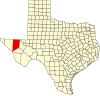 | |
| Unincorporated communities |
| |
| Ghost town | ||
| ||
Austin (capital) | |
| Topics |
|
| Society |
|
| Regions |
|
| Metropolitan areas |
|
| Counties | See: List of counties in Texas |
Authority control | |
|---|---|
| General | |
| National libraries | |
На других языках
[de] Van Horn
Van Horn ist ein Ort im US-Bundesstaat Texas und Sitz der Verwaltung des Culberson County.- [en] Van Horn, Texas
[es] Van Horn (Texas)
Van Horn es un pueblo ubicado en el condado de Culberson en el estado estadounidense de Texas. En el Censo de 2010 tenía una población de 2063 habitantes y una densidad poblacional de 280,67 personas por km².[3][ru] Ван-Хорн (Техас)
Ван-Хорн (англ. Van Horn) — город, расположенный на западе штата Техас (США), примерно в 170 км к юго-востоку от Эль-Пасо и в 640 км к западу от Сан-Антонио. Ван-Хорн является окружным центром округа Калберсон. Согласно Бюро переписи населения США, по переписи 2010 года население Ван-Хорна составляло &&&&&&&&&&&02063.&&&&&02063 человек[1].Другой контент может иметь иную лицензию. Перед использованием материалов сайта WikiSort.org внимательно изучите правила лицензирования конкретных элементов наполнения сайта.
WikiSort.org - проект по пересортировке и дополнению контента Википедии