world.wikisort.org - USA
Eagle Pass is a city in and the county seat of Maverick County in the U.S. state of Texas. Its population was 28,130 as of the 2020 census.[4]
Eagle Pass, Texas | |
|---|---|
City | |
 | |
| Nicknames: El Aguilón El Paso del Aguila | |
 Location of Eagle Pass, Texas | |
| Coordinates: 28°42′38″N 100°29′22″W | |
| Country | |
| State | |
| County | Maverick |
| Government | |
| • Type | Council-Manager |
| • City Council | Mayor Rolando Salinas Elias Diaz William "Billy" Davis Yolanda Ramon |
| • City Manager | George Antuna |
| Area | |
| • Total | 9.49 sq mi (24.58 km2) |
| • Land | 9.42 sq mi (24.40 km2) |
| • Water | 0.07 sq mi (0.18 km2) |
| Elevation | 732 ft (223 m) |
| Population (2020) | |
| • Total | 28,130 |
| • Density | 3,150.83/sq mi (1,216.59/km2) |
| Time zone | UTC-6 (Central (CST)) |
| • Summer (DST) | UTC-5 (CDT) |
| ZIP codes | 78852-78853 |
| Area code | 830 |
| FIPS code | 48-21892[2] |
| GNIS feature ID | 1356538[3] |
| Website | www |
Eagle Pass borders the city of Piedras Negras, Coahuila, Mexico, which is to the southwest and across the Rio Grande. The Eagle Pass-Piedras Negras metropolitan area (EP-PN) is one of six binational metropolitan areas along the United States-Mexican border. As of January 2008, according to the US census, the EPPN's population was 48,401 people, and the Piedras Negras metropolitan area's population was 169,771.
History
Eagle Pass was the first American settlement on the Rio Grande. Originally known as Camp Eagle Pass, it served as a temporary outpost for the Texas militia, which had been ordered to stop illegal trade with Mexico during the Mexican–American War.[5] Eagle Pass is so named because the contour of the hills through which the Rio Grande flows bore a fancied resemblance to the outstretched wings of an eagle.[6]
General William Leslie Cazneau (1807–1876) founded the Eagle Pass townsite in the 1840s.[7]
In 1850, Rick Pawless opened a trading post called Eagle Pass. In 1871, Maverick County was established, and Eagle Pass was named the county seat. During the remainder of the 19th century, schools and churches opened, the mercantile and ranching industries grew, and a railway was built.
The United States Army established the presumably permanent Fort Duncan on March 27, 1849, a few miles upstream from Camp Eagle Pass. Captain Sidney Burbank supervised the construction of Fort Duncan, which was named after Colonel James Duncan, who had fought in the Mexican War. After the war, trade flourished under the protection of the fort, which was near the trail of westward immigration to California. It also served as an outpost against hostile Apache. It was abandoned and reopened several times. In March 1860, it served as the base of operations against the border assaults arranged by Juan N. Cortina.[8] Rancher and gunfighter King Fisher lived in Eagle Pass until his ambush and murder in San Antonio in 1884.
Fort Duncan was held by the Confederacy during the American Civil War. On July 4, 1865, General Joseph O. Shelby, en route to offer his troops' service to Maximilian in Mexico, stopped at Fort Duncan and buried in the Rio Grande the last Confederate flag to have flown over his men.[5] After several decades of deactivation, Fort Duncan was activated as a training camp during World War I, as a post of the U.S. Army. The 3rd Infantry Regiment was assigned there and patrolled the Mexican border. In 1938, the City of Eagle Pass acquired the fort and still operates a museum and a children's library at the site.[8]
Lawsuit
The City of Eagle Pass was sued by the US government in 2008 to gain access to the land and construct a fence on the United States-Mexico border.[9]
Maverick County corruption scandal
An ongoing public corruption, bid-rigging, and kickback investigation by the FBI and Texas Department of Public Safety has resulted in the arrest and imprisonment of all four Maverick County commissioners, one justice of the peace, and several local government employees and businessmen since October 2012, making it the largest public criminal probe in Eagle Pass and Maverick County history.[10] On February 20, 2015, a federal grand jury in Del Rio indicted a county commissioner and a former county justice of the peace in connection with an alleged bribery, kickback, and bid-rigging scheme, all related to the ongoing public corruption investigation.[11] On February 23, 2015, former Maverick County Commissioner Rodolfo Heredia was sentenced to 10 years in federal prison, followed by three years of supervised release, and ordered to perform 1,200 hours of community service after completing his prison term. He was also ordered to pay a maximum of $56,003.88 in restitution to Maverick County.[12]
City of Eagle Pass gasoline card theft and fraud
On August 8, 2012, a federal grand jury in the U.S. District Court in Del Rio indicted five Eagle Pass residents, including a former Public Works Department employee, in connection with an estimated $70,000 credit-card fraud scheme. According to the indictment, during 2011, City of Eagle Pass employee Edgar Aguilar obtained five City of Eagle Pass-owned Fuelman credit cards designated for fuel purchases for Public Works department vehicles and distributed them to his accomplices to purchase fuel for their own vehicles and to purchase fuel for others at the city's expense. In some instances, defendants charged individuals a reduced rate for fuel purchased using the city's credit card and then pocketed the cash.[13] On November 29, 2012, Aguilar entered a guilty plea for the charges of theft and fraud, and on May 15, 2013, was sentenced to 42 months in federal prison and ordered to pay $68,373.87 in restitution for his role in the fraudulent scheme.[14]
Former city manager charged with lying to the FBI
On March 30, 2017, Hector Chavez Sr., the former Eagle Pass city manager, pleaded guilty to lying to the FBI regarding a bribery scheme involving public contracts in Maverick County. Chavez, with the company Chace Management, was charged with receiving $20,000 from the owner of the engineering firm Hejl, Lee, and Associates to bribe a county commissioner to procure a $270,000 contract for the engineering firm. Chavez admitted to having given false information in 2015. Chavez was sentenced to 42 months in federal prison and three years' supervised release on August 21, 2017.[15][16]
Economy

The City of Eagle Pass is home to small and large businesses alike, but its primary sectors are in retail, import/export and manufacturing. Two of its largest manufacturers are Mossberg and MicroStar. In fact, it was in 2014 when Maverick Arms decided to expand to Eagle Pass[17] after it received assistance from the State of Texas using the Texas Enterprise Fund.
The City of Eagle Pass and Maverick County recently adopted matching incentives policies (2020) making it easier for outside business to expand operations in the region. Incentives are handled through the City's Economic Development Department.
Because of its location along the U.S./Mexico border, the retail sector is healthy due to the large number of visitors Eagle Pass gets from within Mexico. It is estimated that on a regular weekday, Eagle Pass gets 6,000 people come across into the U.S. vs. 10,000 on the weekend. Many of these visitors stay within the city limits to shop and eat at local restaurants.
Climate
Eagle Pass has a hot semi-arid climate (Köppen: BSh). The average hottest month is August, and the highest recorded temperature was 115 °F (46.1 °C) in 1944. Typically, the coolest month is January, while the lowest recorded temperature was 10 °F (−12.2 °C) in 1962. Most precipitation occurs in the spring through fall with a drier winter. The highest monthly average precipitation occurs in September, with a secondary peak in May and June. Late July and August demonstrate a significant, secondary dry season, with very high temperatures and high sun exposure, resulting in high evaporation rates.
| Climate data for Eagle Pass, Texas (1991-2020 normals, extremes 1897-2018) | |||||||||||||
|---|---|---|---|---|---|---|---|---|---|---|---|---|---|
| Month | Jan | Feb | Mar | Apr | May | Jun | Jul | Aug | Sep | Oct | Nov | Dec | Year |
| Record high °F (°C) | 96 (36) |
101 (38) |
106 (41) |
108 (42) |
114 (46) |
115 (46) |
115 (46) |
112 (44) |
111 (44) |
106 (41) |
100 (38) |
94 (34) |
115 (46) |
| Average high °F (°C) | 64.5 (18.1) |
70.0 (21.1) |
77.6 (25.3) |
84.4 (29.1) |
90.3 (32.4) |
96.0 (35.6) |
97.5 (36.4) |
98.6 (37.0) |
91.8 (33.2) |
83.4 (28.6) |
72.4 (22.4) |
64.8 (18.2) |
82.6 (28.1) |
| Daily mean °F (°C) | 52.1 (11.2) |
56.7 (13.7) |
64.5 (18.1) |
71.0 (21.7) |
78.1 (25.6) |
83.9 (28.8) |
85.6 (29.8) |
86.5 (30.3) |
80.4 (26.9) |
71.4 (21.9) |
60.3 (15.7) |
52.3 (11.3) |
70.2 (21.2) |
| Average low °F (°C) | 39.7 (4.3) |
43.4 (6.3) |
51.4 (10.8) |
57.7 (14.3) |
65.9 (18.8) |
71.8 (22.1) |
73.8 (23.2) |
74.3 (23.5) |
69.1 (20.6) |
59.3 (15.2) |
48.3 (9.1) |
39.8 (4.3) |
57.9 (14.4) |
| Record low °F (°C) | 10 (−12) |
10 (−12) |
20 (−7) |
32 (0) |
42 (6) |
47 (8) |
62 (17) |
60 (16) |
42 (6) |
27 (−3) |
19 (−7) |
12 (−11) |
10 (−12) |
| Average precipitation inches (mm) | 0.74 (19) |
0.74 (19) |
1.18 (30) |
2.02 (51) |
2.80 (71) |
2.20 (56) |
2.10 (53) |
1.68 (43) |
3.29 (84) |
2.14 (54) |
1.13 (29) |
0.81 (21) |
20.83 (529) |
| Source: NOAA[18] | |||||||||||||
Geography
Eagle Pass is located at 28°42′38″N 100°29′22″W (28.710622, −100.489331).[19]
According to the United States Census Bureau, the city has a total area of 7.4 mi2 (19.2 km2), of which 0.04 mi2 (0.1 km2) (0.40%) is covered by water.
The area is served by U.S. Routes 57 and 277, and Farm-to-Market Road 481. Maverick County Memorial International Airport is a general-aviation field. The nearest commercial air service is 50 miles away, via the Del Rio International Airport in Del Rio, which is served by American Airlines.
Demographics
| Historical population | |||
|---|---|---|---|
| Census | Pop. | %± | |
| 1850 | 383 | — | |
| 1860 | 522 | 36.3% | |
| 1870 | 1,240 | 137.5% | |
| 1880 | 1,627 | 31.2% | |
| 1910 | 3,536 | — | |
| 1920 | 5,765 | 63.0% | |
| 1930 | 5,059 | −12.2% | |
| 1940 | 13,343 | 163.7% | |
| 1950 | 14,211 | 6.5% | |
| 1960 | 12,094 | −14.9% | |
| 1970 | 15,364 | 27.0% | |
| 1980 | 21,407 | 39.3% | |
| 1990 | 20,651 | −3.5% | |
| 2000 | 22,413 | 8.5% | |
| 2010 | 26,248 | 17.1% | |
| 2020 | 28,130 | 7.2% | |
| U.S. Decennial Census 2018 Estimate[20] | |||
2020 census
| Race | Number | Percentage |
|---|---|---|
| White (NH) | 1,006 | 3.58% |
| Black or African American (NH) | 117 | 0.42% |
| Native American or Alaska Native (NH) | 61 | 0.22% |
| Asian (NH) | 159 | 0.57% |
| Pacific Islander (NH) | 1 | 0.0% |
| Some Other Race (NH) | 67 | 0.24% |
| Mixed/Multi-Racial (NH) | 55 | 0.2% |
| Hispanic or Latino | 26,664 | 94.79% |
| Total | 28,130 |
As of the 2020 United States census, there were 28,130 people, 8,850 households, and 7,053 families residing in the city.
2006
As of the census[2] of 2006, 24,847 people, 6,925 households, and 5,588 families resided in the city. The population density was 3,030.3 people/sq mi (1,169.4/km2). The 7,613 housing units averaged 1,029.3/sq mi (397.2/km2). The racial makeup of the city was 42.73% White, 0.27% African American, 0.39% Native American, 0.76% Asian, 22.71% from other races, and 3.13% from two or more races. Hispanics or Latinos of any race were 96.90% of the population.
Of the 6,925 households, 43.5% had children under the age of 18 living with them, 59.0% were married couples living together, 18.3% had a female householder with no husband present, and 19.3% were not families. About 17.7% of all households were made up of individuals, and 9.5% had someone living alone who was 65 or older. The average household size was 3.22, and the average family size was 3.69.
In the city, the population was distributed as 32.7% under 18, 8.6% from 18 to 24, 25.6% from 25 to 44, 19.9% from 45 to 64, and 13.1% who were 65 or older. The median age was 32 years. For every 100 females, there were 88.5 males. For every 100 females age 18 and over, there were 81.8 males.
The median income for a household in the city was $23,623, and for a family was $27,140. Males had a median income of $26,350 versus $17,346 for females. The per capita income for the city was $11,414. About 26.0% of families and 29.0% of the population were below the poverty line, including 34.0% of those under age 18 and 39.1% of those age 65 or over.
Nearby cities/communities
- Carrizo Springs, Texas
- Ciudad Acuña, Coahuila
- Crystal City, Texas
- Del Rio, Texas
- El Indio, Texas
- Elm Creek, Texas
- La Pryor, Texas
- Laredo, Texas
- Nuevo Laredo, Tamaulipas
- Piedras Negras, Coahuila
- San Antonio, Texas
- Radar Base, Texas
- Rosita North, Texas
- Rosita South, Texas
- Uvalde, Texas
- Quemado, Texas
Transportation
Highways
 US Highway 57
 US Highway 277
 State Highway 131
Government
Federal representation
The United States Postal Service operates a post office in located at 455 S Bibb Ave.
The United States Border Patrol has two stations in Eagle Pass. The Eagle Pass North Station is at 2285 Del Rio Blvd and the Eagle Pass South Station at 4156 El Indio Hwy.
Eagle Pass is the headquarters of the Kickapoo Traditional Tribe of Texas, a federally recognized tribe of Kickapoo people.[24]
Media
- Eagle Pass News Leader
- The News Gram
Education
Eagle Pass is served by the Eagle Pass Independent School District, which operates 15 elementary schools, two junior high schools, and two high schools, which compete in UIL academics and sports.
Private schools
- Our Lady of Refuge Catholic School
- Redeemer Episcopal School
- Word of Life Christian School
Elementary schools
- Armando Cerna Elementary School
- Benavides Heights Elementary School
- Dena Kelso Graves Elementary School
- Graves Elementary School
- Henry B Gonzalez Elementary School
- Liberty Elementary School
- Nellie Mae Glass Elementary School
- Perfecto Mancha Elementary School
- Pete Gallego Elementary School
- Ray H Darr Elementary School
- Robert E Lee Elementary School
- Rosita Valley Elementary School
- Rosita Valley Literacy Academy
- Sam Houston Elementary School
- San Luis Elementary School
- Seco Mines Elementary School
- Kirchner Elementary School
Middle schools
- Eagle Pass Junior High School
- Memorial Junior High School
High schools
- Eagle Pass High School
- C.C. Winn High School
The community is served by branches of four-year Sul Ross University in Alpine, in the form of Rio Grande College, and Southwest Texas Junior College, a two-year community college based in Uvalde.
Notable people
- Guadalupe Garcia McCall, author and educator
- Rian James (1899–1953), author and screenwriter
- Biz Mackey (1897–1965), catcher and manager in Negro League baseball
- Robert C. Mathis (1927–2016), retired Air Force four-star general, served as Vice Chief of Staff, U.S. Air Force
- Connie Douglas Reeves (1901–2003), rancher, National Cowgirl Museum and Hall of Fame
- Gus Sorola (born 1978), co-founder of Rooster Teeth
- Louis Lane (1923–2016) conductor of Cleveland and Atlanta symphonies
- Tres Barrera (born 1994), backup catcher for the Washington Nationals
HVDC-back-to-back station
In 2000, as part of the power exchange between Texas and Mexico, a high-voltage direct current facility equipped with insulated-gate bipolar transistors was built. This facility, built for Central Power and Light (now AEP Texas) by the ABB Group, operates at a bipolar voltage of 15.9 kV, and has a maximum transfer rate of 36 megawatts. The power station enables AEP to purchase electricity from Mexico's Comisión Federal de Electricidad, when needed.[25]
Tornado
On April 24, 2007, at 7:00 pm CST, a tornado tore through outside of Eagle Pass and caused loss of life and property damage. The community was paralyzed for more than a week.This tornado tore through the southern part of the town, And major damage was done. At the Rosita Valley Elementary school, one child was waiting with his teacher to be picked up and as the dangerous storm approached, the child was picked up and his teacher left the campus too. Minutes later, the school was flattened with nothing to spare. Now the school was rebuilt and children and staff will now live their normal life.[26]
Gallery
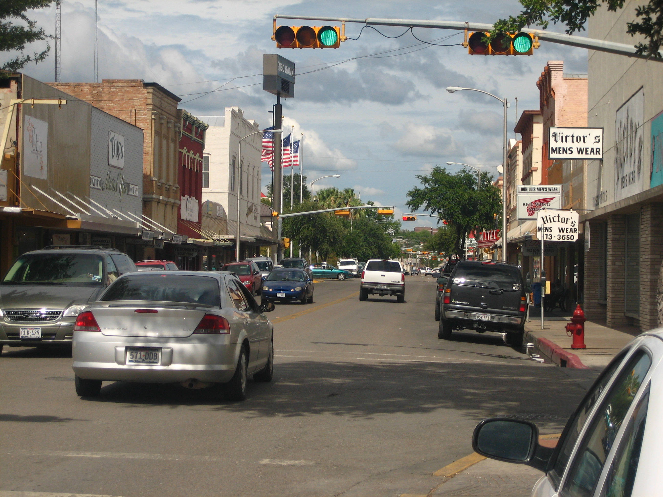
 Downtown Eagle Pass
 Eagle Pass City Hall at the foot of International Bridge
 The Rio Grande at Eagle Pass, Texas, with Piedras Negras in the background
 Historic First United Methodist Church on Quarry Street
 Map of the city 1887
 The restored Fort Duncan in Eagle Pass is located near the International Bridge.
 The International Bridge across the Rio Grande in Eagle Pass
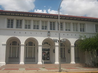 The Eagle Pass public library is located on Main Street east of the Maverick County Courthouse.
 Fort Duncan Medical Center in Eagle Pass is named after the former US Army outpost.
 Historic Maverick County Courthouse
 Mall de las Aguilas on Bibb Street in Eagle Pass


See also
- Camino Real International Bridge
- Eagle Pass – Piedras Negras International Bridge
- Fort Duncan
- Union Pacific International Railroad Bridge
References
- "2019 U.S. Gazetteer Files". United States Census Bureau. Retrieved August 7, 2020.
- "U.S. Census website". United States Census Bureau. Retrieved 2008-01-31.
- "US Board on Geographic Names". United States Geological Survey. 2007-10-25. Retrieved 2008-01-31.
- "Explore Census Data".
- Texas Transportation Commission, Texas State Travel Guide, 2008, p. 232
- Gannett, Henry (1905). The Origin of Certain Place Names in the United States. Govt. Print. Off. pp. 112.
- Handbook of Texas Online
- Texas Historical Commission, historical marker at Fort Duncan, Eagle Pass, Texas, 1970
- Texas City Ordered to Turn Over Land to Feds for Border Fence Construction, January 16, 2008
- Buch, Jason (Dec 9, 2012). "Corruption costly for Maverick residents". San Antonio Express-News. Retrieved Aug 15, 2019.
- Buch, Jason (Feb 20, 2015). "More Maverick County officials arrested by FBI in bribery investigation". San Antonio Express-News. Retrieved Aug 15, 2019.
- "Former Maverick County Commissioner, Former County Employee, and Three Contractors Sentenced to Federal Prison in Connection with a Bribery, Kickback, and Bid-Rigging Scheme — FBI". www.fbi.gov. Retrieved Aug 15, 2019.
- "Federal Grand Jury Indicts Five in Connection with Credit Card Fraud Scheme Involving the City of Eagle Pass". FBI. Retrieved Aug 15, 2019.
- "Former Eagle Pass Department of Public Works Employee Sentenced for Role in City Credit Card Fraud Scheme". FBI. Retrieved Aug 15, 2019.
- Guillermo Contreras, "Ex-Eagle Pass manager faces up to 5 years for lying to FBI," San Antonio Express-News, April 1, 2017, p. 6.
- "Former Eagle Pass City Manager Hector Chavez, Sr. Sentenced to Federal Prison for Lying to FBI in Connection with Investigation into "Pay-To-Play" Bribery Scheme Involving Maverick County Contracts - Eagle Pass Business Journal". www.epbusinessjournal.com. Retrieved Aug 15, 2019.
- Keys, Lili (8 July 2014). "Maverick Arms expanding in Eagle Pass, Texas". LSONews. Archived from the original on 2014-11-14. Retrieved 22 December 2021.
- "NOWData - NOAA Online Weather Data". NOAA. Retrieved August 14, 2022.
- "US Gazetteer files: 2010, 2000, and 1990". United States Census Bureau. 2011-02-12. Retrieved 2011-04-23.
- "Population Estimates". United States Census Bureau. Retrieved June 8, 2018.
- "Explore Census Data". data.census.gov. Retrieved 2022-05-20.
- http://www.census.gov [not specific enough to verify]
- "About the Hispanic Population and its Origin". www.census.gov. Retrieved 18 May 2022.
- "Tribal Directory." National Congress of American Indians. Retrieved 12 Sept 2013.
- "References | ABB". new.abb.com. Retrieved Aug 15, 2019.
- "Tornado Kills 7 Near Eagle Pass On Mexican Border". CBS 11 TV. 2007-04-25. Retrieved 2009-03-21.
External links
Municipalities and communities of Maverick County, Texas, United States | ||
|---|---|---|
County seat: Eagle Pass | ||
| City |  | |
| CDPs | ||
| Indian reservation |
| |
| ||
State of Texas | |
|---|---|
Austin (capital) | |
| Topics |
|
| Society |
|
| Regions |
|
| Metropolitan areas |
|
| Counties | See: List of counties in Texas |
Authority control | |
|---|---|
| General | |
| National libraries | |
| Other |
|
На других языках
[de] Eagle Pass (Texas)
Eagle Pass ist eine Stadt im Maverick County im US-Bundesstaat Texas und Sitz der County-Verwaltung (County Seat). Eagle Pass liegt am Rio Grande (spanisch Río Bravo del Norte), der hier die Grenze zu Mexiko bildet und durch die Eagle Pass–Piedras Negras International Bridge mit dem gegenüberliegenden Piedras Negras im mexikanischen Bundesstaat Coahuila verbunden wird.- [en] Eagle Pass, Texas
[ru] Игл-Пасс
Игл-Пасс (англ. Eagle Pass) — город в США, расположенный в южной части штата Техас, административный центр округа Мэверик. По данным переписи за 2010 год число жителей составляло 26 248 человек, по оценке Бюро переписи США в 2017 году в городе проживало 28 945 человек[2].Другой контент может иметь иную лицензию. Перед использованием материалов сайта WikiSort.org внимательно изучите правила лицензирования конкретных элементов наполнения сайта.
WikiSort.org - проект по пересортировке и дополнению контента Википедии