world.wikisort.org - USA
Zapata is a census-designated place (CDP) in and the county seat of Zapata County, Texas, United States.[3] The population was 14,018 at the 2010 census. As an unincorporated community, Zapata has no municipal government but like all 254 Texas counties has four elected county commissioners chosen by single-member districts and a countywide elected administrative judge.
Zapata, Texas | |
|---|---|
CDP | |
 U.S. Highway 83 in Zapata | |
 | |
 Zapata, Texas Location of Zapata, Texas  Zapata, Texas Zapata, Texas (the United States) | |
| Coordinates: 26°54′22″N 99°16′12″W | |
| Country | |
| State | |
| County | Zapata |
| Area | |
| • Total | 9.6 sq mi (25 km2) |
| • Land | 7.6 sq mi (20 km2) |
| • Water | 2.0 sq mi (5 km2) |
| Elevation | 394 ft (120 m) |
| Population (2013) | |
| • Total | 14,390 |
| • Density | 1,500/sq mi (580/km2) |
| Time zone | UTC-6 (Central (CST)) |
| • Summer (DST) | UTC-5 (CDT) |
| ZIP code | 78076 |
| Area code | 956 |
| FIPS code | 48-80716[1] |
| GNIS feature ID | 1350720[2] |
History
Zapata was named for José Antonio de Zapata (died 1839), the revolutionary commander who served in the cavalry of the Republic of the Rio Grande, of which the town was a part.[4] The town was relocated to higher ground in 1953 prior to the completion of Falcon Dam, which left the original town center beneath the waters of Falcon Lake.
Geography
Zapata is located at 26°54′22″N 99°16′12″W (26.906244, -99.270007).[5]
According to the United States Census Bureau, the CDP has a total area of 9.6 square miles (25 km2), of which, 7.6 square miles (20 km2) of it is land and 2.0 square miles (5.2 km2) is water.[6]
Recreation
The city is located right on Falcon International Reservoir[7] which is at the center of multiple fishing events throughout the year.
The city also served by a number of parks, most notably, Romeo Flores Park.
Climate
Zapata has a hot semi-arid (Köppen: BSh) climate with hot summers and milder winters. Official record temperatures range from 13 °F (−11 °C) on January 4, 1911, to 116 °F (47 °C) on June 16, 1998.
Precipitation averages 19.8 in (500 mm) annually, with higher amounts typically occurring from May to October. Snowfall is rare but has occurred, with 1.0 in (2.5 cm) on Christmas Day in 2004. Zapata is sometimes the hottest location in the United States.[8]
| Climate data for Zapata, Texas | |||||||||||||
|---|---|---|---|---|---|---|---|---|---|---|---|---|---|
| Month | Jan | Feb | Mar | Apr | May | Jun | Jul | Aug | Sep | Oct | Nov | Dec | Year |
| Record high °F (°C) | 98 (37) |
101 (38) |
105 (41) |
111 (44) |
114 (46) |
116 (47) |
113 (45) |
114 (46) |
111 (44) |
104 (40) |
98 (37) |
95 (35) |
116 (47) |
| Average high °F (°C) | 70.1 (21.2) |
74.1 (23.4) |
82.8 (28.2) |
89.3 (31.8) |
94.0 (34.4) |
98.0 (36.7) |
99.3 (37.4) |
99.6 (37.6) |
94.0 (34.4) |
87.3 (30.7) |
78.2 (25.7) |
70.4 (21.3) |
86.4 (30.2) |
| Daily mean °F (°C) | 58.4 (14.7) |
61.8 (16.6) |
70.0 (21.1) |
76.7 (24.8) |
82.3 (27.9) |
86.1 (30.1) |
87.2 (30.7) |
87.4 (30.8) |
82.8 (28.2) |
75.7 (24.3) |
66.7 (19.3) |
58.8 (14.9) |
74.5 (23.6) |
| Average low °F (°C) | 46.7 (8.2) |
49.5 (9.7) |
57.1 (13.9) |
64.1 (17.8) |
70.5 (21.4) |
74.3 (23.5) |
75.2 (24.0) |
75.1 (23.9) |
71.5 (21.9) |
64.2 (17.9) |
55.1 (12.8) |
47.3 (8.5) |
62.6 (17.0) |
| Record low °F (°C) | 13 (−11) |
22 (−6) |
22 (−6) |
38 (3) |
50 (10) |
50 (10) |
42 (6) |
64 (18) |
45 (7) |
30 (−1) |
31 (−1) |
15 (−9) |
13 (−11) |
| Average precipitation inches (mm) | 0.77 (20) |
0.94 (24) |
0.61 (15) |
1.50 (38) |
2.55 (65) |
2.12 (54) |
1.80 (46) |
1.73 (44) |
4.40 (112) |
1.57 (40) |
1.06 (27) |
0.74 (19) |
19.78 (502) |
| Average precipitation days (≥ 0.01 inch) | 4 | 4 | 3 | 3 | 4 | 4 | 4 | 4 | 6 | 4 | 3 | 4 | 48 |
| Source: WRCC [9] | |||||||||||||
Demographics
| Year | Pop. | ±% |
|---|---|---|
| 1950 | 343 | — |
| 1960 | 2,031 | +492.1% |
| 1970 | 2,102 | +3.5% |
| 1980 | 3,831 | +82.3% |
| 1990 | 4,594 | +19.9% |
| 2000 | 4,856 | +5.7% |
| 2010 | 5,089 | +4.8% |
| 2012 | 5,173 | +1.7% |
| source:[10] | ||
2020 census
| Race | Number | Percentage |
|---|---|---|
| White (NH) | 267 | 4.96% |
| Black or African American (NH) | 4 | 0.07% |
| Native American or Alaska Native (NH) | 1 | 0.02% |
| Asian (NH) | 5 | 0.09% |
| Some Other Race (NH) | 11 | 0.2% |
| Mixed/Multi-Racial (NH) | 28 | 0.52% |
| Hispanic or Latino | 5,067 | 94.13% |
| Total | 5,383 |
As of the 2020 United States census, there were 5,383 people, 2,010 households, and 1,037 families residing in the CDP.
2010 census
At the 2010 census,[1] there were 5,089 people,[14] 4,328 households[citation needed] and 1,265 families[citation needed] residing in the CDP. The population density was 666.7 per square mile.[15] There were 2,239 housing units at an average density of 290.4 per square mile (112.1/km2). The racial makeup of the CDP was 92.38% White, 0.02% African American, 0.06% Native American, 0.18% Asian, 0.00% Pacific Islander, 6.82% from other races, and 0.55% from two or more races. Hispanic or Latino of any race were 94.99% of the population.
At the 2000 census, there were 1,574 households, of which 41.7% had children under the age of 18 living with them, 61.7% were married couples living together, 15.0% had a female householder with no husband present, and 19.6% were non-families. 18.2% of all households were made up of individuals, and 11.4% had someone living alone who was 65 years of age or older. The average household size was 3.07 and the average family size was 3.50.
31% of the population were under the age of 18, 7.4% from 20 to 24, 30.1% from 25 to 49, 15.2% from 50 to 64, and 12.9% who were 65 years of age or older. The median age was 32 years. For every 100 females, there were 92.2 males. For every 100 females age 18 and over, there were 89.8 males.
The median household income was $24,136 and the median family income was $27,708. Males had a median income of $30,833 compared with $12,604 for females. The per capita income was $11,863. About 29.1% of families and 33.5% of the population were below the poverty line, including 45.1% of those under the age of 18 and 27.0% of those ages 65 and older.
Economy
Leading employers in Zapata County are the educational, health and social services, natural gas and oil, and retail trade industries.
The county’s present economy is mainly centered on oil and gas production, ranching, trading and services, and tourism. Its primary employers are in the mining/energy, construction, retail trade, health care, social welfare, and the services sector. Government is also a major employer in the county.
Government
Local government
The structure of the management and coordination of city services is:[16]
| Department | Director |
|---|---|
| County Judge | Joe Rathmell |
| County Attorney | Said Alfonso Figueroa |
| County Clerk | Mary Jayne Villarreal-Bonoan |
| County Sheriff | Raymundo Del Bosque |
| County Tax Assessor | Delia Mendoza |
| County Auditor | Triunfo Gonzalez |
| County Treasurer | Romeo Salinas |
Public libraries
The county operates the main branch of the "Olga V. Figueroa Zapata County Public Library". It is located on 901 Kennedy Street in Zapata. Aida R. Garcia is the library director. The library is known as a site for viewing Morelet’s seedeaters. This small bird draws thousands to the library grounds every year. Their computers are slightly outdated though, however that doesn't stop the children of Zapata from playing Roblox on them.
State government
Zapata is represented in the Texas Senate by Democrat Judith Zaffirini, District 28, and in the Texas House of Representatives by Democrat Ryan Guillen, District 31.
At the Federal level, the two U.S. Senators from Texas are Republicans John Cornyn and Ted Cruz; Zapata is part of Texas' US Congressional 28th District, which is currently represented by Democrat Henry Cuellar.
The United States Postal Service Zapata Post Office is located at 810 N US Highway 83.
The United States Border Patrol Zapata Station is located at 105 Kennedy Street.
Education
All of Zapata County is within the Zapata County Independent School District. ZCISD is designated as Class 4A, and participates in numerous UIL academic and athletic events. Sports offered by the school include cross country, volleyball, football, basketball, tennis, golf, track & field, softball, baseball, as well as powerlifting through the THSPA/THSWPA.
The Zapata High School Mariachi Band, Mariachi Halcon, has won the state championship in division 3A. It was the subject of a film, Mariachi High, which was broadcast nationally on PBS in 2012 and is rated 4.5 stars on Amazon Prime.
Colleges and universities
The city is served by schools in Laredo, fifty miles to the north on U.S. Highway 83 through Laredo Community College, Main and South campuses, and Texas A&M International University. In addition, educational institutions are also available fifty miles to the south in Rio Grande City, through the Starr County campuses of both South Texas College of McAllen and the University of Texas–Rio Grande Valley of Edinburg.
Public school districts
Zapata has one school district within the county Zapata County Independent School District.
Zapata County Independent School District
All of the schools listed here are in the city of Zapata. All of the ZCISD section of Zapata is zoned to Zapata High School:[17]
Public elementary and middle schools
middle high schools that serve the ZCISD portion are:
- Zapata Middle School
The elementary schools that serve the ZCISD portion are:
- Arturo L. Benavides Elementary School
- Fidel and Andrea R. Villarreal Elementary School
- Zapata North Elementary School
- Zapata South Elementary School
Youth groups
- Law Enforcement Exploring
- Girl Scouts
- Boys & Girls Club of Zapata County
Hang gliding
More world records in hang gliding have been set from Zapata than any other location in the world. The World Record Encampment has been taking place at the Zapata County Airport since 2000, and the first hang glider flights to break the 308-mile barrier took place there the first year. A distance record of 438 miles was set by Mike Barber in 2002. Three new world records were set in 2005,[18][19] with the current world record, 472 miles, set by Dustin Martin in July, 2012.[20]
Transportation
Major highways in Zapata and their starting and ending points:
 U.S. Highway 83 Brownsville-Zapata-Westhope.
 Texas State Highway 16 Zapata Wichita Falls
 Farm to Market Road 496 Zapata – Falcon Mesa
 Farm to Market Road 3074 Falcon Mesa – Falcon Mesa
Zapata County Airport (FAA: APY) provides general aviation services to Zapata.
Nearby cities
| City | Population | Distance (km) |
|---|---|---|
| Nuevo Laredo, Tamaulipas | 373,725 | 50 mi (81 km) |
| Laredo, Texas | 236,091 | 50 mi (81 km) |
| Monterrey, Nuevo Leon | 4,080,329 | 141 mi (227 km) |
| Reynosa, Tamaulipas | 589,466 | 101 mi (163 km) |
| Corpus Christi, Texas | 305,215 | 164 mi (264 km) |
| San Antonio, Texas | 1,327,407 | 205 mi (330 km) |
| Heroica Matamoros, Tamaulipas | 449,815 | 159 mi (256 km) |
| Brownsville, Texas | 175,023 | 154 mi (248 km) |
| Dallas, Texas | 1,197,816 | 482 mi (776 km) |
Bass fishing
Falcon International Reservoir located in Zapata is becoming well known for its bass fishing. The community hosts numerous "Winter Texans" between November and April, most residing in travel camper trailers. The lake has been decreasing in recent years.
Gallery
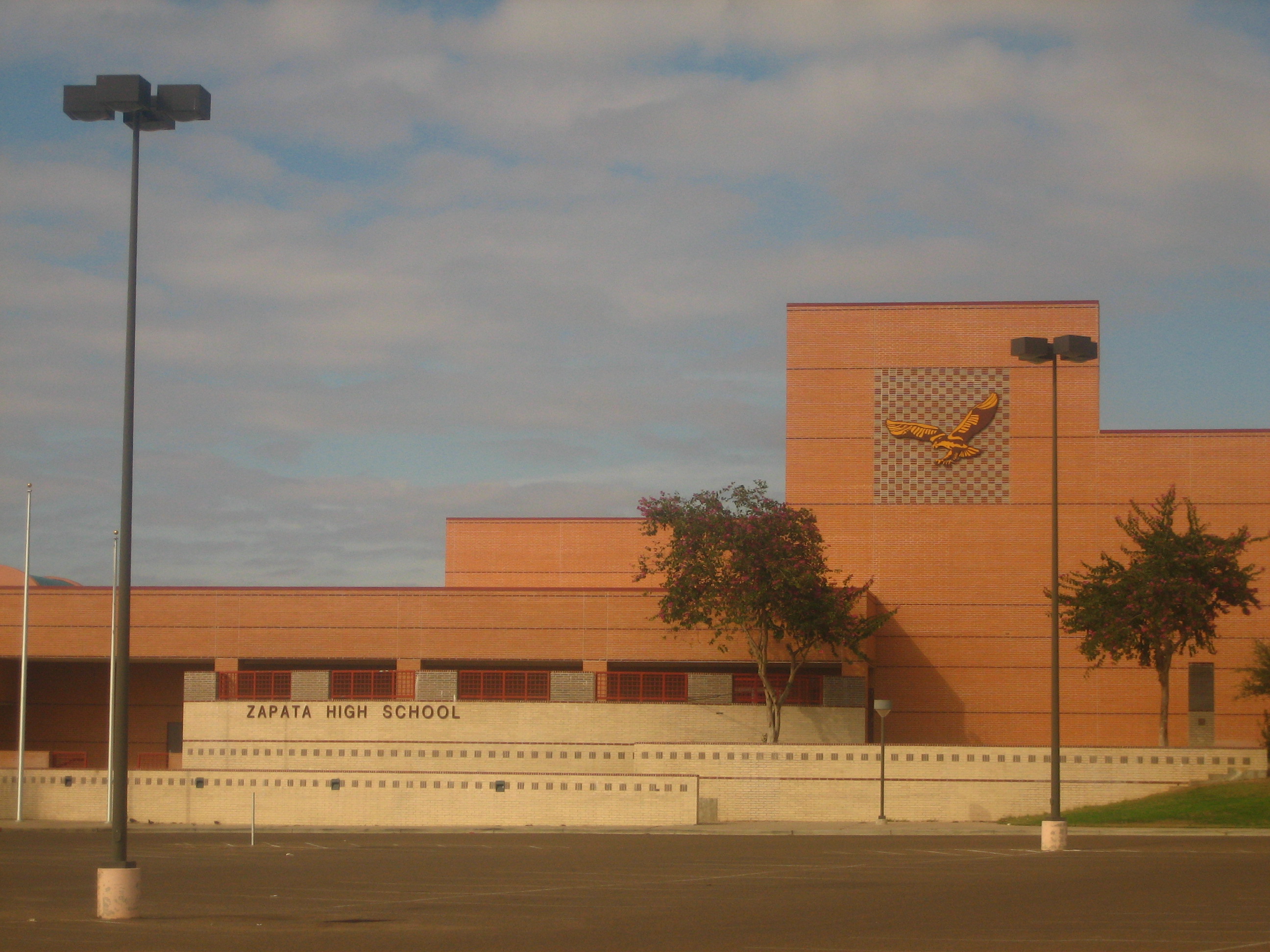
 Zapata High School
 The Olga V. Figueroa Zapata County Public Library.
 The new Our Lady of Lourdes Roman Catholic Church in Zapata has replaced an older sanctuary.
 The rustic Frontier Ranch Museum on State Highway 16 in Zapata
 The First Baptist Church of Zapata, located north of State Highway 16
 The United Methodist Church of Zapata.
 The praying cowboy at Zapata Sesquicentennial Travel Park on U.S. Highway 83 was a flashy and jazzy, and remarkably humble, addition to the town's decor until someone decapitated the poor horse.
 Side view of the Zapata County Courthouse.
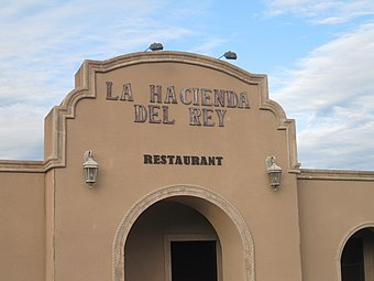 The former La Hacienda Del Rey restaurant in Zapata, is now known as Mariscos El Jarocho.
 The mariachi Herencia Mexicana band from San Antonio is shown performing at the former La Hacienda Del Rey in Zapata.


See also
![]() Texas portal
Texas portal
References
- "U.S. Census website". United States Census Bureau. Retrieved 2008-01-31.
- "US Board on Geographic Names". United States Geological Survey. 2007-10-25. Retrieved 2008-01-31.
- "Find a County". National Association of Counties. Archived from the original on May 31, 2011. Retrieved 2011-06-07.
- Joan B. Anderson, James Gerber Fifty Years of Change on the U.S.-Mexico Border 2008 Page 30 "The town of Zapata was not named for the Mexican revolutionary war hero Emiliano Zapata but rather for Colonel José Antonio Zapata, who lost his life in 1839 while fighting to establish the Republic of the Rio Grande."
- "US Gazetteer files: 2010, 2000, and 1990". United States Census Bureau. 2011-02-12. Retrieved 2011-04-23.
- "US Gazetteer Files 2016-Places-Texas". US Census. Retrieved 9 January 2017.
- "Fishing Falcon Reservoir".
- "National High and Low Temperature for 02/04/2021". Weather Prediction Center. Retrieved 18 February 2021.
- "ZAPATA 1 S, TEXAS - Climate Summary". Western Regional Climate Center. Retrieved 18 February 2021.
- "CENSUS OF POPULATION AND HOUSING (1790-2000)". U.S. Census Bureau. Retrieved March 26, 2012.
- "Explore Census Data". data.census.gov. Retrieved 2022-05-19.
- https://www.census.gov/ [not specific enough to verify]
- "About the Hispanic Population and its Origin". www.census.gov. Retrieved 18 May 2022.
- "U.S. Census Bureau QuickFacts: Zapata CDP, Texas". www.census.gov. Retrieved 2022-09-07.
- "U.S. Census Bureau QuickFacts: Zapata CDP, Texas". www.census.gov. Retrieved 2022-09-07.
- "Zapata Chamber of Commerce | Government". zapatatxcoc.weblinkconnect.com. Archived from the original on 9 February 2013. Retrieved 3 February 2022.
- http://www.zcisd.org/education/district/district.php?sectionid=1/ [permanent dead link]
- "Zapata" at The Oz Report, retrieved 2008-05-14
- Hang Gliding and Paragliding World Records Archived February 12, 2005, at the Wayback Machine, Fédération Aéronautique Internationale (FAI), retrieved 2008-05-14
- Sulzberger, A. G. (12 January 2013). "Two Men, One Sky: A Flight to the Finish". The New York Times.
External links
![]() Media related to Zapata, Texas at Wikimedia Commons
Media related to Zapata, Texas at Wikimedia Commons
- Mariachi High at IMDb
Municipalities and communities of Zapata County, Texas, United States | ||
|---|---|---|
County seat: Zapata | ||
| CDPs |  | |
| ||
Austin (capital) | |
| Topics |
|
| Society |
|
| Regions |
|
| Metropolitan areas |
|
| Counties | See: List of counties in Texas |
Authority control | |
|---|---|
| General | |
| National libraries | |
| Other | |
На других языках
[de] Zapata (Texas)
Zapata ist ein Ort (Census-designated place) im US-Bundesstaat Texas in den Vereinigten Staaten und der Verwaltungssitz des Zapata County. Die Einwohnerzahl lag 2010 bei ca. 5100. Die Siedlung liegt Nahe der Grenze zu Mexiko und über 90 % der Bevölkerung gehört den Hispanics an.- [en] Zapata, Texas
[ru] Запата (Техас)
Запата (англ. Zapata) — невключённая община и статистически обособленная местность в США, расположенная в южной части штата Техас, административный центр одноимённого округа. По данным переписи за 2010 год число жителей составляло 5089 человек[2], по оценке Бюро переписи США в 2016 году в городе проживало 4646 человек[3].Другой контент может иметь иную лицензию. Перед использованием материалов сайта WikiSort.org внимательно изучите правила лицензирования конкретных элементов наполнения сайта.
WikiSort.org - проект по пересортировке и дополнению контента Википедии