world.wikisort.org - USA
Balcones Heights is a city in Bexar County, Texas, United States. The population was 2,746 at the 2020 census, and it was incorporated in 1948. Balcones Heights is an enclave of San Antonio, surrounded entirely by the city, thus some residents and out-of-town visitors erroneously consider it merely a neighborhood of the larger city rather than its own unique community which did so to prevent annexation.
Balcones Heights, Texas | |
|---|---|
City | |
 City Logo | |
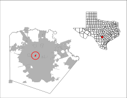 Location of Balcones Heights, Texas | |
 Balcones Heights  Balcones Heights  Balcones Heights | |
| Coordinates: 29°29′23″N 98°32′53″W | |
| Country | United States |
| State | Texas |
| County | Bexar |
| Government | |
| • Type | Type A General Law |
| • City Council | Mayor Suzanne de Leon Stephen Lara Gloria Cantu Juan Lecea Lamar Gillian Miguel Valverde[1] |
| • Interim City Administrator | Gilbert T. Perales |
| Area | |
| • Total | 0.66 sq mi (1.70 km2) |
| • Land | 0.66 sq mi (1.70 km2) |
| • Water | 0.00 sq mi (0.00 km2) |
| Elevation | 830 ft (253 m) |
| Population (2020) | |
| • Total | 2,746 |
| • Density | 5,032.06/sq mi (1,944.32/km2) |
| Time zone | UTC-6 (Central (CST)) |
| • Summer (DST) | UTC-5 (CDT) |
| ZIP code | 78201 |
| Area codes | 210; 726 (assigned) |
| FIPS code | 48-05384[3] |
| GNIS feature ID | 1329967[4] |
| Website | bhtx |
Geography
Balcones Heights is located at 29°29′23″N 98°32′53″W (29.489729, –98.547927),[5] 9 miles northwest of Downtown San Antonio.
According to the United States Census Bureau, the city has a total area of 0.6 square miles (1.6 km2). None of the area is covered with water.
Demographics
| Historical population | |||
|---|---|---|---|
| Census | Pop. | %± | |
| 1950 | 376 | — | |
| 1960 | 950 | 152.7% | |
| 1970 | 2,504 | 163.6% | |
| 1980 | 2,640 | 5.4% | |
| 1990 | 3,022 | 14.5% | |
| 2000 | 3,016 | −0.2% | |
| 2010 | 2,941 | −2.5% | |
| 2020 | 2,746 | −6.6% | |
| U.S. Decennial Census[6] | |||
| Race | Number | Percentage |
|---|---|---|
| White (NH) | 417 | 15.19% |
| Black or African American (NH) | 323 | 11.76% |
| Native American or Alaska Native (NH) | 17 | 0.62% |
| Asian (NH) | 36 | 1.31% |
| Pacific Islander (NH) | 1 | 0.04% |
| Some Other Race (NH) | 13 | 0.47% |
| Mixed/Multi-Racial (NH) | 50 | 1.82% |
| Hispanic or Latino | 1,889 | 68.79% |
| Total | 2,746 |
As of the 2020 United States census, there were 2,746 people, 1,461 households, and 558 families residing in the city.
As of the census[3] of 2000, there were 3,016 people, 1,437 households, and 708 families residing in the city. The population density was 4,674.6 people per square mile (1,791.5/km2). There were 1,539 housing units at an average density of 2,385.4 per square mile (914.2/km2). The racial makeup of the city was 69.66% White, 5.37% African American, 1.56% Native American, 1.13% Asian, 0.03% Pacific Islander, 17.41% from other races, and 4.84% from two or more races. Hispanic or Latino of any race were 69.60% of the population.
There were 1,437 households, out of which 27.2% had children under the age of 18 living with them, 26.2% were married couples living together, 18.2% had a female householder with no husband present, and 50.7% were non-families. 43.6% of all households were made up of individuals, and 7.7% had someone living alone who was 65 years of age or older. The average household size was 2.10 and the average family size was 2.92.
In the city, the population was spread out, with 23.7% under the age of 18, 14.5% from 18 to 24, 33.1% from 25 to 44, 19.5% from 45 to 64, and 9.2% who were 65 years of age or older. The median age was 32 years. For every 100 females, there were 107.1 males. For every 100 females age 18 and over, there were 107.1 males.
The median income for a household in the city was $21,452, and the median income for a family was $27,074. Males had a median income of $21,209 versus $18,944 for females. The per capita income for the city was $13,529. About 18.1% of families and 21.1% of the population were below the poverty line, including 23.6% of those under age 18 and 15.2% of those age 65 or over.
Education
Most of the city is served by San Antonio Independent School District.[10] Most residents of the San Antonio ISD section are zoned to Baskin Academy,[11] with a small portion zoned to Maverick Elementary.[12] All such residents are zoned to Longfellow Middle School,[13] and Jefferson High School, all in San Antonio.[14]
Some of the city is served by the North East Independent School District.[10] The portion is served by Dellview Elementary School,[15] Jackson Middle School,[16] and Lee High School, all in San Antonio.[17]
References
- "Mayor & City Council". City Of Balcones Heights. 3 August 2015. Retrieved 4 May 2020.
- "2019 U.S. Gazetteer Files". United States Census Bureau. Retrieved August 7, 2020.
- "U.S. Census website". United States Census Bureau. Retrieved 2008-01-31.
- "US Board on Geographic Names". United States Geological Survey. 2007-10-25. Retrieved 2008-01-31.
- "US Gazetteer files: 2010, 2000, and 1990". United States Census Bureau. 2011-02-12. Retrieved 2011-04-23.
- "Census of Population and Housing". Census.gov. Retrieved June 4, 2015.
- "Explore Census Data". data.census.gov. Retrieved 2022-05-24.
- http://www.census.gov [not specific enough to verify]
- "About the Hispanic Population and its Origin". www.census.gov. Retrieved 18 May 2022.
- "Zoning Map." City of Balcones Heights. Retrieved on March 24, 2010.
- "Baskin Elementary Attendance Boundary" (Archive). San Antonio Independent School District. Retrieved on June 26, 2016.
- "Maverick Elementary Attendance Boundary" (Archive). San Antonio Independent School District. Retrieved on June 26, 2016.
- "Longfellow Middle Attendance Boundary" (Archive). San Antonio Independent School District. Retrieved on June 26, 2016.
- "Jefferson High Attendance Boundary 2014-2015" (Archive). San Antonio Independent School District. Retrieved on June 26, 2016.
- "Dellview Elementary School[permanent dead link]" Map. North East Independent School District. Retrieved on March 24, 2010.
- "Jackson Middle School[permanent dead link]" Map. North East Independent School District. Retrieved on March 24, 2010.
- "Lee High School Archived 2010-08-06 at the Wayback Machine" Map. North East Independent School District. Retrieved on March 24, 2010.
External links
Municipalities and communities of Bexar County, Texas, United States | ||
|---|---|---|
County seat: San Antonio | ||
| Cities |  | |
| Towns | ||
| CDPs | ||
| Other communities | ||
| Ghost towns |
| |
| Footnotes | ‡This populated place also has portions in an adjacent county or counties | |
| ||
Authority control | |
|---|---|
| General | |
| National libraries | |
Другой контент может иметь иную лицензию. Перед использованием материалов сайта WikiSort.org внимательно изучите правила лицензирования конкретных элементов наполнения сайта.
WikiSort.org - проект по пересортировке и дополнению контента Википедии