world.wikisort.org - USA
Huntley is a village in McHenry and Kane counties, Illinois, United States. As of the 2020 census it had a population of 27,740.[7] It is a part of the Chicago metropolitan area.
This article needs additional citations for verification. (February 2010) |
Huntley, Illinois | |
|---|---|
Village | |
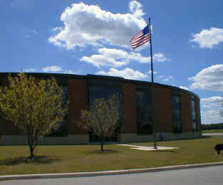 Huntley High School | |
| Etymology: Thomas Stillwell Huntley[1] | |
| Motto(s): The Friendly Village with Country Charm | |
 Location of Huntley in Kane County, Illinois | |
 Location of Illinois in the United States | |
| Coordinates: 42°09′42″N 88°26′03″W | |
| Country | United States |
| State | Illinois |
| Counties | Kane, McHenry |
| Townships | Grafton, Hampshire, Rutland |
| Founded | 1851 |
| Incorporated | 1872 |
| Government | |
| • Type | Council–manager |
| • Village President | Timothy Hoeft |
| Area | |
| • Total | 14.35 sq mi (37.17 km2) |
| • Land | 14.29 sq mi (37.01 km2) |
| • Water | 0.06 sq mi (0.16 km2) |
| Elevation | 889 ft (271 m) |
| Population (2020) | |
| • Total | 27,740 |
| • Density | 1,941.35/sq mi (749.55/km2) |
| Time zone | UTC-6 (CST) |
| • Summer (DST) | UTC-5 (CDT) |
| ZIP Code(s) | 60142 |
| Area code(s) | 847, 224 |
| FIPS code | 17-36750 |
| Website | www |
| [3][4][5][6] | |
Geography
Huntley is in the southern part of McHenry County and the northern part of Kane County, 48 miles (77 km) northwest of the Chicago Loop. Neighboring communities are Lake in the Hills to the northeast, Algonquin to the east, Gilberts to the southeast, Pingree Grove to the south, and Hampshire to the southwest. Unincorporated Union is to the northwest.
According to the 2010 census, Huntley has a total area of 14.102 square miles (36.52 km2), of which 14.07 square miles (36.44 km2) (or 99.77%) are land and 0.032 square miles (0.08 km2) (or 0.23%) are water.[8]
Demographics
| Historical population | |||
|---|---|---|---|
| Census | Pop. | %± | |
| 1880 | 505 | — | |
| 1890 | 550 | 8.9% | |
| 1910 | 773 | — | |
| 1920 | 720 | −6.9% | |
| 1930 | 670 | −6.9% | |
| 1940 | 674 | 0.6% | |
| 1950 | 830 | 23.1% | |
| 1960 | 1,143 | 37.7% | |
| 1970 | 1,432 | 25.3% | |
| 1980 | 1,646 | 14.9% | |
| 1990 | 2,453 | 49.0% | |
| 2000 | 5,730 | 133.6% | |
| 2010 | 24,291 | 323.9% | |
| 2020 | 27,740 | 14.2% | |
| U.S. Decennial Census[9] 2010[10] 2020[11] | |||
2020 census
| Race / Ethnicity | Pop 2010[10] | Pop 2020[11] | % 2010 | % 2020 |
|---|---|---|---|---|
| White alone (NH) | 20,524 | 22,223 | 84.49% | 80.11% |
| Black or African American alone (NH) | 293 | 450 | 1.21% | 1.62% |
| Native American or Alaska Native alone (NH) | 40 | 24 | 0.16% | 0.09% |
| Asian alone (NH) | 1,254 | 1,516 | 5.16% | 5.47% |
| Pacific Islander alone (NH) | 1 | 1 | 0.00% | 0.00% |
| Some Other Race alone (NH) | 25 | 60 | 0.10% | 0.22% |
| Mixed Race/Multi-Racial (NH) | 292 | 883 | 1.20% | 3.18% |
| Hispanic or Latino (any race) | 1,862 | 2,583 | 7.67% | 9.31% |
| Total | 24,291 | 27,740 | 100.00% | 100.00% |
Note: the US Census treats Hispanic/Latino as an ethnic category. This table excludes Latinos from the racial categories and assigns them to a separate category. Hispanics/Latinos can be of any race.
2000 Census
As of the census[5] of 2000, there were 5,730 people, 2,324 households, and 1,756 families residing in the village. The population density was 489.1 inhabitants per square mile (188.8/km2). There were 2,501 housing units at an average density of 213.5 per square mile (82.4/km2). The racial makeup of the village was 94.94% White, 0.44% African American, 0.17% Native American, 2.13% Asian, 0.00% Pacific Islander, 1.26% from other races, and 1.06% from two or more races. 4.28% of the population were Hispanic or Latino of any race.
There were 2,324 households, out of which 31.2% had children under the age of 18 living with them, 67.3% were married couples living together, 5.9% had a female householder with no husband present, and 24.4% were non-families. 20.7% of all households were made up of individuals, and 9.9% had someone living alone who was 65 years of age or older. The average household size was 2.47 and the average family size was 2.85.
In the village, the population was spread out, with 23.3% under the age of 18, 6.1% from 18 to 24, 31.3% from 25 to 44, 22.0% from 45 to 64, and 17.4% who were 65 years of age or older. The median age was 37 years. For every 100 females, there were 95.5 males. For every 100 females age 18 and over, there were 91.8 males.
The median income for a household in the village was $60,456, and the median income for a family was $65,433. Males had a median income of $44,524 versus $30,363 for females. The per capita income for the village was $27,451. 2.8% of the population and 1.9% of families were below the poverty line. 2.2% of those under the age of 18 and 1.9% of those 65 and older were living below the poverty line.
Government
Huntley is governed as a village with an elected village president and a six-member board of trustees. Trustees are elected at-large to four-year staggered terms. The village president is Timothy Hoeft.
Transportation

- The village is located along the "Golden Corridor" of Interstate 90/Northwest Tollway. It has direct access to I-90 via a full interchange at Illinois Route 47. Conversion of the interchange from an eastbound interchange to a full interchange was completed in November 2013.
- Illinois Route 47 serves as the chief north–south artery in Huntley. Handling over 20,000 vehicles a day, Route 47 was expanded from two to five lanes in 2011. Portions of Route 47 between Kreutzer Road and I-90 are six lanes. Route 47 connects to Woodstock to the north and Pingree Grove and Elburn to the south.
- Algonquin Road and Main Street/Huntley-Dundee Road act as the village's primary east–west routes. Algonquin Road is a four-lane divided highway that connects Route 47 to other suburbs to the east like Algonquin and Lake in the Hills. Main Street connects to Marengo and Harmony roads on the west (leading to U.S. Route 20 and towns like Marengo, Hampshire, and Union), while Huntley-Dundee Road connects to the Carpentersville-Dundee area to the east.
- Other important streets in the village include Ruth Road, Reed Road, Kreutzer Road, Haligus Road, Del Webb Boulevard, and Church Street. Reed and Kreutzer are local east–west roads, while Haligus, Ruth, and Church are local north–south streets. Del Webb Boulevard is the primary collector road in the Sun City neighborhood.
- The village is located along a branch of the Chicago & Northwestern Railroad, and thus many of the village's industries are near the railroad for convenient access to Elgin, Rockford, Chicago, and the rest of the continent.
Local newspapers
- Northwest Herald – daily newspaper based in Crystal Lake which serves the greater McHenry County area.
- Northwest Herald MyHometown – Northwest Herald's Huntley MyHometown homepage.
- Daily Herald – daily newspaper based in Arlington Heights; serves cities in five counties incl. McHenry & Kane
- Huntley Farmside – weekly newspaper edited in St. Charles (Kane Co.), published in Downers Grove.
- Sun Day – Biweekly/Weekly newspaper published by White Silo Media, Inc.; serves the communities of Sun City and Edgewater in Elgin.
- The Voice — Monthly newspaper published by students in Huntley High School's journalism program.
References
- "History of Huntley, Illinois". Huntley Area Public Library. 2010. Archived from the original on December 18, 2006. Retrieved 20 March 2010.
- "2020 U.S. Gazetteer Files". United States Census Bureau. Retrieved March 15, 2022.
- U.S. Geological Survey Geographic Names Information System: Village of Huntley
- "Huntley village, Illinois – Population Finder". American FactFinder. United States Census Bureau. 2008. Retrieved 20 March 2010.[permanent dead link]
- "Huntley village, Illinois – Fact Sheet". American FactFinder. United States Census Bureau. 2000. Archived from the original on 6 June 2011. Retrieved 20 March 2010.
- "Huntley village" (PDF). Census 2000, Summary File 3. Northeastern Illinois Planning Commission. 16 February 2004. Retrieved 20 March 2010.
- "Huntley village, Illinois". United States Census Bureau. Retrieved March 13, 2022.
- "G001 – Geographic Identifiers – 2010 Census Summary File 1". United States Census Bureau. Archived from the original on 2020-02-13. Retrieved 2015-08-03.
- "Decennial Census of Population and Housing by Decades". US Census Bureau.
- "P2 HISPANIC OR LATINO, AND NOT HISPANIC OR LATINO BY RACE - 2010: DEC Redistricting Data (PL 94-171) - Huntley village, Illinois". United States Census Bureau.
- "P2 HISPANIC OR LATINO, AND NOT HISPANIC OR LATINO BY RACE - 2020: DEC Redistricting Data (PL 94-171) - Huntley village, Illinois". United States Census Bureau.
External links
Municipalities and communities of McHenry County, Illinois, United States | ||
|---|---|---|
County seat: Woodstock | ||
| Cities |
|  |
| Villages |
| |
| Townships | ||
| CDPs |
| |
| Other communities | ||
| Footnotes | ‡This populated place also has portions in an adjacent county or counties | |
| ||
Municipalities and communities of Kane County, Illinois, United States | ||
|---|---|---|
County seat: Geneva | ||
| Cities |
|  |
| Villages |
| |
| Townships | ||
| CDP | ||
| Other unincorporated communities | ||
| Footnotes | ‡This populated place also has portions in an adjacent county or counties | |
| ||
Chicago metropolitan area | ||
|---|---|---|
| Major city |
|  |
| Cities (over 30,000 in 2010) |
| |
| Towns and villages (over 30,000 in 2010) |
| |
| Counties | ||
| Regions |
| |
| Sub-regions |
| |
Illinois, United States | ||
Springfield (capital) | ||
| Topics |
|  Seal of Illinois |
| Regions |
| |
| Municipalities |
| |
| Counties |
| |
Authority control | |
|---|---|
| General | |
| National libraries | |
Другой контент может иметь иную лицензию. Перед использованием материалов сайта WikiSort.org внимательно изучите правила лицензирования конкретных элементов наполнения сайта.
WikiSort.org - проект по пересортировке и дополнению контента Википедии