world.wikisort.org - USA
Childress (/ˈtʃɪldrɪs/ CHIL-driss) (established 1887; incorporated 1890) is a city in Childress County, Texas, United States. The population was 6,905 at the 2010 census. It is the county seat of Childress County.[6]
Childress, Texas | |
|---|---|
City | |
 Veterans Memorial at the Childress County Courthouse (built 1939) | |
| Motto: Gateway to the Panhandle | |
 Location of Childress, Texas | |
| Coordinates: 34°25′30″N 100°12′50″W | |
| Country | United States |
| State | Texas |
| County | Childress |
| Incorporated | 1890 |
| Government | |
| • Mayor | Cary Preston[1] |
| Area | |
| • Total | 8.31 sq mi (21.53 km2) |
| • Land | 8.26 sq mi (21.39 km2) |
| • Water | 0.05 sq mi (0.14 km2) |
| Elevation | 1,870 ft (570 m) |
| Population (2010) | |
| • Total | 6,105 |
| • Estimate (2019)[3] | 6,048 |
| • Density | 732.20/sq mi (282.71/km2) |
| Time zone | UTC−6 (Central (CST)) |
| • Summer (DST) | UTC−5 (CDT) |
| ZIP code | 79201 |
| Area code | 940 |
| FIPS code | 48-14668[4] |
| GNIS feature ID | 1354393[5] |
| Website | childresstexas |
The city and county were named in honor of George Campbell Childress, a native of Nashville, Tennessee, who was the principal author of the Texas Declaration of Independence. The county and city were incorporated more than four decades after Childress's death.[7]
In December 2015, the Seattle Post-Intelligencer voted Childress ninth among the ten "most conservative" cities in the United States in regard to political contributions. Other West Texas communities in the most conservative lineup are Hereford (No. 1), Monahans (No. 5), and Dalhart in Dallam County in the far northwestern Texas Panhandle (No. 8). Princeton in Collin County north of Dallas ranked No. 2. In contrast, Vashon Island, Washington was named the "most liberal" city in the nation in terms of political donations.[8]
History


Geography
According to the United States Census Bureau, the city has a total area of 8.3 square miles (21 km2), of which 8.2 square miles (21 km2) is land and 0.04 square miles (0.10 km2) is water.
Childress is bordered on the west by Hall County, on the southeast by Hardeman County, on the northeast by Harmon County, Oklahoma, on the north by Collingsworth County, and on the south by Cottle County.[9]
Climate
| Climate data for Childress Municipal Airport, Texas (1981−2010 normals,[10] extremes 1893−present) | |||||||||||||
|---|---|---|---|---|---|---|---|---|---|---|---|---|---|
| Month | Jan | Feb | Mar | Apr | May | Jun | Jul | Aug | Sep | Oct | Nov | Dec | Year |
| Record high °F (°C) | 87 (31) |
95 (35) |
100 (38) |
106 (41) |
111 (44) |
117 (47) |
114 (46) |
115 (46) |
108 (42) |
103 (39) |
93 (34) |
88 (31) |
117 (47) |
| Mean maximum °F (°C) | 76.7 (24.8) |
81.0 (27.2) |
88.7 (31.5) |
94.1 (34.5) |
98.9 (37.2) |
102.1 (38.9) |
104.3 (40.2) |
103.0 (39.4) |
98.0 (36.7) |
92.6 (33.7) |
83.4 (28.6) |
76.3 (24.6) |
106.4 (41.3) |
| Average high °F (°C) | 54.6 (12.6) |
58.2 (14.6) |
67.3 (19.6) |
76.5 (24.7) |
84.1 (28.9) |
91.6 (33.1) |
95.9 (35.5) |
94.7 (34.8) |
87.0 (30.6) |
76.3 (24.6) |
64.8 (18.2) |
54.6 (12.6) |
75.6 (24.2) |
| Average low °F (°C) | 28.3 (−2.1) |
32.1 (0.1) |
39.7 (4.3) |
48.1 (8.9) |
58.4 (14.7) |
66.4 (19.1) |
70.8 (21.6) |
69.4 (20.8) |
61.4 (16.3) |
49.9 (9.9) |
38.5 (3.6) |
29.4 (−1.4) |
49.4 (9.7) |
| Mean minimum °F (°C) | 13.8 (−10.1) |
15.7 (−9.1) |
23.1 (−4.9) |
32.9 (0.5) |
45.1 (7.3) |
56.9 (13.8) |
63.6 (17.6) |
61.6 (16.4) |
46.2 (7.9) |
34.1 (1.2) |
22.5 (−5.3) |
13.9 (−10.1) |
7.4 (−13.7) |
| Record low °F (°C) | −13 (−25) |
−10 (−23) |
2 (−17) |
22 (−6) |
27 (−3) |
44 (7) |
53 (12) |
52 (11) |
34 (1) |
21 (−6) |
6 (−14) |
−5 (−21) |
−13 (−25) |
| Average precipitation inches (mm) | 0.73 (19) |
1.05 (27) |
1.53 (39) |
2.12 (54) |
3.14 (80) |
3.95 (100) |
1.95 (50) |
2.62 (67) |
2.42 (61) |
2.25 (57) |
1.25 (32) |
0.91 (23) |
23.92 (608) |
| Average snowfall inches (cm) | 2.7 (6.9) |
1.1 (2.8) |
0.4 (1.0) |
0.2 (0.51) |
0 (0) |
0 (0) |
0 (0) |
0 (0) |
0 (0) |
0.2 (0.51) |
0.7 (1.8) |
1.7 (4.3) |
7.0 (18) |
| Average precipitation days (≥ 0.01 in) | 3.5 | 4.6 | 5.3 | 5.9 | 8.0 | 8.7 | 5.5 | 6.6 | 6.1 | 6.1 | 4.6 | 4.1 | 69.0 |
| Average snowy days (≥ 0.1 in) | 1.6 | 0.9 | 0.4 | 0.1 | 0 | 0 | 0 | 0 | 0 | 0.1 | 0.2 | 1.6 | 4.9 |
| Source: NOAA[11][12] | |||||||||||||
Demographics
| Historical population | |||
|---|---|---|---|
| Census | Pop. | %± | |
| 1900 | 692 | — | |
| 1910 | 3,818 | 451.7% | |
| 1920 | 5,003 | 31.0% | |
| 1930 | 7,163 | 43.2% | |
| 1940 | 6,464 | −9.8% | |
| 1950 | 7,619 | 17.9% | |
| 1960 | 6,399 | −16.0% | |
| 1970 | 5,408 | −15.5% | |
| 1980 | 5,817 | 7.6% | |
| 1990 | 5,055 | −13.1% | |
| 2000 | 6,778 | 34.1% | |
| 2010 | 6,105 | −9.9% | |
| 2019 (est.) | 6,048 | [3] | −0.9% |
| U.S. Decennial Census[13] | |||
2020 census
| Race | Number | Percentage |
|---|---|---|
| White (NH) | 3,023 | 52.69% |
| Black or African American (NH) | 560 | 9.76% |
| Native American or Alaska Native (NH) | 20 | 0.35% |
| Asian (NH) | 51 | 0.89% |
| Pacific Islander (NH) | 2 | 0.03% |
| Some Other Race (NH) | 14 | 0.24% |
| Mixed/Multi-Racial (NH) | 173 | 3.02% |
| Hispanic or Latino | 1,894 | 33.01% |
| Total | 5,737 |
As of the 2020 United States census, there were 5,737 people, 1,936 households, and 1,316 families residing in the city.
2000 census
As of the census[4] of 2000, there were 6,778 people, 2,116 households, and 1,369 families residing in the city. The population density was 821.8 people per square mile (317.2/km2). There were 2,554 housing units at an average density of 309.7 per square mile (119.5/km2). The racial makeup of the city was 64.52% White, 15.65% African American, 0.34% Native American, 0.34% Asian, 0.06% Pacific Islander, 17.13% from other races, and 1.96% from two or more races. Hispanic or Latino of any race were 22.37% of the population.
There were 2,116 households, out of which 31.3% had children under the age of 18 living with them, 48.9% were married couples living together, 12.6% had a female householder with no husband present, and 35.3% were non-families. 32.8% of all households were made up of individuals, and 18.0% had someone living alone who was 65 years of age or older. The average household size was 2.37 and the average family size was 3.01.
In the city, the population was spread out, with 21.7% under the age of 18, 13.1% from 18 to 24, 31.3% from 25 to 44, 18.3% from 45 to 64, and 15.6% who were 65 years of age or older. The median age was 36 years. For every 100 females, there were 147.7 males. For every 100 females age 18 and over, there were 157.6 males.
The median income for a household in the city was $26,536, and the median income for a family was $33,323. Males had a median income of $25,365 versus $19,442 for females. The per capita income for the city was $11,708. About 14.6% of families and 18.6% of the population were below the poverty line, including 29.5% of those under age 18 and 10.2% of those age 65 or over.
Government
Republican Drew Springer, Jr., a businessman from Muenster in Cooke County, has since January 2013 represented Childress in the Texas House of Representatives.[17]
The Texas Department of Criminal Justice (TDCJ) operates the Childress Distribution Center and the Roach Unit in two locations in Childress.[18][19]
The United States Postal Service operates the Childress Post Office.[20]
Culture and recreation
Fair Park Auditorium is located at the entrance to the city park. Nearby is the stadium for the Childress High School football team.
Education
Childress is served by the Childress Independent School District which operates an elementary school (grades PreK to 5), Childress Elementary School, middle school (grades 6 to 8), Childress Junior High School, and a high school (grades 9 to 12), Childress High School. The high school athletic teams are known as the Bobcats. The primary school color is blue, with secondary colors of white and red. The football team plays in a stadium in Fair Park. Basketball teams play in a gym on high school campus and the baseball team plays on their field located between the campus and Fair Park.
Clarendon College, a two-year community college, maintains a campus in Childress.
In popular media
Texas Chainsaw Massacre film – Childress is mentioned in the movie as the location with the nearest pay phone.
Brokeback Mountain book and movie – In both the movie and the book, Childress serves as the location from which Jack Twist's wife, Lureen, hails.
American Pickers television show – In the episode Law & Hoarder, the show visits a local attorney and picks through his warehouse of memorabilia.
Hell or High Water film – Although the movie was not filmed in Childress, much of the action surrounding the story and characters takes place in Childress.
Media
Radio
- K221FL
- K237EE
- KCTX-AM
- KCTX-FM
Newspaper
- The Red River Sun, formerly The Childress Index
Notable people
- Hardy Brown, NFL Linebacker
- Walter Chrysler, founder of Chrysler Motor Corporation, lived in Childress from 1905 to 1906
- Lou Dobbs, radio host and former anchor and managing editor for CNN's Lou Dobbs Tonight and now a FOX News Anchor
- Margaret A. Edwards, educator and librarian
- Roy Furr, founder of Furr's grocery store and cafeterias chain, lived in Childress County as a youth and worked with his father in Kirkland
- Ruby Gilbert, Kansas state representative
- James "T" Jones, Texas quarterback and Texas Tech Athletic director
- Bubba McDaniel, mixed martial artist fighting for the UFC
Gallery
 Childress welcoming sign
 Childress Municipal Building
 The steeple of the First Baptist Church of Childress (pastor Chad King) can be seen throughout the city.
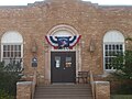 The Childress County Heritage Museum is housed in a former post office building across from the First Baptist Church.
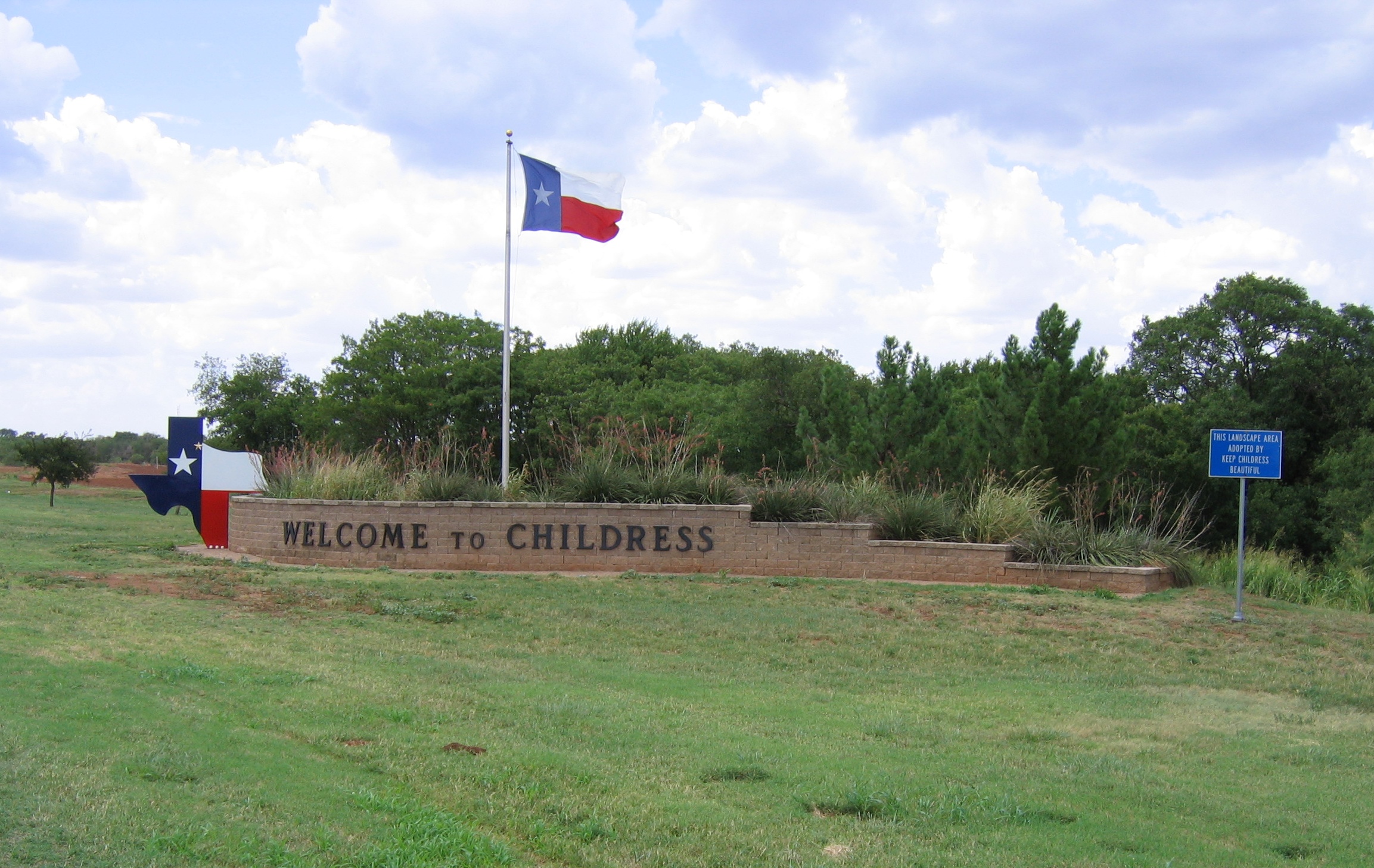
 Sign on Highway 287 directs motorists into downtown Childress.
 Main Street in downtown Childress
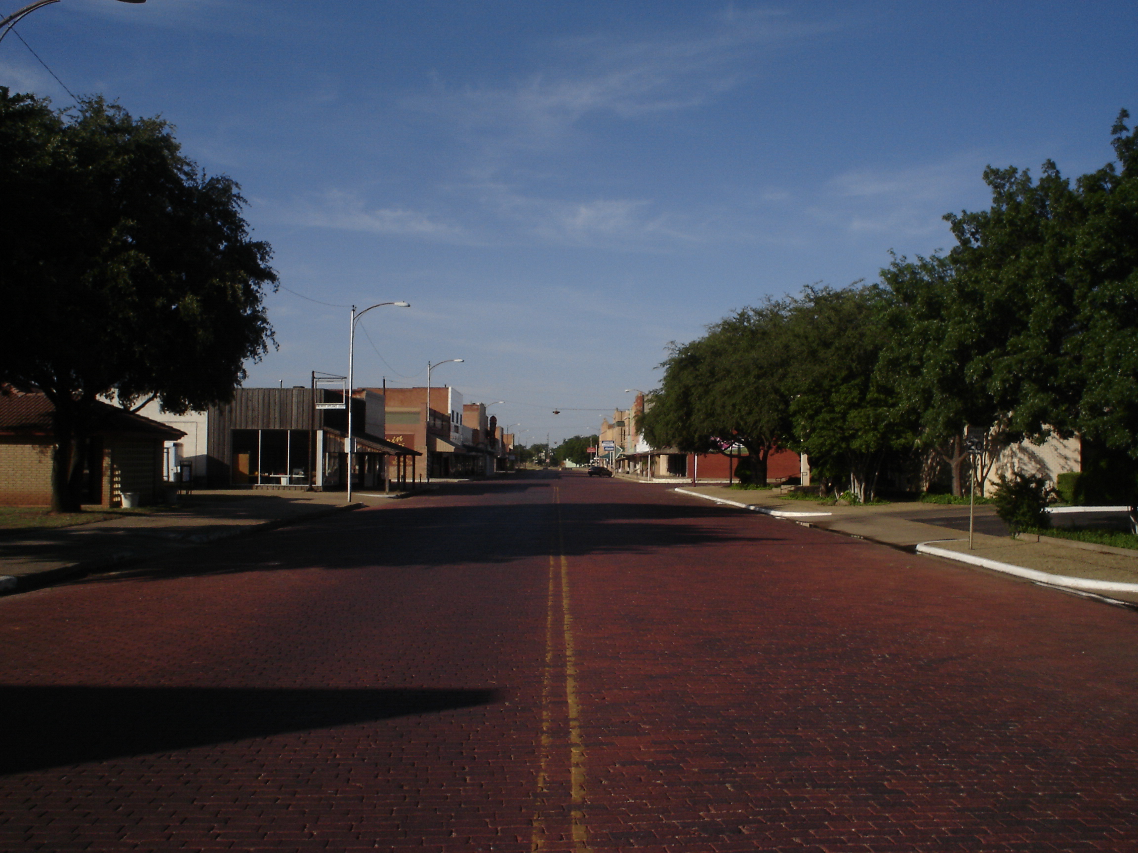
 Brick streets of downtown Childress
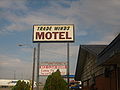 Since the 1950s, the Trade Winds Motel has hosted hunters, truckers, and Colorado-bound vacationers.
 K-Bob's Steakhouse sign in Childress, a Western-theme restaurant
 The refreshing fountain in the summer heat at Fair Park in Childress
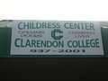 Clarendon College offers two-year courses in Childress.
 Bobcats Stadium in Fair Park in Childress
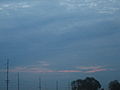 Summer sunset at Childress
 Abandoned buildings off U.S. Highway 83 south of Childress
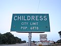 2008 City Limits sign for Childress


References
- "City of Childress, Texas | Your Government". City of Childress, Texas | Official Website. Retrieved 2019-01-08.
- "2019 U.S. Gazetteer Files". United States Census Bureau. Retrieved August 7, 2020.
- "Population and Housing Unit Estimates". United States Census Bureau. May 24, 2020. Retrieved May 27, 2020.
- "U.S. Census website". United States Census Bureau. Retrieved 2008-01-31.
- "US Board on Geographic Names". United States Geological Survey. 2007-10-25. Retrieved 2008-01-31.
- "Find a County". National Association of Counties. Archived from the original on 2015-05-09. Retrieved 2011-06-07.
- H. W. Brands, Lone Star Nation (Anchor Books, 2005), ISBN 1-4000-3070-6
- Daniel DeMay (December 17, 2015). "The most liberal and most conservative cities in the US". The Connecticut Post. Bridgeport, Connecticut. Retrieved December 20, 2015.
- Texas Department of Transportation, Texas State Travel Guide, 2007, pp. 114–115
- Mean monthly maxima and minima (i.e. the expected highest and lowest temperature readings at any point during the year or given month) calculated based on data at said location from 1981 to 2010.
- "NowData – NOAA Online Weather Data". National Oceanic and Atmospheric Administration. Retrieved 2018-03-07.
- "Station Name: TX CHILDRESS MUNI AP". National Oceanic & Atmospheric Administration. Retrieved 2018-03-07.
- "Census of Population and Housing". Census.gov. Retrieved June 4, 2015.
- "Explore Census Data". data.census.gov. Retrieved 2022-05-19.
- http://www.census.gov [not specific enough to verify]
- "About the Hispanic Population and its Origin". www.census.gov. Retrieved 18 May 2022.
- "State Rep. Springer announces district tour July 30". Lubbock Avalanche-Journal, July 16, 2013. Retrieved July 18, 2013.
- "Childress Distribution Center Archived 2010-07-11 at the Wayback Machine." Texas Department of Criminal Justice. Retrieved on May 22, 2010.
- "Roach Unit Archived 2010-07-25 at the Wayback Machine." Texas Department of Criminal Justice. Retrieved on May 22, 2010.
- "Post Office Location - CHILDRESS Archived 2012-06-12 at the Wayback Machine." United States Postal Service. Retrieved on May 22, 2010.
External links
- City of Childress
- Childress, Texas in The Handbook of Texas Online
- Childress Independent School District
- Childress Regional Medical Center
Municipalities and communities of Childress County, Texas, United States | ||
|---|---|---|
County seat: Childress | ||
| City |  | |
| Unincorporated communities | ||
| ||
State of Texas | |
|---|---|
Austin (capital) | |
| Topics |
|
| Society |
|
| Regions |
|
| Metropolitan areas |
|
| Counties | See: List of counties in Texas |
Authority control | |
|---|---|
| General | |
| National libraries | |
| Other |
|
На других языках
- [en] Childress, Texas
[ru] Чилдресс (Техас)
Чи́лдресс (англ. Childress) — город в США, расположенный в северной части штата Техас, административный центр одноимённого округа. По данным переписи за 2010 год число жителей составляло 6105 человек[2], по оценке Бюро переписи США в 2018 году в городе проживало 6203 человека[3].Другой контент может иметь иную лицензию. Перед использованием материалов сайта WikiSort.org внимательно изучите правила лицензирования конкретных элементов наполнения сайта.
WikiSort.org - проект по пересортировке и дополнению контента Википедии