world.wikisort.org - United_Kingdom
Falkirk (/ˈfɔːlkɜːrk/; Scots: Fawkirk; Scottish Gaelic: An Eaglais Bhreac) is one of 32 unitary authority council areas of Scotland. It was formed on 1 April 1996 by way of the Local Government etc. (Scotland) Act 1994 from the exact boundaries of Falkirk District, one of three parts of the Central region created in 1975, which was abolished at that time. Prior to the 1975 reorganisation, the majority of the council area was part of the historic county of Stirlingshire, and a small part, namely Bo'ness and Blackness, was part of the former county of West Lothian.
Falkirk
Fawkirk An Eaglais Bhreac | |
|---|---|
 | |
 | |
| Sovereign state | |
| Country | |
| Lieutenancy area | Stirling and Falkirk |
| Admin HQ | Falkirk |
| Government | |
| • Body | Falkirk Council |
| • Control | SNP minority (council NOC) |
| • MPs |
|
| • MSPs |
|
| Area | |
| • Total | 114.8 sq mi (297.4 km2) |
| • Rank | Ranked 22nd |
| Population (mid-2019 est.) | |
| • Total | 160,340 |
| • Rank | Ranked 11th |
| • Density | 1,400/sq mi (540/km2) |
| ONS code | S12000014 |
| ISO 3166 code | GB-FAL |
| Website | www |
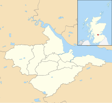
The council area borders with North Lanarkshire, Stirling and West Lothian, and, across the Firth of Forth to the northeast, Clackmannanshire and Fife. The largest town, and the location of the council headquarters, is Falkirk; other settlements, most of which surround Falkirk within 6 miles (9.7 km) of its centre, include Bo'ness, Bonnybridge, Denny, Grangemouth, Larbert, Polmont, Shieldhill, Camelon and Stenhousemuir.
The council is led by the SNP which gained 12 seats in the 2017 Council Election. The incumbent leader of is councillor Cecil Meiklejohn; the provost is Robert Bissett and the deputy provost is David Balfour.
Council political composition
The composition of Falkirk Council is as follows:[1]
| Party | Councillors | |
| Scottish National Party | 13 | |
| Labour | 7 | |
| Conservative | 7 | |
| Independent | 3 |
Electoral wards
For the purposes of elections to Falkirk Council, the Falkirk area is divided geographically into a number of wards which then elect either three or four councillors each by the Single Transferable Vote system. The electoral system of local councils in Scotland is governed by the Local Governance (Scotland) Act 2004, an Act of the Scottish Parliament which first introduced proportional representation to councils. These electoral wards are as follows:
- Ward 1 - Bo'ness and Blackness (3 councillors)
- Ward 2 - Grangemouth (3 councillors)
- Ward 3 - Denny and Banknock (4 councillors)
- Ward 4 - Carse, Kinnaird and Tryst (4 councillors)
- Ward 5 - Bonnybridge and Larbert (3 councillors)
- Ward 6 - Falkirk North (4 councillors)
- Ward 7 - Falkirk South (3 councillors)
- Ward 8 - Lower Braes (3 councillors)
- Ward 9 - Upper Braes (3 councillors)
References
External links
Local government areas of Scotland, in use 1973 to 1996 | ||
|---|---|---|
| Borders |
|  |
| Central Region | ||
| Dumfries and Galloway |
| |
| Fife |
| |
| Grampian |
| |
| Highland |
| |
| Lothian |
| |
| Strathclyde |
| |
| Tayside |
| |
| Island areas1 |
| |
1 The island areas were unitary authorities, combining the powers of a region and a district. | ||
На других языках
[de] Falkirk (Council Area)
Falkirk (gälisch an Eaglais Bhreac) ist eine von 32 Council Areas in Schottland. Sie grenzt an North Lanarkshire, Stirling und West Lothian. Der Verwaltungsbezirk umfasst Teile der traditionellen Grafschaften Stirlingshire und West Lothian.- [en] Falkirk (council area)
[ru] Фолкерк (округ)
Фо́лкерк (англ. Falkirk, гэльск. Eaglais Bhreac, скотс. Fawkirk) — один из 32 округов Шотландии. Граничит с округами Уэст-Лотиан на юго-востоке, Норт-Ланаркшир на юго-западе и Стерлинг на северо-западе. На противоположном берегу залива Ферт-оф-Форт расположен округ Клакманнаншир.Другой контент может иметь иную лицензию. Перед использованием материалов сайта WikiSort.org внимательно изучите правила лицензирования конкретных элементов наполнения сайта.
WikiSort.org - проект по пересортировке и дополнению контента Википедии