world.wikisort.org - United_Kingdom
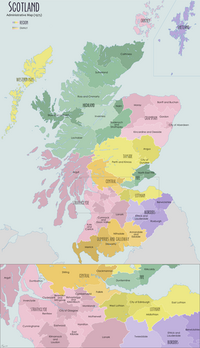
The Stirling council area (Scots: Stirlin; Scottish Gaelic: Sruighlea) is one of the 32 council areas of Scotland, and has a population of about 94,330 (2017 estimate).[1] It was created under the Local Government etc (Scotland) Act 1994 with the boundaries of the Stirling district of the former Central local government region, and it covers most of Stirlingshire (except Falkirk) and the south-western portion of Perthshire. Both counties were abolished for local government purposes under the Local Government (Scotland) Act 1973.
Stirling
Sruighlea Stirlin | |
|---|---|
 Coat of arms  Council logo | |
 | |
| Sovereign state | |
| Country | |
| Lieutenancy area | Stirling and Falkirk |
| Admin HQ | Stirling |
| Government | |
| • Body | Stirling Council |
| • Control | Lab minority (council NOC) |
| • MPs |
|
| • MSPs |
|
| Area | |
| • Total | 844 sq mi (2,187 km2) |
| • Rank | Ranked 9th |
| Population (mid-2019 est.) | |
| • Total | 94,330 |
| • Rank | Ranked 24th |
| • Density | 110/sq mi (43/km2) |
| ONS code | S12000030 |
| ISO 3166 code | GB-STG |
| Website | www |
The administrative centre of the area is the city of Stirling, with the headquarters at Old Viewforth.
The area borders the council areas of Clackmannanshire (to the east), North Lanarkshire (to the south), Falkirk (to the south east), Perth and Kinross (to the north and north east), Argyll and Bute (to the north and north west), and both East and West Dunbartonshire to Stirling's southwest.
The majority of the population of the area is located in its southeast corner, in the city of Stirling and in the surrounding lowland communities: Bridge of Allan and Dunblane to the north, Bannockburn to the immediate south, and the three former coal mining communities of Cowie, Fallin, and Plean, known collectively as the "Eastern Villages".
The remaining 30 percent of the region's population is sparsely distributed across the rural, mainly highland, expanse in the north of the region. The southern half of this rural area comprises the flat western floodplain of the River Forth, bounded on the south by the Touch Hills and the Campsie Fells. North of the glen lie the Trossachs mountains, and the northern half of the region is generally mountainous in character.
The Council

As with all local authorities in Scotland, Stirling Council has a number of multi-member wards electing representatives under the single transferable vote system.
| Party | Councillors | |
|---|---|---|
| Scottish National Party | 8 | |
| Conservative | 7 | |
| Labour | 6 | |
| Green Party | 1 | |
| Independent | 1 |
The wards and their councillors are:
- Bannockburn (3 Councillors): Alasdair MacPherson (Ind), Margaret Brisley (Lab), Brian Hambly (SNP)
- Dunblane and Bridge of Allan (4 Councillors): Douglas Dodds (Con), Graham Houston (SNP), Alasdair Tollemache (Green), Ewan Dillon (Lab).
- Forth and Endrick (3 Councillors): Paul Henke (Con), Rosemary Fraser (SNP), Gerry McGarvey (Lab)
- Stirling East (3 Councillors): Bryan Flannagan (Con), Chris Kane (Lab), Gerry McLaughlan (SNP)
- Stirling North (4 Councillors): Danny Gibson (Lab), Susan McGill (SNP), Rachel Nunn (Con), Jim Thomson (SNP)
- Stirling West (3 Councillors): Neil Benny (Con), Scott Farmer (SNP), Jen Preston (Lab)
- Trossachs and Teith (3 Councillors): Martin Earl (Con), Elaine Watterson (Con), Gene Maxwell (SNP)
The council is currently run as a minority administration by Scottish Labour, after successful negotiations with the Scottish Conservatives. Chris Kane (Lab) was elected as Council Leader, with Councillor Margaret Brisley (Lab) elected as Depute Leader. Councillor Douglas Dodds (Con) is the Provost of Stirling Council.
Settlements

As well as the city of Stirling itself, there are many towns, villages and hamlets spread across the council area, as well as dispersed settlements:
Towns
Villages
- Aberfoyle
- Ashfield
- Balfron
- Balmaha
- Balquhidder
- Blairlogie
- Blanefield
- Buchlyvie
- Cambusbarron
- Cambuskenneth
- Cowie
- Crianlarich
- Croftamie
- Deanston
- Drymen
- Fallin
- Fintry
- Gargunnock
- Gartmore
- Killearn
- Killin
- Kinlochard
- Kippen
- Milton of Buchanan
- Lochearnhead
- Plean
- Port of Menteith
- Strathblane
- Strathyre
- Thornhill
- Tyndrum
Hamlets
- Ardchullarie More
- Ardeonaig
- Arnprior
- Auchlyne
- Balfron Station
- Boquhan
- Buchanan Smithy
- Carbeth
- Dumgoyne
- Gartness
- Inverarnan
- Kilmahog
- Kinbuck
- Milton
- Mugdock
- Stronachlachar
- Throsk
Dispersed settlements
Places of interest
- Carse of Lecropt
- Culcreuch Castle
- Inchmahome Priory (a ruined Augustinian priory on an island in the Lake of Menteith, used as a refuge in 1547 by Mary, Queen of Scots)
- Breadalbane Folklore Centre
- Cambuskenneth Abbey (formerly the seat of the Scottish Parliament)
- Doune Castle
- Dunblane Cathedral
- Falls of Dochart
- Falls of Lochay
- Glen Dochart
- Glenfinlas
- Lake of Menteith
- Lecropt Kirk
- Loch Achray
- Loch Ard
- Loch Earn
- Loch Lomond and the Trossachs National Park
- Loch Katrine (The source of most of the drinking water for the city of Glasgow)
- Loch Rusky
- Loch Venachar
- Moirlannich Longhouse
- Queen Elizabeth Forest Park (run by Forestry and Land Scotland)
- Scottish Institute of Sport (on the grounds of Stirling University)
- Stirling Castle
- The University of Stirling
- The Trossachs
- Wallace Monument
- West Highland Way
References
- "Population Estimates for UK, England and Wales, Scotland and Northern Ireland, Mid-2019". Office for National Statistics. 6 May 2020. Retrieved 6 May 2020.
External links
- Stirling Council official website
- Stirling (council area) at Curlie
На других языках
[de] Stirling (Council Area)
Stirling (gälisch Sruighlea) ist eine von 32 Council Areas in Schottland. Sie grenzt an Argyll and Bute, Clackmannanshire, East Dunbartonshire, Falkirk, North Lanarkshire, Perth and Kinross und West Dunbartonshire.- [en] Stirling (council area)
[ru] Стерлинг (округ, Шотландия)
Сте́рлинг (англ. Stirling, гэльск. Sruighlea) — один из 32 округов Шотландии. Граничит с округами Аргайл-энд-Бьют, Ист-Данбартоншир, Уэст-Данбартоншир, Клакманнаншир, Перт-энд-Кинросс и Фолкерк.Другой контент может иметь иную лицензию. Перед использованием материалов сайта WikiSort.org внимательно изучите правила лицензирования конкретных элементов наполнения сайта.
WikiSort.org - проект по пересортировке и дополнению контента Википедии
