world.wikisort.org - United_Kingdom
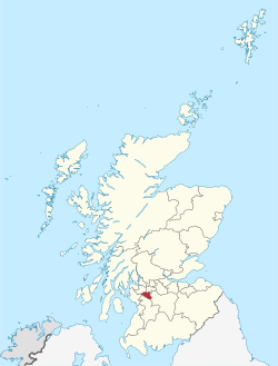
East Renfrewshire (Scots: Aest Renfrewshire; Scottish Gaelic: Siorrachd Rinn Friù an Ear) is one of 32 council areas of Scotland. Until 1975, it formed part of the county of Renfrewshire for local government purposes along with the modern council areas of Renfrewshire and Inverclyde. Although no longer a local authority area, Renfrewshire still remains the registration county and lieutenancy area of East Renfrewshire.
This article needs additional citations for verification. (June 2018) |
East Renfrewshire Aest Renfrewshire Siorrachd Rinn Friù an Ear | |
|---|---|
 | |
|
Council Logo | |
| Coordinates: 55°47′54″N 4°17′27″W | |
| Sovereign state | United Kingdom |
| Country | Scotland |
| Lieutenancy area | Renfrewshire |
| Admin HQ | Giffnock |
| Government | |
| • Body | East Renfrewshire Council |
| • Control | Lab + Ind (council Independent/Labour) |
| • MPs | Kirsten Oswald (SNP – East Renfrewshire) |
| • MSPs | • Jackson Carlaw (Conservative – Eastwood) • Tom Arthur (SNP – Renfrewshire South) |
| Area | |
| • Total | 67.3 sq mi (174.2 km2) |
| • Rank | Ranked 28th |
| Population (mid-2019 est.) | |
| • Total | 95,170 |
| • Rank | Ranked 23rd |
| • Density | 1,400/sq mi (550/km2) |
| ONS code | S12000011 |
| ISO 3166 code | GB-ERW |
| Website | www |
The East Renfrewshire local authority was formed in 1996, as a successor to the Eastwood district, with the Levern Valley (which came from Renfrew district) being annexed. East Renfrewshire has borders with East Ayrshire, Glasgow, Renfrewshire, South Lanarkshire, and North Ayrshire.
East Renfrewshire Council
The composition of East Renfrewshire Council following the 5 May 2022 local elections:
Council leader: Cllr Owen O'Donnell (Labour) Civic Leader: Provost Mary Montague (Labour).[1] Political composition:
| Party | Members | |
|---|---|---|
| SNP | 6 | |
| Conservative | 5 | |
| Labour | 5 | |
| Independent | 2 | |
Wards

Six multi-member wards (20 seats) were created for the 2007 election, replacing 20 single-member wards which had been in place since the creation of the council in 1995. This representation decreased to 18 seats across five renamed and redrawn wards for the 2017 election:[2]
- Barrhead, Liboside and Uplawmoor (4 seats)
- Newton Mearns North and Neilston (3 seats)
- Giffnock and Thornliebank (3 seats)
- Clarkston, Netherlee and Williamwood (4 seats)
- Newton Mearns South and Eaglesham (4 seats)
Elections
- 1995 East Renfrewshire Council election
- 1999 East Renfrewshire Council election
- 2003 East Renfrewshire Council election
- 2007 East Renfrewshire Council election
- 2012 East Renfrewshire Council election
- 2017 East Renfrewshire Council election
- 2022 East Renfrewshire Council election
Reader's Digest poll
In a 2007 Reader's Digest poll, East Renfrewshire was voted the second best place in Britain to raise a family, ranking just behind East Dunbartonshire to the north of Glasgow.[3]
In January 2008, East Renfrewshire became the first Scottish local authority to create a Facebook page to publicise its services.[4]
Demographics
The results of the 2001 census were as follows:
- White - 96.19% - 86,196
- White British - 93.49% - 83,776
- White Irish - 1.3% - 1165
- Other White - 1.4% - 1255
- Mixed Race - 0.21% - 188
- South Asian - 2.93% - 2,626
- Indian - 0.77% - 690
- Pakistani - 1.98% - 1774
- Bangladeshi - 0.01% - 9
- Other South Asian - 0.17% - 153
- Black - 0.071% - 63
- Black Caribbean - 0.03% - 27
- Black African - 0.04% - 35
- Other Black - 0.001% - 1
- Chinese - 0.38% - 340
- Other - 0.21% - 197
A 2011 survey showed that 41% of Scotland's Jewish population live in East Renfrewshire, making up 2.4% of the area's population.[5]
Business
East Renfrewshire is home to many small to medium businesses. The interests of these businesses are looked after by the East Renfrewshire Chamber of Trade & Commerce.
The local newspapers are the Barrhead News, covering the local authority with emphasis on the western half of the area, which primarily includes the town of Barrhead and the villages of Neilston and Uplawmoor, and the Glasgow South and Eastwood Extra, which is delivered free to homes and businesses, which has its emphasis on the eastern half of the local authority, but also covers news across the western half as well as the south of Glasgow.
History
This section needs additional citations for verification. (October 2020) |
The earliest evidence of human activity in the area is traces of an iron-age fort in the Busby area and a pre-Roman settlement in what is now Overlee Park, in Clarkston. These early buildings that predate any maps show the land around would have been suitable for farming, which retained its importance thousands of years later, when the earliest documentation of habituation was of the 230 residents of Muirend in 1435. At the time, the village was surrounded by farmland. The village was mostly in modern-day Glasgow but did cross slightly over into modern day Netherlee, which is part of East Renfrewshire. The villagers were predominantly Irish and worked at the paper mill on the nearby White Cart Water. The farmlands were owned by the Maxwells, a rich and influential family who owned land and important buildings all over Glasgow, growing and building more with each generation, including the building of the Pollok House in Pollok Park in C.1700.
The surrounding lands were known collectively under the name "Lee", but separated into the smaller districts as they are today in 1678, when John Maxwell, owner of the lands was found guilty of assisting the covenanting cause and forced to give up his lands, and his servants were sent as slaves to the West Indies. The areas around his house were named 'Williamwood' after the mansion itself and the lower parts of the lands of 'Lee' were adequately renamed 'Netherlee'. The higher parts of the lands of 'Lee' were named Midlee and Overlee. Today, the name Midlee has gone and much of what used to be Midlee and Overlee is now the neighbourhood of Stamperland, which has a park named Overlee Park located within, as well as the old Overlee farmhouse. A small neighbourhood on the other side of the railway is still known as Overlee today. Some suburbs also retain the name Williamwood, North Williamwood, located in Netherlee, and the much larger South Williamwood, located in Clarkston. South Williamwood also has Williamwood railway station located there. Williamwood House was rebuilt multiple times, but the house still exists as a care home in North Williamwood, overlooking Williamwood Golf Course.
Giffnock expanded rapidly when many of the workers of the Giffnock Quarries (opened in 1835 and whose honey-coloured stones can be found in Glasgow University, Central Station, the old Co-op building on Morrison St, and many buildings worldwide) moved there due to the linking of the two sites by rail in 1866.
Around this time the area around the border with Glasgow (East Renfrewshire's Netherlee and most of Glasgow's Muirend and Cathcart) remained farmlands, dominated by the massive 'Bogton's Farm & Dairy' building on the Glasgow side (situated at what used to be the first Safeway supermarket in Scotland, but is now the Muirend Sainsbury's supermarket) owned by John M. Hamilton, dairy farmer and horse enthusiast. The lands to the left of his farm were a training ground for his horses, and his favourite was a Spanish horse by the name of "Toledo", which cinema builder William Beresford Inglis took as the name of his Toledo Cinema which was built on that spot in 1933. The cinema was closed on 21 October 2001 to make way for 30 new 2 bedroom flats, but the art-deco façade was kept and restored.
The building of the cinema was in response to the need for entertainment in the area, which had since grown to a population of around 4,000. New stone residential buildings had been built over the period of 15 years due to resource shortage during the war, the last house not being finished until 1925, at first being used to house evacuees during World War I. This area would become known as Netherlee.
In 1941, Rudolf Hess, one of Adolf Hitler's top deputies within the Nazi Party, parachuted into Floors Farm, near the village of Waterfoot, on a secret mission to meet the Duke of Hamilton and Brandon for peace negotiations. The botched landing led to his capture and arrest.
Growth continued slowly during the second half of the 20th century, however tragedy struck when at around 3pm on 21 October 1971, a huge gas explosion destroyed a large part of a building on Clarkston's main street. The blast killed 21, and injured more than 100, as the blast caught a passing bus and caused the upper-level car park to collapse. The building was repaired and in parts rebuilt, and a plaque mourning the event can be found on the building, by the entrance to the neighbouring Clarkston railway station, together with an anniversary plaque and tree in the car park of the nearby Clarkston Hall.[6]
East Renfrewshire has a strong legacy in education and in 2007, St. Mark's RC Primary in Barrhead received an outstanding HMIe report with 11 'excellents', making St. Mark's the highest ranked school in Scotland. The second highest ranked school in Scotland is also in East Renfrewshire; Our Lady of the Missions Primary School in Giffnock achieved nine "excellents" in its HMIE report in October 2006.[7] However, the reputation for excellence in education was damaged in 2011 when East Renfrewshire Council opted to close Robslee Primary School and to give the Robslee building over to Our Lady of The Missions Primary from August 2014. This was a hugely unpopular local decision and the consultation met with strong local objection.[citation needed] Despite this, Director of Education, John Wilson OBE, recommended to the council that Robslee should close to give their accommodation to Our Lady of The Missions Primary School [citation needed].
References
- "Local government election results 2022".
- "United Kingdom: Scotland | Council Areas and Electoral Wards". City Population. 30 June 2019. Retrieved 28 March 2021.
- "Scots areas top happy family poll". BBC News. 18 April 2007.
- Macleod, Fiona (31 January 2008). "East Renfrewshire uses Facebook to boost its libraries and sports centres". The Scotsman. Archived from the original on 21 October 2008.
- "Religion - East Renfrewshire Council". www.eastrenfrewshire.gov.uk. Archived from the original on 4 April 2019.
- Information on the Clarkston Gas Explosion.
- BBC News - Primary School 'best in Scotland' - 23 October 2006
External links
- East Renfrewshire Council official website
- East Renfrewshire at Curlie
- East Renfrewshire Online
- East Renfrewshire Events Guide
- East Renfrewshire History - Parishes of Cathcart, Eastwood & Mearns
| Authority control |
|
|---|
На других языках
[de] East Renfrewshire
East Renfrewshire (gälisch Siorrachd Rinn Friù an Ear) ist eine von 32 Council Areas in Schottland. Sie grenzt an North Ayrshire, East Ayrshire, Renfrewshire, South Lanarkshire und Glasgow. Von 1975 bis 1996 bildete East Renfrewshire (ohne Barrhead) unter dem Namen Eastwood einen District der Region Strathclyde.- [en] East Renfrewshire
[ru] Ист-Ренфрушир
Ист-Ренфрушир[1] (англ. East Renfrewshire, гэльск. Siorrachd Rinn Friù an Ear) — один из 32 округов Шотландии. Граничит с округами Ист-Эршир, Норт-Эршир, Глазго-Сити, Саут-Ланаркшир и Ренфрушир.Другой контент может иметь иную лицензию. Перед использованием материалов сайта WikiSort.org внимательно изучите правила лицензирования конкретных элементов наполнения сайта.
WikiSort.org - проект по пересортировке и дополнению контента Википедии