world.wikisort.org - United_Kingdom
Tamfourhill is a working-class residential suburb of Falkirk within the Falkirk (council area), Scotland. It is located approximately 1.5 miles (2.5 kilometres) west of the city centre.[3] The Falkirk Wheel is located just to the northwest of the village. Tamfourhill includes the residential area between the south side of the Forth & Clyde Canal and the north side of the Union Canal.[4] It also contains the Tamfourhill Industrial Estate. To the west of the village is a well preserved part of the Antonine Wall, built in the 2nd century and Rough Castle.
| |
|---|---|
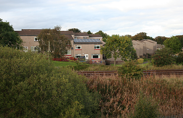 These modirn hooses are close to the site of Tamfourhill, which, apparently vanished, like so many other old buildings, in the second half of the 20th century. | |
 Tamfourhill Location within the Falkirk council area | |
| Population | 1,300 (2018)[1][2] |
| OS grid reference | NS858797 |
| Civil parish | |
| Council area | |
| Lieutenancy area |
|
| Country | Scotland |
| Sovereign state | United Kingdom |
| Post town | FALKIRK |
| Postcode district | FK1 |
| Dialling code | 01324 |
| Police | Scotland |
| Fire | Scottish |
| Ambulance | Scottish |
| UK Parliament |
|
| Scottish Parliament |
|
References
- Tamfourhill - 03 (715), Scottish Government Statistics
- Tamfourhill - 04 (642), Scottish Government Statistics
- "Tamfourhill". Scottish Gazetteer. Retrieved 21 January 2011.
- "Tamfourhill". Central Scotland Police. Archived from the original on 8 February 2006. Retrieved 21 January 2011.
External links
Wikimedia Commons has media related to Tamfourhill.
This Falkirk location article is a stub. You can help Wikipedia by expanding it. |
Текст в блоке "Читать" взят с сайта "Википедия" и доступен по лицензии Creative Commons Attribution-ShareAlike; в отдельных случаях могут действовать дополнительные условия.
Другой контент может иметь иную лицензию. Перед использованием материалов сайта WikiSort.org внимательно изучите правила лицензирования конкретных элементов наполнения сайта.
Другой контент может иметь иную лицензию. Перед использованием материалов сайта WikiSort.org внимательно изучите правила лицензирования конкретных элементов наполнения сайта.
2019-2025
WikiSort.org - проект по пересортировке и дополнению контента Википедии
WikiSort.org - проект по пересортировке и дополнению контента Википедии