world.wikisort.org - Turkey
Şırnak (Kurdish: Şirnex)[3][4] is a town and district in southeastern Turkey. It is the capital of Şırnak Province. The Habur border gate with Iraq which is one of Turkey's main links to the Kurdistan Region and Iraq is also on Şırnak.
This article uses bare URLs, which are uninformative and vulnerable to link rot. (August 2022) |
Şırnak | |
|---|---|
Municipality | |
 Şırnak Municipality Building | |
 Şırnak  Şırnak  Şırnak | |
| Coordinates: 37°30′59″N 42°27′40″E | |
| Country | Turkey |
| Province | Şırnak |
| Government | |
| • Mayor | Mehmet Yarka (AKP) |
| • Governor | Mehmet Aktaş |
| Area | |
| • District | 1,863.61 km2 (719.54 sq mi) |
| Elevation | 1,650 m (5,410 ft) |
| Population (2012)[2] | |
| • Urban | 63,298 |
| • District | 87,719 |
| • District density | 47/km2 (120/sq mi) |
| Website | www.sirnak.bel.tr www.sirnak.gov.tr |
Composition of Şırnak District
| Settlement | Ethnicity (tribe) |
|---|---|
| Şırnak (Şirnex) | Kurdish (Şirnexî)[5] |
| Akçay (Dêra) | Kurdish (Dêrşewî)[6] |
| Araköy (Kirun) | Kurdish (Berwarî)[7] |
| Atbaşı (Fêrisan) | Kurdish (Botikan)[8] |
| Bağpınar (Çînete) | Kurdish (Botikan)[8] |
| Balveren (Melê) | Kurdish (Berwarî)[7] |
| Başağaç (Medikeyan) | Kurdish (Botikan)[8] |
| Dağkonak (Nerex) | Kurdish (Berwarî)[7] |
| Geçitboyu (Bîryan) | Kurdish (Berwarî)[7] |
| Güneyce (Banê) | Kurdish (Botikan)[8] |
| Güneyçam (Navyan) | Kurdish (Botikan)[8] |
| Ikizce (Milga Şantiyê) | |
| Kasrik | Kurdish (Botikan)[8] |
| Kavuncu (Nanîp) | Kurdish (Botikan)[8] |
| Kayaboyun (Şerefî) | Kurdish (Dêrşewî)[6] |
| Kırkkuyu (Deştalela) | Kurdish (Dêrşewî)[6] |
| Kızılsu (Zûrîn) | Kurdish (Botikan)[8] |
| Koçbeyi (Banê Mihinda) | Kurdish (Botikan)[8] |
| Körüklükaya (Nehke) | |
| Kumçatı (Dergul) | Kurdish (Botikan)[8] |
| Toptepe (Avka meziyan) | Kurdish (Botikan)[8] |
| Yeniaslanbaşar (Mila Kere) | Kurdish (Botikan)[8] |
| Yoğurtçular (Heştan) | Kurdish (Şirnexî)[5] |
History

1992 Turkish military operation
On 18 August 1992, fighting broke out between Turkish security forces and Kurdish separatists of the PKK. 20,000 out of 25,000 residents fled the city during the three days of fighting.
While the town was under bombardment, there was no way to get an account of what was happening in the region as journalists were prevented from entering the city centre which was completely burned down by the security forces. Şırnak was under fire for three days and tanks and cannons were used to hit buildings occupied by civilians.[9]
2016 Turkish military operation
On 13 March 2016 military operations by Turkish security forces began against PKK. The military curfew imposed on the Kurdish city was lifted after 246 days. Neighbourhoods like Gazipaşa, Yeşilyurt, İsmetpaşa, Dicle, Cumhuriyet and Bahçelievler were completely destroyed in the war.[10]
Politics
On 15 October 2011 it was announced that the Ministry of the Interior had suspended him from his functions.[11]
On March 29, 2019, elections, the mayor of Sirnak became AKP Mehmet Yarka (19.718 or 61,72%).[12]
Geography
The population of Şırnak province is 430,424 (2009 census) living in an area extending over 7,172 square kilometers. The population of the Şırnak city is 63,664. The total fertility rate is one of the highest in Turkey at 3.21 children per woman.
Climate
Şırnak has a hot-summer Mediterranean climate (Köppen: Csa, Trewartha: Cs) with chilly, snowy winters and very hot, dry summers. Humidity is always low throughout the year due to its inland location. February and March are the wettest months, July and August are the driest, with virtually no precipitation at all.
| Climate data for Şırnak (1991–2020, extremes 1970–2020) | |||||||||||||
|---|---|---|---|---|---|---|---|---|---|---|---|---|---|
| Month | Jan | Feb | Mar | Apr | May | Jun | Jul | Aug | Sep | Oct | Nov | Dec | Year |
| Record high °C (°F) | 18.1 (64.6) |
17.3 (63.1) |
24.8 (76.6) |
29.0 (84.2) |
31.8 (89.2) |
37.5 (99.5) |
40.4 (104.7) |
40.3 (104.5) |
37.1 (98.8) |
31.3 (88.3) |
22.6 (72.7) |
22.5 (72.5) |
40.4 (104.7) |
| Average high °C (°F) | 5.9 (42.6) |
7.4 (45.3) |
12.0 (53.6) |
16.7 (62.1) |
23.0 (73.4) |
30.1 (86.2) |
34.2 (93.6) |
34.0 (93.2) |
29.4 (84.9) |
22.0 (71.6) |
13.5 (56.3) |
8.4 (47.1) |
19.7 (67.5) |
| Daily mean °C (°F) | 2.6 (36.7) |
3.8 (38.8) |
8.1 (46.6) |
12.5 (54.5) |
18.7 (65.7) |
25.3 (77.5) |
29.5 (85.1) |
29.3 (84.7) |
24.7 (76.5) |
17.8 (64.0) |
9.9 (49.8) |
5.1 (41.2) |
15.6 (60.1) |
| Average low °C (°F) | −0.4 (31.3) |
0.5 (32.9) |
4.2 (39.6) |
8.2 (46.8) |
13.9 (57.0) |
20.1 (68.2) |
24.3 (75.7) |
24.1 (75.4) |
19.7 (67.5) |
13.3 (55.9) |
6.0 (42.8) |
1.7 (35.1) |
11.3 (52.3) |
| Record low °C (°F) | −14.5 (5.9) |
−13.2 (8.2) |
−11.2 (11.8) |
−4.7 (23.5) |
0.8 (33.4) |
9.2 (48.6) |
13.1 (55.6) |
15.0 (59.0) |
3.2 (37.8) |
−0.5 (31.1) |
−5.0 (23.0) |
−10.8 (12.6) |
−14.5 (5.9) |
| Average precipitation mm (inches) | 107.3 (4.22) |
103.8 (4.09) |
125.8 (4.95) |
115.1 (4.53) |
52.6 (2.07) |
5.3 (0.21) |
6.1 (0.24) |
0.7 (0.03) |
13.2 (0.52) |
54.6 (2.15) |
82.5 (3.25) |
101.2 (3.98) |
768.2 (30.24) |
| Average precipitation days | 9.04 | 9.11 | 10.52 | 10.44 | 6.74 | 1.70 | 0.78 | 0.48 | 1.07 | 5.81 | 7.63 | 10.22 | 73.5 |
| Mean monthly sunshine hours | 96.1 | 121.5 | 170.5 | 219.0 | 263.5 | 318.0 | 347.2 | 350.3 | 306.0 | 223.2 | 153.0 | 99.2 | 2,667.5 |
| Mean daily sunshine hours | 3.1 | 4.3 | 5.5 | 7.3 | 8.5 | 10.6 | 11.2 | 11.3 | 10.2 | 7.2 | 5.1 | 3.2 | 7.3 |
| Source: Turkish State Meteorological Service[13] | |||||||||||||
References
- "Area of regions (including lakes), km²". Regional Statistics Database. Turkish Statistical Institute. 2002. Retrieved 2013-03-05.
- "Population of province/district centers and towns/villages by districts - 2012". Address Based Population Registration System (ABPRS) Database. Turkish Statistical Institute. Retrieved 2013-02-27.
- Jwaideh, Wadie (1919-03-19). The Kurdish national movement: its. ISBN 9780815630937. Retrieved 2010-08-22 – via Google Books.
- "Koerdisch kind blind geraakt door Turkse politie". Rudaw.nl. Retrieved 2010-08-22.
- Baz, Ibrahim (2016). Şırnak aşiretleri ve kültürü (in Turkish). p. 114. ISBN 9786058849631.
- Baz, Ibrahim (2016). Şırnak aşiretleri ve kültürü (in Turkish). p. 131. ISBN 9786058849631.
- Baz, Ibrahim (2016). Şırnak aşiretleri ve kültürü (in Turkish). p. 121. ISBN 9786058849631.
- Baz, Ibrahim (2016). Şırnak aşiretleri ve kültürü (in Turkish). p. 76. ISBN 9786058849631.
- nytimes
- "246 Days After Curfew and Siege: Sirnak in Photos - KurdishQuestion.com". Archived from the original on 2016-11-17.
- "31 elected Kurdish politicians dismissed without waiting trials' results". Dicle News Agency. 2011-10-15. Retrieved 2011-10-16.
- http://www.hurriyetdailynews.com/secim/31-mart-2019-yerel-secimleri/sirnak-belediye-baskani-adaylari
- "Resmi İstatistikler: İllerimize Ait Mevism Normalleri (1991–2020)" (in Turkish). Turkish State Meteorological Service. Retrieved 3 May 2021.
Şırnak in Şırnak Province of Turkey | |||||||||||||||||||||||||||
|---|---|---|---|---|---|---|---|---|---|---|---|---|---|---|---|---|---|---|---|---|---|---|---|---|---|---|---|
| Districts |  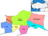 | ||||||||||||||||||||||||||
|
Metropolitan municipalities are bolded. | |||||||||||||||||||||||||||
Authority control | |
|---|---|
| General |
|
| National libraries | |
На других языках
[de] Şırnak
Şırnak (kurdisch .mw-parser-output .Arab a,.mw-parser-output a bdi.Arab{text-decoration:none!important}.mw-parser-output .Arab{font-size:120%}Şirnex) ist eine Stadt in der türkischen Region Südostanatolien. Gleichzeitig ist sie Hauptort der 1990 gegründeten Provinz und des zentralen Landkreises (Merkez İlçe). Die Kreisstadt vereint zwei Drittel der Bevölkerung des gesamten Landkreises.- [en] Şırnak
[es] Şırnak
Şırnak es una ciudad y distrito situada en la región de Anatolia Suroriental, en Turquía, y la capital de la provincia de Şırnak. Cuenta con una población de 54 302 habitantes[2] (2007). El nombre de la ciudad significa "castillo roto".[ru] Ширнак
Ширнак[1] (тур. Şırnak) — город и район в провинции Ширнак (Турция), административный центр провинции.Другой контент может иметь иную лицензию. Перед использованием материалов сайта WikiSort.org внимательно изучите правила лицензирования конкретных элементов наполнения сайта.
WikiSort.org - проект по пересортировке и дополнению контента Википедии