world.wikisort.org - Turkey
Kartal is a district of Istanbul, Turkey, located on the Asian side of the city, on the coast of the Marmara Sea between Maltepe and Pendik.
Kartal | |
|---|---|
District | |
 | |
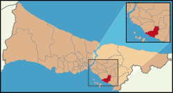 Location of Kartal in Istanbul | |
 Kartal | |
| Coordinates: 40°53′14″N 29°11′24″E | |
| Country | Turkey |
| City | Istanbul |
| Settled | 6th century |
| Government | |
| • Mayor | Gökhan Yüksel (CHP) |
| • Governor | Abdullah Demir |
| Area | |
| • District | 34.43 km2 (13.29 sq mi) |
| Population (2018)[2] | |
| • District | 461.155 |
| • District density | 13/km2 (35/sq mi) |
| Time zone | UTC+3 (TRT) |
| Area code | 0-216 |
| Website | www www |
Despite being far from the city centre, Kartal is heavily populated (total population of 541,209) (2008 census). The total land area is 147,000 m2, which includes some countryside areas inland. The district's neighbours are Maltepe to the west, Sultanbeyli and Sancaktepe to the north and Pendik to the east. Inland from the coast, the land rises sharply up to the hills Yakacık and Aydos, the latter of which is the highest point in Istanbul.[3]
History
Kartal ('eagle' in Turkish, although etymologically inaccurate) was a fishing village on the shore of the Marmara Sea during the Byzantine Empire, called Kartalimen or Kartalimin in Greek, and was founded at the beginning of the 6th century. In the 11th century, the town was conquered by the ruler of the Seljuks, Suleyman Shah. In 1329, Kartal became part of the Ottoman Empire, the Byzantines re-took the city in 1403, however, and held it for 17 years before losing it to the Ottomans again.[4][5]
According to the Ottoman General Census of 1881/82-1893, the kaza of Kartal had a total population of 12.969, consisting of 6.920 Greeks, 5.095 Muslims, 869 Armenians, 3 Catholics, 1 Jew and 81 foreign citizens.[6]
By 1947, Kartal was an industrial area and with the introduction of commuter trains to Haydarpaşa Terminal from Gebze in 1973, Kartal became even more important as an industrial area of Istanbul. However, the current trend is that factories are being closed down and moved inland. For example, the large cement factory on the shore, which is to be converted into a cultural center, was closed in 2003.[7]
There is a historical Roman bath ruin near Dragos Hill, which is being recovered by the Istanbul Archaeology Museums, with the financial support of Kartal Municipality.[8][9]
Kartal today
Luxury apartment complexes have been built on the coast, along with much more housing inland and this has attracted more shops and infrastructure.
There are a number of well-known private and state schools in the area, Maltepe University is the private university of Kartal.
Housing is of good-quality in general.[citation needed] Building near the coast slowed after the 1999 earthquake, when people became aware that a major fault line runs just off this coast. However, building on the high ground inland is proceeding apace.
On 4 June 2007, the Greater Istanbul Municipality and the former mayor of Kartal announced that a new urban city environment would be built in Kartal-Pendik. The plan includes a central business district, luxury residential developments, cultural facilities such as concert halls, museums, and theatres, and leisure locations including a marina and tourist hotels.[10]
Kartal is the terminal station of Kartal - Kadıköy metro (M4). The Marmaray for commuter trains also passes through Kartal.
Geography
The coast of Kartal has sandy and clay soils, whereas the northern part of the district is mostly silica. On Yakacık Hill, there are limestone and quartz deposits.
The streams of Paşaköy, Kavaklıdere and Fındıklı feed the reservoir behind the Ömerli Dam.
Climate
Kartal experiences a Mediterranean climate (Csa/Cs) according to both Köppen and Trewartha climate classifications, with cool winters and warm to hot summers. Kartal is rain-shadowed by Yakacık and Aydos hills, and is therefore in a warmer and drier microclimate, and has the driest summers in Istanbul. As such it is frequently cited as the second warmest district of Istanbul, and also one of the few districts in Istanbul with a USDA hardiness zone rating of 9b and an AHS heat zone rating of 4.[11]
| Climate data for Karlıktepe, Istanbul | |||||||||||||
|---|---|---|---|---|---|---|---|---|---|---|---|---|---|
| Month | Jan | Feb | Mar | Apr | May | Jun | Jul | Aug | Sep | Oct | Nov | Dec | Year |
| Average high °C (°F) | 7.6 (45.7) |
7.5 (45.5) |
10.7 (51.3) |
15.6 (60.1) |
21.4 (70.5) |
26.2 (79.2) |
27.8 (82.0) |
28.9 (84.0) |
24.6 (76.3) |
19.8 (67.6) |
15.0 (59.0) |
11.9 (53.4) |
18.1 (64.6) |
| Daily mean °C (°F) | 5.5 (41.9) |
5.4 (41.7) |
7.8 (46.0) |
12.6 (54.7) |
18.7 (65.7) |
21.6 (70.9) |
23.6 (74.5) |
23.6 (74.5) |
21.8 (71.2) |
16.5 (61.7) |
12.0 (53.6) |
8.3 (46.9) |
14.8 (58.6) |
| Average low °C (°F) | 2.4 (36.3) |
2.3 (36.1) |
4.5 (40.1) |
8.5 (47.3) |
13.0 (55.4) |
17.4 (63.3) |
18.8 (65.8) |
19.7 (67.5) |
16.2 (61.2) |
13.5 (56.3) |
9.3 (48.7) |
5.0 (41.0) |
10.9 (51.6) |
| Average precipitation mm (inches) | 116.8 (4.60) |
73.4 (2.89) |
71.1 (2.80) |
53.0 (2.09) |
24.6 (0.97) |
17.9 (0.70) |
11.9 (0.47) |
19.5 (0.77) |
53.0 (2.09) |
61.1 (2.41) |
71.4 (2.81) |
139.3 (5.48) |
713.0 (28.07) |
| Source: [12] | |||||||||||||
Religion
The majority religion of today's Kartal is Islam. Kartal Cemevi is one of the several Alevi temples in Istanbul. Kartal Surp Nişan Armenian Orthodox Church (Holy Cross Armenian Church) is an Armenian Church[13] located on the downtown of Kartal. Muhammad Maarifi Mosque which is also in Kartal features the mausoleum of the founder of the Maarifi Islamic order. There are seventy mosques within the district.[14]
Transport
- Metro
- M4 Kadıköy-Tavşantepe (with extension to Sabiha Gökçen International Airport)
- Train Line[15]
- Ferryboats
- Kartal - Princes' Islands boats[16]
Recreation
A part of the Kartal Park was developed in July 2018 as a "mist" park" featuring articial mist, colorful light effects and classical music attracting local residents and mainly children during hot summer days.[17]
Sister towns
 Ardino, Bulgaria
- Asparuhovo, Bulgaria
 Banovići, Bosnia and Herzegovina
 Bor, Niğde, Turkey
 Buzovna, Azerbaijan
- Gölpazarı, Bilecik, Turkey
- Çüngüş, Diyarbakır, Turkey
- Damal, Ardahan, Turkey
 Esentepe, Northern Cyprus
- Gölpazarı, Bilecik, Turkey
- Hacıbektaş, Niğde, Turkey
- İmrenler, Konya
 Ilfov, Romania
- Kemalpaşa, Artvin, Turkey
- Mudurnu, Bursa, Turkey
- Ovacık, Tunceli, Turkey
- Ömerli, Mardin, Turkey
- Pınarhisar, Kırklareli, Turkey
 Sjenica, Serbia
- Subaşı, Yalova, Turkey
- Visoko, Bosnia and Herzegovina
See also
- List of districts of Istanbul
- 9 March 2004, attack on Istanbul restaurant
References
- "Area of regions (including lakes), km²". Regional Statistics Database. Turkish Statistical Institute. 2002. Retrieved 5 March 2013.
- "Population of province/district centers and towns/villages by districts - 2012". Address Based Population Registration System (ABPRS) Database. Turkish Statistical Institute. Retrieved 27 February 2013.
- What is the highest point of Istanbul? Kartal 24
- "Kartal İlçe Tarihi" (in Turkish). Kartal Kaymakamlığı. Archived from the original on 11 October 2012. Retrieved 7 September 2012.
- "History of Kartal". Kartal Municipality. Retrieved 7 September 2012.
- Kemal Karpat (1985), Ottoman Population, 1830-1914, Demographic and Social Characteristics, The University of Wisconsin Press, p. 138-139
- "Türkiye Büyük Millet Meclisi Genel Kurul Tutanağı 20. Dönem 3. Yasama Yılı 115. Birleşim" (in Turkish). TCBMM. 3 July 1998. Retrieved 13 September 2012.
- "Kartal Belediyesi 2010 Faaliyet Raporu" (PDF). Kartal Municipality. Retrieved 3 December 2012.
- "Tarihi eserler günışığına çıkıyor". CNN Türk. Archived from the original on 21 January 2013. Retrieved 3 December 2012.
- Zaha Hadid Architects Kartal - Pendik Masterplan Archived 13 May 2008 at the Wayback Machine.
- "Bitki Soğuğa ve Sıcağa Dayanıklılık". www.mgm.gov.tr. Retrieved 28 April 2021.
- "Climate Explorer: Time series". climexp.knmi.nl. Retrieved 3 June 2021.
- T.C. Başbakanlık Vakıflar Genel Müdürlüğü Archived 24 July 2012 at the Wayback Machine.
- Kartal Municipality Official Site - Worship.
- "Marmararay - ASRIN PROJESİ MARMARAY".
- "2012 Yaz Tarifesi" (in Turkish). Prenstur. Archived from the original on 7 September 2013. Retrieved 7 September 2012.
- "İstanbul'da çocuklara 'Sis Parkı' eğlencesi". Anadolu Agancy (in Turkish). 20 July 2018. Retrieved 26 July 2018.
External links
Kartal in Istanbul Province of Turkey | |||||||||||||||||||||||||||
|---|---|---|---|---|---|---|---|---|---|---|---|---|---|---|---|---|---|---|---|---|---|---|---|---|---|---|---|
| Districts |
|   | |||||||||||||||||||||||||
||
Metropolitan municipalities are bolded. | |||||||||||||||||||||||||||
На других языках
[de] Kartal (Istanbul)
Kartal (türkisch für „Adler“, verballhornt aus griechisch Kartalimen) ist eine Stadtgemeinde (Belediye) im gleichnamigen Ilçe (Landkreis) der Provinz Istanbul in der türkischen Marmararegion und gleichzeitig ein Stadtbezirk der 1984 gebildeten Büyükşehir belediyesi İstanbul (Großstadtgemeinde/Metropolprovinz). Kartal liegt auf der asiatischen Seite der Großstadt und ist seit der Gebietsreform ab 2013 flächen- und einwohnermäßig identisch mit dem Landkreis.- [en] Kartal
[es] Distrito de Kartal
Kartal es un distrito de Estambul, Turquía, ubicado en la parte asiática de la ciudad, en la costa del mar de Mármara, entre Maltepe y Pendik. A pesar de encontrarse lejos del centro de la ciudad, Kartal cuenta con población de 426.748 (2008). La superficie total es de 147.000 m², incluyendo algunas zonas en el interior. Limita al oeste con Maltepe, al norte con Sancaktepe, al noreste con Sultanbeyli y al este con Pendik.Другой контент может иметь иную лицензию. Перед использованием материалов сайта WikiSort.org внимательно изучите правила лицензирования конкретных элементов наполнения сайта.
WikiSort.org - проект по пересортировке и дополнению контента Википедии