world.wikisort.org - Turkey
Artvin (Laz and Georgian: ართვინი, romanized: artvini; Armenian: Արտուին, romanized: Artuin) is a city in northeastern Turkey about 30 kilometres (19 miles) inland from the Black Sea.
Artvin | |
|---|---|
Municipality | |
 Artvin Çoruh University City Campus | |
 Artvin Artvin | |
| Coordinates: 41°11′00″N 41°49′05″E | |
| Country | Turkey |
| Province | Artvin |
| Government | |
| • Mayor | Demirhan Elçin (CHP) |
| Area | |
| • District | 1,084.74 km2 (418.82 sq mi) |
| Elevation | 345 m (1,132 ft) |
| Population (2012)[2] | |
| • Urban | 25,771 |
| • District | 33,692 |
| • District density | 31/km2 (80/sq mi) |
| Post code | 0800 |
| Climate | Cfb |
| Website | www.artvin.bel.tr |
 | |
It is located on a hill overlooking the Çoruh River near the Deriner Dam. It is a former bishopric and (vacant) Armenian Catholic titular see and the home of Artvin Çoruh University.

History
Artifacts dating back to the Bronze Age and even earlier have been found. The area was part of the kingdom of Colchis and part of the Greater Armenia but was always vulnerable to invasions, first the Scythians from across the Caucasus, then the Muslim armies led by Habib, son of Caliph Uthman who controlled the area from 853 AD to 1023 when it was conquered by the Byzantines from the Sac Emirate linked to the Abbasids.
The Principalities of Tao-Klarjeti arose out of the turmoils of the Muslim conquests in the Caucasus in the 7th and 8th centuries, succeeding the early medieval Kingdom of Iberia and latter leading unification of Georgian Kingdom. For a long time the region became a cultural safe-house and one of the most important religious centers of Georgia.
The Seljuk Turks of Alp Arslan conquered the area in 1064 AD; but soon, it was briefly recaptured by the Georgians with the help of the Byzantines. But in 1081 Turkish forces led by Saltukoğlu Beylik managed to take it back with the aid of Melikşah. With the collapse of the Seljuks, the Artvin area came under the control of the Ildeniz tribe of the Anatolian Turkish beyliks.[3][4][5][6][7][8][9][10]
The Kingdom of Georgia regained control over the region through Georgian-Seljuk wars. Taking advantage of Georgia's weakness through Mongol invasions, Turkmens started their incursions into south-western Georgia. The largely Georgian population of the region called on lord of Samtskhe, to assist them against the Turkmens. By the mid-13th century, the Jaqelis realm thus incorporated most of the mountainous areas of north eastern Anatolia. Various Turkish clans fought for control over the area and this continued until the Safavids ultimately took advantage of the infighting and conquered the area in 1502.
The Ottoman Empire under Mehmet II defeated the Empire of Trebizond to bring the eastern Black Sea coast and the mountainous hinterland under their control. Subsequent expeditions into the mountains by Selim I and Mehmed Han Yusufeli gave them control of a number of castles and thus the whole district. Kara Ahmet Pasha, the vizier of Suleiman I formed the first Livane Sanjak with the name Pert-Eğekte. On 13 July 1551, with İskender Pasha's Ardanuç castle, the Ottoman control of Artvin was secure. Ahmed III's vizer Hasan Pasha founded the city of Batum in the newly acquired lands of Ajaria and it became the hub of the area.
This lasted 250 years until the area was ceded to the Russians by the Ottoman Empire following the Russo-Turkish War (1828–1829), and recovered and again ceded at the conclusion of the Russo-Turkish War of 1877-78. Artvin was in a war zone and continuously changing hands between Russia and Turkey with the Treaties of Brest-Litovsk, Moscow and Kars. The conflict and uncertainty between Russia and Turkey in the late 19th century brought terrible suffering to the people of Artvin (Muslim Georgians), with much of the population moving westwards away from the Russian-controlled areas. The town was the administrative center of the Artvin Okrug of the Batum Oblast.
The Russians withdrew from Artvin following the Russian Revolution of 1917; but when the First World War ended with the Ottomans on the losing side, British troops moved into the area in 1918, followed by Democratic Republic of Georgia. As a result of Red Army invasion of Georgia, Artvin was ceded to newly established Turkey under the Treaty of Kars in 1921.[11]
Above the strategically placed town and road is the fortress, which was once within the medieval Georgian district of Nigali. The site consists of a single circuit wall surrounding the summit of the outcrop, several impressive rooms, an outwork protecting the south entrance, and a large donjon at the west. There are also embrasures and windows suitable for archers. In 1983 the fortress was surveyed and three years later an accurate scaled plan and description were published.[12]

Ecclesiastical history


On 30 April 1850, the papal bulla Universi Dominici gregis from Pius IX established the Armenian Catholic eparchy (Eastern Catholic diocese) of Artvin of the Armenians, with jurisdiction over the extreme northeast of Turkey and in the (Russian) Transcaucasus. It has had only three incumbents:
- Timoteus Astargi (or Astorgi) (30 April 1850 - death 26 March 1851)
- Antonius Halagi (5 May 1859 - resigned 1878)
- Johannes (John) Zakarian (1 October 1878 - death 1888), who was never allowed to take possession of his see by the Czarist Russian Empire, which had taken control of the whole province of Artvin [13][14][15][16] after the Russo-Turkish War (1877–1878)
In 1890 about 12,000 Armenian Catholics were reported, entrusted to the care of 13 Armenian priests in 2 churches and 5 chapels.[17]
Under an agreement between Russia and the Holy See in 1904, Catholic Armenians throughout the Caucasus and interior Russia were entrusted to an apostolic administrator resident in Tbilisi (Georgia), but the Soviet authorities imprisoned him, and he died some time before 1937.[18] The diocese had already lost most of its faithful in the Armenian genocide at the end of the First World War.
The Holy See continued to list the eparchy of Artvin as a vacant residential see until 1971,[19] but in 1972, suppressing it as such, began to list Artvin as the Armenian Catholic titular bishopric of Artvin (Curiate Italian) / Artwin / Artuinen(sis) Armenorum (Latin).[20]
However it never has had a titular incumbent, who should be of the fitting Episcopal (lowest) rank.

Demographics


In the census of 1897, the town of Artvin was mainly populated by Armenians, part of whom came from the Mush and Van region.[21] However, the district in which the town was located was largely Muslim. Outside of the town, the population in the district numbered 49,049 people, of whom 39,997 (82%) were Turks, 5,458 (11%) Georgian and 3,173 (6%) Armenian.[22]
| Year | Total | Ethnic groups |
|---|---|---|
| 1886[23] | 6,442 | Armenians (76.4%), Turks (23.4%) |
| 1897[24] | 7,091 | Armenians (65.5%), Turks (21.0%), East Slavs (11.9%), Georgians (0.9%) |
| 1907[25] | 7,345 | Predominantly Armenians and Turks |
| 1916[26] | 6,997 | Armenians (77.9%), Georgians (12.6%), North Caucasians (4.3%), Russians (3.1%), Shia Muslims (2.0%) |
| 1985[27] | 18,720 | Turks, Laz, Georgian |
| 1990[27] | 20,306 | Turks, Laz, Georgian |
| 2000[27] | 23,157 | Turks, Laz, Georgian |
| 2016 | 26,329 | Turks, Laz, Georgian |
Places of interest
- Artvin or Livana (Livane) castle, built in 937
There are a number of Ottoman Empire houses and public buildings, including :
- Salih Bey mosque,[28] built in 1792
- Çarsi mosque, built in the 18th century[28]
- Balcioglu mosque, built in the 18th century[28]
- The fountain of Çelebi Efendi, built in 1783.
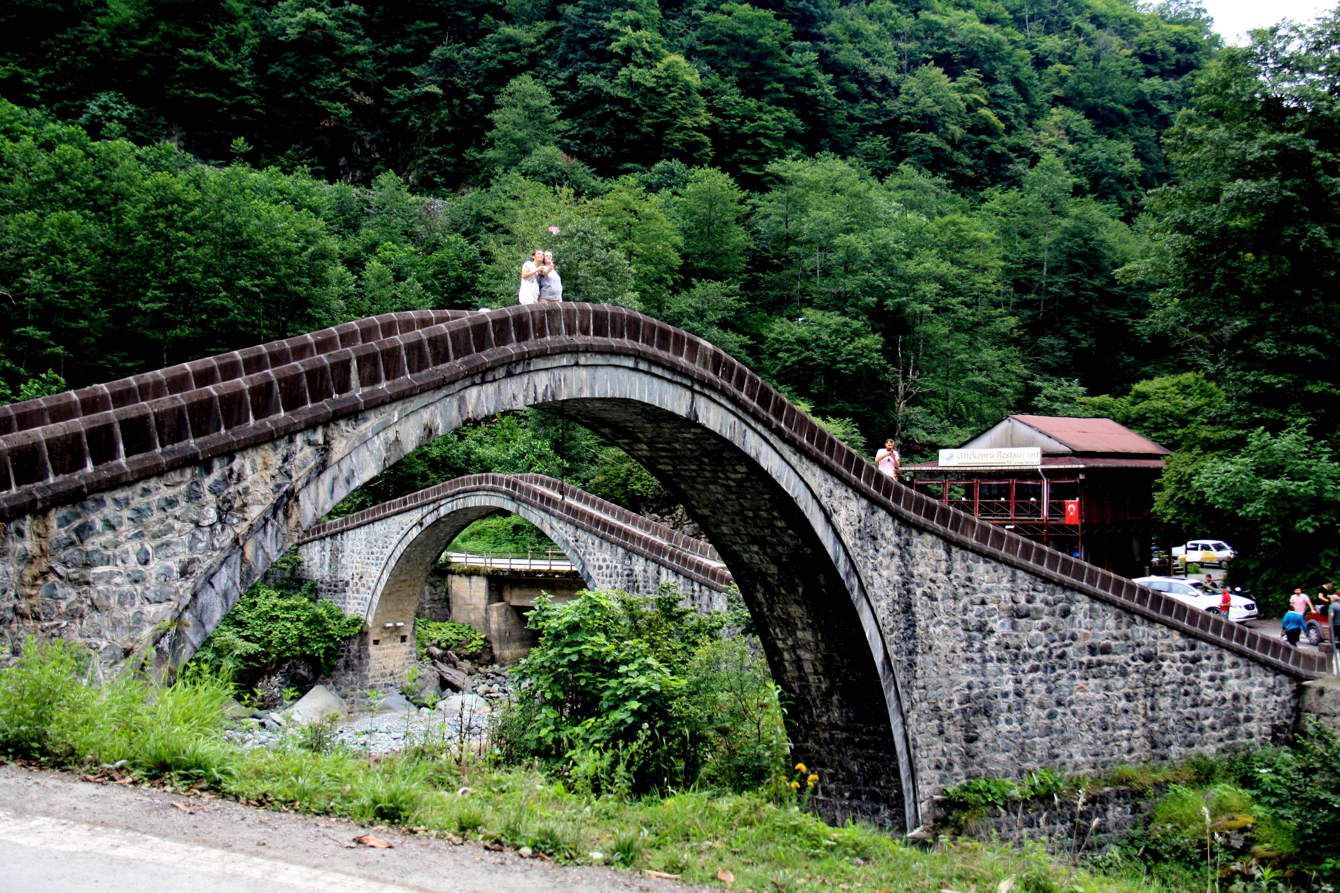
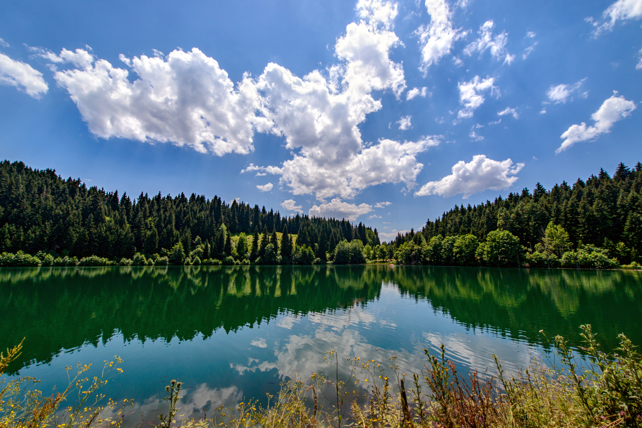
The surrounding countryside offers many places for climbing, trekking and rafting.
Events
Artvin is known for the Caucasus (Kafkas in Turkish) Culture and Arts Festival, a celebration that takes place at the Kafkasör plateau every year.[29] The most famous event is the bull wrestling which draws many local and international visitors.[30]
Climate
Artvin, unlike most of the coastal Black Sea Region of Turkey, has a Warm-summer Mediterranean climate (Csb) under the Köppen classification, bordering very closely on an Oceanic climate (Cfb), with the wettest winter month, December, having nearly 3 times the amount of precipitation as the driest summer month, August, which is the prime classifier for a dry-summer climate in the Köppen system. It has a warm summer oceanic climate (Dob) according to the Trewartha classification system.
| Climate data for Artvin (1949–2020) | |||||||||||||
|---|---|---|---|---|---|---|---|---|---|---|---|---|---|
| Month | Jan | Feb | Mar | Apr | May | Jun | Jul | Aug | Sep | Oct | Nov | Dec | Year |
| Record high °C (°F) | 18.9 (66.0) |
21.5 (70.7) |
28.4 (83.1) |
34.4 (93.9) |
36.4 (97.5) |
39.0 (102.2) |
42.0 (107.6) |
43.0 (109.4) |
39.5 (103.1) |
33.9 (93.0) |
27.9 (82.2) |
20.9 (69.6) |
43.0 (109.4) |
| Average high °C (°F) | 6.3 (43.3) |
8.3 (46.9) |
12.4 (54.3) |
17.8 (64.0) |
21.9 (71.4) |
24.3 (75.7) |
25.8 (78.4) |
26.3 (79.3) |
23.9 (75.0) |
19.7 (67.5) |
13.4 (56.1) |
7.9 (46.2) |
17.3 (63.1) |
| Daily mean °C (°F) | 2.6 (36.7) |
3.8 (38.8) |
7.0 (44.6) |
11.8 (53.2) |
16.0 (60.8) |
18.9 (66.0) |
20.9 (69.6) |
21.1 (70.0) |
18.3 (64.9) |
14.2 (57.6) |
9.0 (48.2) |
4.4 (39.9) |
12.3 (54.1) |
| Average low °C (°F) | −0.2 (31.6) |
0.4 (32.7) |
2.9 (37.2) |
7.1 (44.8) |
11.3 (52.3) |
14.4 (57.9) |
16.9 (62.4) |
17.2 (63.0) |
14.2 (57.6) |
10.3 (50.5) |
5.7 (42.3) |
1.7 (35.1) |
8.5 (47.3) |
| Record low °C (°F) | −16.1 (3.0) |
−11.9 (10.6) |
−9.8 (14.4) |
−7.1 (19.2) |
−0.6 (30.9) |
3.7 (38.7) |
9.5 (49.1) |
9.5 (49.1) |
4.2 (39.6) |
−1.6 (29.1) |
−8.2 (17.2) |
−10.8 (12.6) |
−16.1 (3.0) |
| Average rainfall mm (inches) | 84.1 (3.31) |
71.3 (2.81) |
59.2 (2.33) |
53.3 (2.10) |
53.1 (2.09) |
49.1 (1.93) |
30.6 (1.20) |
29.4 (1.16) |
37.7 (1.48) |
61.1 (2.41) |
74.7 (2.94) |
86.2 (3.39) |
689.8 (27.16) |
| Average rainy days | 12.4 | 11.1 | 13.6 | 14.1 | 16.1 | 14.6 | 9.8 | 10.0 | 10.3 | 12.3 | 11.8 | 11.6 | 147.7 |
| Mean monthly sunshine hours | 71.3 | 93.2 | 136.4 | 156.0 | 198.4 | 213.0 | 207.7 | 213.9 | 192.0 | 145.7 | 93.0 | 65.1 | 1,785.7 |
| Mean daily sunshine hours | 2.3 | 3.3 | 4.4 | 5.2 | 6.4 | 7.1 | 6.7 | 6.9 | 6.4 | 4.7 | 3.1 | 2.1 | 4.9 |
| Source: Turkish State Meteorological Service[31] | |||||||||||||
Twin cities
- Akhaltsikhe,
 Georgia
 - Oslo,
 Norway
 - Batumi, Georgia
- Frankfurt,
 Germany
 - Casablanca,
 Morocco
See also
- Arifana
- Cerattepe
- Lazistan
References
- "Area of regions (including lakes), km²". Regional Statistics Database. Turkish Statistical Institute. 2002. Retrieved 2013-03-05.
- "Population of province/district centers and towns/villages by districts - 2012". Address Based Population Registration System (ABPRS) Database. Turkish Statistical Institute. Retrieved 2013-02-27.
- The Turks: Middle ages, Hasan Celāl Güzel, Cem Oğuz, Osman Karatay, 2002
- Les Origines de l'Empire ottoman, Mehmet Fuat Köprülü, Gary Leiser, 1992, page 82
- European and Islamic trade in the early Ottoman state: the merchants of Genoa and Turkey, Kate Fleet, 1999, page 49
- Turkey, Verity Campbell, 2007, page 35
- Turkey, James Bainbridge, 2009, page 33
- Eastern Turkey: The Bradt Travel Guide, Diana Darke, 2011, page 77
- The Turks: Early ages, Hasan Celāl Güzel, Cem Oğuz, Osman Karatay, 2002
- The sons of Bayezid: empire building and representation in the Ottoman civil war of 1402-1413, Dimitris J. Kastritsis, 2007, page 2
- Artvin Valiliği Resmi Web Sayfası <<! HOŞGELDİNİZ !>>
- Robert W. Edwards, “The Fortifications of Artvin: A Second Preliminary Report on the Marchlands of Northeast Turkey,” Dumbarton Oaks Papers 40, 1986, pp.165-70, pls. 2-10.
- Pius Bonifacius Gams, Series episcoporum Ecclesiae Catholicae, Leipzig 1931, p. 456
- Pius Bonifacius Gams, Series episcoporum Ecclesiae Catholicae, Supplement, Leipzig 1931, p. 93
- Joseph Lins, "Artvin" in The Catholic Encyclopedia (New York 1907)
- Christopher Lawrence Zugger, The Forgotten (Syracuse University Press 2001 ISBN 978-0-81560679-6), p. 60
- O. Werner, Orbis terrarum catholicus, Friburgo 1890, p. 149.
- Chronology of Catholic Dioceses:Notes on the Armenian Catholic Eparchy of Artvin
- Annuario Pontificio 1971 (Tipografia Poliglotta Vaticana0, p. 41
- Annuario Pontificio 2013 (Libreria Editrice Vaticana 2013 ISBN 978-88-209-9070-1), p. 840
- Morgan Philips. War & Revolution in Asiatic Russia. London, G. Allen & Unwin ltd. 1918. Print. " But the town of Artvin is chiefly inhabited by Armenians, 9.000 in all, who have an interesting history. They are nearly all Roman Catholics; and according to one of the priests with whom I talked, their forebears came from the Mush and Van regions a hundred and fifty years ago, and settled here for the purpose of carrying on trade between the coast and the Armenian plateau along the line of the Chorokh river. "
- Первая всеобщая перепись населения Российской Империи 1897 г. Распределение населения по родному языку и уездам Российской Империи кроме губерний Европейской России (in Russian). Demoscope Weekly. Retrieved 11 August 2014.
- Свод статистических данных о населении Закавказского края, извлечённых из посемейных списков 1886 года, г. Тифлис, 1893. Available online here
- Первая всеобщая перепись населения Российской Империи 1897 г. Распределение населения по родному языку и уездам Российской Империи кроме губерний Европейской России (in Russian). Demoscope Weekly. Retrieved 8 April 2014.
- Кавказский календарь на 1910 год [Caucasian calendar for 1910] (in Russian) (65th ed.). Tiflis: Tipografiya kantselyarii Ye.I.V. na Kavkaze, kazenny dom. 1910. p. 187. Archived from the original on 15 March 2022.
- Кавказский календарь на 1917 год [Caucasian calendar for 1917] (in Russian) (72nd ed.). Tiflis: Tipografiya kantselyarii Ye.I.V. na Kavkaze, kazenny dom. 1917. pp. 351–352. Archived from the original on 4 November 2021.
- "Artvin: Nüfus Bilgileri" (in Turkish). Belediyeler Konuşuyor. Archived from the original on 17 April 2014. Retrieved 17 April 2014.
- Sinclair, T.A. (1989). Eastern Turkey: An Architectural & Archaeological Survey, Volume I. Pindar Press. p. 18. ISBN 9780907132325.
- Kafkasör Bull Wrestling Festival
- Bullwrestling in Artvin, Turkey Archived 2011-11-17 at the Wayback Machine
- "Resmi İstatistikler: İllerimize Ait Genel İstatistik Verileri" (in Turkish). Turkish State Meteorological Service. Archived from the original on 22 January 2019. Retrieved 11 December 2021.
- The Catholic Encyclopedia
- Karadeniz Ansiklopedik Sözlük.İstanbul. 2005. ISBN 975-6121-00-9.
Sources and external links
- Governor's Office
- the Municipality Archived 2014-04-27 at the Wayback Machine
- GCatholic - former & titular see
- Joseph Lins, "Artvin" in The Catholic Encyclopedialemma 'Artvin' in Catholic Encyclopedia (New York 1907)
- Artvin Village (in Turkish)
- Photographic survey and plan of Artvin Castle
- local information (in Turkish)
- Artvin Weather Forecast Information
- Artvin Otelleri
- Bibliography - ecclesiastical
- Pius Bonifacius Gams, Series episcoporum Ecclesiae Catholicae, Leipzig 1931, p. 456 & Series episcoporum Ecclesiae Catholicae, Complementi, Leipzig 1931, p. 93
- Notizie storiche sull'eparchia di Artvin, katolsk.no.
- Papal Bulla 'Universi Dominici gregis', in Giovanni Domenico Mansi, Sacrorum Conciliorum Nova et Amplissima Collectio, vol. XL, coll. 779-780
Artvin in Artvin Province of Turkey | |||||||||||||||||||||||||||
|---|---|---|---|---|---|---|---|---|---|---|---|---|---|---|---|---|---|---|---|---|---|---|---|---|---|---|---|
| Districts |  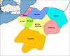 | ||||||||||||||||||||||||||
|
Metropolitan municipalities are bolded. | |||||||||||||||||||||||||||
Authority control | |
|---|---|
| General | |
| National libraries | |
| Other |
|
На других языках
[de] Artvin
Artvin (georgisch ართვინი .mw-parser-output .Latn{font-family:"Akzidenz Grotesk","Arial","Avant Garde Gothic","Calibri","Futura","Geneva","Gill Sans","Helvetica","Lucida Grande","Lucida Sans Unicode","Lucida Grande","Stone Sans","Tahoma","Trebuchet","Univers","Verdana"}Artwini, armenisch Արդվին Ardwin) ist die Hauptstadt der zur Schwarzmeerregion gehörenden gleichnamigen Provinz im Nordosten der Türkei. Sie bildet auch den zentralen Landkreis (Merkez) der Provinz. Die Stadt liegt am Ostabfall des Pontischen Gebirges hoch über dem Flusstal des Çoruh. Die Kreisstadt beherbergt etwa 72 Prozent der Landkreisbevölkerung.- [en] Artvin
[ru] Артвин
Артви́н (тур. Artvin, арм. Արդվին[1], груз. ართვინი, ართვანი[1]) — город и район в Северо-Восточной Турции, расположен на реке Чорох, недалеко от границы с Грузией. Артвин — центр одноимённого ила (провинции) Турции. Население — 23 157 (2000, перепись).Другой контент может иметь иную лицензию. Перед использованием материалов сайта WikiSort.org внимательно изучите правила лицензирования конкретных элементов наполнения сайта.
WikiSort.org - проект по пересортировке и дополнению контента Википедии