world.wikisort.org - Japan
Toyokawa (豊川市, Toyokawa-shi) is a city in the eastern part of Aichi Prefecture, Japan. As of 1 October 2019[update], the city had an estimated population of 183,930 in 72,949 households,[1] and a population density of 1,141 persons per km2. The total area of the city is 161.14 square kilometres (62.22 sq mi). Toyokawa, famous for its Toyokawa Inari temple, is blessed with a good balance of industry, commerce, agriculture and forestry, and is situated in an area rich in history, traditions, and culture.
Toyokawa
豊川市 | |
|---|---|
City | |
Toyokawa Inari Tezutsu Fireworks Festival Toga Shrine Mikawa Province Kokufu Toyokawa skyline | |
 Flag  Emblem | |
 Interactive map outlining Toyokawa | |
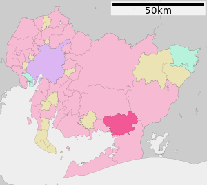 Location of Toyokawa in Aichi Prefecture | |
 Toyokawa | |
| Coordinates: 34°49′36.4″N 137°22′33.3″E | |
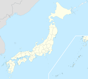
| Country | Japan |
| Region | Chūbu (Tōkai) |
| Prefecture | Aichi |
| First official recorded | 480 AD |
| City Settled | June 1, 1943 |
| Government | |
| • Mayor | Minoru Yamawaki |
| Area | |
| • Total | 161.14 km2 (62.22 sq mi) |
| Population (October 1, 2019) | |
| • Total | 183,930 |
| • Density | 1,100/km2 (3,000/sq mi) |
| Time zone | UTC+9 (Japan Standard Time) |
| – Tree | Japanese Black Pine |
| – Flower | Dwarf azalea |
| Phone number | 0533-89-2111 |
| Address | 1-1 Suwa-chō, Toyokawa-shi, Aichi-ken 442-0068 |
| Website | Official website |


Geography
Toyokawa is located in an area of rolling hills in southeastern Aichi Prefecture. It has a short coastline with Mikawa Bay.
Climate
The city has a climate characterized by hot and humid summers, and relatively mild winters (Köppen climate classification Cfa). The average annual temperature in Toyokawa is 15.8 °C. The average annual rainfall is 1751 mm with September as the wettest month. The temperatures are highest on average in August, at around 27.5 °C, and lowest in January, at around 4.8 °C.[2]
Demographics
Per Japanese census data,[3] the population of Toyokawa has been increasing over the past 60 years.
| Year | Pop. | ±% |
|---|---|---|
| 1950 | 98,332 | — |
| 1960 | 105,590 | +7.4% |
| 1970 | 130,997 | +24.1% |
| 1980 | 157,084 | +19.9% |
| 1990 | 168,796 | +7.5% |
| 2000 | 176,698 | +4.7% |
| 2010 | 181,882 | +2.9% |
Surrounding municipalities
 Aichi Prefecture
History
Origins
The area of modern Toyokawa was settled in prehistoric times. During the Nara period, the kokubunji of Mikawa Province was established in 741.
Middle Ages
Muromachi Period
The temple of Toyokawa Inari, a popular pilgrimage destination, dates from 1441.
Sengoku Period
A number of daimyō clans under the Tokugawa shogunate originate in what are now parts of Toyokawa, most notably the Makino clan.
Early modern period
Edo Period
The area prospered during the Edo period with two post towns along the Tōkaidō, Goyu-shuku and Akasaka.
Late modern period
Meiji Period
After the Meiji Restoration, on October 1, 1889, several villages were organized with the establishment of the modern municipalities system within Hoi District, Aichi Prefecture, including Toyokawa Village. On March 13, 1893, Toyokawa was promoted to town status.
Showa Period
Toyokawa City was founded on June 1, 1943, by the merger of Toyokawa town with neighboring Ushikubo Town and Yawata Village, all from Hoi District.
In 1939 the massive Toyokawa Naval Arsenal was established, one of the largest producers of machine guns, aviation ordnance and ammunition in the Empire of Japan. It was also had sections that produced military-issue katana, bayonets, and glass lenses for use in cameras, binoculars, and similar equipment. During World War II, many thousands of civilians were conscripted or volunteered to work at the Arsenal, and towards the end of the war, this workforce included hundreds of middle school students and high school girls. On August 7, 1945, the Toyokawa Naval Arsenal was targeted by a flight of B-29 bombers. About 2,500 people were killed during the Toyokawa Air Raid.
Toyokawa was one of the last places to be targeted using conventional explosive and incendiary bombs in the closing days of World War II, occurring the day after Hiroshima was destroyed by an atomic bomb.[4]
Contemporary history
After WWII
After the war, on April 12, 1955, Toyokawa annexed Mikami village from Yana District. This was followed by the neighboring town of Goyu from Hoi District on April 1, 1959. Toyokawa further expanded on February 1, 2006, by annexing Ichinomiya, On January 15, 2008, the towns of Otowa and Mito became part of Toyokawa, and finally on February 1, 2010, the town of Kozakai likewise was merged into Toyokawa City.
 Toga Shrine
 Toyokawa Inari
 Ina Castle
 Goyu-shuku
 Akasaka-juku (Tōkaidō)
 Toyokawa Tezutsu Fireworks Festival
 Memorial to the victims of the Toyokawa Air Raid


Government
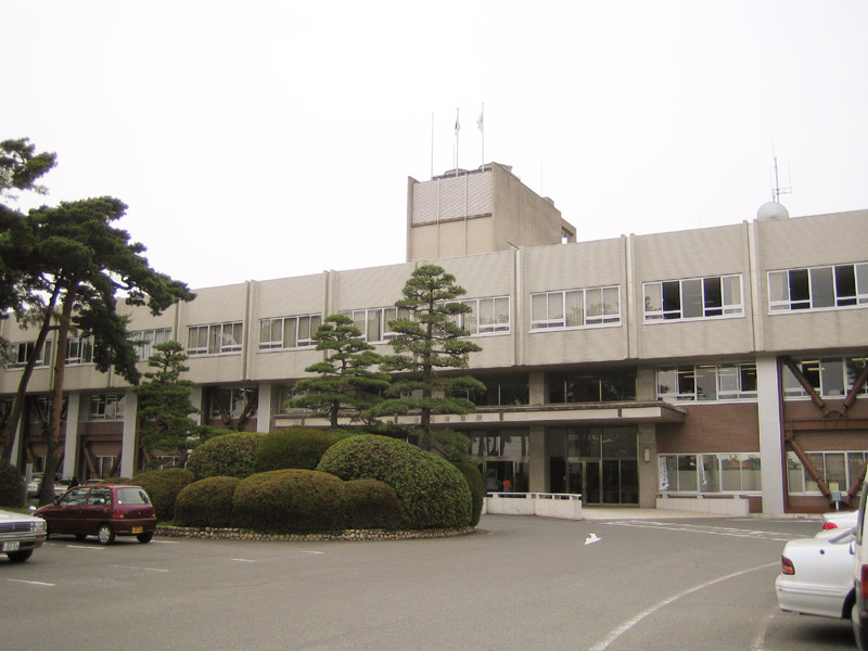
Toyokawa has a mayor-council form of government with a directly elected mayor and a unicameral city legislature of 30 members. The city contributes one member to the Aichi Prefectural Assembly. In terms of national politics, the city is part of Aichi District 8 of the lower house of the Diet of Japan.
Military facilities
- JGSDF Camp Toyokawa
External relations
Twin towns/sister cities
International
- Sister cities
 Cupertino, California(California, United States of America)
- since, 1978[5]
- Friendship city
 Xinwu District(Wuxi, Jiangsu, China)
- since April 15, 2009[6]
Education
Toyokawa has 26 public elementary schools and 10 public junior high schools operated by the city government, and five public high schools operated by the Aichi Prefectural Board of Education. There is also one private high school. The prefecture also operates one special education school for the handicapped.
Transportation

Railways
Conventional lines
 Central Japan Railway Company
- Tōkaidō Main Line:- Nishi-Kozakai – Aichi-Mito –
- Iida Line:- Kozakai – Ushikubo – Toyokawa – Mikawa-Ichinomiya – Nagayama – Ejima – Tōjō –
 Meitetsu
- Nagoya Main Line:- Ina – Odabuchi – Kō – Goyu – Meiden-Akasaka – Meiden-Nagasawa –
- Toyokawa Line:- Kō – Yawata – Suwachō – Inariguchi – Toyokawa-Inari
Roads
Expressways
 Tōmei Expressway
Japan National Route
 National Route 1
 National Route 23
 National Route 151
 National Route 247
 National Route 362
Seaways
Seaport
- Port of Mito(Port of Mikawa)
Local attractions

- Castles
- Ina Castle
- Makino Castle
- Ushikubo Castle
- Temples
- Toyokawa Inari – noted Buddhist temple
- Mikawa Kokubun-ji
- Shrines
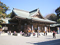
- Toga Shrine – ichinomiya of Mikawa Province
Notable people from Toyokawa

(2015)
This section does not cite any sources. (April 2014) |
- Atsuya Ota, Basketball player
- Yuka Kato, Olympic swimmer
- Gakuto Kondo, professional soccer player
- Masahiko Morifuku, Baseball player
- Sion Sono, movie director
- Yukinari Sugawara, professional soccer player
- Yamamoto Kansuke, Japanese Samurai of the Sengoku period
- Yusuke Yamamoto, Japanese Actor
References
- Toyokawa City official statistics (in Japanese)
- Toyokawa climate data
- Toyokawa population statistics
- Air War Pacific Chronology: America's Air War Against Japan in East Asia and the Pacific 1941–1945 by Eric Hammel, (Pacifica, CA: Pacifica Press, 1988, ISBN 0-935553-26-6)
- "豊川市 姉妹都市キュパティーノ市".
- "International Exchange". List of Affiliation Partners within Prefectures. Council of Local Authorities for International Relations (CLAIR). Archived from the original on December 24, 2015. Retrieved November 21, 2015.
External links
- Official website
 (in Japanese)
  Geographic data related to Toyokawa, Aichi at OpenStreetMap
Nagoya (capital) | ||||
| Nagoya |
| |||
| Core cities |
| |||
| Special city | ||||
| Cities | ||||
| Districts | ||||
| ||||
Authority control | |
|---|---|
| General | |
| National libraries | |
| Scientific databases | |
| Other |
|
На других языках
[de] Toyokawa
Toyokawa (jap. .mw-parser-output .Hani{font-size:110%}豊川市, -shi) ist eine Stadt in der Präfektur Aichi auf Honshū, der Hauptinsel von Japan.- [en] Toyokawa, Aichi
[es] Toyokawa (Aichi)
Toyokawa (豊川市, Toyokawa-shi?) es una ciudad que se encuentra al sureste de la prefectura de Aichi, Japón.[ru] Тоёкава
Тоё́кава (яп. 豊川市 Тоёкава-си) — город в Японии, расположенный в юго-восточной части префектуры Айти на берегу нижнего течения реки Тоё. Основан 1 мая 1969 года путём объединения посёлков Тоёкава, Усикубо, Кокуфу и села Явата уезда Хои. Площадь города составляет 160,79 км²[1], население — 181 134 человека (1 июня 2014)[2], плотность населения — 1126,53 чел./км². Город является центром машиностроения (в том числе оптической отрасли) и деревообработки.Другой контент может иметь иную лицензию. Перед использованием материалов сайта WikiSort.org внимательно изучите правила лицензирования конкретных элементов наполнения сайта.
WikiSort.org - проект по пересортировке и дополнению контента Википедии