world.wikisort.org - Japan
Taketoyo (武豊町, Taketoyo-chō) is a town located in Chita District, Aichi Prefecture, Japan. As of 1 October 2019[update], the town had an estimated population of 43,147 in 18,392 households,[1] and a population density of 1,636 persons per km2. The total area of the town was 26.38 square kilometres (10.19 sq mi).
Taketoyo
武豊町 | |
|---|---|
Town | |
 Taketoyo Town Office | |
 Flag  Emblem | |
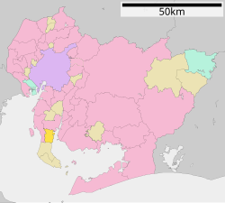 Location of Taketoyo in Aichi Prefecture | |
 Taketoyo | |
| Coordinates: 34°51′3.8″N 136°54′53″E | |
| Country | Japan |
| Region | Chūbu region Tōkai region |
| Prefecture | Aichi |
| District | Chita |
| Area | |
| • Total | 26.38 km2 (10.19 sq mi) |
| Population (October 1, 2019) | |
| • Total | 43,147 |
| • Density | 1,600/km2 (4,200/sq mi) |
| Time zone | UTC+9 (Japan Standard Time) |
| - Tree | Cinnamomum camphora |
| - Flower | Camellia sasanqua |
| Phone number | 0569-72-1111 |
| Address | 2 Nagaoyama, Taketoyo-chō, Chita-gun, Aichi-ken 470-2406 |
| Website | Official website |
Geography
Taketoyo is located in the northeast corner of Chita Peninsula in southern Aichi Prefecture, bordered by Mikawa Bay to the east. Part of the town's area is within the borders of the Mikawa Wan Quasi-National Park.
Neighboring municipalities
- Aichi Prefecture
- Hekinan
- Handa
- Tokoname
- Minamichita
Demographics
Per Japanese census data,[2] the population of Taketoyo has been increasing over the past 70 years.
| Year | Pop. | ±% |
|---|---|---|
| 1940 | 10,790 | — |
| 1950 | 15,504 | +43.7% |
| 1960 | 17,103 | +10.3% |
| 1970 | 25,575 | +49.5% |
| 1980 | 33,924 | +32.6% |
| 1990 | 38,105 | +12.3% |
| 2000 | 39,993 | +5.0% |
| 2010 | 42,416 | +6.1% |
Climate
The town has a climate characterized by characterized by hot and humid summers, and relatively mild winters (Köppen climate classification Cfa). The average annual temperature in Taketoyo is 15.5 °C. The average annual rainfall is 1672 mm with September as the wettest month. The temperatures are highest on average in August, at around 27.5 °C, and lowest in January, at around 4.6 °C.[3]
History
The village of Taketoyo was established within Chita District, Aichi by the early Meiji period establishment of the modern municipalities system on October 1, 1889. Taketoyo was raised to town status on February 15, 1891.
An Imperial decree in July 1899 established Taketoyo as an open port for trading with the United States and the United Kingdom.[4]
On October 5, 1954, Taketoyo annexed the neighboring village of Fuki, also from Chita District.
Economy
Due to its location near the Greater Nagoya metropolis and the port facilities at the Port of Kinuura, Taketoyo is home to numerous factories, including glass manufacturing, and pharmaceuticals. Chubu Electric Power also has a large electrical generating facility, the Taketoyo Thermal Power Station, which provides substantial employment and tax revenues. The traditional industries in the town center around the production of soy sauce, miso and cotton products.
Education
- Taketoyo has four public elementary schools and two public junior high schools operated by the town government and one public high school operated by the Aichi Prefectural Board of Education.
- Escola Expressão - Brazilian primary school[5]
Transportation
Railway
![]() Central Japan Railway Company - Taketoyo Line
Central Japan Railway Company - Taketoyo Line
- Taketoyo
![]() Meitetsu – Kōwa Line
Meitetsu – Kōwa Line
- Age - Chita-Taketoyo - Fuki
![]() Meitetsu – Chita New Line
Meitetsu – Chita New Line
- Fuki
Highway
 National Route 247
Notable people from Taketoyo
- Shōko Ieda, author
References
- Taketoyo Town official statistics (in Japanese)
- Taketoyo population statistics
- Taketoyo climate data
- US Department of State. (1906). A digest of international law as embodied in diplomatic discussions, treaties and other international agreements (John Bassett Moore, ed.), Vol. 5, p. 759.
- "Escolas Brasileiras Homologadas no Japão" (Archive). Embassy of Brazil in Tokyo. Retrieved on October 13, 2015.
External links
![]() Media related to Taketoyo at Wikimedia Commons
Media related to Taketoyo at Wikimedia Commons
- Official website (in Japanese)
 Geographic data related to Taketoyo at OpenStreetMap
Nagoya (capital) | ||||
| Nagoya |
| |||
| Core cities |
| |||
| Special city | ||||
| Cities | ||||
| Districts |
| |||
| ||||
Authority control | |
|---|---|
| General | |
| National libraries | |
This Aichi Prefecture location article is a stub. You can help Wikipedia by expanding it. |
На других языках
- [en] Taketoyo
[ru] Такетоё
Такетоё (яп. 武豊町 Такэтоё-тё:) — посёлок в Японии, находящийся в уезде Тита префектуры Айти. Площадь посёлка составляет 25,82 км²[1], население — 42 624 человека (1 июня 2014)[2], плотность населения — 1650,81 чел./км².Другой контент может иметь иную лицензию. Перед использованием материалов сайта WikiSort.org внимательно изучите правила лицензирования конкретных элементов наполнения сайта.
WikiSort.org - проект по пересортировке и дополнению контента Википедии