world.wikisort.org - India
Ujjain district is a district of Madhya Pradesh state in central India. The historic city of Ujjain is the district headquarters. The district has an area of 6,091 km², and a population of 19,86,864 (2011 census), a 16.12% increase from its 2001 population of 17,10,982.
Ujjain district | |
|---|---|
District of Madhya Pradesh | |
 Mahakal temple, Ujjain | |
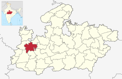 Location of Ujjain district in Madhya Pradesh | |
| Country | |
| State | Madhya Pradesh |
| Division | Ujjain |
| Headquarters | Ujjain |
| Government | |
| • Lok Sabha constituencies | Ujjain |
| Area | |
| • Total | 6,091 km2 (2,352 sq mi) |
| Population (2011) | |
| • Total | 1,986,864 |
| • Density | 330/km2 (840/sq mi) |
| Demographics | |
| • Literacy | 73.55 per cent |
| • Sex ratio | 954 |
| Time zone | UTC+05:30 (IST) |
| Website | ujjain |
Geography
The district is bounded by the districts of Agar malwa to the north, Shajapur to the east, Dewas to the southeast, Indore to the south, Dhar to the southwest, and Ratlam to the west and northwest. The district is part of Ujjain Division.
Rivers and lakes
The main river is the Shipra river, a tributary of the Chambal river in the east. Other small rivers include the Gambhir river and Kahn river, two tributaries of the Shipra.
Cities and towns
- Ujjain – The city is the administrative centre and chief city of the district and an ancient city situated on the eastern bank of the Kshipra River, Ujjain was the most prominent city on the Malwa plateau of central India for much of its history.
- Nagda – Prior to being an industrial town, Nagda was a small village. The location near river Chambal and availability of acres of land attracted Ghanshyam Das Birla to set up a major facility. Today Nagda is one of the largest viscose staple fiber manufacturers in Asia.
- Badnagar – The city is the birthplace of great national poet Kavi Pradeep. Former Prime Minister of India Atal Bihari Vajpayee spent some of his childhood time in Badnagar.
- Fatehabad Chandrawatiganj – The city is famous for its railway junction on the Ratlam-Indore meter gauge line with a link line going to Ujjain Junction.
- Khachrod – It is a city and a municipality in Ujjain district
- Mahidpur – It is a city and a municipality in Ujjain district. The Battle of Mahidpur between the Marathas and the British was fought in this town.
- Tarana – It is a town and a nagar panchayat in Ujjain district.
- Unhel – It is a town and a nagar panchayat in Ujjain district.
Villages
- Jagoti – It is a Gram panchayat in Mahidpur tehsil.
Divisions
At present, after the delimitation of parliamentary and legislative assembly constituencies in 2008, there are eight Vidhan Sabha constituencies in this district: Nagada-Khachrod, Mahidpur, Tarana, Ghatiya, Ujjain Dakshin, Ujjain Uttar, Badnagar including a lot from Ratlam District.[1] It is reserved for the candidates belonging to the Scheduled castes since 1966. The current member of the Lok Sabha from Ujjain constituency is Anil firoziya of the Bharatiya Janata Party (BJP).
Demographics
| Year | Pop. | ±% p.a. |
|---|---|---|
| 1901 | 295,312 | — |
| 1911 | 340,132 | +1.42% |
| 1921 | 337,554 | −0.08% |
| 1931 | 396,894 | +1.63% |
| 1941 | 454,370 | +1.36% |
| 1951 | 543,325 | +1.80% |
| 1961 | 661,720 | +1.99% |
| 1971 | 862,516 | +2.69% |
| 1981 | 1,117,002 | +2.62% |
| 1991 | 1,383,086 | +2.16% |
| 2001 | 1,710,982 | +2.15% |
| 2011 | 1,986,864 | +1.51% |
| source:[2] | ||
According to the 2011 census Ujjain District has a population of 1,986,864,[3] roughly equal to the nation of Slovenia[4] or the US state of New Mexico.[5] This gives it a ranking of 233rd in India (out of a total of 640).[3] The district has a population density of 326 inhabitants per square kilometre (840/sq mi) .[3] Its population growth rate over the decade 2001-2011 was 16.11%.[3] Ujjain has a sex ratio of 954 females for every 1000 males,[3] and a literacy rate of 73.55%. Scheduled Castes and Scheduled Tribes make up 26.36% and 2.45% of the population respectively.[3]
At the time of the 2011 Census of India, 47.58% of the population in the district spoke Malvi, 47.30% Hindi, 2.83% Urdu, 0.58% Gujarati, 0.56% Marathi and 0.40% Sindhi as their first language.[7]
Education
Higher education
Ujjain District is home to Vikram University located on Dewas Road and Maharshi Panini Sanskrit University.
- Pt. Jawaharlal Nehru Institute of Business Management, Ujjain
- Ruxmaniben Deepchand Gardi Medical College, Ujjain
- Mahakal Institute of Technology, Ujjain
- Govt. Madhav Science PG College, Dewas Road, Ujjain
- Govt. Madhav Arts and Commerce College, Dewas Gate, Ujjain
- Ujjain Engineering College, Ujjain used to be Government Engineering College. Edited by Ravi Soni
- Avantika College
- Mahraja College
- Ujjain Institute of Pharmaceutical Sciences, Ujjain
- Institute of Computer Science, Ujjain
- Lokmany Tilak Education College, Ujjain
- Government Kalidas Girls College, Ujjain
- Govt. Girls PG College. Ujjain,
- Lokmanya Tilak Science And Commerce College, Ujjain
- Sandipani Law College, Ujjain
- Ujjain Polytechnic College, Ujjain
- Alpine Institute of Technology, Ujjain
Vikram Uddhyog Puri
The Government of Madhya Pradesh has allotted 1,200 acres for the development of Knowledge City near Ujjain which will be known as Vikram Uddhyog Puri. The city will be mainly used for the education sector and is a part of the ambitious Delhi Mumbai Industrial Corridor project. The city will come up near Narwar village on Dewas-Ujjain Road.[8][9]
See also
References
- Parliamentary & Assembly Constituency-Wise Report of Electors in the Final Roll-2009
- Decadal Variation In Population Since 1901
- "District Census 2011". Census2011.co.in. 2011. Retrieved 30 September 2011.
- US Directorate of Intelligence. "Country Comparison:Population". Archived from the original on 13 June 2007. Retrieved 1 October 2011.
Slovenia 2,000,092 July 2011 est.
- "2010 Resident Population Data". U. S. Census Bureau. Retrieved 30 September 2011.
New Mexico - 2,059,179
- "C-16 Population By Religion - Madhya Pradesh". census.gov.in. Retrieved 26 July 2021.
- 2011 Census of India, Population By Mother Tongue
- Ujjain's 'Knowledge City' renamed 'Vikram Udyog Puri
- Madhya Pradesh seeks DMIC approval for two infra projects
External links
Places adjacent to Ujjain district | ||||||||||||||||
|---|---|---|---|---|---|---|---|---|---|---|---|---|---|---|---|---|
| ||||||||||||||||
Capital: Bhopal | |
| State symbols | |
| Topics |
|
| Governance |
|
| Divisions |
|
| Districts |
|
| Major cities | |
Authority control | |
|---|---|
| General | |
| National libraries | |
На других языках
[de] Ujjain (Distrikt)
Der Distrikt Ujjain (Hindi उज्जैन जिला) ist ein Distrikt des zentralindischen Bundesstaats Madhya Pradesh. Verwaltungs- und Wirtschaftszentrum ist die gleichnamige Großstadt Ujjain, die auch als eine der sieben heiligen Städte des Hinduismus gilt.- [en] Ujjain district
[ru] Удджайн (округ)
Удджайн (хинди उज्जैन जिला; англ. Ujjain) — округ в индийском штате Мадхья-Прадеш. Административный центр — город Удджайн. Площадь округа — 6091 км². По данным всеиндийской переписи 2001 года население округа составляло 1 710 982 человека. Уровень грамотности взрослого населения составлял 70,9 %, что выше среднеиндийского уровня (59,5 %). Доля городского населения составляла 38,7 %.Другой контент может иметь иную лицензию. Перед использованием материалов сайта WikiSort.org внимательно изучите правила лицензирования конкретных элементов наполнения сайта.
WikiSort.org - проект по пересортировке и дополнению контента Википедии