world.wikisort.org - India
Murwara district popularly known as Katni district is one of the 52 districts of Madhya Pradesh state in central India. The town of Murwara is the district headquarters. The district is part of Jabalpur Division. The district occupies an area of 4949.59 km².
Murwara district
मुड़वारा जिला | |
|---|---|
District of Madhya Pradesh | |
 Vijayraghav Fort | |
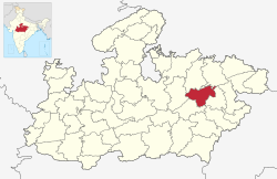 Location of Murwara district in Madhya Pradesh | |
| Country | |
| State | Madhya Pradesh |
| Division | Jabalpur |
| Headquarters | Murwara |
| Government | |
| • District Magistrate | Mr.Prayank Mishra IAS |
| • Lok Sabha constituencies | Khajuraho |
| Area | |
| • Total | 4,949 km2 (1,911 sq mi) |
| Population (2011) | |
| • Total | 1,292,042 |
| • Density | 260/km2 (680/sq mi) |
| Demographics | |
| • Literacy | 73.62 per cent |
| • Sex ratio | 948 |
| Time zone | UTC+05:30 (IST) |
| Website | katni |
Economy
Katni is a town in Madhya Pradesh with many laurels. It is also one of the largest rail junctions in the country and the second biggest diesel shed in the country is also located here. Katni is also a mineral-rich district, especially known for lime and bauxite.
In 2006 the Ministry of Panchayati Raj named Katni one of the country's 250 most backward districts (out of a total of 640).[1] It is one of the 24 districts in Madhya Pradesh currently receiving funds from the Backward Regions Grant Fund Programme (BRGF).[1]
Demographics
According to the 2011 census Katni District has a population of 1,292,042,[2] roughly equal to the nation of Estonia[3] or the US state of New Hampshire.[4] This gives it a ranking of 379th in India (out of a total of 640).[2] The district has a population density of 261 inhabitants per square kilometre (680/sq mi).[2] Its population growth rate over the decade 2001-2011 was 21.38%.[2] Katni has a sex ratio of 948 females for every 1000 males[2] and a literacy rate of 73.62%. Scheduled Castes and Scheduled Tribes made up 12.05% and 24.59% of the population respectively.[2]
Kols are the largest tribal group which is 41% of the tribal population, while Gonds (34%) and Bharias (20%) are the other major tribes.[2]
At the time of the 2011 Census of India, 97.98% of the population in the district spoke Hindi and 1.56% Sindhi as their first language.[6]
| Year | Pop. | ±% p.a. |
|---|---|---|
| 1901 | 249,049 | — |
| 1911 | 272,920 | +0.92% |
| 1921 | 272,832 | −0.00% |
| 1931 | 283,025 | +0.37% |
| 1941 | 333,078 | +1.64% |
| 1951 | 383,027 | +1.41% |
| 1961 | 452,246 | +1.68% |
| 1971 | 566,145 | +2.27% |
| 1981 | 714,508 | +2.35% |
| 1991 | 881,925 | +2.13% |
| 2001 | 1,064,167 | +1.90% |
| 2011 | 1,292,042 | +1.96% |
| source:[7] | ||
References
- Ministry of Panchayati Raj (8 September 2009). "A Note on the Backward Regions Grant Fund Programme" (PDF). National Institute of Rural Development. Archived from the original (PDF) on 5 April 2012. Retrieved 27 September 2011.
- "District Census 2011". Census2011.co.in. 2011. Retrieved 30 September 2011.
- US Directorate of Intelligence. "Country Comparison:Population". Archived from the original on 13 June 2007. Retrieved 1 October 2011.
Estonia 1,282,963 July 2011 est.
- "2010 Resident Population Data". U. S. Census Bureau. Archived from the original on 1 January 2011. Retrieved 30 September 2011.
New Hampshire 1,316,470
- "C-16 Population By Religion - Madhya Pradesh". censusindia.gov.in. Office of the Registrar General & Census Commissioner, India.
- 2011 Census of India, Population By Mother Tongue
- Decadal Variation In Population Since 1901
External links
Places adjacent to Katni district | ||||||||||||||||
|---|---|---|---|---|---|---|---|---|---|---|---|---|---|---|---|---|
| ||||||||||||||||
Capital: Bhopal | |
| State symbols | |
| Topics |
|
| Governance |
|
| Divisions |
|
| Districts |
|
| Major cities | |
На других языках
[de] Katni (Distrikt)
Der Distrikt Katni (Hindi कटनी ज़िला) ist ein Distrikt des zentralindischen Bundesstaats Madhya Pradesh in der historischen Region Bundelkhand nahe der Grenze zu Baghelkhand. Verwaltungs- und Wirtschaftszentrum ist gleichnamige Stadt Katni (früher Murwara).- [en] Katni district
[ru] Катни (округ)
Катни (хинди कटनी जिला; англ. Katni) — округ в индийском штате Мадхья-Прадеш. Образован в 1998 году из части территории округа Джабалпур. Административный центр — город Катни. Площадь округа — 4950 км². По данным всеиндийской переписи 2001 года население округа составляло 1 064 167 человек. Уровень грамотности взрослого населения составлял 63,6 %, что немного выше среднеиндийского уровня (59,5 %). Доля городского населения составляла 21,2 %.Другой контент может иметь иную лицензию. Перед использованием материалов сайта WikiSort.org внимательно изучите правила лицензирования конкретных элементов наполнения сайта.
WikiSort.org - проект по пересортировке и дополнению контента Википедии