world.wikisort.org - India
Mandla District is a district of Madhya Pradesh in central India. The town of Mandla is the administrative headquarters of the district. It is part of Jabalpur Division.[1]
Mandla district | |
|---|---|
District of Madhya Pradesh | |
 Kanha National Park | |
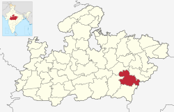 Location of Mandla district in Madhya Pradesh | |
| Country | |
| State | Madhya Pradesh |
| Division | Jabalpur |
| Headquarters | Mandla |
| Tehsils | 6 |
| Government | |
| • Lok Sabha constituencies | Mandla |
| • Vidhan Sabha constituencies | 3 |
| Area | |
| • Total | 8,771 km2 (3,387 sq mi) |
| Population (2011) | |
| • Total | 1,054,905 |
| • Density | 120/km2 (310/sq mi) |
| Demographics | |
| • Literacy | 66.87 per cent |
| • Sex ratio | 1008 |
| Time zone | UTC+05:30 (IST) |
| Major highways | 12A(NH 30) |
| Website | mandla |
The district has an area of 8771 km², and a population of 779,414. It has 9 development blocks, 6 tehsils, and 1214 villages. It lies in the Mahakoshal region, and most of the district lies in the basin of the Narmada River.
Economy
In 2006 the Ministry of Panchayati Raj named Mandla one of the country's 250 most backward districts (out of a total of 640).[2] It is one of the 24 districts in Madhya Pradesh currently receiving funds from the Backward Regions Grant Fund Programme (BRGF).[2]
Demographics
| Year | Pop. | ±% p.a. |
|---|---|---|
| 1901 | 207,152 | — |
| 1911 | 263,662 | +2.44% |
| 1921 | 251,438 | −0.47% |
| 1931 | 290,034 | +1.44% |
| 1941 | 328,300 | +1.25% |
| 1951 | 356,304 | +0.82% |
| 1961 | 420,563 | +1.67% |
| 1971 | 539,873 | +2.53% |
| 1981 | 627,717 | +1.52% |
| 1991 | 779,414 | +2.19% |
| 2001 | 894,236 | +1.38% |
| 2011 | 1,054,905 | +1.67% |
| source:[3] | ||
According to the 2011 census Mandla District has a population of 1,054,905,[4] roughly equal to the nation of Cyprus[5] or the US state of Rhode Island.[6] This gives it a ranking of 432nd in India (out of a total of 640).[4] The district has a population density of 182 inhabitants per square kilometre (470/sq mi) .[4] Its population growth rate over the decade 2001-2011 was 17.81%.[4] Mandla has a sex ratio of 1005 females for every 1000 males,[4] and a literacy rate of 68.28%. Scheduled Castes and Scheduled Tribes make up 4.69% and 57.88% of the population respectively. Gonds are the largest Scheduled Tribe with over 50% of the district's population.[4]
Languages
At the time of the 2011 Census of India, 88.67% of the population in the district spoke Hindi and 10.22% Gondi as their first language.[8] The dialect of the region is a central Indo-Aryan dialect closely related to Chhattisgarhi.
Ecology
Much of the district is forested, and it is home to Kanha National Park, a Project Tiger sanctuary. Kanha has the largest number of tigers in India. The park has won national awards for good management and infrastructure. The park is open year round except for July and August. The district is also home to Mandla Plant Fossils National Park. However, once upon a time Kanha and Satpura forest region, now famous as tiger reserves, were ruled by wild Indian elephants and lions.[9][10]
Villages
- Bineka
References
- "Mandla district".
- Ministry of Panchayati Raj (September 8, 2009). "A Note on the Backward Regions Grant Fund Programme" (PDF). National Institute of Rural Development. Archived from the original (PDF) on April 5, 2012. Retrieved September 27, 2011.
- Decadal Variation In Population Since 1901
- "District Census 2011". Census2011.co.in. 2011. Retrieved 2011-09-30.
- US Directorate of Intelligence. "Country Comparison:Population". Archived from the original on June 13, 2007. Retrieved 2011-10-01.
Cyprus 1,120,489 July 2011 est.
- "2010 Resident Population Data". U. S. Census Bureau. Archived from the original on 2013-10-19. Retrieved 2011-09-30.
Rhode Island 1,052,567
- "C-16 Population By Religion - Madhya Pradesh". censusindia.gov.in. Office of the Registrar General & Census Commissioner, India.
- 2011 Census of India, Population By Mother Tongue
- . banglalive.com
- "Mandla district".
External links
Places adjacent to Mandla district | ||||||||||||||||
|---|---|---|---|---|---|---|---|---|---|---|---|---|---|---|---|---|
| ||||||||||||||||
Capital: Bhopal | |
| State symbols | |
| Topics |
|
| Governance |
|
| Divisions |
|
| Districts |
|
| Major cities | |
Authority control | |
|---|---|
| General | |
| National libraries | |
На других языках
[de] Mandla (Distrikt)
Mandla ist ein Distrikt im indischen Bundesstaat Madhya Pradesh. Verwaltungssitz ist die gleichnamige Stadt Mandla.- [en] Mandla district
[ru] Мандла (округ)
Мандла (хинди मंडला जिला; англ. Mandla) — округ в индийском штате Мадхья-Прадеш. Административный центр — город Мандла. Площадь округа — 5800 км². По данным всеиндийской переписи 2001 года население округа составляло 894 236 человек. Уровень грамотности взрослого населения составлял 59,6 %, что примерно соответствовало среднеиндийскому уровню (59,5 %). Доля городского населения составляла 10,3 %.Другой контент может иметь иную лицензию. Перед использованием материалов сайта WikiSort.org внимательно изучите правила лицензирования конкретных элементов наполнения сайта.
WikiSort.org - проект по пересортировке и дополнению контента Википедии