world.wikisort.org - India
Chhota Udaipur district (also Chhota Udepur district) is a district in the state of Gujarat in India. It was carved out of the Vadodara district on 26 January 2013 with its headquarters at Chhota Udaipur town and is the 28th district of Gujarat.[1]
This article uses bare URLs, which are uninformative and vulnerable to link rot. (August 2022) |
Chhota Udaipur district | |
|---|---|
District of Gujarat | |
 Orsang River near Bodeli | |
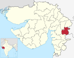 Location in Gujarat | |
| Country | |
| State | Gujarat |
| Headquarters | Chhota Udaipur |
| Area | |
| • Total | 3,436 km2 (1,327 sq mi) |
| Population | |
| • Total | 1,071,831 |
| • Density | 310/km2 (810/sq mi) |
| Languages | |
| • Official | Gujarati, Marathi, Hindi, English, Rathawi |
| Time zone | UTC+5:30 (IST) |
| ISO 3166 code | IN-GJ |
| Vehicle registration | GJ 34 |
| Climate | Semi-Arid (BSh) (Köppen) |
| Avg. annual temperature | 12-43 °C |
| Avg. summer temperature | 26-43 °C |
| Avg. winter temperature | 12-33 °C |
| Website | chhotaudepur |
Establishment
The district consists of the six talukas of Chhota Udaipur, Jetpur Pavi, Kawant, Naswadi, Sankheda and the newly created Bodeli taluka.[2] The district headquarters is located at Chhota Udaipur.[3]
The district was created to facilitate decentralisation and ease of access to government services.[4][5] Its creation, announced in the run up to the Assembly elections in Gujarat in 2012, was also seen by the media and political analysts as a government strategy to attract tribal votes.[6]
Description
Chhota Udaipur shares its borders with the state of Madhya Pradesh. Chhota Udaipur district has a forest area of 75,704 hectares and has deposits of dolomite, fluorite, granite and sand all of which are mined. The district is also home to a large dairy industry.
Chhota Udaipur is a tribal dominated district, and the district headquarters is located 110 km away from Vadodara. Chhota Udaipur is the third tribal dominated district in eastern Gujarat after the Narmada and Tapi districts.[1][7]
Chhota Udaipur, once a princely state of Gujarat lies in the heart of a tribal area with rich indigenous history and culture which is more representative of the region than palaces. The town is a good base from which to explore the surrounding tribal villages, particularly in the Rathwa communities. The Rathwa tribals who live here produce the Pithora mural paintings by mixing colours with liquor and milk and then using it to depict intricate motifs and scenes on the walls of their village dwellings.[8] The Tribal Museum here displays a nice collection of people and culture of this place. Every Saturday there is a tribal market which is a hub for local artisans making pithoda paintings and terracotta horses.[9]
Chhota Udaipur town sits on the edge of a big lake, with a series of temples along the skyline. Structures from the 1920s such as the Kusum Vilas Palace (now a heritage hotel) and Prem Bhavan are also worth visiting, though they need permission from the local royal family. The Kali Niketan (Nahar Mahal) palace, built as the summer residence of the erstwhile royal family is a notable monument in Chhota Udaipur.[10] The Jain temple is an interesting example of the influence of Victorian art on local building styles, which is otherwise rare display in traditional Jain buildings elsewhere.
Demographics
Chhota Udaipur has a population of 1,071,831. Scheduled Castes and Scheduled Tribes make up 25,279 and 856,862 which is 2.36% and 79.94% of the population respectively.[11]
Hindus are 1,035,085 while Muslims are 34,222.[12]
At the time of the 2011 census 98.46% of the population spoke Gujarati and 1.05% Hindi as their first language.[13]
Politics
| No. | Constituency | Name | Party | Remarks | |
|---|---|---|---|---|---|
| 137 | Chhota Udaipur (ST) | Mohan Rathwa | INC | ||
| 138 | Jetpur (ST) | Sukhrambhai Rathwa | INC | Leader Of Opposition | |
| 139 | Sankheda (ST) | Abhesinh Tadvi | BJP | ||
See also
- Chhota Udaipur State
References
- "Modi Announces Creation of New District". Outlook. September 10, 2012. Archived from the original on 2013-11-05. Retrieved 23 February 2013.
- "Process to set up Chhota Udepur district begins". The Times of India. 9 February 2013. Archived from the original on 21 September 2013. Retrieved 23 February 2013.
- "Bandh to protest Chhota Udepur as headquarters peaceful". The Indian Express. 17 August 2013. Retrieved 20 September 2013.
- "Narendra Modi announces new tribal district to clear his 'debt'". The Indian Express. September 11, 2012. Retrieved 23 February 2013.
- "Chhota Udepur is Gujarat's 28th dist". DNA. September 11, 2012. Retrieved 23 February 2013.
- "Gujarat CM announces Chhota Udepur district". The Pioneer. 10 September 2012. Retrieved 23 February 2013.
- "Gujarat gets its 28th district as Chhota Udaipur". Daily Bhaskar. September 11, 2012. Retrieved 23 February 2013.
- "Rich in mineral resources, Chhota Udepur set to become highest revenue-earning district". The Indian Express. 30 August 2013. Retrieved 20 September 2013.
- "Chhota Udepur, Princely state, Vadodara, Tourism Hubs, Gujarat, India". Archived from the original on 2019-12-09. Retrieved 2016-06-13.
- http://chhotaudepur.com
- "Gujarat Distrct Census - Vadodara" (PDF). Office of the Registrar General & Census Commissioner, India.
- "C-16 Population By Religion - Gujarat". census.gov.in. Office of the Registrar General & Census Commissioner, India.
- 2011 Census of India, Population By Mother Tongue
External links
Places adjacent to Chhota Udaipur district | |
|---|---|
Другой контент может иметь иную лицензию. Перед использованием материалов сайта WikiSort.org внимательно изучите правила лицензирования конкретных элементов наполнения сайта.
WikiSort.org - проект по пересортировке и дополнению контента Википедии