world.wikisort.org - India
Alirajpur is one of the 52 districts of Madhya Pradesh state in India. It was created from Alirajpur, Jobat and Bhabra tehsils of the former Jhabua district on 17 May 2008. It is the least literate district in India as per Census 2011. Alirajpur is the administrative headquarters of the district. The district occupies an area of 2,165.24 square kilometres (836.00 sq mi), and at the 2011 census had a population of 728,999. It includes the city of Alirajpur.
Alirajpur district | |
|---|---|
District of Madhya Pradesh | |
 Traditional Bhil fair in Alirajpur | |
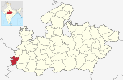 Location of Alirajpur district in Madhya Pradesh | |
| Coordinates (Alirajpur): 22°18′18″N 74°21′36″E | |
| Country | India |
| State | Madhya Pradesh |
| Division | Indore |
| Headquarters | Alirajpur |
| Government | |
| • Lok Sabha constituencies | Ratlam |
| • Vidhan Sabha constituencies | 1. Alirajpur, 2. Jobat |
| Area | |
| • Total | 3,182 km2 (1,229 sq mi) |
| Population (2011) | |
| • Total | 728,677 |
| • Density | 230/km2 (590/sq mi) |
| Demographics | |
| • Literacy | 37.22 per cent |
| • Sex ratio | 1009 |
| Time zone | UTC+05:30 (IST) |
| Website | http://alirajpur.nic.in/ |
Origin of name
The district is named after its headquarters, Alirajpur, which was the capital of the former princely state of Ali Rajpur. The name of this town is derived by conjoining Ali (the fortress town and the former capital of the princely state founded by Anand Deo in 1437) and Rajpur (the latter capital).[1] According to the 2011 census Alirajpur district has a population of 728,677,[2] roughly equal to the nation of Bhutan or the US state of Alaska.[3][4] This gives it a ranking of 498th in India (out of a total of 640).[5] The district has a population density of 229 inhabitants per square kilometre (590/sq mi).[5] Its population growth rate over the decade 2001–2011 was 19.4 per cent.[5] Alirajpur has a sex ratio of 1,009 females for every 1,000 males, and a literacy rate of 37.22 per cent, the lowest in India.[3][5]
Divisions
This district comprises five tehsils: Alirajpur, Jobat, Sondwa Chandra Sekhra Ajad Nagar and Kathiwada.[6]
Presently, there are two Madhya Pradesh Vidhan Sabha constituencies in this district: Alirajpur and Jobat.[5] Both of these are part of Ratlam Lok Sabha constituency.
Demographics
According to the 2011 census Alirajpur district has a population of 728,999,[2] roughly equal to the nation of Bhutan or the US state of Alaska.[4][7] This gives it a ranking of 498th in India (out of a total of 640).[2] The district has a population density of 229 inhabitants per square kilometre (590/sq mi).[2] Its population growth rate over the decade 2001–2011 was 19.45 per cent.[2] Alirajpur has a sex ratio of 1,009 females for every 1,000 males, and a literacy rate of 37.22 per cent, the lowest in India.[2][3] Scheduled Castes and Scheduled Tribes make up 3.69% and 88.98% of the population respectively.
Almost 90% of the population speaks different Bhili dialects. At the time of the 2011 Census of India, 53.68% of the population in the district spoke Bhilali, 35.42% Bhili, 7.27% Hindi and 1.87% Gujarati as their first language.[9]
| Year | Pop. | ±% p.a. |
|---|---|---|
| 1901 | 70,763 | — |
| 1911 | 98,753 | +3.39% |
| 1921 | 114,538 | +1.49% |
| 1931 | 133,892 | +1.57% |
| 1941 | 157,188 | +1.62% |
| 1951 | 175,255 | +1.09% |
| 1961 | 228,765 | +2.70% |
| 1971 | 293,125 | +2.51% |
| 1981 | 347,730 | +1.72% |
| 1991 | 483,481 | +3.35% |
| 2001 | 610,275 | +2.36% |
| 2011 | 728,999 | +1.79% |
| source:[10] | ||
See also
- Jambukheda
References
- "Ali Rajpur". Imperial Gazetteer of India, vol. 5, p. 223.
- "District Census 2011". Census2011.co.in. 2011. Retrieved 30 September 2011.
- Dhar, Aarti (31 March 2011). "Significant boost in literacy: 2011 census". The Hindu. New Delhi. Retrieved 1 April 2011.
- US Directorate of Intelligence. "Country Comparison:Population". Archived from the original on 13 June 2007. Retrieved 1 October 2011.
Bhutan 708,427
- "District/Assembly List". Chief Electoral Officer, Madhya Pradesh website. Archived from the original on 1 December 2015. Retrieved 16 April 2010.
- "Government of Madhya Pradesh website for Alirajpur District".
- "2010 Resident Population Data". US Census Bureau. Archived from the original on 19 October 2013. Retrieved 30 September 2011.
Alaska 710,231
- "C-16 Population By Religion - Madhya Pradesh". census.gov.in.
- 2011 Census of India, Population By Mother Tongue
- Decadal Variation In Population Since 1901
External links
Places adjacent to Alirajpur district | ||||||||||||||||
|---|---|---|---|---|---|---|---|---|---|---|---|---|---|---|---|---|
| ||||||||||||||||
Capital: Bhopal | |
| State symbols | |
| Topics |
|
| Governance |
|
| Divisions |
|
| Districts |
|
| Major cities |
|
На других языках
- [en] Alirajpur district
[ru] Алираджпур (округ)
Алираджпур (хинди अलीराजपुर जिला; англ. Alirajpur) — округ в индийском штате Мадхья-Прадеш. Образован 17 мая 2008 года из части территории округа Джхабуа. Административный центр — город Алираджпур. Площадь округа — 2165 км². По данным всеиндийской переписи 2001 года население округа составляло 248 803 человека.Другой контент может иметь иную лицензию. Перед использованием материалов сайта WikiSort.org внимательно изучите правила лицензирования конкретных элементов наполнения сайта.
WikiSort.org - проект по пересортировке и дополнению контента Википедии