world.wikisort.org - India
Khandwa district, formerly known as the East Nimar district, is a district of the Madhya Pradesh state in central India. The city of Khandwa is the administrative headquarters of the district. Other notable towns in the district include Mundi, Harsud, Pandhana and Omkareshwar.
Khandwa district | |
|---|---|
District of Madhya Pradesh | |
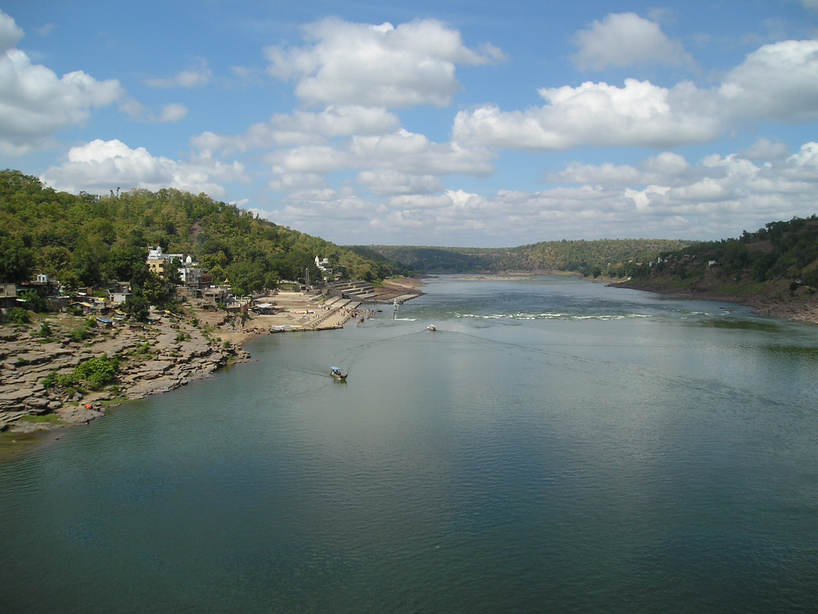 Narmada near Omkareshwar | |
 Location of Khandwa district in Madhya Pradesh | |
| Country | |
| State | Madhya Pradesh |
| Division | Indore |
| Headquarters | Khandwa |
| Tehsils | Khandwa, Punasa (Mundi), Harsud, Pandhana |
| Government | |
| • Lok Sabha constituencies | Khandwa |
| • Vidhan Sabha constituencies | Bagli (174) Mandhata (175) Harsud (176) Khandwa (177) Pandhana (178) |
| Area | |
| • Total | 6,206 km2 (2,396 sq mi) |
| Population (2011) | |
| • Total | 1,310,061 |
| • Density | 210/km2 (550/sq mi) |
| Demographics | |
| • Literacy | 67.53 per cent |
| • Sex ratio | 944 |
| Time zone | UTC+05:30 (IST) |
| Major highways | Khandwa-Indore State Highway Khandwa-Mundi-Ashta State Highway Khandwa-Amrawati Road |
| Website | khandwa |
Geography
The district has an area of 6,206 km2 (2,396 sq mi), and a population 1,310,061 (2011 census). Khandwa District lies in the Nimar region, which includes the lower valley of the Narmada River, Kherkhali River, Choti Tawa River, Shiva River. The Narmada forms part of the northern boundary of the district, and the Satpura Range form the southern boundary of the district. Burhanpur District, to the south, lies in the basin of the Tapti River. The pass through the Satpuras connecting Khandwa and Burhanpur is one of the main routes connecting northern and southern India, and the fortress of Asirgarh, which commands the pass, is known as the "Key to the Deccan". Betul and Harda districts lie to the east, Dewas District to the north, and Khargone District to the west.
History
Khandwa district was surrendered by the Marathas to the British Raj in 1818, and later became part of the Central Provinces and Berar. The area to the west, which forms the present Khargone district, was part of the princely state of Indore. After India's independence in 1947, the Central Provinces and Berar became the new Indian state of Madhya Pradesh.
The Khandwa district was known as "Nimar District" before 1954, when the state of Madhya Bharat to the west was merged with the state of Madhya Pradesh. Later it came to be called "East Nimar district", and a separate "West Nimar district" with headquarters at Khargone was established. The East Nimar district was part of the Nerbudda (Narmada) Division of the Central Provinces and Berar, which became the state of Madhya Bharat (later Madhya Pradesh) after India's independence in 1947.[1] Khandwa was known as East Nimar until recently. Burhanpur District was separated from Khandwa District on 15 August 2003. Khandwa District is part of Indore Division.
Economy
In 2006 the Ministry of Panchayati Raj named Khandwa one of the country's 250 most backward districts (out of a total of 640).[2] It is one of the 24 districts in Madhya Pradesh currently receiving funds from the Backward Regions Grant Fund Programme (BRGF).[2]
Demographics
| Year | Pop. | ±% p.a. |
|---|---|---|
| 1901 | 210,188 | — |
| 1911 | 250,875 | +1.79% |
| 1921 | 254,443 | +0.14% |
| 1931 | 299,822 | +1.65% |
| 1941 | 329,540 | +0.95% |
| 1951 | 346,916 | +0.52% |
| 1961 | 446,906 | +2.57% |
| 1971 | 568,143 | +2.43% |
| 1981 | 729,781 | +2.54% |
| 1991 | 898,596 | +2.10% |
| 2001 | 1,078,251 | +1.84% |
| 2011 | 1,310,061 | +1.97% |
| source:[3] | ||
According to the 2011 census Khandwa District has a population of 1,310,061,[4] This gives it a ranking of 374th in India (out of a total of 640).[4] The district has a population density of 178 inhabitants per square kilometre (460/sq mi).[4] Its population growth rate over the decade 2001–2011 was 21.44%.[4] East Nimar has a sex ratio of 944 females for every 1,000 males,[4] and a literacy rate of 67.53%. Scheduled Castes and Scheduled Tribes made up 11.95% and 35.05% of the population respectively.[4]
Languages
At the time of the 2011 Census of India, 40.59% of the population in the district spoke Nimadi, 33.84% Hindi, 9.71% Korku, 3.20% Urdu, 2.94% Bhili, 2.06% Bareli, 1.67% Banjari, 1.24% Gondi and 1.05% Marathi as their first language.[6]
Languages spoken include Nimadi, a Bhil language with approximately 64 000 speakers, written in the Devanagari script.[7]
Cities of Khandwa
Major cities of Khnadwa include Khandwa, Mundi, Harsud, Pandhana and Omkareshwar.
Notable people
- Ashok Kumar, actor
- Kishore Kumar, singer and actor
- Anoop Kumar
- Bhagwantrao Mandloi, former Chief Minister of Madhya Pradesh
- Pt. Makhanlal Chaturvedi, Hindi poet & freedom fighter
- Shaan (singer)
- Saroo Brierley was born in Khandwa and lived there until about the age of five years when he was lost and adopted by a family in Australia[8]
See also
- Mahishmati
References
- Hunter, William Wilson, Sir, et al. (1908). Imperial Gazetteer of India, Volume 6. 1908-1931; Clarendon Press, Oxford
- Ministry of Panchayati Raj (8 September 2009). "A Note on the Backward Regions Grant Fund Programme" (PDF). National Institute of Rural Development. Archived from the original (PDF) on 5 April 2012. Retrieved 27 September 2011.
- Decadal Variation In Population Since 1901
- "District Census 2011 - Khandwa" (PDF). Office of the Registrar General & Census Commissioner, India. 2011.
- "C-16 Population By Religion - Madhya Pradesh". census.gov.in. Retrieved 26 July 2021.
- 2011 Census of India, Population By Mother Tongue
- M. Paul Lewis, ed. (2009). "Bareli, Rathwi: A language of India". Ethnologue: Languages of the World (16th ed.). Dallas, Texas: SIL International. Retrieved 28 September 2011.[permanent dead link]
- Brierley, Saroo (2013). A Long Way Home. Viking, Australia ISBN 9780670077045
External links
Places adjacent to Khandwa district | ||||||||||||||||
|---|---|---|---|---|---|---|---|---|---|---|---|---|---|---|---|---|
| ||||||||||||||||
Capital: Bhopal | |
| State symbols | |
| Topics |
|
| Governance |
|
| Divisions |
|
| Districts |
|
| Major cities | |
На других языках
[de] Khandwa (Distrikt)
Der Distrikt Khandwa (Hindi खंडवा जिला – auch als East Nimar District bezeichnet) ist ein Distrikt des zentralindischen Bundesstaats Madhya Pradesh. Verwaltungs- und Wirtschaftszentrum ist die gleichnamige Stadt Khandwa.- [en] Khandwa district
[ru] Кхандва (округ)
Кхандва (хинди खांडवा जिला; англ. Khandwa), прежние названия — Нимар (до 1956 года), Восточный Нимар (англ. East Nimar) — округ в индийском штате Мадхья-Прадеш. Образован в 1948 году. Административный центр — город Кхандва. Площадь округа — 10 776 км². По данным всеиндийской переписи 2001 года население округа составляло 1 078 251 человек. Уровень грамотности взрослого населения составлял 61,8 %, что немного выше среднеиндийского уровня (59,5 %). Доля городского населения составляла 26,8 %. В 2003 году из части территории округа Кхандва был образован новый округ Бурханпур. На территории округа расположено важное индуистское место паломничества Омкарешвар.Другой контент может иметь иную лицензию. Перед использованием материалов сайта WikiSort.org внимательно изучите правила лицензирования конкретных элементов наполнения сайта.
WikiSort.org - проект по пересортировке и дополнению контента Википедии