world.wikisort.org - India
Ratlam District is a district of Madhya Pradesh state in central India. The town of Ratlam is administrative headquarters of the district.
Ratlam district | |
|---|---|
District of Madhya Pradesh | |
 Ratlam Fort | |
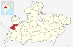 Location of Ratlam district in Madhya Pradesh | |
| Coordinates (Ratlam): 23.33°N 75.05°E | |
| Country | |
| State | Madhya Pradesh |
| Division | Ujjain |
| Established | 26-1-1949 |
| Headquarters | Ratlam |
| Tehsils | 9 |
| Government | |
| • Lok Sabha constituencies | Ratlam |
| Area | |
| • Total | 4,861 km2 (1,877 sq mi) |
| Population (2011) | |
| • Total | 1,455,069 |
| • Density | 300/km2 (780/sq mi) |
| Demographics | |
| • Literacy | 68.03 per cent |
| • Sex ratio | 973 |
| Time zone | UTC+05:30 (IST) |
| Major highways | NH 79, NH 927A |
| Website | ratlam |
Geography
Ratlam District has an area of 4,861 square kilometres (1,877 sq mi). It is bounded by Mandsaur District to the north, Jhalawar District of Rajasthan state to the northwest, Ujjain District to the east, Dhar District to the south, Jhabua District to the southwest, and Pratapgarh District of Rajasthan to the west. It is divided into nine tehsils and is home to 9 at and 1,063 villages (as of 2001). The district is part of Ujjain Division.[1]
Information
Ratlam District was created after Indian independence in 1947, out of the territory of several princely states, including Ratlam State, Jaora State, Sailana State and Piploda State. Ratlam District was part of the new state of Madhya Bharat. The major stop for tourism in Ratlam district is the town of Sailana which is known for its cactus garden, Palace, Kharmor Bird Sanctuary and the cave temples of Kedareshwa. Ratlam city is known for Garadu (fried Yam), Sev and Gold. Ratlam also has a DRM office of Railway.[1]
Demographics
| Year | Pop. | ±% p.a. |
|---|---|---|
| 1901 | 238,624 | — |
| 1911 | 244,513 | +0.24% |
| 1921 | 245,021 | +0.02% |
| 1931 | 290,437 | +1.71% |
| 1941 | 335,147 | +1.44% |
| 1951 | 381,719 | +1.31% |
| 1961 | 483,521 | +2.39% |
| 1971 | 626,534 | +2.62% |
| 1981 | 782,729 | +2.25% |
| 1991 | 971,888 | +2.19% |
| 2001 | 1,215,393 | +2.26% |
| 2011 | 1,455,069 | +1.82% |
| source:[2] | ||
According to the 2011 census Ratlam District has a population of 1,455,069 [3] roughly equal to the nation of Eswatini[4] or the US state of Hawaii.[5] This gives it a ranking of 342nd in India (out of a total of 640).[3] The district has a population density of 299 inhabitants per square kilometre (770/sq mi) .[3] Its population growth rate over the decade of 2001-2011 was 19.67%.[3] Ratlam has a sex ratio of 973 females for every 1,000 males,[3] and a literacy rate of 68.03%. Scheduled Castes and Tribes made up 13.65% and 28.16% of the population respectively.[3]
At the time of the 2011 Census of India, 42.33% of the population in the district spoke Malvi, 41.38% Hindi, 13.59% Bhili and 1.27% Urdu as their first language.[7]
References
- "Ratlam". Ratlam district administration. Retrieved 12 August 2010.
- Decadal Variation In Population Since 1901
- "District Census 2011". CensusIndia.co.in. 2011.
- US Directorate of Intelligence. "Country Comparison:Population". Archived from the original on 13 June 2007. Retrieved 1 October 2011.
Swaziland 1,370,424
- "2010 Resident Population Data". U. S. Census Bureau. Retrieved 30 September 2011.
Hawaii 1,360,301
- "C-16 Population By Religion - Madhya Pradesh". census.gov.in.
- 2011 Census of India, Population By Mother Tongue
External links
Places adjacent to Ratlam district | ||||||||||||||||
|---|---|---|---|---|---|---|---|---|---|---|---|---|---|---|---|---|
| ||||||||||||||||
Capital: Bhopal | |
| State symbols | |
| Topics |
|
| Governance |
|
| Divisions |
|
| Districts |
|
| Major cities |
|
Authority control | |
|---|---|
| General | |
| National libraries | |
This article related to a location in Madhya Pradesh is a stub. You can help Wikipedia by expanding it. |
На других языках
[de] Ratlam (Distrikt)
Ratlam ist ein Distrikt im indischen Bundesstaat Madhya Pradesh.- [en] Ratlam district
[ru] Ратлам (округ)
Ратлам (хинди रतलाम जिला; англ. Ratlam) — округ в индийском штате Мадхья-Прадеш. Образован в 1948 году. Административный центр — город Ратлам. Площадь округа — 4861 км². По данным всеиндийской переписи 2001 года население округа составляло 1 215 393 человека. Уровень грамотности взрослого населения составлял 67,2 %, что выше среднеиндийского уровня (59,5 %). Доля городского населения составляла 30,3 %.Другой контент может иметь иную лицензию. Перед использованием материалов сайта WikiSort.org внимательно изучите правила лицензирования конкретных элементов наполнения сайта.
WikiSort.org - проект по пересортировке и дополнению контента Википедии