world.wikisort.org - India
Bhind district is a district in the Chambal division of the Indian state of Madhya Pradesh. The town of Bhind is the district headquarters. Bhind District is situated in Chambal region in the northwest of the state. It is bounded by Agra, Etawah, Jalaun and Jhansi districts of Uttar Pradesh state to the north and the east, and the Madhya Pradesh districts of Datia to the south, Gwalior to the southwest, and Morena to the west. The geography of the district is characterised by uneven ravines, plain fertile fields and scanty forests. The total area of the district is 4,459 km2 (1,722 sq mi).
This article may require cleanup to meet Wikipedia's quality standards. The specific problem is: Desperate need of clean-up. (May 2017) |
Bhind district | |
|---|---|
District of Madhya Pradesh | |
 Chhatri of Malhar Rao Holkar in Alampur | |
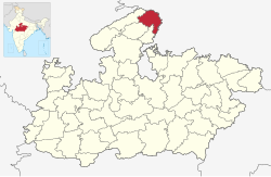 Location of Bhind district in Madhya Pradesh | |
| Coordinates (Bhind): 26.6°N 78.8°E | |
| Country | |
| State | Madhya Pradesh |
| Division | Morena |
| Headquarters | Bhind |
| Tehsils | 10: Bhind, Ater, Gormi, Mau, Mehgaon, Gohad, Lahar, Mihona, Raun and Amayan |
| Government | |
| • District Magistrate | Dr. Satish Kumar S. IAS |
| • Lok Sabha constituencies | Bhind |
| • SP | Shailendra Singh Chauhan IPS |
| Area | |
| • Total | 4,459 km2 (1,722 sq mi) |
| Population (2011)[1] | |
| • Total | 1,703,005 |
| • Density | 380/km2 (990/sq mi) |
| Demographics | |
| • Literacy | 75.3 per cent |
| • Sex ratio | 838 |
| Language | |
| • Official | Hindi |
| • Dialect | Brajbhasha |
| Time zone | UTC+05:30 (IST) |
| Vehicle registration | MP-30 |
| Major highways | NH 92 |
| Website | bhind |
Bhind's soil is drained by the Chambal, Kali Sind, Kunwari or Kwari, Pahuj and Baisali rivers by an extensive canal system. Formerly there were four tehsils, Bhind, Mehgaon, Gohad and Lahar, but at present there are ten tehsils: Bhind, Ater, Gormi, Mau, Mehgaon, Gohad, Lahar, Mihona, Raun and recently Amayan is the newest tehsil of Bhind. The district is part of the Chambal Division.
History
The district is named after the mythological Hindu saint Vibhandak Rishi, also called Bhindi Rishi. During the Mahabharata war the district was believed to have been ruled by the Chedis, then the Yadus. The Chedis were one of the Mahajanapadas. Then the district was ruled by the Nandas, Mauryas and later Shungas. Soon Shunga rule was replaced with branches of the Nagas with headquarters in Kantipuri and Padmavati. After a brief interregnum by the Kushans, the Nagas re-emerged. Around 270 copper coins from this period were found from the third and fourth centuries CE in Akoda village in Bhind district. By the middle of the fourth century the territory came under Gupta control. Afterwards the territory was controlled by the Vardhanas and in the eighth century, the Gujara-Pratiharas. In 1195 Mohammed Ghuri attacked the Pratihara chief in Gwalior, who surrendered. For the next three centuries the Delhi Sultanate had control over the district.[citation needed]
In the Mughal period the district fell under the Subedar of Agra. At the latter half of the 17th century a Jat family founded the town of Gohad and captured all the territory around it. He was, however, defeated by the Bhadawar rajputs. In 1736 and 1737, the Marathas defeated the Raja of Bhadawar and forced him to flee from the district. In 1805, the British, under a treaty with Gwalior, gave all the land comprising Bhind to the Scindias of Gwalior. In 1899, the Bhind-Gwalior light rail was built.[2]
The State of Madhya Bharat was formally inaugurated by Jawaharlal Nehru, the then Prime Minister of India, on 28 May 1948 at Gwalior. Scindia and Holkar were sworn in as the Rajpramukh and Up-Rajpramukh, respectively. It was decided to divide the Union into six districts and Bhind was one among them. As a result of reorganisation of the states Madhya Bharat was added to Madhya Pradesh state on 1 November 1956.[citation needed]
Mythology and history
This section does not cite any sources. (February 2018) |
- Ganesh Mandir is an ancient Ganesh temple built at the ghats of Gauri pond.
- Dandraua Hanuman Mandir (Mau) is an ancient Hanuman Mandir. Hanuman ji is best known as Dr. Hanuman.
- Vankhandeshwar Mandir is an ancient Shivalaya built by Prithviraj Chauhan.
- Akoda is the place where Kherapati Hanuman Mandir (Panjay Sarkar). This town is situated 10 km (6.2 mi) from Bhind.
- Naarada (Lahar) is the place where mythological saint Maharshi Narada prayed.
- Pandari is a village in Bhind Tehsil, where Pandavas took refuge during Agyatvas period of their banishment. Pandari is originated from the word Pandav Vati.
- Bhawani Gauri Sarover is a pond built at Bhind town by Prithvi Raj Chauhan.
- Machhand is a village in Mihona Tehsil, noted as the place of penance of Machhendranath, the Guru of Guru Gorakhnath.
- Bijpuri is a village in Bhind Tehsil, known for the Samadhi of Sage Gwalav, after which Gopachal fort came to be known as Gwalior Fort.
- Boreshwar is a temple in Ater Tehsil at Dulhagan village and contains an ancient Shiva temple.
Ravines
This region is known for its extensive ravines. The ravines created by gully erosion are heavily under soil loss. The Government of Madhya Pradesh has tried to check this soil erosion and expansion of ravines by the means of watershed development and by aerial-seeding for plants like Prosopis, Acacia, and Jatropha in the ravines.
Demographics
| Year | Pop. | ±% p.a. |
|---|---|---|
| 1901 | 432,296 | — |
| 1911 | 412,684 | −0.46% |
| 1921 | 393,849 | −0.47% |
| 1931 | 430,376 | +0.89% |
| 1941 | 494,059 | +1.39% |
| 1951 | 527,978 | +0.67% |
| 1961 | 641,169 | +1.96% |
| 1971 | 793,955 | +2.16% |
| 1981 | 973,816 | +2.06% |
| 1991 | 1,219,000 | +2.27% |
| 2001 | 1,428,559 | +1.60% |
| 2011 | 1,703,005 | +1.77% |
| source:[3] | ||
According to the 2011 census Bhind District had a population of 1,703,005,[1] roughly equal to the nation of The Gambia[4] or the US state of Nebraska.[5] This gives it a ranking of 286th in India (out of a total of 640).[6][better source needed] The district has a population density of 382 inhabitants per square kilometre (990/sq mi).[6] Its population growth rate over the decade 2001-2011 was 19.25%.[6][better source needed] Bhind has a sex ratio of 837 females for every 1000 males,[1] and a literacy rate of 64.29%. Scheduled Castes and Scheduled Tribes make up 22.01% and 0.36% of the population respectively.[1]
At the time of the 2011 Census of India, 99.66% of the population in the district spoke Hindi as their first language.[8]
The dominant castes of Bhind are , Rajput,Brahmin,Yadav,Soni, Baghel,Kayastha,Gurjar and Jain with sizeable number of Lodhis and Yadavs.[9]
Administration
Sandhya Ray is the MP from Bhind Lok Sabha constituency, elected in the 2019 Indian general election as a member of the Bharatiya Janata Party.[10]
Tourist attractions
This section does not cite any sources. (February 2018) |
Chhatri of Malhar Rao Holkar, Alampur
Maharani Ahilyabai Holkar built the chhatri of Malhar Rao Holkar at Alampur in Bhind district in 1766. It is marked by carvings. It is built on the pattern of the chhatris of Holkar rulers at Indore.
Shri Rawatpura Dham
The temple of Hindu Lord Hanuman is situated at Lahar tehsil of Bhind. This place is known as Rawatpura Dham and is under in Lahar tehsil.
Fort of Ater
Ater Fort was built by king Badan Singh Bhadauria from 1664 to 1668. The Fort of Ater is located near Ater town, 35 km (22 mi) from Bhind and 40 km (25 mi) from Porsa Morena.[citation needed]
Jain temples
The temple of Lord Mahavira is situated at Barason in Mehgaon tehsil. In Jain tradition, it is among the Atishaya kshetra, i.e. places where Lord Mahavira visited during his journey after getting Kaivalya (Ultimate Realization) and miraculous events took place. It is situated 14 km (8.7 mi) from Bhind town. Other Atishaya kshetra are Jain temple of Lord Neminath at Pavai near Bhind town and Lord Ajitnatha at Barahi, which is 20 km (12 mi) from Bhind at the Bhind-Etawah district border on the bank of the Chambal. An ancient holy place called "Digambar jain Parasnath Jinalaya" is situated in the village of Simar Biragma, about 20 km (12 mi) from Bhind and approximately 6 km (3.7 mi) from Atishaya kshetra Barason. There are approximately 60 Jain temples in Bhind town itself.
Mata Renuka Temple
An ancient temple is situated at Jamdara village in Mau tehsil, 45 km (28 mi) from Bhind, which was thought to be built by the mythological sage Parashurama.
Narad Dev Temple
An ancient temple of God Narad Dev is situated on the banks of the Kali Sindh. It can be reached by Lahaar Madori road, and is around 1 km (0.62 mi) from Madori.
National Chambal (Gharial) Wildlife Sanctuary
National Chambal (Gharial) Wildlife Sanctuary is situated on the Chambal River, and is inhabited by crocodiles, ghariyals, Ganges dolphins, and migratory birds. A boat cruise is organised by local forest officials. The sanctuary is 22 kilometres (14 mi) from Bhind town.
Gohad Fort
Gohad Fort was built by the Bamraulia Jat ruler Singhandev II in 1505. Government offices are currently situated on its premises.[citation needed]
Sun Temple
The Sun temple, also known as Balaji Temple, is situated 42 kilometres (26 mi) from Bhind at Balaji near Mihona Tehsil.
Ancient Dandraua Temple Mau Tehsil
This is a temple to the Hindu God Hanuman, believed to possess curing powers. Worshipers go to the temple every Tuesday and Saturday. Another Panchmukhi Hanuman mandir in Heerapura 10 km (6.2 mi) from Lahar. Dandraua Dham [website] Dr. Hanuman | Dandraua sarkar | Dandraua Dham and in Rohani jagir village, 4 km (2.5 mi) from lahar tehsil; you can see about 70- to 80-year-old banyan tree which is very huge and under which is the temple of Lord Shiva is also built, which is known as asana and there is also a waterfall next to the temple.
Vankhandeshwar Temple
Vankhandeshwar temple of Lord Shiva is located near the bank of Gauri Sarovar, a beautiful lake. It is said that this temple is founded by Prithviraj chauhan (Prithviraj).
Malanpur
Malanpur is the modern industrial area in Bhind District near Gwalior in Gohad tehsil, 65 km (40 mi) from Bhind town. Its industries include modern automobiles, bicycles, soaps and detergents, electronics, pharmaceuticals and food and dairy products
Akoda, a town 10 km (6.2 mi) east of district Bhind. Here is a nagar panchayat having population approximately 20,000. This is a historical place. Bhadauriya Rajput (Rao sahab) ruled here and had their kings here.
Main attractions are old garhi and Hanuman mandir.
References
- "Census of India: Bhind". www.censusindia.gov.in. Retrieved 9 October 2019.
- "History | District Bhind, Government Of Madhya Pradesh | India". Retrieved 5 February 2021.
- "Decadal Variation In Population Since 1901". Retrieved 25 February 2020.
- US Directorate of Intelligence. "Country Comparison:Population". Archived from the original on 13 June 2007. Retrieved 1 October 2011.
Gambia, The 1,797,860 July 2011 est.
- "2010 Resident Population Data". U. S. Census Bureau. Archived from the original on 19 October 2013. Retrieved 30 September 2011.
Nebraska 1,826,341
- "District Census 2011". Census2011.co.in. 2011. Retrieved 30 September 2011.
- "C-16 Population By Religion - Madhya Pradesh". census.gov.in. Office of the Registrar General and Census Commissioner, India.
- "C-16 Population By Mother Tongue - Madhya Pradesh". censusindia.gov.in. Retrieved 23 September 2019.
- "Study of Bundelkhand" (PDF). Planning Commission. Archived from the original (PDF) on 4 March 2016. Retrieved 23 March 2019.
- "Bhind Election Results 2019 Live Updates: Sandhya Ray of BJP Wins". News 18. 23 May 2019. Retrieved 24 May 2019.
External links
Places adjacent to Bhind district | |
|---|---|
Capital: Bhopal | |
| State symbols | |
| Topics |
|
| Governance |
|
| Divisions |
|
| Districts |
|
| Major cities | |
На других языках
[de] Bhind (Distrikt)
Bhind ist ein Distrikt im indischen Bundesstaat Madhya Pradesh.- [en] Bhind district
[ru] Бхинд (округ)
Бхинд (хинди भिंड जिला; англ. Bhind) — округ в индийском штате Мадхья-Прадеш. Образован в 1948 году и является одним из шести изначальных округов штата. Административный центр — город Бхинд. Площадь округа — 4459 км². По данным всеиндийской переписи 2001 года население округа составляло 1 428 559 человек. Уровень грамотности взрослого населения составлял 70,5 %, что выше среднеиндийского уровня (59,5 %). Доля городского населения составляла 23,7 %.Другой контент может иметь иную лицензию. Перед использованием материалов сайта WikiSort.org внимательно изучите правила лицензирования конкретных элементов наполнения сайта.
WikiSort.org - проект по пересортировке и дополнению контента Википедии