world.wikisort.org - India
Madhepura district is one of the thirty-eight districts of Bihar state, India, and Madhepura town is the administrative headquarters of this district. Madhepura district is a part of Kosi division.
Madhepura district | |
|---|---|
District of Bihar | |
 Singeshwar Shiva temple | |
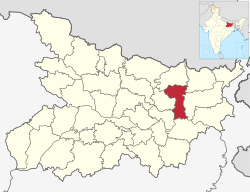 Location of Madhepura district in Bihar | |
| Country | |
| State | Bihar |
| Division | Kosi |
| Headquarters | Madhepura |
| Government | |
| • Lok Sabha constituencies | Madhepura |
| • Vidhan Sabha constituencies | Alamnagar, Bihariganj, Singheshwar, Madhepura |
| Area | |
| • Total | 1,787 km2 (690 sq mi) |
| Population (2011) | |
| • Total | 2,001,762 |
| • Density | 1,100/km2 (2,900/sq mi) |
| Demographics | |
| • Literacy | 53.78 per cent |
| • Sex ratio | 914 |
| Time zone | UTC+05:30 (IST) |
| Major highways | NH 106 |
| HDI (2016) | |
| Website | madhepura |
History
| Year | Pop. | ±% p.a. |
|---|---|---|
| 1901 | 429,692 | — |
| 1911 | 442,985 | +0.31% |
| 1921 | 427,735 | −0.35% |
| 1931 | 452,600 | +0.57% |
| 1941 | 456,140 | +0.08% |
| 1951 | 528,845 | +1.49% |
| 1961 | 642,346 | +1.96% |
| 1971 | 774,477 | +1.89% |
| 1981 | 964,033 | +2.21% |
| 1991 | 1,177,706 | +2.02% |
| 2001 | 1,526,646 | +2.63% |
| 2011 | 2,001,762 | +2.75% |
| source:[2] | ||
Madhepura is part of the Mithila region and the people here speak the Maithili language.[3]
Mithila first gained prominence after being settled by Indo-Aryan peoples who established the Mithila Kingdom (also called Kingdom of the Videhas).[4] During the late Vedic period (c. 1100–500 BCE), Videha became one of the major political and cultural centers of South Asia, along with Kuru and Pañcāla. The kings of the Videha Kingdom were called Janakas.[5] The Videha Kingdom was later incorporated into the Vajjika League, which had its capital in the city of Vaishali, which is also in Mithila.[6]
During British Raj, the district of Madhepura was dominated by the Yadav Zamindars of Murho Estate, who were the biggest landlords of the district.[7][8]
Madhepura district as it stands now was carved out of Saharsa district and got the status of revenue district on 9 May 1981.[citation needed] Prior to that, Madhepura was a sub-division under Bhagalpur district with effect from 3 September 1845. Subsequently, it was on 1 April 1954 that Saharsa district was carved out of Bhagalpur district.[citation needed]
Geography
Madhepura district occupies an area of 1,788 square kilometres (690 sq mi),[9] comparatively equivalent to Russia's Bolshoy Shantar Island.[10] Madhepura district is surrounded by Araria and Supaul district in the north, Khagaria and Bhagalpur district in the south, Purnia district in the east and Saharsa district in the West. It is situated in the Plains of River Koshi and located in the Northeastern part of Bihar at latitude between 25°. 34 to 26°.07' and longitude between 86° .19' to 87°.07'.
The district has 2 sub-divisions - Madhepura and Uda Kishunganj, 13 blocks, 13 police stations, 170 panchayats and 434 revenue villages. The total population of Madhepura, as per census of the year 2001 is 15,24,596 of which 7,96,272 are male and 7,29,324 are female. Literacy rate is 36.9% as against the national rate of 64.8% and state rate of 47%. The density of population is 859 per km2.
Climate
The maximum temperature of this district ranges from 35 to 45 degree Celsius and the minimum temperature varies from 7 to 9 degree Celsius. The average rain fall in this district is 1300mm.
Politics
| No. | Constituency | Name | Party | Alliance | Remarks | ||
|---|---|---|---|---|---|---|---|
| 70 | Alamnagar | Narendra Narayan Yadav | Janata Dal (United) | MGB | |||
| 71 | Bihariganj | Niranjan Kumar Mehta | Janata Dal (United) | MGB | |||
| 72 | Singheshwar | Chandrahas Chaupal | Rashtriya Janata Dal | MGB | |||
| 73 | Madhepura | Chandra Shekhar Yadav | Rashtriya Janata Dal | MGB | |||
Economy
In 2006 the Ministry of Panchayati Raj named Madhepura one of the country's 250 most backward districts (out of a total of 640).[11] It is one of the 36 districts in Bihar currently receiving funds from the Backward Regions Grant Fund Programme (BRGF).[11]
An electric locomotive factory has been set up at Madhepura by the Indian Railways in a joint venture with Alstom SA of France. The factory has the distinction of manufacturing the most powerful railway engine in India, the WAG-12.
Sub-divisions
Madhepura district comprises the following Sub-Divisions:
- Madhepura
- Uda Krishanganj
Blocks
Demographics
According to the 2011 census Madhepura district has a population of 2,001,762,[13] roughly equal to the nation of Slovenia.[14] This gives it a ranking of 232nd in India (out of a total of 640).[13] The district has a population density of 1,116 inhabitants per square kilometre (2,890/sq mi) .[13] Its population growth rate over the decade 2001-2011 was 30.65%.[13] Madhepura has a sex ratio of 914 females for every 1000 males,[13] and a literacy rate of 53.78%. Scheduled Castes and Scheduled Tribes make up 17.30% and 0.63% of the population respectively.[13]
At the time of the 2011 Census of India, 38.43% of the population spoke Maithili, 37.15% Hindi and 5.71% Urdu as their first language. 18.04% were classified as speaking a language under 'Other' Hindi in the census.[15] Around 25% of total population of the district are of Yadav caste.
Religious place
- Singeshwar temple
Madhepura is also in the limelight for Singheshwar Temple that the Istha Linga of Lord Shiva established in it. The Barah Purana also refers to Singheshwar as Shringeshwar. Mahakavi Vidyapati also refers to it in his literature in the 14th century. The Valmiki Ramayana gives due reference of Rishi Shringa (Rishyasringa) Ashram. Lord Shiva has been imagined to be residing on the bank of his favourite and affectionate river Kosi in the epic Kumar Shambhavam written by Mahakavi Kalidas. As per another belief, Lord Vishnu himself established this linga. The present temple was erected by Kushan dynasty. In early survey, the temple is recorded in the name of one Bhanu Das. They say that a night's stay at Singheswar gives the fruit of the gift of thousand cows.
- Dakini Sthan, Alamnagar Block
Nayanagar Bhagwati Sthan, Nayanagar, Gwalpara Block
Baba Vishu Raut, Lowalagan. Chousa
Kali mandir, Ramnagar [kumarkhand block]
Government institutions and courts
Governmental institutions in Madhepura include:
- Municipal Corporation
- Collectorate
- Office of the Divisional Commissioner
- District Court, Madhepura
- Urban Improvement Trust (UIT)
Health services
Healthcare is provided by a combination of public and private-sector hospitals.
Education
834 Govt. schools are imparting education in the district. Bhupendra Narayan Mandal University is situated at the district headquarter, Madhepura and adding glory to the educational atmosphere of this district.
List of Educational Institutes
- B.N.Mandal University Mahepura
- P.Sc.College,
- Commerce College,
- Madhepura College,
- C.M.Sc College,
- R.P.M. College
- Jawahar Navodaya vidyalaya,
- Shiv Nandan Prasad Mandal High School
- Rash Bihari High School
- Kiran Public School, Holy Cross, Holy angels, (Website)
- B R Oxford Residential Public School, Murligang Madhepura
- SAMIDHA GROUP
- Madhepura Public School
- K.P.College Murligang
- B.L.High School Murligang
- Parasmani High School Babu Babhni
- Govt. High School Amari Murliganj Madhepura
- M.M. High School Kumarkhand
- Project kanya High school Kumarkhand
- Durgapur, bhddhi, Manguwar
- Ved Vyas Inter College Amleshwar Nagar Madhepura
- Ved Vyas Degree College Amleshwar Nagar Madhepura
- St Williams Residential School, Karpuri Chowk, Madhepura
- Holy Cross Girls School, Shastri Nagar Madhepura
- South Point Public School, Main Road Madhepura
- Holy Cross School, N. H. 107 Chakla Chowk Madhepura
- Maya Vidya Niketan, Naya Nagar, Madanpur, Madhepura
(Website)
Transport
Madhepura is connected with road ways and railways.
Roadways
The district is connected with neighbouring districts and with nearby cities outside the state. National highway No.107 and National Highway No.106 passes through the district.
Daily buses carry passengers inter-state as well as within the city.
Railways
The district is linked with broad gauge Rail of North Eastern Railway. It is connected to Patna, Bihar. The Town is a halt for around 4 trains.
Airways
Nearest Airport is at 116.8 km in Darbhanga via SH-56 and supaul.
Media
The Radio Stations are following:
Newspapers
- Dainik Jagran
- Dainik Bhaskar
- Hindustan
- Madhepura Times
- Prabhat Khabar
Festivals
Shivratri is the most celebrated festival of Madhepura. Common Indian Festivals such as Holi, Diwali, Durga Puja, Vijayadashami, Saraswati puja and Moharram are celebrated with great pomp and show in the city.
Notable person
- Rash Bihari Lal Mandal, Zamindar of Murho Estate.
- Kamleshwari Prasad Yadav, politician
- B.P. Mandal, 7th Chief Minister of Bihar and chairman of the Second Backward Classes Commission (popularly known as the Mandal Commission).
References
- [[16]]
- "Development of Human Development Index at District Level for EAG States". March 2016. Retrieved 18 February 2022.
{{cite web}}: CS1 maint: url-status (link) - Decadal Variation In Population Since 1901
- Thakur, Minni (2010). Women Empowerment Through Panchayati Raj Institutions. p. 74. ISBN 9788180696800. Retrieved 15 January 2017.
- Michael Witzel (1989), Tracing the Vedic dialects in Dialectes dans les litteratures Indo-Aryennes ed. Caillat, Paris, pages 13, 17 116–124, 141–143
- Witzel, M. (1989). "Tracing the Vedic dialects". In Caillat, C. (ed.). Dialectes dans les litteratures Indo-Aryennes. Paris: Fondation Hugot. pp. 141–143.
- Hemchandra, R. (1972). Political History of Ancient India. Calcutta: University of Calcutta.
- Revenue, Bihar and Orissa (India) Board of (1912). Report on Wards', Encumbered, Trust and Attached Estates in the Province of Bihar and Orissa.
- "A village that symbolises Bihar". www.rediff.com. Retrieved 2022-02-13.
- Srivastava, Dayawanti et al. (ed.) (2010). "States and Union Territories: Bihar: Government". India 2010: A Reference Annual (54th ed.). New Delhi, India: Additional Director General, Publications Division, Ministry of Information and Broadcasting (India), Government of India. pp. 1118–1119. ISBN 978-81-230-1617-7.
{{cite book}}:|last1=has generic name (help) - "Island Directory Tables: Islands by Land Area". United Nations Environment Program. 1998-02-18. Retrieved 2011-10-11.
Bolshoy Shantar Island 1,766km2
- Ministry of Panchayati Raj (September 8, 2009). "A Note on the Backward Regions Grant Fund Programme" (PDF). National Institute of Rural No 1 district in education No 1 wheat and rice production in Bihar Development. Archived from the original (PDF) on April 5, 2012. Retrieved September 27, 2011.
- "2011 Census Table Table C-1: Population By Religious Community - Bihar". Office of the Registrar General & Census Commissioner, India.
- "District Census 2011". Census2011.co.in. 2011. Retrieved 2011-09-30.
- US Directorate of Intelligence. "Country Comparison:Population". Archived from the original on June 13, 2007. Retrieved 2011-10-01.
Slovenia 2,000,092 July 2011 est.
- 2011 Census of India, Population By Mother Tongue
- "Singheswar mandir". Archived from the original on 2014-10-03. Retrieved 2014-09-23.
- "Madhepura News in Hindi: Madhepura Latest News,Madhepura News Paper".
- "मधेपुरा टाइम्स| MadhepuraTimes News|". Archived from the original on 2014-12-05. Retrieved 2014-11-04.
- "Madhepura News - मधेपुरा न्यूज़ | madhepura news in Hindi - मधेपुरा समाचार | Latest News in मधेपुरा - Hindi News only on Prabhat Khabar - Page 1".
External links
Places adjacent to Madhepura district | ||||||||||||||||
|---|---|---|---|---|---|---|---|---|---|---|---|---|---|---|---|---|
| ||||||||||||||||
Capital: Patna | |
| State symbols | |
| History |
|
| Administration |
|
| Overviews |
|
| Divisions and districts | |
| Cities | |
| Municipal Corporation |
|
| Politics |
|
| Culture | |
| Authority control |
|
|---|
На других языках
[de] Madhepura (Distrikt)
Der Distrikt Madhepura (Hindi मधेपुरा जिला, Urdu مدھے پورا ضلع) ist ein Distrikt im indischen Bundesstaat Bihar. Verwaltungssitz ist die Stadt Madhepura.- [en] Madhepura district
[ru] Мадхепур (округ)
Мадхепур (хинди मधेपुरा जिला; англ. Madhepur) — округ на востоке индийского штата Бихар. Образован 9 мая 1981 года из части территории округа Сахарса. Административный центр — город Мадхепур. Площадь округа — 1787 км². По данным всеиндийской переписи 2001 года население округа составляло 1 526 646 человек. Уровень грамотности взрослого населения составлял 36,07 %, что значительно ниже среднеиндийского уровня (59,5 %).Другой контент может иметь иную лицензию. Перед использованием материалов сайта WikiSort.org внимательно изучите правила лицензирования конкретных элементов наполнения сайта.
WikiSort.org - проект по пересортировке и дополнению контента Википедии