world.wikisort.org - India
Lakhisarai district is one of the thirty-eight districts of Bihar state, India, and Lakhisarai town is the administrative headquarters of this district. Lakhisarai district is a part of Munger Division. The district occupies an area of 1,228 km2 (474 sq mi).
Lakhisarai district | |
|---|---|
District of Bihar | |
 | |
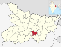 Location of Lakhisarai district in Bihar | |
| Country | India |
| State | Bihar |
| Division | Munger |
| Headquarters | Lakhisarai |
| Government | |
| • Lok Sabha constituencies | Munger |
| Area | |
| • Total | 1,228 km2 (474 sq mi) |
| Population (2011) | |
| • Total | 1,000,912 |
| • Density | 820/km2 (2,100/sq mi) |
| Demographics | |
| • Literacy | 64.95 per cent |
| • Sex ratio | 900 |
| Time zone | UTC+05:30 (IST) |
| Website | lakhisarai |
History
On 3 July 1994 this district was carved out from Munger district, which comprised the erstwhile Lakhisarai sub-division of the undivided district.
Geography
Lakhisarai district occupies an area of 1,228 square kilometres (474 sq mi),[1]
Economy
In 2006 the Ministry of Panchayati Raj named Lakhisarai one of the country's 250 districts (out of a total of 640).[2] It is one of the 36 districts in Bihar currently receiving funds from the Backward Regions Grant Fund Programme (BRGF).[2]
Industrial background; there are various fertilizer and pesticide factories in the district, including Bihar Mineral Industries. The market for fabrics in the district also flourishes with many old and new shops, and there are many factories like Sindur.
National Thermal Power Corporation Limited and Bihar State Power Generation Company Ltd has signed Memorandum of Understanding to set up 1320MW thermal power plant in Kajra.[3]
Divisions
This section does not cite any sources. (June 2013) |
The district consists only one sub-division Lakhisarai, which is divided into Seven developmental blocks, namely, Lakhisarai, Surajgarha, Barahiya, Halsi, Pipariya, Ramgarh Chowk and Chanan.
The district headquarters Lakhisarai is a city with mixed population, the majority being the upper-caste (Bhumihaar-Brahmins) people. Still under the process of development, the city has one newly constructed PCC road and a New bypass is constructed recently which gives some relaxation from traffic jams in the city . The Law and Order as well as development process is taking place during Nitish Kumar government's tenure. Also, Piribazar, Chanan police stations are naxal-prone due to their geographical layout. The city well known for its sindur (vermilion) production.
Demographics
| Year | Pop. | ±% p.a. |
|---|---|---|
| 1901 | 229,288 | — |
| 1911 | 236,466 | +0.31% |
| 1921 | 224,854 | −0.50% |
| 1931 | 253,195 | +1.19% |
| 1941 | 286,239 | +1.23% |
| 1951 | 316,343 | +1.01% |
| 1961 | 352,448 | +1.09% |
| 1971 | 439,256 | +2.23% |
| 1981 | 533,840 | +1.97% |
| 1991 | 646,395 | +1.93% |
| 2001 | 802,225 | +2.18% |
| 2011 | 1,000,912 | +2.24% |
| source:[4] | ||
According to the 2011 census Lakhisarai district has a population of 1,000,912,[6] This gives it a ranking of 445th in India (out of a total of 640).[6] The district has a population density of 815 inhabitants per square kilometre (2,110/sq mi) .[6] Its population growth rate over the decade 2001-2011 was 24.74%.[6] Lakhisarai has a sex ratio of 900 females for every 1000 males,[6] and a literacy rate of 64.95%. Scheduled Castes and Scheduled Tribes made up 15.31% and 0.83% of the population respectively.[6]
At the time of the 2011 Census of India, 46.96% of the population in the district spoke Magahi, 29.09% Hindi and 1.73% Urdu as their first language. 21.17% of the population recorded a language classified as 'Others' under Hindi on the census.[7] The main languages are Magahi and Angika, but both are counted as Hindi under the census.
Politics
| No. | Constituency | Name | Party | Alliance | Remarks | ||
|---|---|---|---|---|---|---|---|
| 167 | Suryagarha | Prahlad Yadav | Rashtriya Janata Dal | MGB | |||
| 168 | Lakhisarai | Vijay Kumar Sinha | Bharatiya Janata Party | NDA | |||
Notable towns
Notable villages
Notable people
- Giriraj Singh, Minister of Rural Development
External links
References
- Srivastava, Dayawanti et al. (ed.) (2010). "States and Union Territories: Bihar: Government". India 2010: A Reference Annual (54th ed.). New Delhi, India: Additional Director General, Publications Division, Ministry of Information and Broadcasting (India), Government of India. pp. 1118–1119. ISBN 978-81-230-1617-7.
{{cite book}}:|last1=has generic name (help) - Ministry of Panchayati Raj (September 8, 2009). "A Note on the Backward Regions Grant Fund Programme" (PDF). National Institute of Rural Development. Archived from the original (PDF) on April 5, 2012. Retrieved September 27, 2011.
- "NTPC to set up 1,320-MW power plant in Bihar".
- Decadal Variation In Population Since 1901
- "Population by Religious Community – 2011". Census of India, 2011. Office of the Registrar General & Census Commissioner, India.
- "District Census 2011". Census2011.co.in. 2011.
{{cite web}}: Missing or empty|url=(help) - 2011 Census of India, Population By Mother Tongue
Places adjacent to Lakhisarai district | ||||||||||||||||
|---|---|---|---|---|---|---|---|---|---|---|---|---|---|---|---|---|
| ||||||||||||||||
Capital: Patna | |
| State symbols |
|
| History |
|
| Administration |
|
| Overviews |
|
| Divisions and districts | |
| Cities |
|
| Municipal Corporation |
|
| Politics |
|
| Culture |
|
На других языках
[de] Lakhisarai (Distrikt)
Der Distrikt Lakhisarai (Hindi लखीसराय जिला, Urdu لکھی سرائے) ist ein Distrikt im indischen Bundesstaat Bihar. Verwaltungssitz ist die Stadt Lakhisarai.- [en] Lakhisarai district
[ru] Лакхисарай (округ)
Лакхисарай (хинди लक्खिसराय जिला; англ. Lakhisarai) — округ в индийском штате Бихар. Образован 3 июля 1994 года из части территории округа Мунгер. Административный центр — город Лакхисарай. Площадь округа — 1228 км². По данным всеиндийской переписи 2001 года население округа составляло 802 225 человек. Уровень грамотности взрослого населения составлял 47,96 %, что ниже среднеиндийского уровня (59,5 %).Другой контент может иметь иную лицензию. Перед использованием материалов сайта WikiSort.org внимательно изучите правила лицензирования конкретных элементов наполнения сайта.
WikiSort.org - проект по пересортировке и дополнению контента Википедии